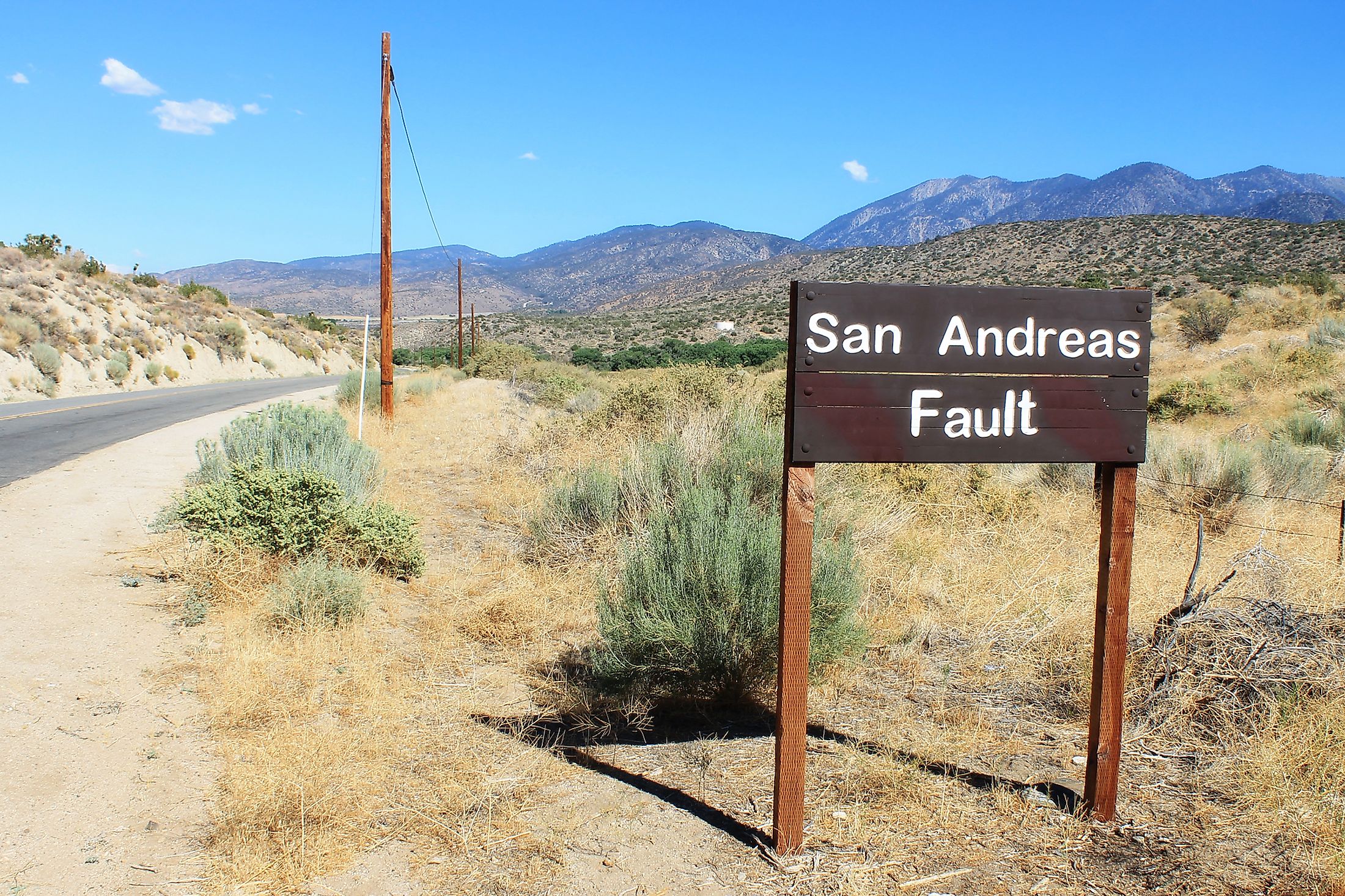
San Andreas Fault
San Andreas Fault is a major continental transform boundary that is situated in the extreme western part of the continent of North America and forms the border between two principal tectonic plates: the North American Plate on the eastern side and the Pacific Plate on the western side. Since the Pacific Plate slides laterally over the North American Plate in a northward direction, geologists classify the San Andreas Fault as a “strike-slip fault” and tectonic movements along the San Andreas Fault often result in severe earthquakes. The San Andreas Fault is one of the world’s largest and most extensively studied faults that extends in the northwestward direction for over 1,300km from the northern edge of the Gulf of California through the western part of the US State of California and passes out to the Pacific Ocean close to the city of San Francisco. A major part of California’s population lives close to the San Andreas Fault.
Geography Of San Andreas Fault

The San Andreas Fault is divided into three principal fault segments: Northern, Central, and Southern segments each of which possesses distinct characteristics with different degrees of earthquake risk. Over Geologic time, the movement of the North American and Pacific tectonic plates relative to each other has been about 1cm per year; and since the beginning of the 20th century, the movement of the plates has been about 4 to 6cm per year. The Northern segment of the San Andreas Fault runs from the city of Hollister passing through the Santa Cruz Mountains and then runs up the San Francisco Peninsula moving offshore at the Daly City close to the Mussel Rock. It returns onshore at the Bolinas Lagoon and then again moves underwater through the Tomales Bay, where it separates the mainland from the Point Reyes Peninsula and further returns onshore at Fort Ross. There are many significant “sister faults” in this area around the San Francisco Bay that run parallel to the San Andreas Fault and which are also capable of causing destructive earthquakes. The Northern segment of the San Andreas Fault then continues over the land where it forms a linear valley and returns offshore at the coastal city of Point Arena. Here, the northern segment runs underwater along the coast until it reaches close to Cape Mendocino, where it turns westwards and ends at the meeting point of the North American, Pacific, and Gorda tectonic plates that is referred to as the Mendocino Triple Junction.

The Central segment of the San Andreas Fault runs from the unincorporated community of Parkfield to the city of Hollister in a northwestern direction. Studies have revealed that while the portion of the fault that passes through Parkfield and the southern section of the fault experiences earthquake, the central segment of the fault exhibits aseismic creep. Geologists believe that aseismic creep is a phenomenon where the fault slips continuously but it does not cause any earthquakes. The Southern segment of the San Andreas Fault starts close to Bombay Beach on the Salton Sea and runs along the southern foot of the San Bernardino Mountains. Here, it crosses the Cajon Pass and continues in the northwest direction along the northern foot of the San Gabriel Mountains. The fault then again continues in the northwest direction and runs along the Elizabeth Lake Road and reaches the town of Elizabeth Lake. The fault then starts to bend in the northward direction and forms the “Big Bend” as it passes through the Tejon Pass and the unincorporated communities of Gorman and Frazier Park. At the northwestern part of Frazier Park, the fault passes through the long, treeless Carrizo Plain. The Southern segment of the San Andreas Fault is capable of causing frequent earthquakes of 8.1 magnitudes that lead to the damage of property worth billions of dollars as well as loss of lives of several people.
Geology Of San Andreas Fault

Geologists believe that the San Andreas Fault started to form about 30 million years ago in the mid-Cenozoic Era. During this time, the spreading center that was situated between the Farallon Plate and the Pacific Plate started to reach the subduction zone. Nevertheless, due to the difference in the relative motions between the Pacific and North American Plates as well as the Farallon and the North American Plates, the spreading ridge started to be eventually subducted. It is believed that the movements along the San Andreas Fault are due to the spreading beneath the East Pacific Rise. The northward movement along the San Andreas Fault had led to the creation of the Baja Peninsula and the subsequent detachment of the peninsula from the Mexican mainland.
History
In 1895, the Northern segment of the San Andreas Fault was first discovered by Andrew Lawson, who served as a Professor of Geology at the University of California, Berkeley. Sir Andrew named the fault after “Laguna de San Andreas” – a small lake that was situated in the valley formed by the fault, just to the south of the city of San Francisco. The tectonic movements along the fault had led to many severe earthquakes including the 1906 San Francisco Earthquake. While reviewing the effects of the 1906 San Francisco Earthquake, Sir Andrew Lawson discovered that the San Andreas Fault stretched further southwards into the southern part of California. In 1953, American geologists Thomas Wilson Dibblee, Jr. and Mason Hill proposed in a research paper about several large-scale lateral movements along the San Andreas Fault. Seismologists working close to the unincorporated community of Parkfield revealed that the San Andreas Fault in this area regularly produced an earthquake of 6.0 magnitude about once every 22 years. Due to the predictable nature of the earthquake activities, the Parkfield area has become one of the world’s most significant sites for the study of earthquakes.


