The National Parks With The Most Dangerous Trails
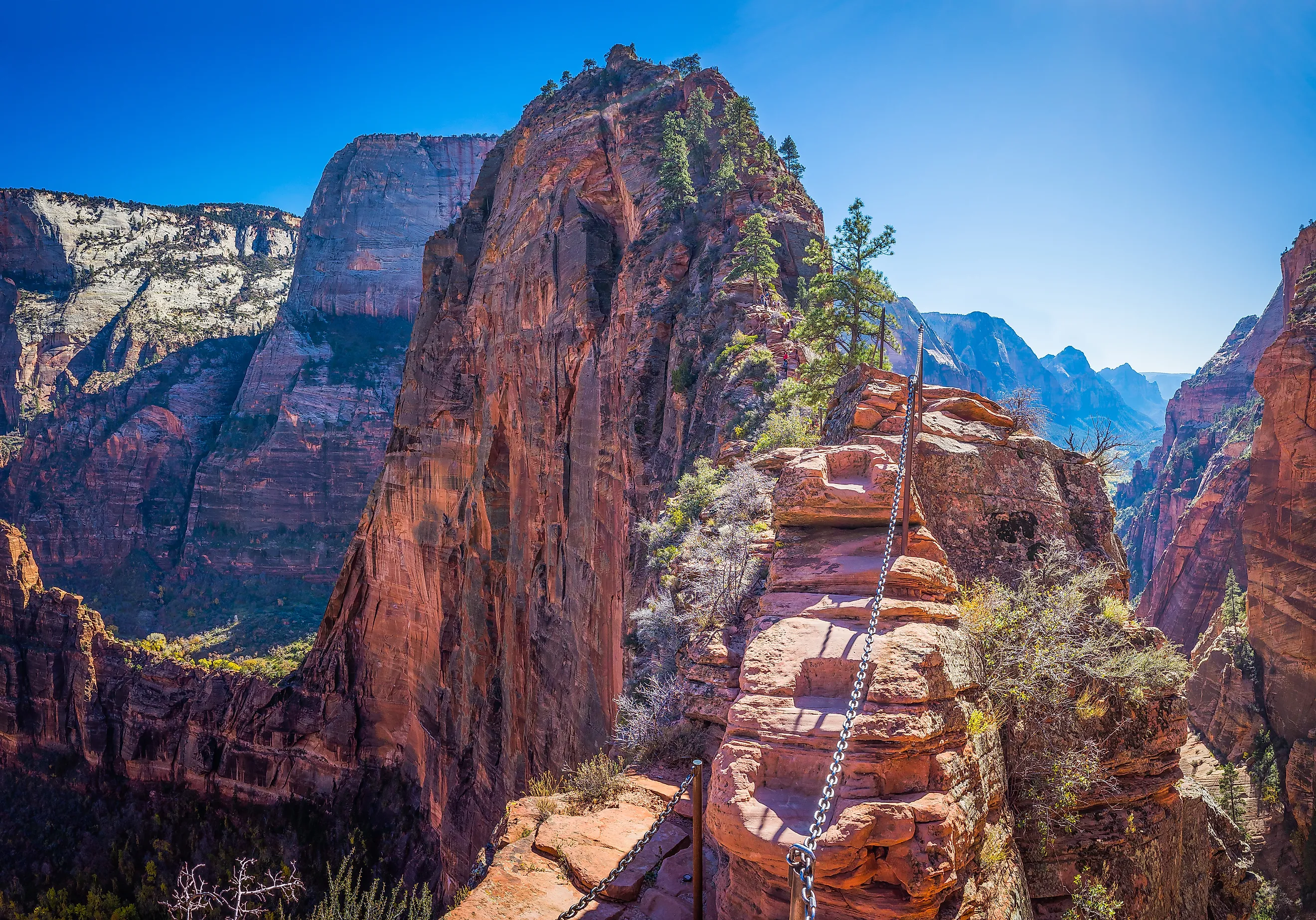
The National Park Service keeps a running count of people who never walk back out. Angel's Landing in Zion has chains bolted into the rock because the ridge is narrow enough to kill you without them. The Autobahn on Denali has recorded more deaths than any other stretch of North America's tallest mountain. The Mist Trail in Yosemite soaks its stone stairs in waterfall spray and sends people down the cliff. These seven parks hold some of the deadliest named trails in the country, and each one is worth understanding before you decide whether to go.
Zion National Park, Utah

The trail everyone comes for in Zion National Park is the one that keeps killing people. Angel's Landing runs 5.4 miles round-trip through southwestern Utah's sandstone, and more hikers have fallen to their deaths here than on any other trail in the park. The route climbs a set of tight switchbacks and finishes on a knife-edge ridge with drops on both sides, which is why the park drilled chains into the rock to hold onto. Summer heat and wet rock both make it worse. In April 2026, a 68-year-old man from Texas lost his balance on the chained section and fell, the eighteenth known fatality on the trail, and the park closed it for a day before reopening.
Grand Canyon National Park, Arizona

The Colorado River spent millions of years cutting the 277-mile gorge that gives Grand Canyon National Park its name, and the Colorado River is still down there at the bottom. Dozens of people have died on the park's trails, and the Nankoweap Trail on the North Rim is the one hikers name first. It runs 11 miles one-way down a steep descent along narrow cliffs of unstable rock, with no water and heat that runs most of the year. Most recorded deaths on it come down to dehydration. The Bright Angel Trail is the popular one, a 16-mile round-trip that drops to the river and climbs back, and heat kills people there too. It stays crowded, and the mule strings that share it do not make things simpler.
Denali National Park and Preserve, Alaska

Denali stands 20,310 feet, the tallest mountain in North America, and the West Buttress is the standard route to the top of it. The multi-day climb through Denali National Park and Preserve covers about 30 miles round-trip and gains over 13,000 feet across icy slopes, sharp ridges, and thin, freezing air. One stretch does most of the damage. The Autobahn, a snow-and-ice traverse between the 17,200-foot high camp and Denali Pass at 18,200 feet, has recorded more deaths than anywhere else on the mountain, and most of them happen on the way down. In May 2026, three climbers on a Latvian expedition fell to their deaths near the pass. A shorter option, the Mount Healy Overlook Trail, climbs 2.7 miles through switchbacks and loose rock to a viewpoint, and the 2.5-mile continuation to the Mount Healy summit adds narrow ridges and steep drops.
Rocky Mountain National Park, Colorado

Longs Peak tops out at 14,259 feet, the highest point in Rocky Mountain National Park, and the Park Service is blunt that the Keyhole Route to the summit is a climb rather than a hike. The 15-mile round-trip crosses vertical rock faces where an unroped fall would likely be fatal, along narrow ledges and loose rock that other climbers knock down on the people below. Altitude brings on dizziness, winter leaves the rock slick, and afternoon thunderstorms roll in with lightning on a schedule. Dozens of people have died on the route over the past century, most of them on the exposed section above the Keyhole known as the Ledges.
Yosemite National Park, California

The Mist Trail is named for a plain reason. Spray off Vernal Fall soaks the stone staircase along the edge of the fast-moving Merced River, and the wet steps have sent hikers over the cliff, worst of all in spring when the water runs at full flow. The trail climbs past Vernal and Nevada Falls in Yosemite National Park, set in California's Sierra Nevada Mountains, and it is also the first leg of the hike up Half Dome. That granite dome stands about 8,800 feet, and its final pitch is a set of two metal cables that hikers use to haul themselves 400 feet up bare rock without climbing gear. The full trip up the Mist Trail and Half Dome runs 14 to 16 miles round-trip and gains 4,800 feet.
Death Valley National Park, California

The danger in Death Valley National Park is simple to state: the heat kills people nearly every year. The largest national park in the contiguous United States protects 3.4 million acres of desert, dunes, and badlands, and it holds the records for hottest, driest, and lowest place in the country. Summer temperatures pass 120°F, and Furnace Creek logged 134°F on July 10, 1913, still recognized as the world's highest air temperature, though recent studies dispute the reading. Death records from NPS Morning Reports run from 1989 to 2025. Any trail here is dangerous in summer, including the 4.3-mile Gower Gulch Loop, which threads high walls into badlands and a canyon of unusual rock.
North Cascades National Park, Washington

North Cascades National Park holds the most extensive glacial system in the lower 48 across its 520,000 acres, and it also carries one of the highest death rates of any park, though mountaineering accounts for much of that record. The terrain is jagged peaks, glaciers, and steep exposed paths prone to avalanches and rockfall. Eldorado Peak, reached by a roughly 10-mile round-trip route, is a mountaineering objective rather than a walk-up, demanding climbing gear along a knife-edge of snow and ice, with falls and avalanches the main hazards in winter. The Copper Ridge Trail toward Copper Lake is a different kind of grind, 23 miles round-trip with over 4,000 feet of gain through forest, exposed ridges with steep drops, and rocky stretches where avalanche risk holds well into summer.
Respect The Ground Before You Walk It
What ties these seven trails together is not scenery but consequence. Zion and the Grand Canyon punish a slip or an empty water bottle, Denali and Rocky Mountain turn on altitude and weather, Death Valley works with heat alone, and North Cascades stacks glaciers and rockfall on top of remote terrain. The people who die on them are not, for the most part, reckless. They are underprepared, or caught by weather, or simply unlucky on a narrow ledge. Every one of these routes can be walked safely by hikers who know the conditions and turn back when they should. The list is worth reading as a set of demands each trail makes, not a dare.