The National Parks Losing Their Glaciers Fastest
As global temperatures rise due to human activity, some of the nation's most beautiful glaciers are melting. Glaciers play a huge role in the ecosystems and lands that surround them and rank among the most striking reminders of nature's majesty. Their disappearance is primarily a result of rising temperatures driven by the use of fossil fuels and deforestation. It has occurred at an alarming rate. As climate change continues to ravage global ecosystems, some of its most visible impacts can be seen in the glaciers of America's national parks.
Glacier National Park, Montana

Despite the park's name, the glaciers of Glacier National Park are expected to disappear completely over the next few decades as rising global temperatures melt the behemoths away. Almost two centuries ago, in 1850, the total number of glaciers in Glacier National Park was around 80. In 1966, the United States Geological Survey found that the park had only 35 glaciers larger than one tenth of a square kilometer, about 25 acres. By 2015, Glacier National Park had only 25. Once the defining feature of the local landscape, scientists expect all of Glacier's glaciers to melt away sometime in the coming decades.
Besides the huge loss of the park's namesake, which inspire millions of people and serve as a monument to the beauty of the natural world, the loss of these glaciers will have huge impacts on the availability of water, worsening droughts and endangering wildlife, and will destroy a one-of-a-kind landscape.
Mount Rainier National Park, Washington

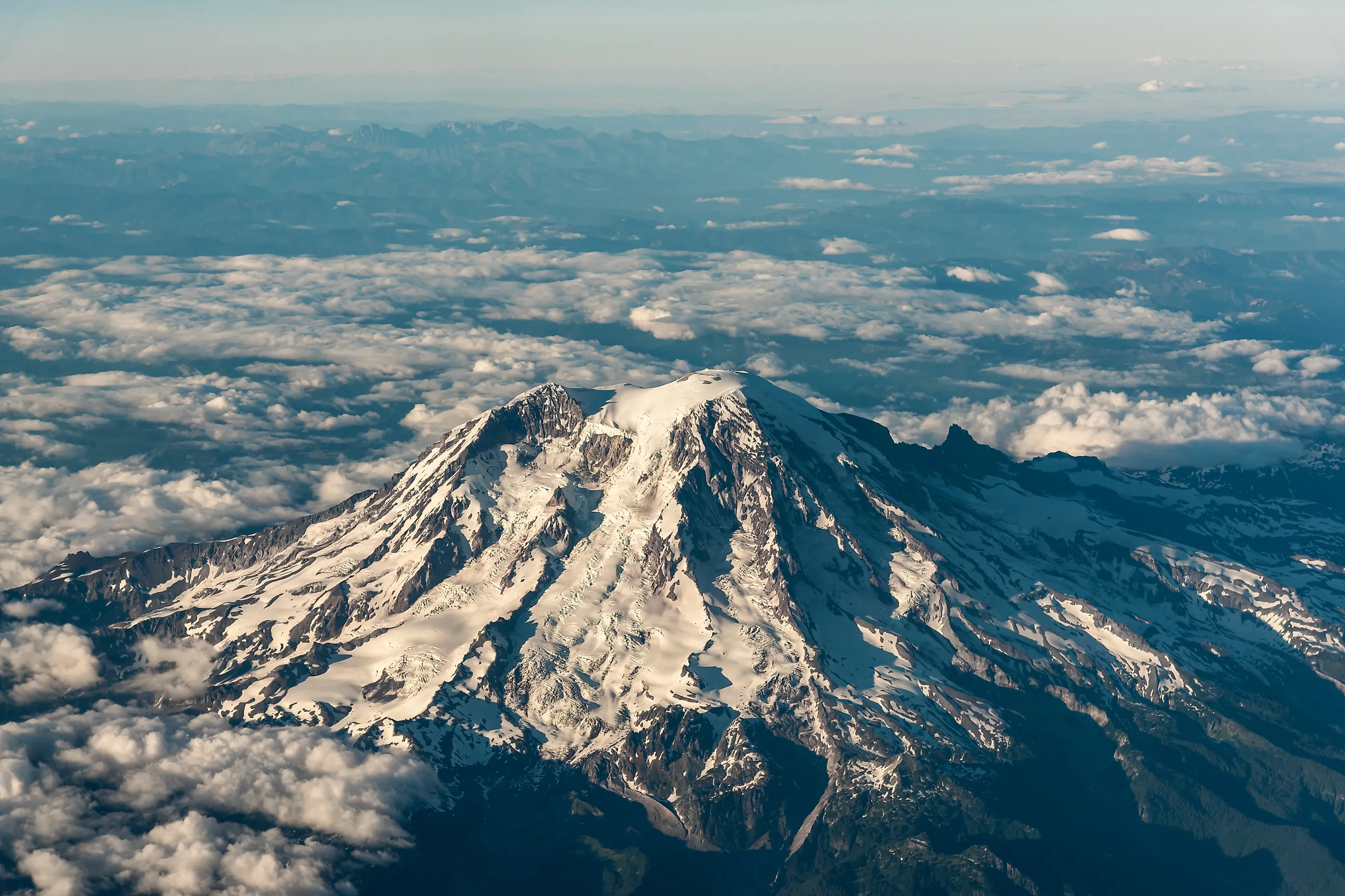
Towering at 14,410 feet, Mount Rainier is the most glaciated peak in the contiguous United States. The mountain is home to 28 glaciers which cover 30 square miles and feed five river systems. As a result of climate change, however, the once white peaks of Mount Rainier have grown duller and grayer. Recently, the mountain's glaciers have been melting at six times the historic rate. In the years between the turn of the millennium and 2014, some 200 billion gallons of water melted away from Rainier's glaciers, sending massive amounts of water and debris bounding down the mountain, ripping away ancient trees, carving paths through roads and trails, and carrying away man-made structures. The loss of these glaciers also puts the area's electric infrastructure at risk, as many of the area's hydroelectric dams are situated in rivers fed by Rainier's glaciers. These rivers also provide water to irrigate local farms, so their depletion means lower crop production.
North Cascades National Park, Washington

Since 1900, North Cascades National Park has lost a staggering 53% of its glaciers. Today, the park still holds over 300 glaciers, the most of any national park outside Alaska, even though they cover only about 42 square miles, a tiny fraction of the park's total area of 1,064 square miles. Despite making up such a small portion of the park, North Cascades' glaciers play a key role in supplying the nearby Skagit River and provide habitats for wolverines, as well as for trout and salmon by feeding rivers.
Alaska's National Parks
Many of the glaciers affected by climate change are found in Alaska, the largest state in the United States of America. The state is one of the most heavily glaciated areas in the world outside of the arctic circle, and is home to 23,000 square miles of glaciers, an area roughly the size of the state of West Virginia. Alaska is also home to massive amounts of national park land. The state has more than 19,000 glaciers, over 7,500 of which are located in the state's national parks.
Even though glaciers cover around 4% of the largest state's total land area, Alaska's glaciers are disappearing. According to the National Parks Service, the loss of glaciers within Alaska's national parks has increased, from an 8% reduction between 1950 and the early 2000s, to a 13% reduction between 1985 and 2020. The loss of glaciers hasn't been uniform across the state though; the glaciers that have receded the most are concentrated at lower elevations in Alaska's south. Here's a look at the parks that have suffered the most
Gates of the Arctic National Park & Preserve

According to the National Parks Service, Gates of the Arctic National Park lost 44% of its total glacial area between the 1950s and 2000, the highest percentage of glacial loss in Alaska's national parks. Today, only 0.3% of the park is covered in glaciers, some 36 square miles, though this loss is relatively minor compared to some of the other parks in Alaska, most of which had much more glacial coverage to begin with.
Kenai Fjords National Park

Between the 1950s and the year 2000, Kenai Fjords National Park lost 11% of its glacial coverage, and between 1985 and 2020 it lost around 12%. Today, 46% of the park is still covered in glaciers, an area totaling 478 square miles. Still, from 1985 to 2020 the park lost 66 square miles of glaciers, not an insignificant loss by any means.
Wrangell-St. Elias National Park and Preserve

By the total square mileage of glaciers lost, Wrangell-St. Elias National Park and Preserve comes in first, losing 373 square miles in the years between 1985 and 2020. However, some of that loss is due to natural cycles that occur as ice breaks off into the sea, and some of the park's glaciers have even grown in the past century. To put the park's glacial changes into perspective, Wrangell-St. Elias still has roughly 33% glacial coverage, 6,757 square miles across 3,121 glaciers. Overall, the park's glaciers receded 5% in both the period between 1950 and 2000, and the period between 1985 and 2020.
Glacier Bay National Park And Preserve

The Alaskan national park with the second highest loss of glaciers by square mileage is Glacier Bay National Park and Preserve. Between 1985 and 2020 the park lost 312 square miles of glacier, a reduction of roughly 19%. Today, 1,045 glaciers cover 1,327 square miles of the park, roughly 26% of the park overall. Still, at current rates, those glaciers will all but disappear sometime within the next few centuries if action isn't taken to reverse the impacts of climate change.
Denali National Park and Preserve

Though its glaciers haven't receded as much as those of some other parks on this list, Denali National Park and Preserve has still lost an astounding 222 square miles of glaciers since the 80s. Today, the park, dominated by massive mountains and astonishing valleys, maintains roughly 1,300 square miles of glaciers. Those are split across 881 individual glaciers which have been receding at a rate of 14% since 1985, a marked increase from the 8% loss between the 1950s and 2000. Home to the highest mountain in the United States, Denali National Park and Preserve is at risk of losing some of its most unique geographical features if we don't act fast.