The Best National Parks In Utah
Utah has the third most National Parks of any one state behind only Alaska and California. The state's five parks are spread across the dramatic red rock landscape of the Colorado Plateau, protecting arches and canyons millions of years in the making. In Zion National Park, you'll find one of the most unique hikes in the country. Less than two hours away, Bryce Canyon protects the highest concentration of hoodoos in the world. Arches contains thousands of natural arches, while Utah's most remote park, Capitol Reef, has miles of trails that wind through the barren rock landscape. No matter which park you choose for your next adventure, you'll find some of the most beautiful natural scenery in Utah.
Zion National Park

In 2025, almost five million people visited this park in southwest Utah, making it the second most visited National Park in the country. Zion National Park is the oldest in Utah, established in 1919 to protect a region where the Great Basin Desert and the Colorado Plateau intersect. The unique geography allows for several life zones to coexist, providing habitats for a diverse range of flora and fauna to thrive. The park contains desert, riparian, and woodland regions, and visitors can explore slot canyons and natural arches all within a park that is less than 150,000 acres.
Zion contains different regions, each with its own distinct landscape, hikes, and varying levels of visitation. Zion Canyon is the region most associated with the park, a fifteen-mile-long, 2,640-foot-deep gorge with sheer sandstone walls and hanging gardens created by the North Fork of the Virgin River. Here you'll find some of Zion's most famous hikes, like Angel's Landing, a permit-only climb up to the summit of a nearly 1,500-foot rock formation with great views of the canyon below. There is also the Narrows, a half-hike, half-wade up the canyon that is one of the most memorable adventures in the country. The canyon is the most popular region in the park, so if you crave a less crowded visit, Kolob Canyons and Kolob Terrace are much more peaceful. Kolob Canyons is in the northwest part of Zion and is great for visitors looking for shorter day hikes like the Timber Creek Overlook Trail and the Middle Fork of Taylor Creek, or who have limited time to visit the park. Kolob Terrace is a higher elevation region and feels much more rugged and remote than the rest of Zion. Forests, lava rock formations, and long-distance trails like the Hop Valley Trail and the West Rim Trail. East Zion is the best option for visitors who want to explore the park in a vehicle. Highway Nine runs through this stretch of Zion from the Zion-Mount Carmel Tunnel to Mount Carmel Junction and passes slickrock formations and sandstone domes. Some notable stops along the way are Many Pools, Checkerboard Mesa, and East Zion, which will offer the best chances to see Bighorn Sheep in the park.
Bryce Canyon National Park

Less than two hours away from Zion, Utah's smallest National Park, is located on the east side of the Paunsaugunt Plateau at the northmost point on the Grand Staircase. Despite the name, Bryce Canyon is not a canyon, but a series of natural amphitheaters carved out of the sedimentary rock by frost weathering and erosion. The park contains the highest concentration of hoodoos anywhere in the world, and the red and orange rock make for sunrises and sunsets. Despite the park's proximity to Zion and Grand Canyon, Bryce Canyon sees a fraction of its visitation, meaning you're much more likely to find peace and quiet on the trails that wind through the amphitheaters.
Bryce Canyon is a great National Park to visit if you're short on time. The park's main road, Southern Scenic Drive, is only 18 miles long and connects the park entrance to Yovimpa Point. If you only have a few hours or a day to explore, this drive will take you past nine scenic overlooks, including the very popular Rainbow Point, and through bristlecone groves that give way to quaking aspen and Douglas-fir as you gain elevation heading south. The pull-offs provide views of the rock formations below, and picnic areas like Whiteman Bench are great, perfect for a quick lunch. Take a hike on the Navajo Loop to get close to iconic rock formations like Wall Street and Thor's Hammer, or explore the Rim Trail if you want to stay above the rim and avoid any long climbs back to your car. For visitors who want a backcountry experience, the 23-mile Under the Rim Trail is a great option for an overnight adventure. The strenuous trek provides an escape from crowds and beautiful views of the amphitheaters between Bryce Point and Rainbow Point. As mentioned previously, the red rocks of the park are especially gorgeous at dawn and dusk, and Sunrise Point and Sunset Point are great places to watch the rising or setting sun make the hoodoos and sheer walls glow. After dark, these are also some of the best stargazing spots in the park. Bryce Canyon's high elevation and remote location create unspoiled dark skies where you can see thousands of stars at the new moon.
Capitol Reef National Park

Capitol Reef protects almost all of the 100-mile-long Waterpocket Fold, a geologic monocline, in south-central Utah. The 242,000-acre park was named for the whitish domes of the Navajo Sandstone cliffs, which resemble the rotundas found on Capitol buildings, and contains a plethora of cliffs, slot canyons, and monoliths that dominate the desert landscape. You'll also find some features you might not expect to see in such a desolate landscape, like orchards, rivers, and waterfalls. Capitol Reef is Utah's most remote National Park and received the second fewest visitors in 2025, which makes it another great choice for hikers who want to explore the region without the crowds.
The best place to begin your visit to Capitol Reef is the Fruita Historic District. Here you'll find the park visitor center, where you can get oriented and pick up any required permits. Fruita has been inhabited by humans for thousands of years by Native Americans and Mormon settlers, and you'll find evidence of this long history of habitation in the Fremont Culture Petroglyphs and the Gifford Homestead. The park's historic fruit orchards, first planted in the late 19th century, are still thriving and play host to a U-pick harvest operation in the summer and early fall. From Fruita, you can spend about an hour and a half driving the entirety of the park's Scenic Drive. Along the way, there are several notable rock formations, including Cassidy Arch, The Tanks, and Golden Throne. Several popular trailheads are right along State Route 24, including Hickman Bridge, a relatively easy 1.8-mile hike that leads to a stunning natural bridge. If you're up for a more challenging hike, the Sulphur Creek Trail winds through Sulphur Creek Canyon, providing a similar experience to the Narrows in Zion. The route is unmarked and not maintained, so orienteering and routefinding skills are necessary. Capitol Reef's sandstone is excellent for rock-climbing, and the most popular routes can be found along the Wingate cliffs. The park's slot canyons offer excellent canyoneering opportunities as well, but given the technical and dangerous nature of these activities, both require permits from the National Park Service.
Arches National Park

It's an apt name for a park that contains more than 2,000 sandstone arches, the highest concentration you can find anywhere in the world. Located in eastern Utah, Arches National Park is one of the more accessible parks in the state. It's about ten minutes north of Moab, and the park's scenic drive can be driven in about three hours. Of course, once you pass through the entrance station, you'll probably want to spend much more than three hours exploring the red rock formations that include not only the aforementioned arches, but balanced rocks, towering sandstone fins, and enormous spires that contrast beautifully with the bright blue sky.
Of Utah's five parks, Arches is probably the best to visit if you only have one day. Auto touring is one of the most popular ways to view the park's outstanding natural features, and simply following the scenic drive will take you past some of the most notable rock formations, including the Windows Section and Balanced Rock. It is important to note that given the park's popularity and proximity to Moab, the roads and parking lots can get crowded, especially during peak season. To avoid the crowds, the National Park Service advises arriving early in the morning or late in the afternoon, when you'll get the added benefit of ideal lighting for photography. If you want to get closer to the rock formations than the viewpoints along the scenic drive allow, Arches has trails for all ability levels. Shorter trails like the Double Arch Trail and the Park Avenue Trail are great for families. If you're up for a more challenging adventure, the Delicate Arch Trail crosses open slickrock for about a mile and a half with minimal shade and some exposure, but it will take you past the historic Wolfe Ranch Cabin and a petroglyph panel before arriving at a viewpoint for the park's largest freestanding arch.
Canyonlands National Park

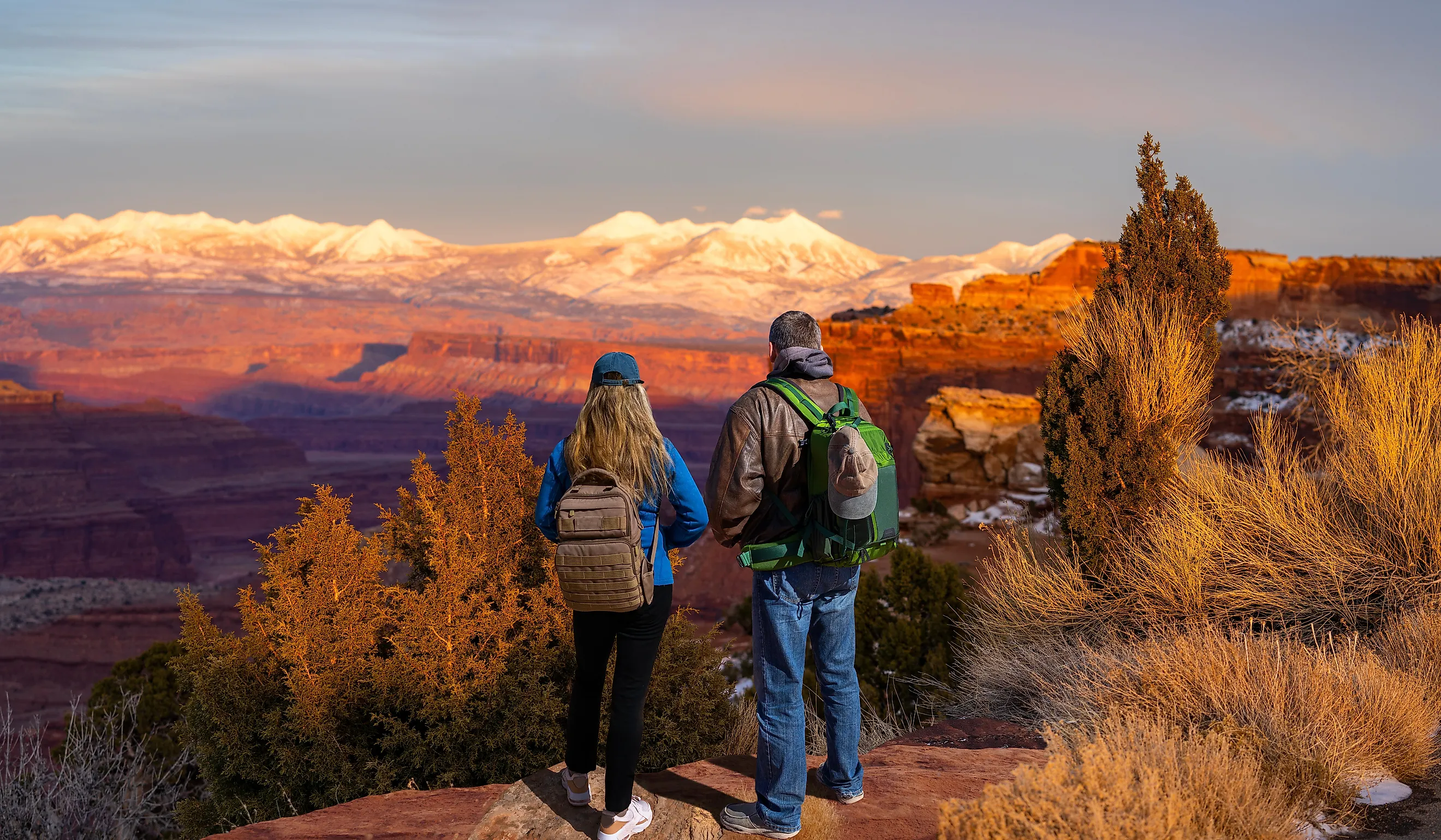
If Arches National Park has Arches, guess what Canyonlands National Park has? Utah's largest National Park was also its least visited in 2025, despite being a half hour southwest of Moab. Canyonlands is easily the most underrated of Utah's five parks. American writer and environmental activist Edward Abbey, who once worked as a seasonal park ranger at Arches when it was still a National Monument, referred to Canyonlands as "the most weird, wonderful, magical place on Earth." While others may harbor differing opinions, it's very difficult to look out at the colorful topography of canyons, mesas, and buttes etched into the Colorado Plateau by the Green River and Colorado River and disagree with Abbey's assessment.
Canyonlands is divided into three distinct land districts: Island in the Sky, Needles, and the Maze. There are no roads connecting the regions, so it will likely take several days to fully explore the park. Island in the Sky is the most accessible and closest to Moab. The district sits atop a mesa, hence the name, about 1,000 feet above the surroundings in the northern part of the park, and has some of the most dramatic vistas and overlooks including the Green River Overlook and the Grand View Point Overlook. Beyond the vistas, the region is full of stunning rock formations like Mesa Arch and Whale Rock. The Needles Region in the southeast corner of the park is named for the colorful Cedar Mesa sandstone spires found throughout the area. About an hour and a half from Moab, this is the go-to district for hikers and backpackers, with over sixty miles of trails winding through the slickrock and creek washes. Easier day hikes like the Stone Storehouse Trail and Cave Spring Trail lead to historic structures and prehistoric rock paintings, while more challenging hikes like the Peekaboo Trail traverse several canyons with steep slopes and unbelievable views. The Maze is the most remote region of the park. For those who do brave the region, the solitude found in the rugged canyons is unmatched by anything you'll find in the other districts.
Take a drive to the Mighty Five!
The Mighty Five is one of the densest concentrations of National Parks in the country, and you can drive between the state's two outlying parks in roughly five hours, making it easy to combine multiple park units into one trip. The striking red rock formations and bright blue desert skies of Southern Utah draw millions of visitors to the region every year, and each park provides a different look at the distinctive landscape. Whether you're diving deep into a single park, trying to cross them all off your list on a cross-state road trip, Utah's National Parks are some of the best the country has to offer.