The Smoky Mountain Valley Where A Whole Community Was Moved Out
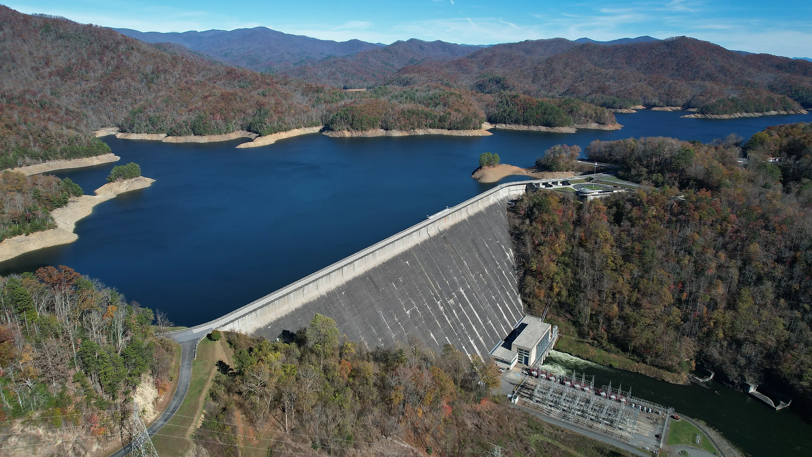
Days after Pearl Harbor, Congress authorized the Tennessee Valley Authority to dam the Little Tennessee River gorge. The power would go to an Alcoa aluminum plant and, later, to enriching uranium. Building it meant flooding more than 10,000 acres and moving out 1,311 families from a string of valley communities called the North Shore. They were told a road would be built so they could come back and visit their cemeteries. Eighty-two years later it still has not been.
Six Communities Went Under

The valleys cleared for Fontana Lake had names and populations.
Fontana, Bushnell, Forney, Judson, Proctor and Hazel Creek were subsistence farms and logging towns along the river. Proctor dated to the 1830s, settled by Moses and Patience Proctor, who had come from Cades Cove.
Roughly 700 families came from the Swain County side and another 600 from Graham County. Some homes were submerged and others were burned to the ground.
The Lake Took The Only Road

The flooding did more than remove the houses, which is where the long dispute originates.
Fontana Lake covered most of North Carolina Highway 288, the road running along the north side of the Little Tennessee from Bryson City to Deals Gap. It was the area's only through route.
A further 44,000 acres north of the new reservoir were transferred to Great Smoky Mountains National Park, which put the old homesites inside a national park with no road to them.
Two Thousand Graves Were Cut Off

The cemeteries are the reason this remains a live issue rather than a historical footnote.
The project required the relocation or isolation of over 2,000 gravesites across 27 cemeteries. Families who had buried relatives in those valleys for a century could no longer reach them.
In 1978 the park pledged to maintain and provide access to the remote cemeteries, working with the North Shore Cemetery Association. Access is by boat and on foot.
The Road Was The Deal

The agreement signed in 1943 is the document everything since has turned on.
The federal government committed to building a new road along the north shore connecting Bryson City to Fontana Village, replacing the drowned Highway 288. One displaced resident, Delia Woodard Watkins, later recalled that nobody objected because the road was going to be built and people could go back.
Between 1948 and 1962 the Park Service carved part of a proposed 30-mile route. Costs and environmental concerns stopped it.
It Ends At A Tunnel

What exists today is about six miles of pavement and a name locals gave it.
The partial route is known as the Road to Nowhere. It runs out of Bryson City into the park and terminates at a tunnel, beyond which the Lakeshore Trail continues on foot.
For descendants of the North Shore families it is a permanent and visible reminder of an unkept promise, which is roughly why the name stuck.
The Fight Lasted Sixty Years

Between the 1940s and 2010 this was a continuous political argument in western North Carolina.
Politicians at local, state and national level repeatedly offered compromise funding proposals to Swain County and the displaced families. None of them produced a road.
By the 2000s most public comment had turned against building it, favoring a financial settlement instead. The park had become wilderness in the intervening decades.
Fifty-Two Million Dollars Instead

In February 2010 the Interior Secretary traveled to Bryson City to end the matter.
The Department of the Interior agreed to pay Swain County 52 million dollars over ten years instead of completing the road, formally closing the 1943 agreement. Congressman Heath Shuler assembled the deal.
The first payment was 12.8 million dollars. It was another eight years before the county saw another installment, and the settlement was finally paid off in 2018.
Not Everyone Considers It Settled

The money ended the legal question without ending the argument.
Descendants have argued the settlement did not address the deeper obligation owed to families the dam and the park displaced. The road would have restored access. A check to the county did not.
Decoration Day gatherings at the North Shore cemeteries continue, reached by boat across the lake that covers the valleys those families farmed.
The Dam Is Now A Visitor Attraction

There is a neat and uncomfortable symmetry in what the site has become.
Fontana Dam is the tallest dam east of the Rocky Mountains and now draws tourists, with a TVA visitor center telling the story of its construction and of the displacement of the North Shore communities.
The structure that ended those valleys explains their ending to visitors.
You Can Still Reach Proctor

The valley is not under water, which surprises people who assume the whole North Shore was flooded.
Hazel Creek and Proctor sit above the waterline and are reachable by boat shuttle across Fontana Lake, then on foot. A handful of structures and the cemetery remain.
What was taken was not the ground. It was the road to it.
The Short Answer

Fontana Dam displaced 1,311 families from Fontana, Bushnell, Forney, Judson, Proctor and Hazel Creek in the early 1940s, flooded over 10,000 acres including the only road, isolated more than 2,000 graves in 27 cemeteries, and added 44,000 acres to Great Smoky Mountains National Park.
The promised replacement road was never built. Six miles of it exist, ending at a tunnel locals call the Road to Nowhere, and in 2010 the government paid Swain County 52 million dollars to stop asking. The cemeteries are still reached by boat.