The Rainiest Mountain In America
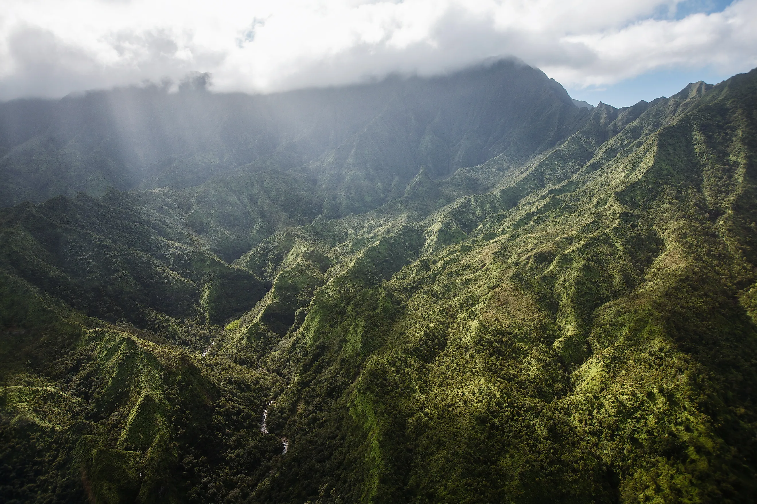
Mount Waialeale is the rainiest mountain in the United States. Located on the island of Kauai in Hawaii, this shield volcano receives up to 450 inches of rain on average annually. The name of the mountain itself points to this feature, as it translates into English as overflowing water. The most rain ever recorded on the mountain was in 1982, when the summit received 683 inches. The mountain receives this rainfall due to its geology, especially its location. We will begin with a discussion of the geology of Waialeale before diving into why it gets so much rainfall.
Geology

The entire island of Kauai comes from a shield volcano that grew under the Pacific Ocean in what is known as the pre-shield period. Eventually, a volcano rose out of the sea around 5 to 6 million years ago, with lava flows identified on the island from 5 million years ago. This makes Kauai the oldest of the main Hawaiian islands, though the Northwestern Hawaiian Islands beyond it are older still.
However, around 4 million years ago, the summit of the shield volcano collapsed, leaving behind a massive caldera 10 to 12 miles across, the largest of its kind in the Hawaiian Islands. A secondary, smaller caldera formed on the southeastern end of the shield due to a collapse. Both of these calderas were filled with lava. Over time, these lava flows cooled, leaving behind basalt rocks. The major caldera formation is known as the Olokele, while the smaller one is the Haupu formation. This process of eruption and cooling leads to subsidence, or a compaction of the land. This, combined with the erosion from wind and rain, is slowly reducing the overall size of Kauai.

The Olokele formation itself is actually more resistant to erosion, due to its horizontal layers of cooled rock. Over the top of this formation are the Waimea Canyon and the Alakai Swamp.
On the northern coast of Kauai, its shoreline consists of large cliffs and sharp ridges, which geologists believe formed when the shield volcano was building, as portions of the volcano fell off and into the ocean.
Mount Waialeale sits at an elevation of 5,148 feet and is an eroded dome. It sits at the southern end of the larger caldera. It is not the tallest mountain on the island, as that honor falls to Kawaikini at 5,243 feet, but it is the wettest of the mountains.
Why is it so wet?

Mount Waialeale receives so much rain due to a combination of factors, including wind, precipitation systems, and its overall size.
It is the northernmost of the main Hawaiian islands, sitting at roughly 22 degrees north latitude. Meaning it receives the brunt of frontal systems during the winter as they arrive from the northwest. Another big factor is the trade wind inversion.
This is a portion of the atmosphere where the temperature either remains the same or increases with height. This change in the wind is caused by high-pressure systems to the northeast of Hawaii. Air continues to rise as long as it is warmer than the air above. But at the inversion point, where the atmospheric temperature is warmer than the rising air, the air stops.
Trade wind inversions vary in height, although in Hawaii it is around 7,000 feet. In Kauai, the trade wind inversion is at 6,000 feet, which is about 852 feet above Mount Waialeale. These trade winds pick up a great deal of moisture from the ocean and drop that moisture on top of Mount Waialeale. The rain itself that falls down is warm due to this inversion.

Another factor is how steep the walls of Mount Waialeale are. They rise up to 3,000 feet, which forces the humid air to rise up before unleashing rain onto its surface.
A study of trade wind rainfall atop Waialeale by C. S. Ramage and Thomas A. Schroeder set out the mechanism in detail. Significant rain arrives when moderate or fresh trade winds are lifted up the mountain's eastern escarpment, but only where a band of cumulus already extends upwind of the peak. Little vertical wind shear and a sharp ceiling on the moist layer together limit entrainment and let cloud droplets grow. At the summit the rain is usually light to moderate, with drops under 2 millimeters, but it persists long enough to pile up enormous totals.
The same paper distinguishes wet days from dry ones by what sits offshore. On wet days, lines of trade wind cumulus reach upwind of the island, while on dry days the top of the moist layer sits near the peak itself, or the sky upwind is close to clear. This rain is often not accompanied by thunderstorms, due to the trade winds themselves surrounding the Hawaiian islands with warmer moist air, rather than the cold fronts that produce thunderstorms.
Exploring Mount Waialeale

Getting around Mount Waialeale can be a challenge due to its very wet and slick walls. For this reason, helicopter tours are one of the most common ways that people visit the mountain, especially to get a view of the summit of the mountain and the Waialeale Crater. However, there are trails that go by some of the mountain's most impressive features, such as the Weeping Wall.
The Weeping Wall is also known as the Blue Hole and is an example of how the large amounts of rain impact the mountain. Here, water cascades down the mountain before splitting off into several finger-shaped smaller waterfalls. The waterfalls flow down three sides of the sheer cliffs. It can be a major challenge to reach the Weeping Wall, as one has to cross over rocks and streams to reach it, and it is often impacted by flash floods. Due to the large amounts of rain, little vegetation grows on Mount Waialeale, as not many plants can withstand the volume of rain, and clouds prevent much sunlight from reaching the summit.
Another notable landmark is the Alakai Swamp Trail, a 3.5-mile one-way journey that goes through rainforests and bogs. Much like the Weeping Wall Trail, it can get very muddy and slippery on the trail.
Waimea Canyon State Park is a more accessible portion of the island. It is sometimes called the Grand Canyon of the Pacific for its 3,600-foot-deep gorge that is 14 miles long by 1 mile wide. This canyon was formed by lava flows and subsequent erosion.
Is it the wettest place on Earth?
Mount Waialeale is the rainiest mountain in America, but it is not the wettest place on Earth, and it is not second either. Mawsynram in India leads most rankings at about 467 inches a year, with Cherrapunji, Tutendo in Colombia, and Cropp River in New Zealand all recording comparable or higher averages than Waialeale's roughly 450 inches. That places the Hawaiian summit around fifth on most lists, though the order shifts as records lengthen and the mountain did hold the outright title in 1982. The mountain acts as a sponge for the rest of Kauai, taking up hundreds of inches of rain annually, while the rest of the island has much lower precipitation averages from around 5 to 60 inches, depending on the section. The combination of its geology, geography, and the trapped warm air of the trade wind inversion makes Mount Waialeale a very moist and slippery place. It well earns its name of overflowing water.