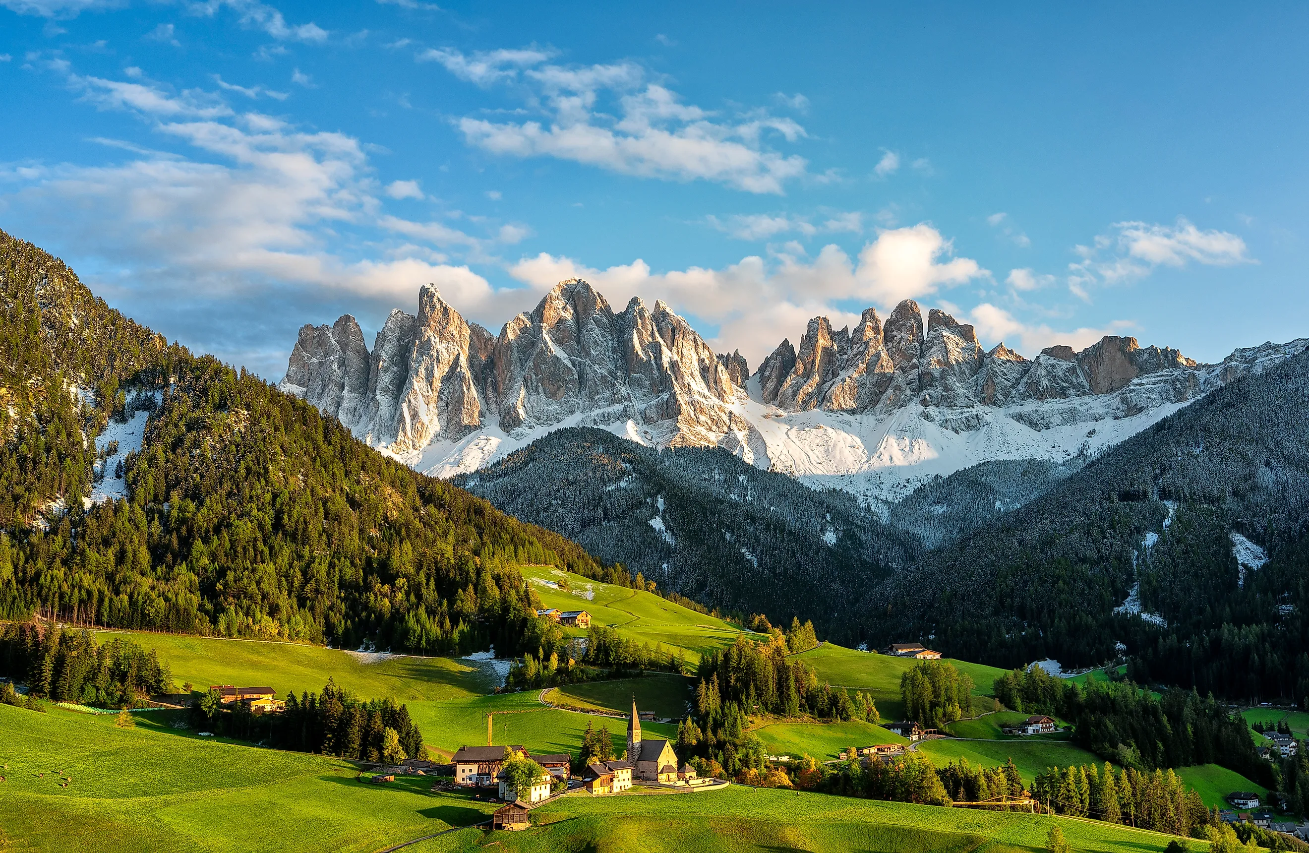
The Major Mountain Ranges In Europe
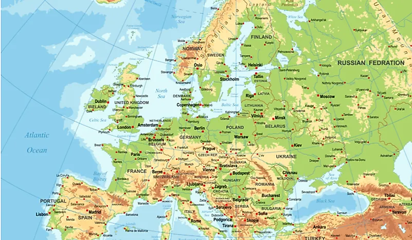
Mount Elbrus, an inactive volcano in the Greater Caucasus of southern Russia, rises to 5,642 metres and is the highest mountain in Europe. Mont Blanc at 4,808 metres is the highest peak entirely within the European Union. Galdhøpiggen at 2,469 metres is the highest point in mainland Northern Europe. Below those headline peaks, Europe contains close to a dozen major mountain ranges, dozens of distinct massifs, and many smaller secondary ranges. The eleven ranges profiled below are the most consequential of these, presented alphabetically with brief notes on length, highest peak, geological origin, and current status. A reference table of 32 named European mountain ranges follows.
Alps

The Alps are the highest and most famous mountain system contained entirely within Europe, stretching roughly 1,200 km in a crescent across eight countries: France, Switzerland, Monaco, Italy, Liechtenstein, Austria, Germany, and Slovenia. The range covers approximately 207,000 km², with a maximum width of around 250 km between Verona, Italy, and Garmisch-Partenkirchen, Germany. The Alps were formed over roughly the last 65 million years by the ongoing collision of the African Plate with the Eurasian Plate, the same collision that uplifted the Apennines, Dinaric Alps, and Caucasus.

Hundreds of peaks in the Alps exceed 4,000 metres. The highest is Mont Blanc at 4,808 metres on the France-Italy border; the second is Monte Rosa at 4,634 metres on the Switzerland-Italy border. The 22.6 km-long Aletsch Glacier in Switzerland's Valais canton is the largest glacier in the Alps. Notable subranges include the Bernese Alps, the Dolomites (a UNESCO World Heritage Site), the Pennine Alps, and the Julian Alps. About 14 million people live in the Alpine region across the eight countries, and the area draws roughly 120 million tourists per year for skiing, mountaineering, and summer recreation.
Apennines

The Apennine Mountains form a roughly 1,200 km chain running the length of the Italian peninsula, from the Liguria region in the northwest to the toe of Calabria in the south, and continuing offshore into Sicily. The highest peak is Corno Grande at 2,912 metres in the Gran Sasso d'Italia massif of central Italy's Abruzzo region. The Apennines were formed during the same Alpine orogeny that built the larger Alps, with active tectonic compression continuing to drive both uplift and the seismic activity that periodically causes destructive earthquakes (including the 2009 L'Aquila and 2016 Norcia earthquakes).
Several Italian national parks protect forests, montane grasslands, and the Apennine wolf and Marsican brown bear populations, including Gran Sasso e Monti della Laga National Park, Abruzzo National Park, and the Pollino National Park in Calabria. The Marsican brown bear, found only in the central Apennines, is one of Europe's most endangered large mammals, with a population of roughly 50 individuals.
Balkan Mountains

The Balkan Mountains, known in Bulgarian as Stara Planina ("Old Mountain"), run for approximately 557 km across the eastern Balkan Peninsula from the Vrashka Chuka Peak on the Bulgaria-Serbia border east to Cape Emine on the Black Sea coast. The highest peak is Botev Peak at 2,376 metres in central Bulgaria. The range gives its name to the entire Balkan Peninsula. Central Balkan National Park and Bulgarka Nature Park preserve much of the high central section.
The Balkan Mountains are closely tied to Bulgarian national identity. Hristo Botev, the Bulgarian revolutionary poet for whom Botev Peak is named, was killed there in 1876 during the failed uprising against Ottoman rule. The Shipka Pass through the central Balkans was the site of a decisive August 1877 battle in the Russo-Turkish War that led directly to Bulgarian independence. Numerous karst cave systems within the range, including Magura, Bacho Kiro, and the Devetashka, are significant tourist and archaeological sites.
Black Forest

The Black Forest (Schwarzwald) is a forested mountain range covering approximately 11,100 km² in the southwestern German state of Baden-Württemberg, extending roughly 160 km north to south and up to 60 km east to west. The highest peak is the Feldberg at 1,493 metres in the southern Black Forest. The range takes its name from the dense canopy of fir and spruce that historically darkened the forest interior, an effect still visible in the older forest stands. The Rhine Valley bounds the range to the south and west; the Neckar drainage bounds it to the east.
The Black Forest is the source of the Danube River, which begins at the confluence of the Brigach and Breg streams near Donaueschingen and flows roughly 2,850 km east to the Black Sea. The cuckoo clock industry, headquartered in towns including Triberg and Schonach, originated in the Black Forest in the 17th century and is still active. Notable destinations include the Triberg Falls (Germany's highest natural waterfalls at 163 metres), Lake Titisee, and the Hohenzollern Castle on a Black Forest foothill.
Carpathian Mountains

The Carpathian Mountains form a roughly 1,500 km arc across Central and Eastern Europe, passing through seven countries: Czechia, Slovakia, Poland, Hungary, Ukraine, Romania, and Serbia. They are the third-longest mountain system in Europe after the Urals and the Scandinavian Mountains. The highest sub-range is the Tatra Mountains on the Poland-Slovakia border, where Gerlachovský štít in Slovakia rises to 2,655 metres. Several distinct sub-ranges form the broader system: the Western, Eastern, and Southern Carpathians; the Apuseni Mountains in Romania; and the Serbian Carpathians.
The Carpathians hold roughly half of Europe's remaining old-growth temperate forest and the continent's largest populations of brown bears, wolves, and lynx outside of Russia. Romania alone is home to approximately 6,000 brown bears, more than any other European country. Bran Castle in Romania, popularly associated with Bram Stoker's 1897 novel Dracula, sits on a Carpathian pass between Wallachia and Transylvania. The Carpathian Biosphere Reserve in Ukraine and Retezat National Park in Romania protect significant portions of the high range.
Caucasus Mountains

The Caucasus Mountains stretch roughly 1,200 km between the Black Sea and the Caspian Sea, forming part of the conventional boundary between Europe and Asia. The range passes through Russia, Georgia, Azerbaijan, and Armenia and is divided into the Greater Caucasus to the north and the Lesser Caucasus to the south. The highest peak is Mount Elbrus, an inactive stratovolcano in the Russian republics of Kabardino-Balkaria and Karachay-Cherkessia, at 5,642 metres. Elbrus is the highest mountain in Europe and one of the Seven Summits.
Eight Caucasus peaks exceed the height of Mont Blanc, including Dykh-Tau (5,205 m), Shkhara (5,193 m), Koshtan-Tau (5,152 m), Kazbek (5,054 m), and Pushkin Peak (5,100 m). Most are concentrated along the Russia-Georgia border. The range was formed by the ongoing northward collision of the Arabian Plate with the Eurasian Plate, the same convergent system that uplifts the Alborz, Zagros, and the eastern extension into the Pamirs and Hindu Kush. The Caucasus region remains seismically active, with significant earthquakes recorded in Armenia (Spitak, 1988) and northern Iran throughout the 20th century.
Dinaric Alps

The Dinaric Alps run for approximately 645 km along the eastern coast of the Adriatic Sea, from the Julian Alps in the northwest of Slovenia south through Croatia, Bosnia and Herzegovina, Montenegro, Serbia, Kosovo, and Albania. The highest peak is Maja Jezercë at 2,694 metres in the Albanian Alps of northern Albania. The range gives its name to the Dinaric karst, the geological term for the dense network of caves, sinkholes, poljes (large flat-floored depressions), and underground rivers that characterise much of the limestone-dominated range.
The Postojna and Škocjan cave systems in Slovenia (Škocjan is a UNESCO World Heritage Site) and the Karlovac region in Croatia are among the most-visited karst landscapes in Europe. Plitvice Lakes National Park in central Croatia, also a UNESCO site, sits in the Dinaric Alps and contains 16 terraced lakes connected by waterfalls. The Tara River Canyon in Montenegro is the deepest canyon in Europe at 1,300 metres in places, second only to the Grand Canyon globally among canyons formed by river erosion.
Owl Mountains

The Owl Mountains (Góry Sowie in Polish) are a small mountain range in southwestern Poland, roughly 26 km long, forming part of the broader Sudetes system between Kłodzko Land and the historic Lower Silesian region. The highest peak is Wielka Sowa ("Great Owl") at 1,015 metres. Much of the range lies within the Owl Mountains Landscape Park, established in 1991 to protect the area's beech and spruce forests and the upland meadows along the ridge.
The range is best known for Project Riese, the unfinished Nazi German underground complex built between 1943 and 1945 using forced labour from the Gross-Rosen concentration camp. Seven separate tunnel complexes were excavated into the mountains and have been only partially explored since the war. Several are now open to visitors, including Osówka, Włodarz, and Rzeczka. The complex's intended purpose has never been conclusively established and remains a subject of historical debate.
Pyrenees

The Pyrenees extend roughly 491 km along the France-Spain border from the Mediterranean coast at Cap de Creus to the Bay of Biscay on the Atlantic, separating the Iberian Peninsula from the rest of continental Europe. The microstate of Andorra is entirely contained within the range. The highest peak is Aneto at 3,404 metres in the Maladeta massif of the Spanish province of Huesca; Aneto was first summited in July 1842 by a five-person team led by Count Albert de Franqueville and Platon de Tchihatcheff.
The Pyrenees are geologically older than the Alps, dating to a Cretaceous-to-Eocene orogeny roughly 100 to 35 million years ago. The range contains 129 peaks above 3,000 metres, concentrated in the Central Pyrenees. Notable features include Gavarnie Falls (422 m, France's highest waterfall) in the Cirque de Gavarnie, the limestone-and-glacier Posets-Maladeta Natural Park, and the Aneto Glacier, which has shrunk from roughly 300 hectares in the 19th century to under 50 hectares today. Wildlife includes the Pyrenean chamois, the Pyrenean desman (a small aquatic mammal endemic to the range), and a small reintroduced population of brown bears.
Scandinavian Mountains

The Scandinavian Mountains, known in Norwegian and Swedish as Skanderna or Kjølen ("the keel"), run roughly 1,700 km along the spine of the Scandinavian Peninsula from southern Norway through Sweden to the northern tip of Finland's Lapland. The range is by length the second-longest in Europe after the Urals. The highest peak is Galdhøpiggen at 2,469 metres in the Jotunheimen massif of southern Norway, which is also the highest point in mainland Northern Europe. Kebnekaise (2,096 m) is the highest in Sweden; Halti (1,324 m) is the highest in Finland.
The western edge of the range drops sharply into the Norwegian Sea and North Sea, carved by Pleistocene glaciation into the network of fjords for which Norway is internationally known. Sognefjord, the longest in Norway at 205 km, cuts more than 1,300 metres below sea level. Jostedalsbreen in central Norway is the largest glacier in continental Europe, covering 474 km². The range is comparatively low relative to its length because its formation predates the Alpine orogeny: the Scandinavian Mountains are the deeply eroded remains of the Caledonian orogeny of roughly 490 to 390 million years ago.
Ural Mountains

The Ural Mountains are the longest mountain range in Europe by some accounts, running roughly 2,500 km north-south through western Russia from the Arctic Ocean coast to the Ural River and the border with Kazakhstan. The range forms part of the conventional boundary between Europe and Asia. The highest peak is Mount Narodnaya at 1,894 metres in the Sub-Polar Urals. The islands of Vaygach and Novaya Zemlya in the Arctic Ocean are the submerged northern continuation of the Urals.
The Urals are exceptionally rich in mineral resources, including iron, copper, manganese, nickel, chromium, platinum, and a variety of precious and semi-precious stones; the city of Yekaterinburg on the eastern slope is the historic centre of Russian gemstone cutting. Mining and metallurgy in the region developed rapidly under Peter the Great in the early 18th century and remain economically significant. The Urals are also geologically old, formed during the Uralian orogeny of roughly 320 to 250 million years ago when Baltica collided with Siberia to form the supercontinent Pangaea.
List of Major Mountain Ranges in Europe
| Rank | Mountain Range | Country of Location |
|---|---|---|
| 1 | Alps | France, Switzerland, Monaco, Italy, Liechtenstein, Austria, Germany, Slovenia |
| 2 | Apennines | Italy, San Marino |
| 3 | Balkan Mountains | Bulgaria, Serbia |
| 4 | Black Forest | Germany |
| 5 | Cantabrian Mountains | Spain |
| 6 | Carpathian Mountains | Czechia, Hungary, Poland, Romania, Serbia, Slovakia, Ukraine |
| 7 | Caucasus Mountains | Azerbaijan, Georgia, Russia, Armenia |
| 8 | Dinaric Alps | Albania, Bosnia and Herzegovina, Croatia, Montenegro, North Macedonia, Serbia, Slovenia |
| 9 | Lake District | England |
| 10 | Măcin Mountains | Romania |
| 11 | Massif Central | France |
| 12 | Owl Mountains | Poland |
| 13 | Ore Mountains | Czechia, Germany |
| 14 | Pennines | England |
| 15 | Pindus Mountains | Greece, Albania |
| 16 | Rila-Rhodope | Bulgaria, North Macedonia, Greece |
| 17 | Rhön Mountains | Germany |
| 18 | Šar Range | Albania, Kosovo, North Macedonia |
| 19 | Scandinavian Mountains | Finland, Norway, Sweden |
| 20 | Scottish Highlands | Scotland |
| 21 | Sierra Morena | Spain |
| 22 | Sistema Bético | Spain |
| 23 | Sistema Central | Portugal, Spain |
| 24 | Sistema Ibérico | Spain |
| 25 | Świętokrzyskie Mountains | Poland |
| 26 | Sudetes | Czechia, Germany, Poland |
| 27 | Šumava | Austria, Czechia, Germany |
| 28 | Swabian Alb | Germany |
| 29 | Serra de Tramuntana | Spain |
| 30 | Ural Mountains | Russia, Kazakhstan |
| 31 | Vogelsberg Mountains | Germany |
| 32 | Vosges Mountains | France |
Where Europe Goes Vertical
Europe's mountain ranges divide into three broad geological groups by age. The Caledonian remnants (Scandinavian Mountains, Scottish Highlands, parts of Ireland) are the oldest, eroded down from earlier alpine-scale heights over 400 million years. The Hercynian or Variscan ranges (Urals, Sudetes, Massif Central, Black Forest, Vosges, parts of the Cantabrians) date to roughly 300 million years ago and are typically rounded and forested. The Alpine ranges (Alps, Pyrenees, Carpathians, Apennines, Dinaric Alps, Caucasus, Balkans, Sistema Bético) are the youngest, formed within the last 100 million years by the ongoing collision of the African and Arabian plates with the Eurasian Plate, and contain almost all of Europe's high peaks above 3,000 metres. The Caucasus, technically the southernmost edge of Europe by the most common convention, holds the continent's highest summits.