Pacific Island Countries
Notoriously remote, these Pacific island countries are unique for the ingenuity that the people living on them need to possess to make the most of their local resources. In recent history, many of these nations were dominated by parasitic European powers that caused significant damage through aggressive exploitation of their resources, but thankfully, towards the end of the 20th century, many of these places received independence and thus an opportunity to rebuild.
While the definition widely varies, in this article, Pacific Island countries refer to the sovereign nations in Melanesia, Micronesia, and Polynesia, which are together grouped as the Pacific Islands region. Tourism and fishing are common sources of income in these countries, thanks to the abundance of gorgeous beaches and lagoons filled with exotic marine life. Mark these Pacific Island nations in your notebook; rising sea levels mean a limited amount of time to visit and appreciate these beauties.
Pacific Island Countries In Micronesia
The Federated States Of Micronesia

Over a hundred thousand people live on this collection of four island states, spread out in the Pacific Ocean just 700 miles north of Papua New Guinea. That distance should not scare off visitors, as Chuuk International Airport is more than capable of getting guests to the Island of Weno safely. Numerous archaeological sites and shipwreck diving opportunities reinforce an economy of tourism in Micronesia, although licensing fishing territory to foreign fleets and exporting marine products account for a sizable annual revenue for Micronesia. After all, the four states are comprised of 607 islands that offer plenty of territory for the seafood industry and the adventurous to share.
Kiribati

Famous for being the first country in the world to usher in the New Year, Kiribati is a remote nation situated halfway between Australia and the United States. Several towns of Kiribati possess whimsical names like Poland, Banana, London, and Paris, and the 122 thousand folks who settle on the Kiribati islands are happy to call them home. Unfortunately, after decades of mining, phosphate depletion negatively impacted the country's GDP, and a 2008 crash made supplying the island all the more difficult. Regardless, through fishing licenses and tourism, Kiribati continues to thrive with the help of international assistance.
The Marshall Islands

Many of these Pacific Island countries are formed by volcanic activity, which tends to appear as a string of islands due to hot spots remaining stationary under a rotating oceanic crust. The Marshall Islands are no different. First claimed by Spain in 1592, named after John Marshall in 1788, occupied after World War I by the US and granted independence in 1979, 55 thousand people live there today. In reality, 1,225 islands make up this nation, producing revenue through shipping, agriculture, fishing, and tourism. A majority of the citizens have an exciting mixture of Christian beliefs and interest in sports like Baseball and Softball, possibly due to its recent relationship with the United States.
Nauru

Only around 12 thousand citizens live on Nauru, considered the world's smallest island nation, but ironically, it is also the country with the highest percentage of overweight citizens on the planet. After all, a little extra space for grazing can be a benefit to everyone. The coastal atoll was formed by a volcano depositing basalt over 132 million years ago on the mid-oceanic ridge. Typical of many Pacific Island countries, Nauru was exploited for phosphate resources that ran dry at the beginning of the 21st century. Once again, the sales of fishing rights and international assistance are the chief economic crutches that the nation depends on for stability.
Palau

Less than 20 thousand people call this 178 square mile archipelago home, which resides 500 miles southeast of the Philippines. Several rainforests dot this island collection, where unique species of tree kangaroo and birds of paradise thrive. Subsistence agriculture and fishing form the bulk of the Palau economy, and financial aid from the United States plays a part in sustaining the local population. Between 3 and 4 thousand years ago, a group of people inhabited the island that possessed traits of insular dwarfism, which is evidenced in the examination of cave burials. Different European countries juggled the 'management' of the nation until it gained independence in 1994, and the two of the first priests to visit the island were killed and cannibalized around 1710 AD.
Pacific Island Countries In Melanesia
Fiji

Over 7 thousand square miles fit themselves onto this surprisingly large island that lies 17 hundred miles northeast of Brisbane, Australia. The history is a Victorian adventure at its best, with the original indigenous population being described as "formidable warriors and ferocious cannibals." Things have settled down, to say the least, and the 890 thousand citizens of Fiji depend more on tourism, where honeymooners and scuba divers are eager to spend their vacations. The fact that Fiji is a landmass formed by volcanic activity does not intimidate its residents, although volcanic activity does stir up discussion now and then.
Papua New Guinea

A country like no other, Papua New Guinea is brimming with mysterious wildscapes, secret tribes, and birds of paradise. This country occupies the eastern half of New Guinea island and also has some offshore islands as part of its territory. The country houses 8,776,110 people in an area of 178,700 square miles. Papua New Guinea earned its independence as recently as 1975 after nearly 60 years of Australian rule. The country is known for its rich cultural and linguistic diversity, with 839 languages spoken there. The biodiversity of Papua New Guinea is extremely rich, with many species found here and nowhere else in the world. A lot also still needs to be discovered about this less explored country.
The Solomon Islands

This fascinating archipelago has been settled for potentially 32 thousand years, and in 1856 was annexed into the Hawaiian Kingdom. Today, over 669 thousand citizens inhabit the nearly 1000 island collection, which exists just west of Papua New Guinea. Sadly, the low per capita GDP of $2,336 lands the country a listing as a lesser developed nation; this is primarily due to the fall in timber prices that the Solomon Islands relied on up until the late 1990s. Failures to continue exports of palm oil and gold also contributed to the current stagnancy, and all of the above factors led to mass layoffs. Foreign aid encompasses a bulk of the region's support from Japan, the European Union, and even countries like Taiwan.
Vanuatu

Agriculture takes up most of Vanuatu's focus, an 80-island grouping that holds 47 hundred square miles in surface area. This wealth of fertile soil is sufficient to maintain the 315-thousand-person population, which also manages to export products like coconuts, cocoa, coffee, fish and beef, and copra. Notably, China, Singapore, and Australia make up the bulk of their importing partners. The tourist service industry is also fairly high performing, with significant growth in the last 20 years. Vanuatu is one of the few island nations that possess coastal plains amongst sets of mountainous archipelagos that were created due to volcanic activity. One peak even reaches a stunning height of 6,158 feet.
Pacific Island Countries In Polynesia
New Zealand

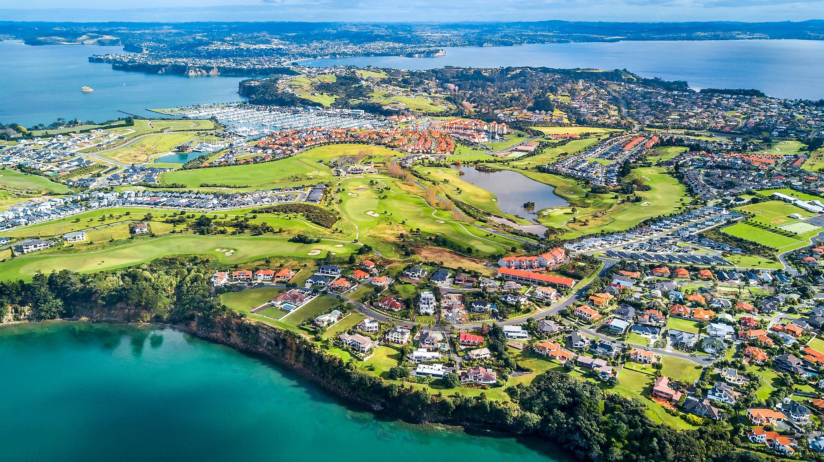
Host to the legendary landscapes that are common occurrences in Hollywood productions like Lord of the Rings, New Zealand is a 103 thousand square mile collection of over 600 islands. Albeit, the primary landmasses are North Island and South Island. In 2021 the country had a GDP of 250 billion USD, which is no small feat in comparison to countries like Norway and Singapore which performed only marginally better. This free market economy, which includes a sizable manufacturing industry, supports the 5.1 million citizens of New Zealand. Fascinatingly, the primary islands used to be conjoined, but extreme tectonic activity sunk, twisted, and separated the islands during the last 65 million years.
Samoa

Samoa, comprising two main islands named Upolu and Savai'i, and several smaller ones, is another sovereign nation in Polynesia. This island state, located northeast of Tonga and Fiji, hosts around 197,100 people. It has Apia as its capital city. Samoa with American Samoa, its neighboring island group owned by the US, were named "Navigator Islands" by European sailors because of the excellent seafaring skills of the Samoans. From 1899 to 1915, Germany colonized the area, following which the control of these island groups passed to a joint British-New Zealand administration. On January 1, 1962, Samoa emerged as an independent country, free of foreign rule.
Tonga

A bit further west of Fiji, this Polynesian Kingdom of nearly 200 islands is known for its gorgeous beaches and a collection of lagoons that continue to bring tourists to its many resorts. Almost exactly 100 thousand people live in Tonga, and the island of Tongatapu has been settled for an extensive period. The Ha'amonga ʻa Mau for instance was built in the 13th century as a monument to the sons of King Tuʻitātui, and it is entirely made of 3 coral limestone blocks that reach 17 feet in height. Different islands have different topography, with 'Eua Island being more forested and elevated than other segments of the nation.
Tuvalu

Nine islands comprise this nation, a land stained with memories from WWII in the form of historical landmarks. Only around 11 thousand people occupy Tuvalu, but the capital Funafuti is known for its attraction to scuba divers and marine life lovers, who come to glimpse the abundant sea turtles. The island areas contain less than 10 square miles, and the soil is not ideal for agriculture, which both contribute to the low population. Following the example of its neighbors, Tuvalu relies on subsistence farming and fishing to keep bread on the table, and the per capita GDP in 2021 was $5,291 according to the World Bank.
Dependencies And Territories
The Pacific Island region also includes many dependencies and territories owned by countries like the United States, Australia, France, and New Zealand. Some examples include American Samoa (an unincorporated territory of the United States), French Polynesia (France's overseas collectivity), Tokelau (dependent territory of New Zealand), and Norfolk Island (an external territory of Australia).
Other Sovereign Island Nations In The Pacific Ocean
Countries outside the three sub-regions of Micronesia, Melanesia, and Polynesia are excluded from the list of Pacific Island countries by most sources. These countries include Japan, Australia, and the Philippines. While Japan is considered an East Asian nation, Philippines is labelled as a Southeast Asian country, while Australia is part of Oceania, a region that also includes the Pacific Island countries.
The Pacific Island nations are ancient examples of the self-sufficient potential of our human ancestors. Tens of thousands of years of history occurred throughout them, each containing stories and oral accounts that would shock and awe listeners of today if they were unburied from their respective eras. However, the potentially rich future of these countries is threatened by climate change, wherein a rise in sea levels will directly impact nations that do not have significant elevation and whose populations reside mostly on coasts. Therefore, cherishing these global treasures is of the utmost importance for current and future generations of the world.
Pacific Island Countries
| Country | Region |
Area (in square miles) |
Population |
|---|---|---|---|
| The Federated States of Micronesia | Micronesia | 271 | 113,810 |
| Kiribati | Micronesia | 313 | 117,610 |
| The Marshall Islands | Micronesia | 70 | 58,790 |
| Nauru | Micronesia | 8 | 12,580 |
| Palau | Micronesia | 177 | 18,010 |
| Fiji | Melanesia | 7,055 | 889,950 |
| Papua New Guinea | Melanesia | 178,703 | 8,776,110 |
| The Solomon Islands | Melanesia | 11,156 | 669,820 |
| Vanuatu | Melanesia | 4,706 | 299,880 |
| New Zealand | Polynesia | 103,798 | 4,917,000 |
| Samoa | Polynesia | 1,093 | 197,100 |
| Tonga | Polynesia | 288 | 104,490 |
| Tuvalu | Polynesia | 10 | 11,650 |