The National Forests With The Darkest Night Skies
Several sites across the US National Forest system hold an official Dark Sky designation from DarkSky International. They vary enormously in scale. The smallest is a 3.5-acre campground loop in New Mexico. The largest is a 2.5-million-acre sanctuary in southeastern Oregon.
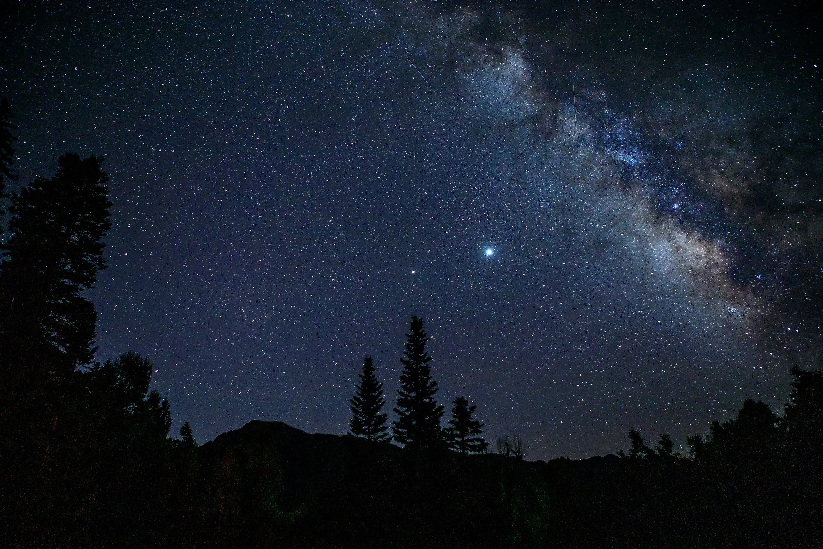
DarkSky International measures night sky quality using two related tools. The Bortle Scale is a nine-level system. Class 1 marks the darkest skies on Earth, and Class 9 describes inner-city skies where only the Moon and brightest planets are visible. The Sky Quality Meter, or SQM, is a handheld device that measures actual sky brightness in magnitudes per square arcsecond, a unit where higher numbers mean darker skies, and about 22 magnitude per square arc second represents the natural, light-pollution-free limit.
DarkSky International also certifies sites under four place categories, Sanctuary, Reserve, Park, and Community, based on remoteness, size, and the strength of a site's commitment to reducing light pollution.
Six national forests contain areas that earned the distinction through a formal application process that requires sky brightness monitoring and a demonstrated commitment to preserving natural darkness. To reach these dark sky havens, some require a several hour canoe trip through backcountry lakes. Others are a short drive to a marked concrete pad just off a state highway.
Superior National Forest, Minnesota

Superior National Forest spans three million acres in northeastern Minnesota, and within its boundaries lies the 1-million-acre Boundary Waters Canoe Area Wilderness, which DarkSky International designated as an International Dark Sky Sanctuary. This designation represents the second largest designated dark sky sanctuary on Earth. Sky Quality Meter readings across the wilderness interior consistently measure between 21.8 and 22.0 magnitude per square arc second, qualifying the Boundary Waters as a Bortle Class 1 site, the darkest possible classification on Earth. Within the sanctuary are 2,000 designated campsites, 1,200 miles of canoe routes, and at least 12 hiking trails.
For skywatching, visitors access backcountry water routes via designated entry points along the Gunflint Trail, including Gunflint Lake and Seagull Lake, or out of the Ely district via the Kawishiwi River entry routes. How long it takes to reach a viewing spot depends heavily on which entry point a paddler uses. Gunflint Lake and Seagull Lake themselves sit just off the road and, according to the U.S. Forest Service, both allow day-use motorized boat access right from their public launches, meaning a paddler can be on open water and away from the boat ramp within well under an hour of arriving.
Reaching the wilderness interior beyond these access lakes requires crossing into paddle-only water through the Magnetic Narrows, South Lake, or similar entry points, at which point trip-planning guides from outfitters along the Gunflint Trail describe individual portage-and-paddle routes ranging from about two to nine miles that take between about four and six hours round trip.
Stargazing is conducted directly from open lakeshore canoe landings, rock beaches, and designated campsite water edges where the tree canopy opens up to reveal wide 360-degree horizon views. During autumn and winter, visitors routinely view the aurora borealis clear down to the northern horizon. Observing gear must be packed in, as all interior travel requires paddling and portaging across backcountry routes.
Gila National Forest, New Mexico

Covering 3.3 million acres in southwestern New Mexico, the Gila National Forest is home to the Cosmic Campground International Dark Sky Sanctuary. Certified in 2016, the site was the first dark sky sanctuary located on US Forest Service land. Positioned eight miles north of Alma off US Highway 180, the campground sits more than 40 miles from the nearest significant source of artificial light, offering an unobstructed 360-degree view of the horizon.
The site is specifically developed for night sky observing, featuring four concrete telescope/observation pads equipped with strict red-light-only protocols to protect observers' night vision. Visitors drive directly into the campground area and set up tripod equipment or visual telescopes directly on the concrete pads or adjacent tent sites. The region's dry, low-humidity air yields exceptional atmospheric transparency, drawing amateur astronomers during peak new-moon cycles.
The National Park Service, which manages nearby Gila Cliff Dwellings National Monument within the same national forest, measures the region's sky brightness at 21.8 magnitudes per square arcsecond or greater, close to the 22 magnitude per square arc second ceiling DarkSky International considers the natural limit of darkness. This measurement places the area at Bortle Class 1 or 2, among the darkest ratings found anywhere in the continental United States. That same NPS data attributes the clarity partly to climate, noting the region sees around 200 cloudless nights a year, conditions that let the Milky Way's galactic core remain visible even on many moonlit nights.
Sawtooth National Forest, Idaho

Encompassing 2.1 million acres across Idaho and Utah, the Sawtooth National Forest forms the core of the Central Idaho Dark Sky Reserve. Designated in 2017, it was the first International Dark Sky Reserve in the United States. The reserve spans 1,400 square miles of mountain terrain, including the Sawtooth Wilderness, and local municipal lighting ordinances strictly regulate outdoor fixtures to prevent light spill.
The Central Idaho Dark Sky Reserve overlays four counties, Blaine, Boise, Custer, and Elmore, and DarkSky International notes that visitors can reach the reserve's core through 23 major trailheads. Vehicle-accessible observing points sit directly along the open shorelines of Redfish Lake and Stanley Lake, providing broad horizon views set against the Sawtooth Mountains. Stargazers set up telescopes along the sandy beaches and day-use boat launch areas. High atmospheric transparency and low regional population density keep sky brightness down to natural baseline levels across the valley basin.
DarkSky International's own designation announcement confirms the Central Idaho Dark Sky Reserve carries Gold Tier status. This is the highest sky-quality tier the organization awards, a distinction it reserves for sites with the least light pollution of any certified reserve and requires SQM values consistently exceeding 21.75 magnitude per square arc second.
San Juan National Forest, Colorado

San Juan National Forest manages 1.8 million acres in southwestern Colorado. Within its Pagosa Ranger District lies the 4,726-acre Chimney Rock National Monument, which DarkSky International designated as an official International Dark Sky Park. Positioned between Pagosa Springs and Durango in a minimally developed valley, the monument preserves both natural darkness and ancient Ancestral Puebloan cultural sites tied to astronomical alignment.
Visitors access the site via Colorado State Highway 151, where the Forest Service and the Chimney Rock Interpretive Association host monthly night sky programs. Some of the best observation points are along the Great House Trail ridge, where stargazers can use telescopes and personal binoculars to observe planetary alignments and the Milky Way against the prominent twin rock spires. The high-desert mesa sits at about 7,000 feet in elevation, offering dry, crisp atmospheric clarity for visual astronomy.
Pisgah National Forest, North Carolina

Pisgah National Forest covers more than 500,000 acres of high-relief mountain terrain in western North Carolina. Within its southern mountain valleys sits the 200-acre campus of the Pisgah Astronomical Research Institute, or PARI, which DarkSky International certified as an official International Dark Sky Park.
Originally built by NASA in 1962 as a satellite tracking station, the facility benefits from the forest's high-elevation ridgelines and thick timber canopies, which shield it from regional artificial light. DarkSky International currently lists the park as a Bortle Class 2.
Visitors reach the site by taking NC Highway 215 near Balsam Grove. Access to the grounds and evening observing sessions is available through scheduled public programs, astronomer-guided tours, and booked campsites. Stargazers gather around PARI's ridge-top observation decks and optical telescope domes, using both professional research-grade instruments and portable setups to view deep-sky targets against one of the few preserved dark-sky windows left east of the Mississippi River.
Fremont-Winema National Forest, Oregon

Fremont-Winema National Forest spans 2.3 million acres in southern Oregon's high desert transition zone. A portion of the forest's eastern district lies within the Oregon Outback International Dark Sky Sanctuary. Certified in 2024 by DarkSky International, the sanctuary encompasses 2.5 million acres, making it the largest certified dark sky sanctuary in the world. The region's 4,000-to-7,000-foot elevations and sparse population deliver exceptional atmospheric clarity for viewing the night sky.
Stargazers access primary viewing points along Highway 31, the Oregon Outback Scenic Byway, near Paisley and Silver Lake. Popular sites include elevated fire lookouts, such as Hager Mountain Lookout, and remote forest campgrounds like Summer Lake and Chewaucan River access areas.
The Outback is situated within Bortle Class 1 skies and measures at least 21.5 magnitude per square arc second. Visitors set up telescopes and camera gear at high-elevation ridges or open sage-scrub clearings, where zero urban glow provides excellent viewing of the Milky Way, zodiacal light, and deep-space objects.
The National Forests' Darkest Skies
The six forests split into two distinct categories of achievement. Superior and Fremont-Winema each protect over a million acres where no road or structure interrupts the horizon. Gila, San Juan, and Pisgah claim smaller areas but offer infrastructure and accessibility instead, building concrete observation pads, interpretive programs, and paved access roads that let a visitor arrive by car and walk a short distance to the viewing area. Sawtooth carries both, containing 1,400 square miles of Dark Sky Reserve while also offering vehicle-access observation points along Redfish and Stanley lakes.
These designations are not permanent by default. Maintaining these exceptional SQM readings requires an ongoing commitment to sky-brightness monitoring, strict outdoor lighting policies, and periodic recertification to ensure the unpolluted observational windows of the night sky within these national forest areas remain intact.