The Southernmost County In The Lower 48
The southernmost county in the lower 48 states is Monroe County, Florida, but its geography is more complicated than its location on a map might suggest. The county stretches across mainland wilderness, the inhabited islands of the Florida Keys, and the outlying Dry Tortugas, about 70 miles west of Key West. It also contains two geographic extremes: Cape Sable, the southernmost point of the US mainland, and Ballast Key, an island farther south than Key West's Southernmost Point buoy.
Where Is Monroe County

Monroe County occupies Florida's southwestern tip, encompassing portions of Everglades National Park, Big Cypress National Preserve, and the island chain connected by the Overseas Highway. Key West, the county seat, is located near the end of the highway, about 160 miles from Miami by road.
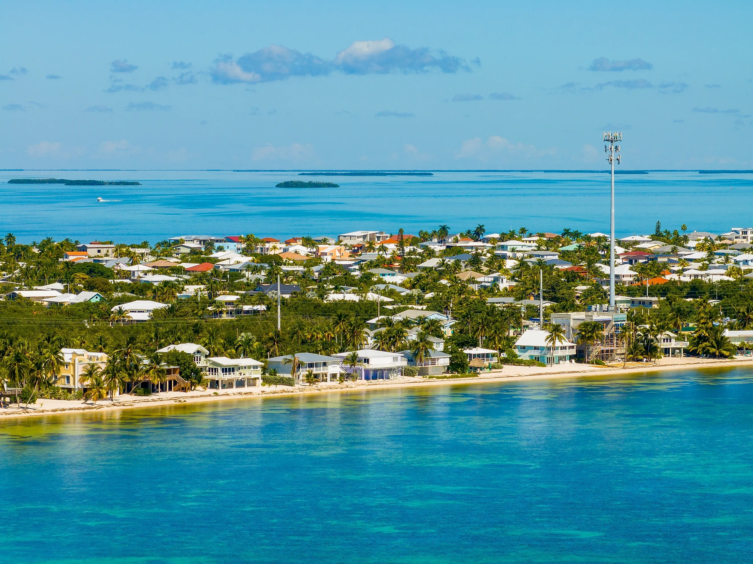
Monroe County has two distinct landscapes. On the mainland, there are wetlands, mangrove forests, and protected wilderness areas. Farther south, the island communities of the Florida Keys lie between the Atlantic Ocean and the Gulf. The county's mainland is largely undeveloped, while its island communities include Key Largo, Marathon, and Key West.
A County Made Mostly of Water

About 73% of Monroe County's 3,738 square miles is water. Of the land that remains, approximately 87% is on the Florida mainland, mostly within the Everglades and Big Cypress National Preserve. Yet more than 99% of the county's residents live in the Florida Keys.
According to the 2020 census, Monroe County had 82,874 residents. Away from the populated Keys, the county is a patchwork of shallow bays, mangrove islands, and open water. Large areas of the mainland have few roads or permanent settlements.
The Southernmost Point Is Not Where Most People Think

One of the most popular places to stop for a picture in Key West is the colorful Southernmost Point buoy. The concrete marker normally stands at the corner of South and Whitehead streets, with the words "Southernmost Point Continental USA" painted across it. The original buoy is temporarily closed for restoration, with a replica on Duval Street. Despite what the buoy says, it does not actually mark the southernmost permanently exposed land in the contiguous United States. That distinction belongs to Ballast Key, a small island about nine miles west of Key West.
The island became part of the Key West National Wildlife Refuge in 2019, after its owner donated it to the federal government. Portions of the nearby Naval Air Station Key West property are also farther south than the buoy. Unlike the easily accessible buoy marker, Ballast Key can only be reached by boat.
Monroe County holds another geographic distinction on the Florida mainland. Cape Sable, a roadless peninsula within Everglades National Park, is the southernmost point of the mainland United States. Its coastline includes Northwest Cape, Middle Cape, and East Cape, with East Cape marking the mainland's southern tip. The area has shell beaches, mangrove forests, coastal wetlands, and almost no development. Reaching Cape Sable requires traveling by boat from Flamingo, about 10 miles away. While thousands of people photograph the Key West buoy, Cape Sable is a much more isolated place.
Life Along the Overseas Highway

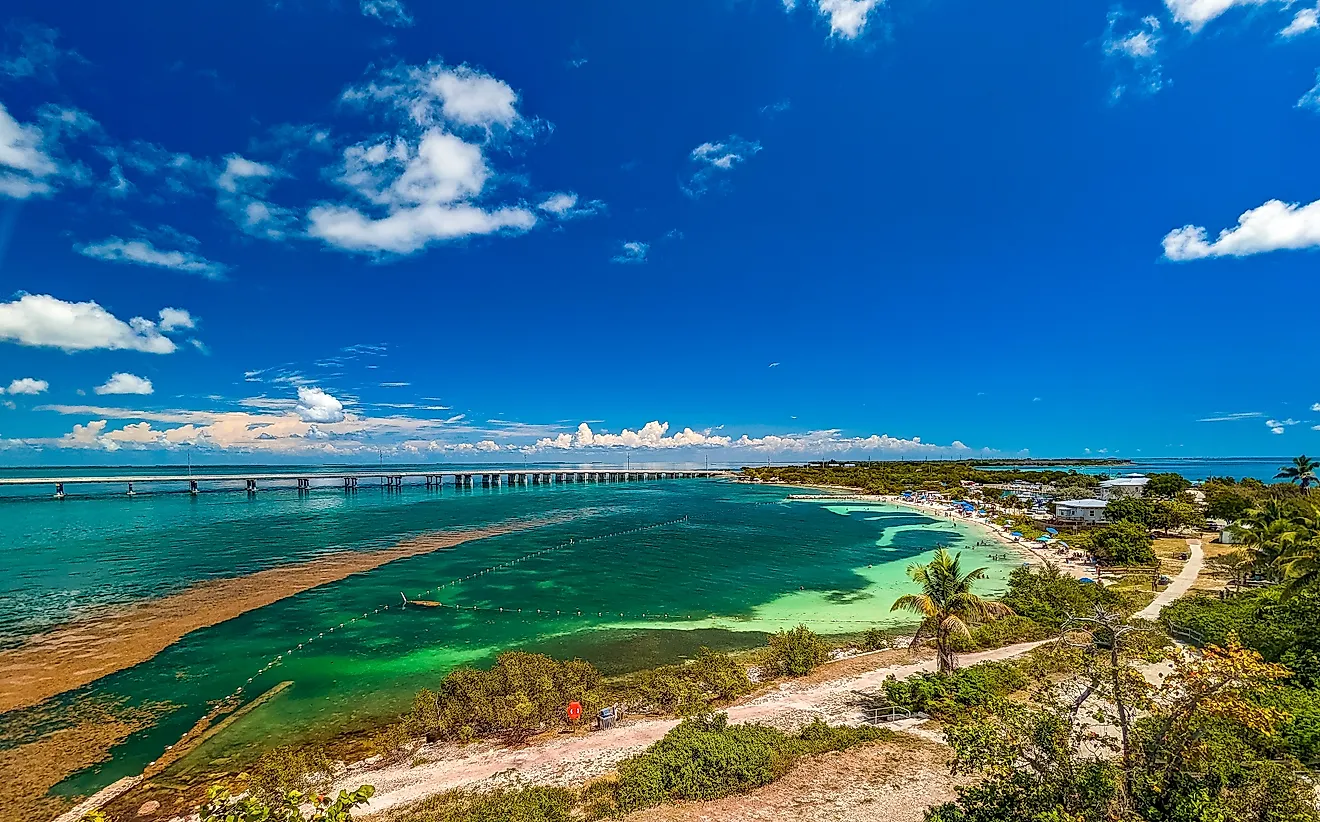
The Overseas Highway is part of US Route 1 and runs for 113 miles through the Florida Keys, connecting Key Largo to Key West across a series of islands and bridges. The highway crosses 42 bridges, with views of the Atlantic Ocean, Florida Bay, and the Gulf of Mexico along the way. In many places, the road runs just above the water, passing mangrove islands, fishing communities, and long expanses of open sea.
Before the highway existed, there was Henry Flagler's Overseas Railroad, which first reached Key West in 1912. The Labor Day Hurricane of 1935 destroyed parts of the railroad, and Florida later used sections of the old route to build the highway. The best-known crossing is the Seven Mile Bridge, connecting Knight's Key near Marathon to Little Duck Key. The modern bridge opened in 1982, but part of the original bridge has been restored, allowing people to walk or ride their bikes over the water.
For people who live in the Keys, the Overseas Highway is their main connection to mainland Florida. Residents rely on it to get to work, shop, and reach hospitals and other services. With few alternative routes between the islands, the highway is essential to everyday life in Monroe County.
Just 90 Miles from Cuba

Key West is 90 miles north of Cuba, across the Florida Straits. That short distance has influenced the island's history for generations. Cuban immigrants began settling here during the 19th century, bringing cigar-making skills that helped turn Key West into one of America's leading producers of cigars. The historic Gato Cigar Factory, built in 1916, is a reminder of the era.
The Florida Keys have also been a landing point for Cubans crossing the Florida Straits by boat, particularly during the migration waves of the 1980s and 1990s. Monroe County's location near Cuba has shaped its communities and connected this southern tip of Florida to the history of both countries.
The Remote Islands of Dry Tortugas National Park

About 70 miles west of Key West, Dry Tortugas National Park covers 100 square miles of mostly open water, with seven small islands scattered throughout. The park is only accessible by boat or seaplane and is completely within Monroe County. One of its islands, Garden Key, is home to Fort Jefferson, a 19th-century coastal fortress and one of the largest masonry structures in the Western Hemisphere. Its construction began in 1846, but the fort was never finished. Today, its brick walls are one of the main attractions for people making the trip out to the islands.
The islands are surrounded by coral reefs and seagrass beds that provide shelter for sea turtles and tropical fish. During nesting season, thousands of seabirds, including sooty terns and brown noddies, gather on Bush Key. Less than 1% of Dry Tortugas National Park is actually dry land, so most of what makes the park special is beneath the water.
A County Of Islands And Wilderness

Monroe County is unusual, even by Florida standards. Its boundaries encompass undeveloped mainland wilderness, a chain of inhabited islands, and waters stretching far into the Gulf of Mexico. For a county at the bottom of the lower 48 states, Monroe County covers a surprising amount of ground, even if most of it is underwater.