The Most Isolated Counties In Alaska
Alaska is not organized by counties, but instead uses boroughs. Out of its 19 organized boroughs, the most isolated boroughs are the Northwest Arctic and the North Slope. Within the Unorganized Borough, which contains about 56% of Alaska's land area, there are 11 census areas. All of these census areas are isolated and rely on air travel and off-road vehicles for supply and travel. Read on to learn more about Alaska's most remote communities and how they came to be.
Why does Alaska have boroughs instead of counties?

Alaska is not organized around counties for a few reasons. First of all, when Alaska became a state in the 1950s, it consisted of many types of communities, including developed industrial towns and small villages without a cash economy. To accommodate these different regions and ensure maximum local control, Alaskan delegates chose to create boroughs rather than counties. These boroughs were designed to enable decisions on the local level and avoid overlapping taxation. This borough system is enshrined in Article X of the Alaskan Constitution, which states: "The purpose of this article is to provide for maximum local self-government with a minimum of local government units, and to prevent duplication of tax-levying jurisdictions. A liberal construction shall be given to the powers of local government units."
Northwest Arctic

The Northwest Arctic Borough is the second-largest of Alaska's organized boroughs, covering around 36,000 square miles in northwestern Alaska. The population here is under 8,000 people, and the region is completely inaccessible by car. In order to reach the borough, one must take a flight to the borough seat of Kotzebue at the Ralph Wien Memorial Airport.
The vast majority of the population is of Indigenous heritage, primarily Inupiat Inuit peoples. The borough was incorporated in 1986 by a vote of its communities. The economy here is heavily dependent on the Red Dog Mine, one of the world's largest zinc mines, though some towns still lead traditional lifestyles, hunting caribou and other animals.

Two of the most prominent natural landmarks in this corner of Alaska are the Bering Land Bridge National Preserve and Kobuk Valley National Park. The preserve spreads across the Seward Peninsula, spanning both the Northwest Arctic Borough and the Nome Census Area. It protects a remnant of the grassland corridor that once carried people and animals across what is now the Bering Strait. Here, one can visit the Serpentine Hot Springs, which have been used by people for thousands of years. Kobuk Valley National Park is home to thousands of migrating caribou, along with sand dunes, which interrupt the tundra landscape. These sand dunes were formed by retreating glaciers in the last Ice Age, which ground rock into sand particles, leaving behind the Great Kobuk Sand Dunes of today.
North Slope

The North Slope Borough is the largest organized borough in Alaska, with nearly 95,000 square miles. It is the northernmost region in Alaska, stretching across its entire northern coast. The Census Bureau put its population at 10,582 in its 2025 estimate, down from 11,031 at the 2020 count.
Technically speaking, one can drive all the way up north to the town of Deadhorse, but it is a difficult journey on the Dalton Highway. This highway runs 414 miles. It begins at Livengood, north of Fairbanks, and ends at Deadhorse. Significant portions of the highway are gravel or dirt, and it is primarily used for commercial vehicles delivering critical supplies. To more reliably reach the North Slope, one can take a plane out to Deadhorse Airport in Prudhoe Bay or the Wiley Post-Will Rogers Memorial Airport in Utqiagvik, the seat of the North Slope. Several villages also have smaller airstrips and airports.

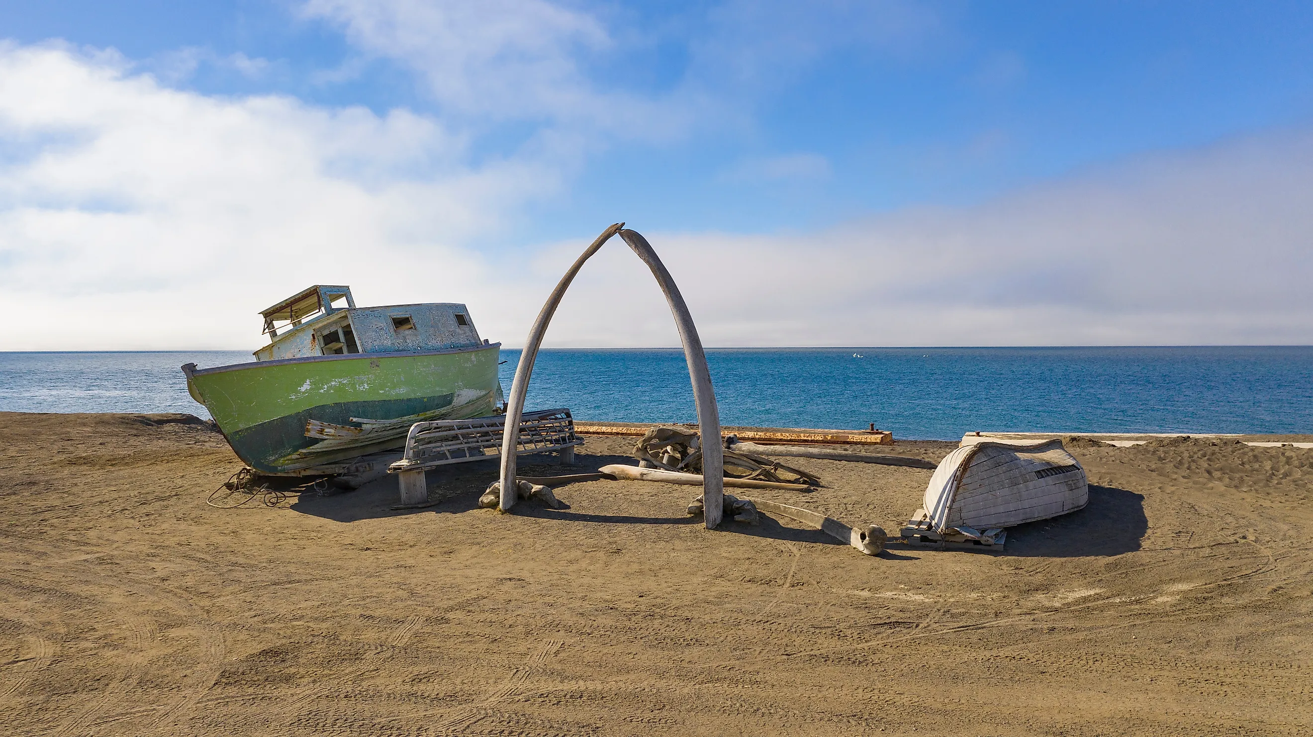
In Utqiagvik, there is a Whale Bone Arch, which reflects the area's tradition of bowhead whale hunting. From Utqiagvik, visitors often enjoy dipping their toes into the Arctic Ocean from downtown or taking tours out to Point Barrow, the northernmost point in the United States. Indigenous culture is further celebrated at the Inupiat Heritage Center.
Unorganized Borough

The Unorganized Borough is the largest area in Alaska, consisting of 323,440 square miles. Its population is just over 77,000. Due to its sparse population, the entire Unorganized Borough is run by the Alaskan state government. For census purposes, it has been broken down into 11 census areas reaching across the entire state. The Aleutians West Census Area marks the far western edge, and Prince of Wales-Hyder the eastern one. Nome sits south of the Northwest Arctic and Yukon-Koyukuk.
Accessibility in the Unorganized Borough varies, as some small areas can be reached by car, such as Valdez in the Chugach census area. However, the two largest cities in the Unorganized Borough, Bethel and Unalaska, are not accessible by road. With around 6,400 residents, Bethel is the most populous city, located in the Bethel census area. It is reachable by air out of Anchorage to Bethel Airport. Much of the landscape here is tundra out in the Yukon Delta National Wildlife Refuge.

Unalaska is part of the Aleutians West Census Area and is home to an estimated 4,254 people. Due to being on an island, it is accessible by airplane, air taxi, or taking an Alaska Marine Highway ferry, which operates on a seasonal summer schedule. Within this community, one can see the Aleutian World War II National Historic Area, cataloging the combat between Japan and America in this region, including the bombing of Dutch Harbor by the Japanese. Other prominent landmarks include the Russian Orthodox Cathedral of the Holy Ascension of Christ, the oldest cruciform-style Russian Orthodox church in Alaska, and the Museum of the Aleutians.
The "road" less traveled

Alaska is a vast state, more than twice the size of Texas at 663,267 square miles of land and water. Roads reach only a small fraction of that, leaving the vast majority of the state isolated. Exploring these isolated boroughs and census areas isn't just taking a road less traveled; it's stepping into truly remote regions connected only by planes, boats, and a gravel highway used mostly for commercial vehicles. This isolation is why the state chose the borough system instead of counties, ensuring maximum flexibility at the local level to manage these large remote regions.