The Counties Separated From Their State By Water
A county line usually means a sign by the roadside and little more. For a handful of American counties, however, it means open ocean, a wall of sea cliffs, or even an international border. Kalawao County sits on a Hawaiian peninsula walled off by some of the tallest sea cliffs anywhere, reachable only by air or a switchback trail. Nantucket County is a single island in the Atlantic with the ocean for a border. San Juan County in Washington has no bridge to the mainland at all. And in northern Minnesota, part of Lake of the Woods County can only be reached by road through Canada. Read on to explore a handful of counties with the geographic distinction of being cut off from their own states by bodies of water.
Kalawao County, Hawaii

Kalawao County lies on the northern coast of Molokaʻi, occupying the remote Kalaupapa Peninsula, one of Hawaii's most geographically isolated areas. The Pacific Ocean surrounds it on three sides, while towering sea cliffs separate it from the rest of Molokaʻi. The National Park Service describes the cliffs as reaching roughly 2,000 feet high, creating a formidable natural barrier between Kalaupapa and the rest of the island.
The isolation is more than a geographic curiosity because Kalaupapa was chosen in the 19th century to isolate people with Hansen's disease (leprosy), partly because the cliffs and ocean made it difficult to reach or leave. From 1866 to 1969, Hawaii sent roughly 8,000 people there under its isolation policies. Today, Kalawao County remains an unusual place geographically and administratively. No road connects the peninsula to the rest of the island, so visitors can reach it by air or by hiking a 3-mile trail with 26 switchbacks down the cliffs.
Nantucket County, Massachusetts

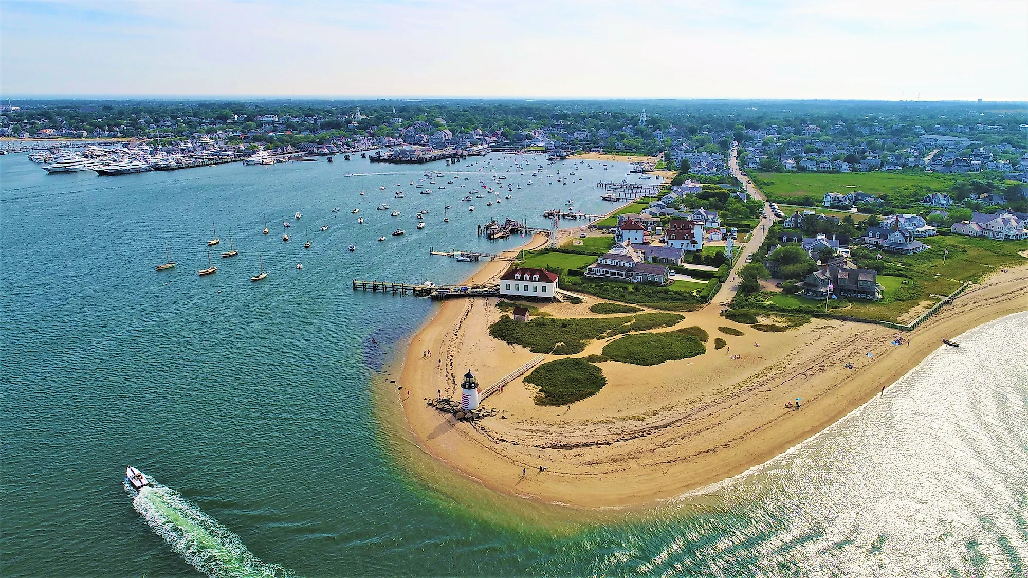
Nantucket County is essentially the island of Nantucket, located in the Atlantic Ocean south of Cape Cod. Unlike Kalawao, Nantucket has no narrow land connection or dramatic cliff separating it from Massachusetts' mainland. The ocean is the boundary. Anyone traveling from the mainland to Nantucket must cross the water by ferry or fly to the island. The geography is distinctive because Nantucket forms its own county, making its boundaries nearly identical to the island's natural borders. Its isolation has shaped everything from transportation to tourism and everyday life. Residents rely on ferries and planes to get back and forth, and the remote setting plays a major role in the tourism industry.
San Juan County, Washington

San Juan County sits in the Salish Sea in the far northwestern corner of Washington, and it is the rare American county with no fixed link to anywhere. No bridge connects the San Juan Islands to the Washington mainland, and none connects the islands to each other. Water makes up about 72% of the county's total area, and the only ways in are by ferry, by plane, or by private boat.
Four islands carry almost all of the county's population, and all four are served by the Washington State Ferry system: San Juan, Orcas, Lopez, and Shaw. Friday Harbor, on San Juan Island, is the county seat and the only incorporated town in the islands. The islands themselves have no state highways, so the ferry routes have been designated part of the state highway system instead, which makes the boats a working road rather than a scenic detour. For the county's roughly 17,800 residents, the ferry schedule is the difference between reaching the mainland and staying put.
New York County and Richmond County, New York

New York City has four counties physically separated from the rest of New York State by water; two of the clearest cases are New York County and Richmond County. New York County, which consists primarily of Manhattan Island, is surrounded by the Hudson River, East River, and Harlem River. Although bridges and tunnels connect Manhattan to the rest of the state, the island itself is surrounded by water.
Richmond County, which corresponds to Staten Island, is also separated from the rest of New York State by water. Staten Island lies between New Jersey and Brooklyn and is surrounded by the Arthur Kill, Kill Van Kull tidal straits, and New York Harbor. Like Manhattan, Staten Island remains part of New York State despite being physically separated from the mainland. Visitors and residents can use the many bridges or ferries to get to and from the island.
Lake of the Woods County & The Northwest Angle, Minnesota

Lake of the Woods in Northern Minnesota might have one of the strangest geographic situations in the United States. The Northwest Angle is part of Lake of the Woods County, but the only way to reach it by land from the rest of Minnesota is by traveling through Canada.
The unusual boundary dates back to early mapping and treaty errors involving the United States and Canada. The Northwest Angle ended up north of the 49th parallel, making it an American exclave surrounded by Canada and Lake of the Woods. So residents and visitors have a peculiar choice, which is they can reach the area from water by boats in Warroad or Baudette, or they can travel overland through Canada. In other words, someone can remain inside the United States geographically while still having to pass through another country to reach it by road.
Where the Map Makes Less Sense
If you have ever assumed a state is one continuous piece of ground, these counties are the exceptions that prove otherwise. From the sea cliffs walling off Kalawao County in Hawaii to Manhattan Island in New York County, each one belongs firmly to its state while sitting well beyond its reach. Whether the barrier is an ocean, a lake, or an international border, these places show that a boundary drawn on paper and a boundary you can actually cross are rarely the same thing.