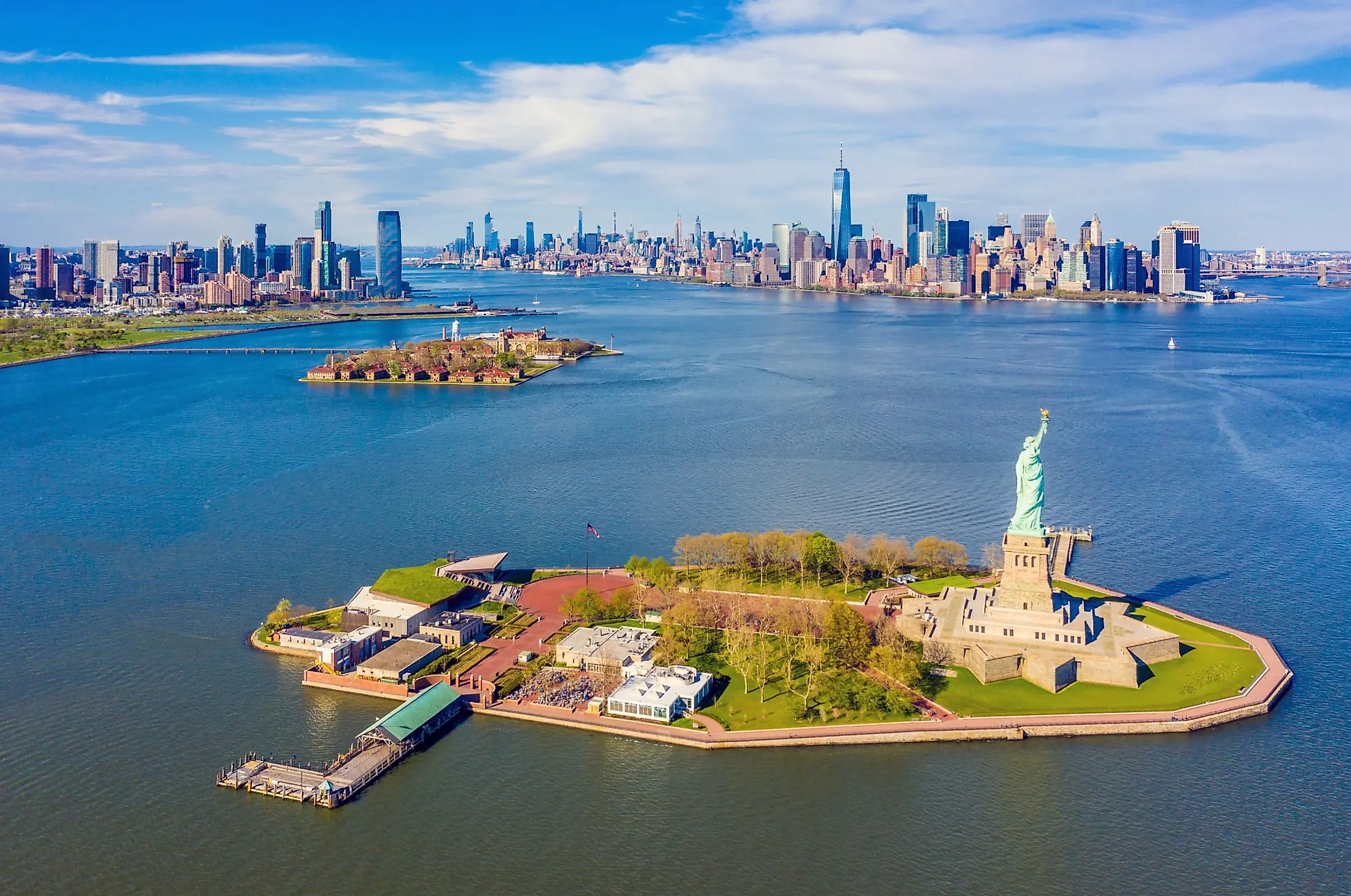
New York Harbor
The New York Harbor is one of the world’s busiest waterways and largest natural harbors. The harbor is located on the East Coast, where the Hudson River drains into the Atlantic Ocean. It surrounds Staten Island, Brooklyn, Manhattan, and parts of New Jersey.

The New York Harbor has played a critical role in the region’s economy, with thousands of water vessels transporting millions of kilograms of cargo docking there. It is United States' 3rd largest container port and the largest petroleum importing port. The harbor also contains several commuter ferries, cruise liners, passenger ships, and excursion boats.
Description

The New York Harbor is a large and busy port area in the northeastern United States located where the Hudson River and other small rivers drain into the New York Bay. It forms a portion of the Port of New York and New Jersey located in the Newark-New York metropolis. It is located close to an ocean bight and New Jersey and New York harbor border places such as Manhattan, Staten Island, and Brooklyn. The harbor includes an outer harbor (Lower Bay) protected from the ocean by the Rockaway and Sandy Hook, and the inner harbor (Upper Bay), separated from the Lower Bay by the Verrazano Narrows. The harbor also sits at the head of the Long Island Sound.
Hydrology and Water Quality

The New York Harbor receives inflow from the Hudson River, Long Island Sound, and the Atlantic Ocean. The tides transport the river’s water up to Troy in New York. The tidal flushing is also responsible for the inflow from the Block Island Sound into the Eastern Long Island Sound and finally into the harbor. The tidal range in the Eastern Long Island is less than one meter but grows to 2-3 meters in the Western Long Island. The tides also flush out pollutants and wastes discharged into the harbor and carry sail-powered vessels in and out of the New York Harbor.
Due to urbanization, industrial activities, and shipping, pollutants, and waste material have found their way into the New York Harbor, causing water pollution. According to a 2019 study, the harbor’s water quality varies by region, with the Lower Bay having the highest quality because of the frequent inflow from the Atlantic Ocean. The regions with the lowest water quality are mainly areas with limited water exchange. These regions include Flushing Bay, Newtown Creek, and Jamaica Bay. However, the water quality has improved in most regions due to the ongoing conservation and pollution control measures implemented throughout the Ney York Harbor.
History

The Native Lenape people were the inhabitants of the New York Harbor before the European arrival in the region in the 16th century. The natives used the complex waterway for travel and fishing. Italian explorer Giovanni da Verrazano arrived at the Narrows in 1524 and was received by the Lenape people. Henry Hudson visited the harbor in 1609 and explored parts of the Hudson River, with his exploration motivating other Europeans to visit the region. European settlement around the harbor began in 1624 when the Dutch settled on the Governor’s Island. The British soon followed the Dutch in establishing settlements around the New York Harbor. The early European explorers benefited from the rich shallow water that contained unlimited resources, including oyster reefs.
Harbor Development
The harbor’s development is divided into four periods; pristine estuary, expansion, degradation, and improvement periods. The pristine estuary period (1609-1800) was a period when the harbor had a lot of oysters, making navigation difficult. The harbor also had plenty of shellfish and fish during this period. The expansion period (19th and 20th century) was characterized by high population growth in New York City from 60,000 to over 3 million. It was also the period of industrial development and a dramatic reduction in the number of oysters. With the expansion, more human and industrial wastes were released into the harbor. The degradation period (up to 1970s) saw increased untreated waste disposal into the harbor and alteration of the shoreline. The Metropolitan Sewage Commission discovered that millions of kilograms of untreated sewage were being discharged into the harbor daily. During the improvement period (the 1970s to present), pollution control laws have been put in place to safeguard the harbor from pollution.
Economic Significance

The Port of New York and New Jersey is the country’s largest oil importing port and the 3rd largest cargo and ship port. The port is a major source of employment for thousands of people in New Jersey and New York. The harbor has also supported fisheries for years due to diverse fisheries resources, including eastern oysters, sturgeons, shad, and striped bass. The New York Harbor is also a recreation destination, hosting waterfront spaces, parks, and other facilities. Recreational activities include boating, kayaking, and sailing. Recreational fishing generates up to $250 million annually.