The 8 Most Scenic Arizona Towns
Arizona's unique topography ranges between high desert plateaus and river-carved canyons, and the lands around them shape its most scenic towns. Each place featured in this article sits within a distinct natural setting, whether that is red rock formations, pine-covered mountains, or the banks of the Colorado River. What follows is a look at the most visually compelling towns in this beautiful state, places worth considering for your next Southwestern adventure.
Cottonwood

Cottonwood is in the heart of the Verde Valley, bordered by the Black Hills to the south and red rock cliffs to the north. The town's scenic value comes mainly from its location along the Verde River, which brings a rare green ribbon through otherwise arid surroundings. Sycamore and cottonwood trees line the local riverbanks, especially visible in Dead Horse Ranch State Park, where trails and lagoons offer wide views of distant formations and seasonal color changes in the foliage later in the year.
Just northwest, the high desert rises toward Tuzigoot National Monument, an ancient Sinagua pueblo perched on a ridge that overlooks Arizona's vast yet peaceful corner. To the east, the road to Sedona passes through open rangeland and basalt outcroppings before revealing views of the Mogollon Rim and red rock escarpments, meaning you can experience the great outdoors here in every direction.
Cottonwood is also renowned for its wines, as it sits in the heart of Arizona wine country. If you want to try some local products, nearby favorites include Merkin Vineyards Tasting Room and Osteria, Alcantara Vineyards and Winery at the confluence of the Verde River and Oak Creek, and The Original Jerome Winery up the hill in Jerome. Over a dozen other vineyards, tasting rooms, and specialty shops are also within easy reach.
Page

Page is seated on a mesa high above the Colorado River in far northern Arizona, surrounded by many notable sandstone cliffs, slot canyons, and incredible views of Lake Powell. Located in the Glen Canyon region, where water, wind, and time have carved some of the most recognizable geologic formations in the Southwest, this town is a hotbed for photographers, hikers, backcountry bikers, and researchers alike.
Sitting nearby, Horseshoe Bend provides one of the most dramatic natural overlooks in the region, offering a 270-degree view of the river's bend around a sheer sandstone butte. Southeast of town, Antelope Canyon cuts narrow, twisting corridors through Navajo sandstone, with sunlight creating vivid color contrasts throughout the day. It sits on Navajo Nation land and can only be entered on an authorized guided tour, so book ahead rather than turning up. Lake Powell adds another layer of scenic and recreational value, with its inlets, steep rock walls along the shore, and deep blue waters stretching into Utah, hosting several boat launches and swimming holes.
This town is roughly 4,300 feet above sea level, which allows for long-distance visibility of the Vermilion Cliffs and Echo Peaks. Its elevated position, proximity to Glen Canyon, and access to river and lake landscapes make this community a must-visit for outdoor adventurers and sightseers.
Sedona

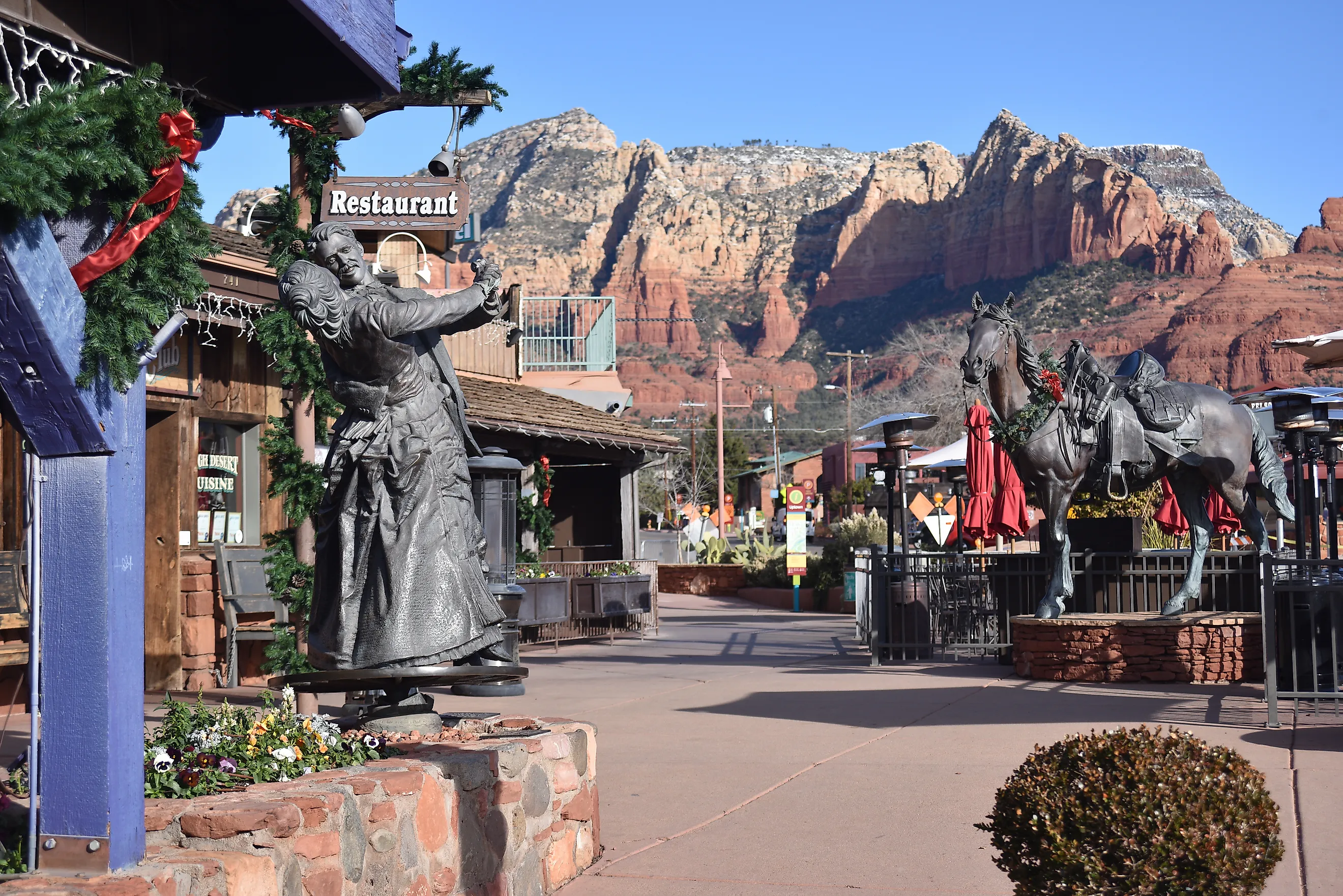
Sedona is a classic Arizona town, defined by its red rock formations, desert buttes, and high desert vegetation framed by the Coconino National Forest. It more specifically sits at the junction of Oak Creek Canyon and the Verde Valley, providing access to one of the most striking landscapes in the state, if not the entire United States.
Landmarks like Cathedral Rock, Bell Rock, and Courthouse Butte are among the most photographed geological spots nearby, with the surrounding terrain supporting a range of trails such as Devil's Bridge and Soldier Pass, both of which offer panoramic views of the area. Both have small trailhead lots that fill early, and a seasonal shuttle serves several of them. Oak Creek adds a nice bit of contrast to the dry climate, especially where it cuts through Slide Rock State Park and Red Rock Crossing. The area's layered sedimentary formations hold up all day but reflect light most dramatically at sunrise and sunset. Sedona's scenery also includes views toward the Mogollon Rim to the north and expansive desert plateaus to the south.
The town's position between elevations of 4,000 and 5,000 feet allows year-round access to its numerous outdoor features, making it one of Arizona's most consistently beautiful and fun-to-explore destinations.
Tubac

Tubac is located in the Santa Cruz River Valley, surrounded by swathes of desert grasslands and foothills that define the far southern Arizona landscape. Sitting at around 3,200 feet, the Tumacacori and Santa Rita Mountains loom in the distance, both rising sharply and shaping the skyline from nearly every angle. The terrain around Tubac further includes mesquite bosques, cottonwood stands along meandering rivers and ravines, and open plains that stretch south toward the borderlands.

Tubac Presidio State Historic Park preserves original adobe walls and 18th-century foundations from the Spanish garrison established here in 1752, which makes this the site of the oldest European settlement in Arizona and, since 1959, the state's first state park. A few miles away, Tumacacori National Historical Park includes mission ruins with massive archways and thick walls.
The Anza Trail, which passes through town, follows an often dry river corridor and provides walking access to shaded riparian areas, with seasonal wildflowers, especially in late winter and spring, brightening the arid desert landscape significantly. Combined with preserved Spanish architecture and uninterrupted desert views, Tubac delivers a scenic mix of history and nature not found in many larger towns in this state.
Bisbee

Bisbee is built into the Mule Mountains near the Mexican border, fitting itself almost flawlessly into the steep terrain. Its layout follows the contours of Brewery Gulch and Tombstone Canyon, giving it a multi-level structure that produces layered views of hillside homes, Wild West-style buildings, and the surrounding wilderness.
Vegetation shifts between desert scrub and oak woodland, creating a diverse landscape that is not typical of lower-elevation Arizona towns. In contrast, the Lavender Pit on the town's edge, an open-pit copper mine named for a mine manager rather than the color, adds a strange piece of man-made scenery worth stopping for. Just outside Bisbee, views from Juniper Flats or the pass toward Naco open onto vast high desert plains ringed by mountain ranges.
Downtown, the easily walkable historic district retains a collection of early 20th-century structures with colorful facades and corrugated metal roofs. Visit the Bisbee Mining and Historical Museum for more on the region's storied past, or embark on an excursion with Old Bisbee Ghost Tours for a more supernatural twist on your stay.
Another benefit of visiting Bisbee is that its elevation of about 5,500 feet keeps temperatures moderate, allowing the area to stay greener longer into the year. Better yet, you stay cooler on otherwise scorching summer days in this southwestern state.
Bullhead City

Bullhead City rests directly on the shores of the Colorado River across from Laughlin, Nevada, with the Black Mountains rising sharply behind it and the Newberry Mountains visible across the river. Its position on the floor of the Mohave Valley means that flat riverbanks quickly transition into steep, rocky slopes, giving you several ways to see the river from both high and low. Check out any of the city parks within steps of the water, too, including Bullhead City Community Park and Rotary Park, along with a number of nearby beaches that offer clear views up and down the waterway.
To the south, sightlines open toward the convergence of wide desert basins and even a collection of farms, while to the north, the terrain becomes more rugged and mountainous. The surrounding Mojave Desert landscape generally includes volcanic rock fields and dry washes that you are usually free to walk amongst. Just be sure to bring sun protection and lots of water when out; this is one of the hottest places in the country in summer.
Jerome

Jerome clings to the side of Cleopatra Hill at over 5,000 feet, with a vantage point that looks across the Verde Valley toward the red rocks of Sedona and the distant San Francisco Peaks beyond. Smaller and quieter than Sedona, Jerome's steep streets and switchbacks are built directly into the slope, giving nearly every structure a view and far fewer crowds.
What makes Jerome particularly eye-catching is the contrast between its mining-era landmarks and the surrounding topography. Brick buildings, weathered wood, and steel relics are set against the arid deserts and mountains smack dab in the center of Arizona. The entire town was designated a National Historic Landmark in 1967, preserving buildings and walkways dating back to its founding in 1876.
The Mingus Mountain range rises immediately behind the town, with pine forests and ridgelines offering access to high-altitude lookout points and hiking routes like the Woodchute Wilderness trail. Below, the valley stretches for miles, changing color with the seasons, making it an ideal destination to see in the fall.
Stick around for either an early morning or a late night, as sunrises bring pink and gold light across the valley floor, while night skies remain clear thanks to the town's elevation and minimal light pollution.
Williams

Williams sits at 6,770 feet surrounded by the Kaibab National Forest, where ponderosa pine forests and volcanic peaks are abundant. Just below Bill Williams Mountain, a 9,256-foot summit that dominates the southern skyline, this community is a year-round outdoor activity and sightseeing landmark.
Williams also marks one of the gateways to the Grand Canyon, via the Grand Canyon Railway, which departs from a restored 1901 depot downtown. If you are keen on travelling by road, Route 66 runs directly through town, preserving vintage signs, storefronts, and old side streets. Williams has a particular claim on that history: after a court fight, it became the very last Route 66 town bypassed by Interstate 40, on October 13, 1984, and the Mother Road was decommissioned the following year. For some exploration just outside town, routes like Perkinsville Road and the Sycamore Canyon Overlook give high-up access to viewpoints above the surrounding landscapes.
The high elevation here allows for snowfall in winter, which turns the town and nearby peaks into more of an alpine retreat. Summer monsoons bring cloud build-ups and dramatic light across the Coconino Plateau. Regardless of when you come, Williams is a haven for landscape photographers, outdoorsmen, and history buffs alike to enjoy throughout the year.
Seeing Arizona At Its Best
Arizona's most scenic communities showcase the state's full range of landscapes, canyon rims and river valleys included. Whether carved by water, framed by mountains, or set against desert expanses, each of these towns offers plenty to appreciate in this classic southwestern state. Page and Bullhead City put you on the water, Sedona and Jerome on the red rock, Williams and Bisbee up where the air cools off, and Tubac and Cottonwood in the river valleys that make the desert green.