9 Most Breathtaking Towns In The Rockies
Live long enough in the Rockies and the peaks turn into wallpaper. Then a river drops into a hole outside Lander and your brain resets. Or the prairie at Waterton stops dead at the town line like a dropped curtain. Or a steam train out of Chama crosses the Colorado line eleven times on its way over a 10,000-foot pass. And outside Stanley the Sawtooths rise straight out of the far shore of Redfish Lake. People who see mountains every single day still look up for these nine, the most breathtaking towns in the Rockies.
Stanley, Idaho

Stanley has fewer than 120 residents, and the Sawtooth Mountains stand right behind them. The town sits at about 6,250 feet in a bowl at the base of the range, and cold air slides off the peaks and settles in the valley. That is why Stanley regularly turns up among the coldest spots in the lower 48. In December 1981 the thermometer hit 54 below. The range itself has more than forty peaks above 10,000 feet, jagged enough that people call it the American Alps.
Redfish Lake sits about five miles south of town, the largest lake in the Sawtooth National Recreation Area, with the peaks rising straight out of the far shore. The Salmon River, the River of No Return, begins its long run nearby. Three national scenic byways meet at Stanley, the only place in the country where that happens. One climbs south toward Sun Valley over Galena Summit, one follows the Salmon north, and one heads west toward Boise. Not much stays open through the winter, though the mountains look their best under snow.
Livingston, Montana

Livingston sits where the Yellowstone River leaves the mountains and swings east out of Paradise Valley. The Absaroka Range rises on one side of the valley and the Gallatins on the other, and from here the river runs 692 miles without a single dam, the longest undammed river in the lower 48. Northern Pacific crews founded the town in 1882 as a railroad stop, and it became the first gateway to Yellowstone. A branch line once ran 50 miles south through the valley to the park's north entrance at Gardiner.
The trains still run through, but the downtown is full of galleries, bookstores, and bars with live music now. Four historic districts cover the old center, and more than a dozen buildings on the register date to the railroad decades. The mountains stay close the whole time. A short drive south, the Pine Creek trail climbs into the Absarokas past a waterfall, and the north entrance to Yellowstone is about an hour down the valley.
Red Lodge, Montana

Broadway runs through a downtown of brick commercial buildings before US 212 starts climbing toward one of the Rockies' wildest paved roads. The Beartooth Highway reaches 10,947 feet and crosses alpine tundra, high lakes, glacial terrain, and switchbacks on its route toward Yellowstone's northeast entrance. The season depends entirely on snow. Montana transportation officials generally expect the high section to operate between Memorial Day weekend and mid-October, though storms can shut it temporarily even in summer.
The result is a town with a very different character from the big ski resorts farther south. Red Lodge sits against the Beartooth Mountains, with Custer Gallatin National Forest almost at its edge. Red Lodge Mountain has downhill skiing in winter, and in warmer months the draw shifts to Rock Creek, hiking, mountain biking, and the Beartooth drive. The downtown is compact enough that the shift into serious mountain country comes remarkably fast.
Lander, Wyoming

Six miles southwest of Lander, the Middle Fork of the Popo Agie River runs down a canyon and pours into a limestone cave. It does not come back out for a quarter mile. The water resurfaces downstream in a calm pool called the Rise, full of oversized trout, after roughly two hours in passages too small to follow. More water comes out of the Rise than goes into the Sinks, and no one has traced the exact route. The whole thing sits inside Sinks Canyon State Park, in the eastern foothills of the Wind River Range.
The Wind River Range runs behind town, the longest range in Wyoming and home to Gannett Peak, the state's highest summit at 13,809 feet. More than forty peaks top 13,000 feet, and hundreds of alpine lakes fill the basins between them. Lander itself is a climbing town. Climbers come to the limestone walls of Sinks Canyon and nearby Wild Iris all summer, gather for an annual festival, and pass through the National Outdoor Leadership School, which has run its longest backcountry courses out of here for decades.
Crested Butte, Colorado

Crested Butte is at its most colorful in July, when lupine, mule's ears, paintbrush, and other alpine flowers spread across the surrounding meadows. The state legislature named it Colorado's Wildflower Capital, and the Crested Butte Wildflower Festival returns each summer. The town itself sits at 8,885 feet, and most of its commercial activity runs along Elk Avenue in the historic district. Those blocks, with their false-front buildings, porches, old saloons, and brightly painted houses, look nothing like the newer resort development uphill in Mt. Crested Butte. Skiers fill Crested Butte Mountain Resort in winter, but summer is every bit as good. Hiking and mountain-bike routes spread into the valleys around town, and wildflower country starts almost immediately beyond the last residential streets.
Ouray, Colorado

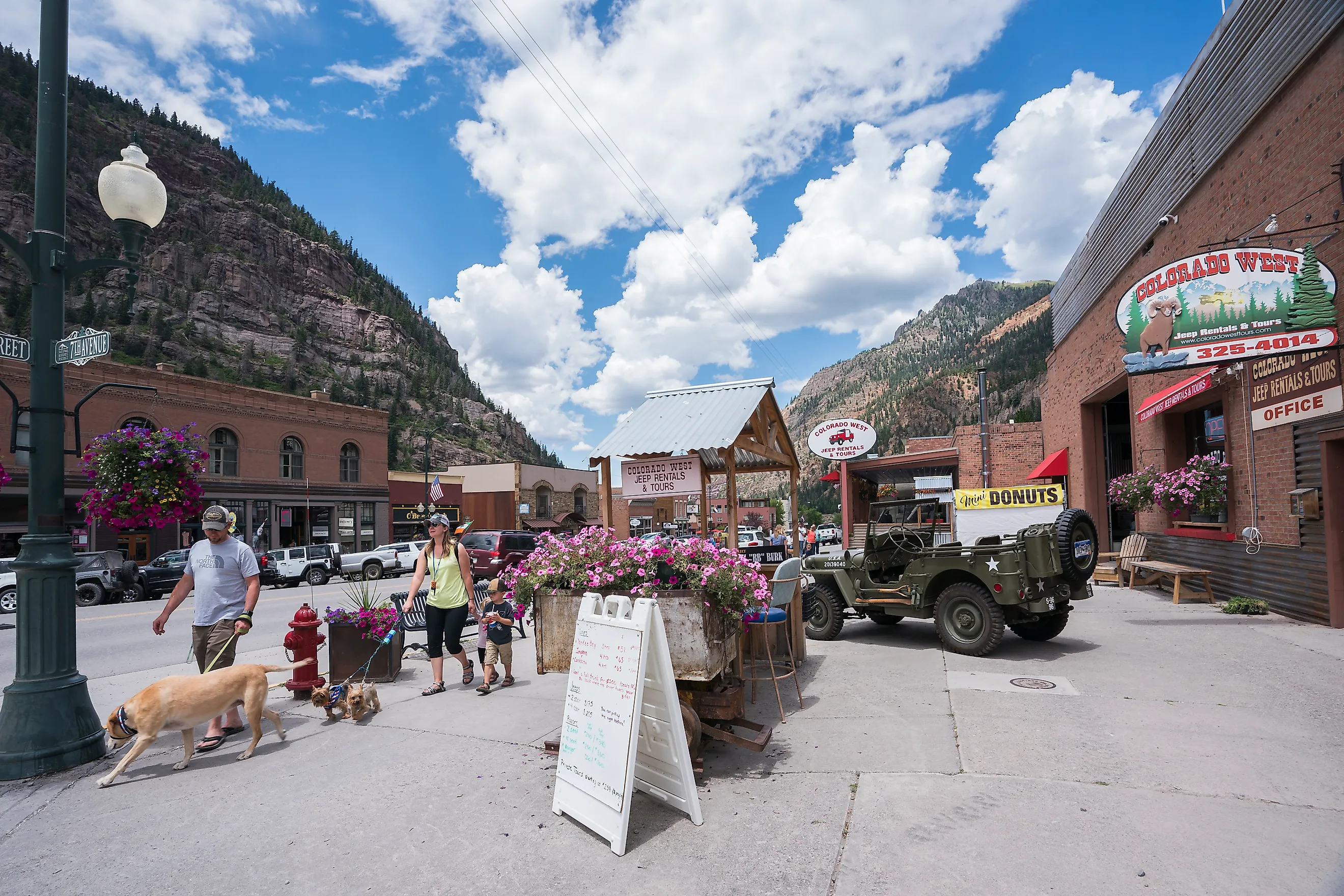
Ouray sits with almost no separation between its streets and the surrounding peaks. Steep San Juan walls rise immediately around the street grid, and two substantial waterfalls sit within town limits. Box Cañon Falls drops 285 feet through a narrow quartzite gorge, reached by a short walkway and a series of viewpoints. On the opposite side of town, Cascade Falls descends toward the end of 8th Avenue, a short walk from downtown. Both are close enough to Main Street to feel tied to the town rather than separate day trips.
The Ouray Hot Springs Pool is the slower version of the same landscape. Its sulfur-free mineral pools sit at the north end of town with mountain walls filling the horizon. US 550 leaves Ouray to the south on the Million Dollar Highway, climbing toward Red Mountain Pass and Silverton. The road, the waterfalls, and the hot springs add up to an unusually dense concentration of scenery for a place covering only a handful of streets.
Chama, New Mexico

Chama is built around a steam railroad. The Cumbres & Toltec Scenic Railroad starts here and climbs 64 miles to Antonito, Colorado, crossing the state line eleven times and topping out at Cumbres Pass, a little over 10,000 feet. It is the longest and highest narrow-gauge steam railroad in North America, built in 1880 to serve the San Juan mining camps and kept running since as a National Historic Landmark. The coal smoke, the water tank, and the roundhouse still sit where they did a century ago.
This is the southern end of the Rocky Mountains, where the San Juans run down into northern New Mexico. The train works its way up through aspen and spruce, over high trestles, and along the edge of Toltec Gorge, with elk and the occasional bear in view from the cars. It runs late May into October, and once snow closes the line most of the town shuts for the winter. A short business district, a few blocks long, sits along the river with the mountains behind it.
Waterton, Alberta

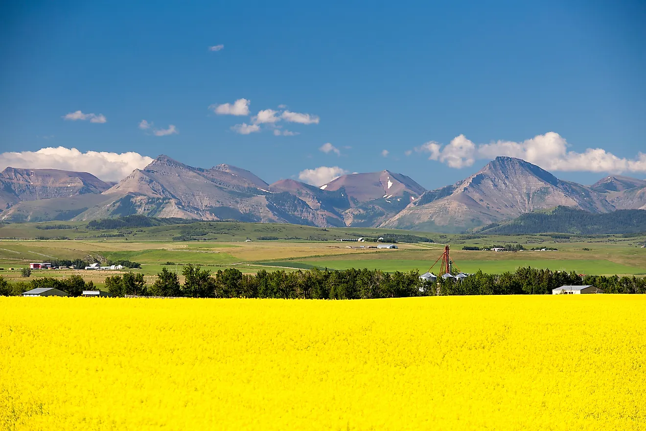
At Waterton the Alberta prairie stops and the Rocky Mountains start, with almost nothing in between. The peaks rise straight off the flat, and Upper Waterton Lake runs south from the townsite into Montana, the deepest lake in the Canadian Rockies. The Prince of Wales Hotel has stood on a bluff above the town since 1927, a steep-roofed landmark the Great Northern Railway built to pull American tourists north. Cameron Falls drops right in the townsite, a few minutes' walk from the main street.
Waterton Lakes is the smallest national park in the Canadian Rockies, which puts a lot of country within a short walk of town. In 1932 it was joined with Montana's Glacier National Park to form Waterton-Glacier International Peace Park, the first of its kind in the world. The two parks are still run as one, and their trails cross the international border. Much of the town is open only between May and October, and the crowds are a fraction of Banff's, a few hours north.
Fernie, British Columbia

Fernie's mountains appear at the ends of downtown streets with almost theatrical precision, but the buildings are worth a look too. After fire destroyed much of the community in 1908, local rules required fire-resistant construction in the commercial core. Many surviving buildings along 2nd Avenue date to 1908 and 1909, with golden brick, sandstone, arched windows, and restrained Italianate details. The Elk River runs nearby, and the short Fairy Creek Falls trail begins only minutes from downtown. Winter is a different trip entirely. Fernie Alpine Resort sits outside town beneath the Lizard Range, with skiing replacing the warm-season hiking and mountain biking. The result is something many purpose-built resorts cannot match: a genuine early-20th-century downtown inside an enormous mountain amphitheater.
Nine Towns, No Single Rockies Story
Read together, these nine are not one Rocky Mountain story told nine times. Stanley is the Sawtooths and the cold, Livingston the Yellowstone and Paradise Valley, Lander the Wind Rivers and a river that drops underground, Chama a steam railroad at the range's southern edge. Red Lodge has the Beartooth Highway, Fernie a downtown rebuilt out of a fire. And the two that lean hardest on their setting sit at the far ends of the range: Waterton, where the Alberta prairie runs straight into the peaks, and the Colorado pair of Ouray and Crested Butte, one built around waterfalls and hot springs, the other around a valley of wildflowers.