9 Main Streets Where New Zealand Comes Alive
Across New Zealand, the principal commercial street of a town still tends to follow the pattern set when the place was built, whether that pattern came from a goldfield or a working harbour. On the West Coast, Revell Street still bends the way its surveyor traced it through the sand dunes. In North Otago, Thames Street carries a line of limestone banks and civic buildings paid for by grain and wool money. Further north, Victoria Avenue links the shopping blocks of Whanganui with the museum and gallery at Pukenamu Queen's Park. These nine main streets have long been lifelines for their communities, and they continue to be the streets where New Zealand comes alive.
Thames Street - Oamaru, Otago

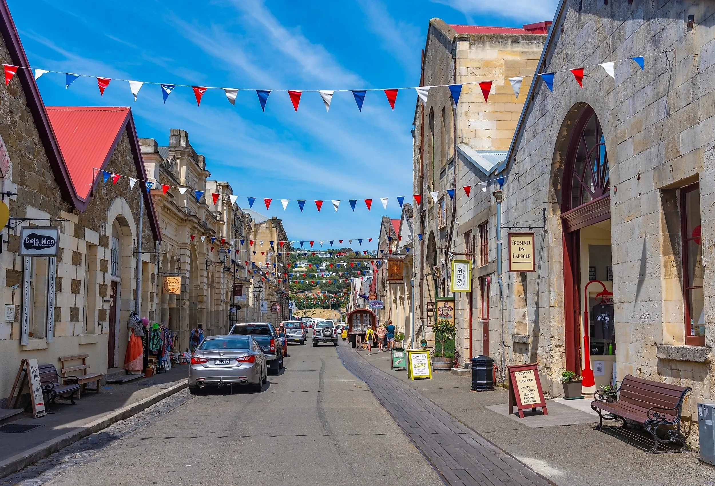
There are few main roads with a stronger architectural identity than Thames Street. The Forrester Gallery, housed in the former Bank of New South Wales, is one example of how this main street has repurposed the old architecture. The building itself is considered a Category 1 historic place by Heritage New Zealand, and the gallery holds a regional collection that includes works by Colin McCahon, a group of which was gifted by the artist's family in 2005.
Further along Thames Street, the Oamaru Opera House stands as another example, having been designed by John Meggett Forrester and officially opened in 1907. It became the centre of civic entertainment and has remained a major part of Oamaru's cultural life for over a century. The street itself is also an attraction. The Thames Street Bridge, built in 1861 and widened in 1876, links the harbour precinct with the main thoroughfare through the town, and it held the title of the widest bridge in the southern hemisphere until the Sydney Harbour Bridge opened in 1932.
Rue Lavaud - Akaroa, Canterbury

Rue Lavaud gives Akaroa a distinct main street through its connection with Akaroa Harbour, where part of the historic area stretches along the waterfront. The street sits within a settlement shaped by Māori history and 19th-century European colonial influence. The Akaroa Museum provides a natural starting point to dive deeper into local heritage, with exhibitions that cover the history of Banks Peninsula, including Māori settlement and the area's maritime and cultural development. Architecture supplies yet another reason for exploration, with the former Bank of New Zealand standing at the corner of Rue Balguerie, opened in 1905 to replace a single-storey timber bank built on the same site in the mid-1870s.
A few doors along, the Langlois-Eteveneaux Cottage carries 1840s French-settler architecture and is the oldest part of the Akaroa Museum complex. The street also leads directly towards the waterfront and a wider historic district, an arrangement that allows visitors to combine the commercial street with the heritage buildings and gardens above the harbour.
Pollen Street - Thames, Waikato

Developed during a transformative period in the history of the Coromandel Peninsula, Thames grew rapidly after the goldfield was proclaimed open on 30 July 1867. Pollen Street was the rough two-kilometre thoroughfare that connected the two settlements of Shortland and Grahamstown, which combined with Parawai to form the town of Thames in 1874. The surviving buildings preserve a trace of that boom in 19th-century shops, government offices, and mining structures.
The Thames Museum, on Cochrane Street, a block off Pollen Street, adds more layers of local history, on ground that formed part of the old Thames Central School site. It holds extensive archival imagery and artifacts that map the timeline of the Thames goldfield, and a stone memorial arch stands outside. Pollen Street is also a fully functioning commercial road, with historic buildings containing cafes and galleries. Although the Grahamstown historic precinct is one of the more obvious places to observe the connection between the street and the gold rush, the Thames School of Mines and the Thames Goldmine Experience provide more direct connections to the town's mining industry.
Revell Street - Hokitika, West Coast

Hokitika became a major port and gold mining centre in the 19th century, and Revell Street developed right alongside the influx of miners, banks, merchants, hotels, and other businesses. The road is still known as the "Crooked Mile", a name earned from the dog-leg that government agent William Revell traced when he laid the street out along the sand dunes. More than 80 of the town's hotels once operated on it. There are many surviving buildings that demonstrate the importance of commerce and banking during that period.
The former Bank of New South Wales and the former Bank of New Zealand stand on the same corner of Revell and Camp Streets. The Bank of New South Wales building dates from 1905, while its neighbour is largely of 1931 construction and incorporates fabric from an 1875 bank on the same site, where gold had been bought and assayed since the 1860s. The Prestons Building at number 95 offers another example, built in 1923 for a Revell Street drapery business and listed by Heritage New Zealand as a Category 2 historic place. That heritage can also be explored through the Hokitika Museum, which reopened in 2025 after a long closure for seismic strengthening and holds collections covering Westland and the wider region.
Talbot Street - Geraldine, Canterbury

This roadway emerged from one of the earliest European settlements in Geraldine. According to the town's own historical account, surveyor Samuel Hewlings built the first bark hut on Talbot Street in 1854, and the totara he planted to mark his daughter's birth still stands opposite the police station. As more settlers moved into the area, sheep farming and sawmilling became the district's primary economic activities. This street continues to hold reminders of those formative years while developing a more contemporary side.
Local galleries and specialty shops are scattered through the commercial centre, such as the Susan Badcock Gallery or The Geraldine Cheese Company, which give visitors a feel for how the culture of the locale has evolved from its settler roots. Nearby, the former Town Board Office of 1885 was dismantled and rebuilt on Cox Street in the 1970s and now houses the Geraldine Historical Museum. The town also supports the Geraldine Military Museum and the Geraldine Vintage Car and Machinery Museum, offering a glimpse into the labour and daily life of the people who once walked these same streets.
Buckingham Street - Arrowtown, Otago

Buckingham Street is a remarkably preserved mountain road that captures the character of the Central Otago gold rush. The frontier outpost that had grown up on the Arrow River was submerged by the flood of 1863 and relocated to this new main street, and by the end of 1864, it held nineteen wholesale and retail stores alongside ten hotels. The street continues as an active cultural and commercial hub, balancing the pioneer past with a working present.
Visitors can dive into local lore directly at the Lakes District Museum & Gallery, which comprises three heritage buildings and showcases a reconstructed gold rush shanty, along with seasonal gold panning. Historic storefronts such as the Gold Nugget, a gold-rush-era general store at number 43 that now trades in New Zealand-made goods, remain in commercial use. Along the upper edge of the road, the preserved Arrowtown Chinese Settlement features conserved miners' huts and the restored Ah Lum's Store, and remains a poignant extension of the main street.
Victoria Avenue - Whanganui, Manawatu-Whanganui

Victoria Avenue cuts straight through the heart of the city's commercial core, linking the shopping precinct of Whanganui with the cultural district. This avenue was already a crucial commercial street in the late 19th century, but by the early 1900s, it was lined with stores, a post office, a clock tower, and trams. A walk along the avenue can start among the local cafes and historic shopfronts before the path leads toward Pukenamu Queen's Park, which holds two major institutions.
The Whanganui Regional Museum covers the region's human and natural history, and the Te Whare o Rehua Sarjeant Gallery, which reopened in November 2024 after a decade-long redevelopment, holds a collection of more than 8,300 works. From there, a short detour can lead downhill towards the Whanganui River, a waterway that played a central role in the town's development.
Bow Street - Raglan, Waikato

The European settlement that established this road took shape in the 19th century on the harbour known to Māori as Whāingaroa, and was renamed Raglan in 1858. Its early economy relied on farming and the shipment of local goods by sea. Bow Street has served and continues to serve as the commercial spine of Raglan, as it provides direct access to the harbour that was central to the local economy. Although much of this street's history survives, a substantial amount was lost to a series of major fires.
One of the most recognizable landmarks of the area, the Harbour View Hotel, was originally a two-storey wooden inn built by George Moon in 1866 at the harbour end of the street. Early wooden frontier towns were vulnerable to fire, and the hotel was destroyed twice, first in 1901 and then again in 1904. The third Harbour View Hotel, a two-storey villa-style building that still operates, went up in early 1905 and is the last surviving historic hotel in the town. Further up the street, the Raglan Town Hall of 1929 is the settlement's only true Art Deco building. After decades as the town cinema and dance hall, it passed to community management in 1994 and still serves that purpose. Bow Street is also the main shopping area, and the fifteen phoenix palms along its planted central strip have stood for close to ninety years.
Sunderland Street - Clyde, Otago

The character of this roadway was set during the Central Otago gold rushes that followed the 1862 strike on the Clutha River, with hotels, stores, banks, and other businesses quickly filling the street as miners and merchants arrived. Timber construction in the area gradually gave way to sturdier buildings made of local schist, and several of those early civic and commercial structures remain to this day, including the former Clyde Town Hall and Public Library, built in 1869 and 1874, respectively. The classical facades and decorative stonework in the local architecture reflect the ambition of a town benefiting from an influx of gold-fuelled wealth.
Further along the street in Clyde, Dunstan House occupies the site of an older hotel that served miners and their horses in the 1860s. The present schist building was begun in 1898 and opened in 1900, and the separate Dunstan Hotel followed on an adjacent corner in 1903. Today a walk down this street reveals a good deal about the local heritage, balancing the raw colonial record with a modern culture of artisanry and tourism.
New Zealand's Working Main Streets
New Zealand's main streets remain working streets, and the ones that hold their character best tend to sit where a harbour or a goldfield shaped the original survey. On Banks Peninsula, Rue Lavaud carries its French street names down to the Akaroa waterfront. In Central Otago, Buckingham Street sits beneath the avenue planted in 1867, while Sunderland Street shows the schist frontages that replaced its first timber stores. On the Coromandel, Pollen Street covers the ground that once separated two rival goldfield townships. These nine towns have long worn their hearts on their main streets, and each one is well worth a wander.