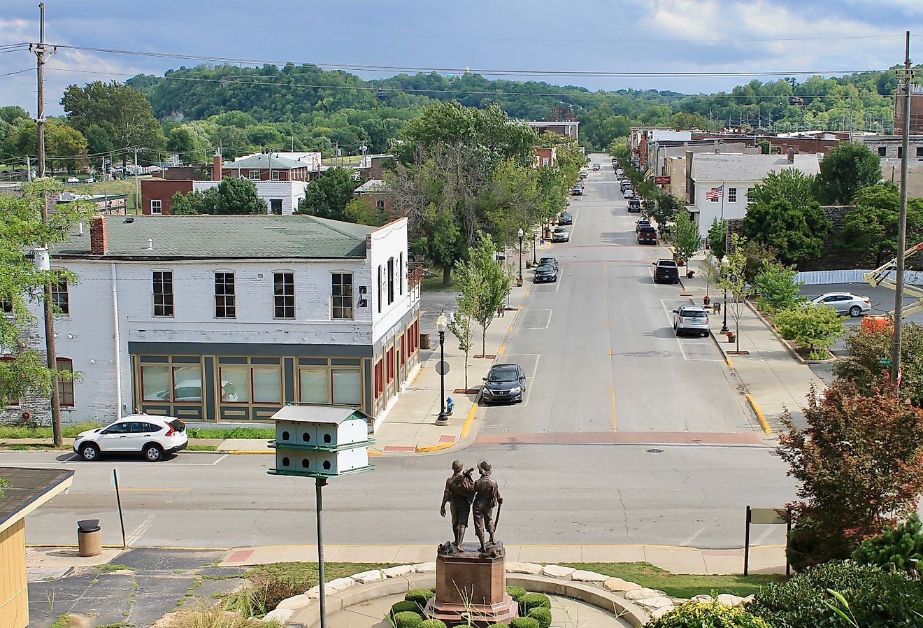
8 Safest Towns In Western Australia For Senior Living
Western Australia is so vast that a place like Esperance functions less like a town and more like a service centre for a vast stretch of southern coast. Smaller settlements around it depend on Esperance for the hospital, the chemist, and the services they cannot sustain themselves. The same pattern holds inland, where a Wheatbelt town like Corrigin serves a surrounding district of wheat farms and gravel roads, and the main street and district hospital matter well beyond the town limits. "Safe" here means eight towns judged on crime levels, access to medical and emergency services, walkability, and lower bushfire or cyclone risk.
Margaret River, South West

The Shire of Augusta-Margaret River consistently records one of the lowest crime severity rankings in WA. The town functions as a low-traffic, walkable centre built around Bussell Highway, where cafes, the Margaret River HEART performing arts centre, and the Margaret River Library sit within easy reach. Margaret River District Hospital at 17 Farrelly Street provides 24-hour emergency care, and Busselton Health Campus on Mill Road sits roughly 65 km north (about 50 minutes away) for higher-acuity needs.

The Augusta-Margaret River Community Resource Centre runs a regular over-55s program, and the Margaret River Senior Citizens Centre on Tunbridge Street hosts weekly activities. On Saturdays, the Margaret River Farmers' Market draws locals to the education campus, while the gentle Rivermouth-to-Old Settlement section of the Wadandi Track offers a flat walk close to town. Voyager Estate and Vasse Felix are both within easy reach for a winery lunch, and the Mammoth Cave interpretive boardwalk offers wheelchair access to the first chamber for visitors who prefer an easier outing.
Denmark, Great Southern Coast

Denmark sits on Wilson Inlet, roughly 420 km south of Perth. The broader Shire of Denmark consistently records one of the lowest violent-crime rates in regional WA. Strickland Street forms the town centre's main spine, with a flat layout and sealed footpaths linking the IGA, post office, library, and the Denmark Riverside walking trail. Denmark Health Service provides emergency and inpatient services, and Albany Health Campus, the Great Southern's largest health facility, is about 55 km east. The Denmark Community Resource Centre coordinates senior tech-help sessions and the local Home and Community Care program.

The Mokare Heritage Trail offers an easy walk from town to Berridge Park, while Greens Pool in William Bay National Park remains a popular spot for a swim or picnic. Rockcliffe and Singlefile wineries on Scotsdale Road sit a short drive out of town, and the wheelchair-accessible Tree Top Walk at the Valley of the Giants is about 50 km west through Walpole.
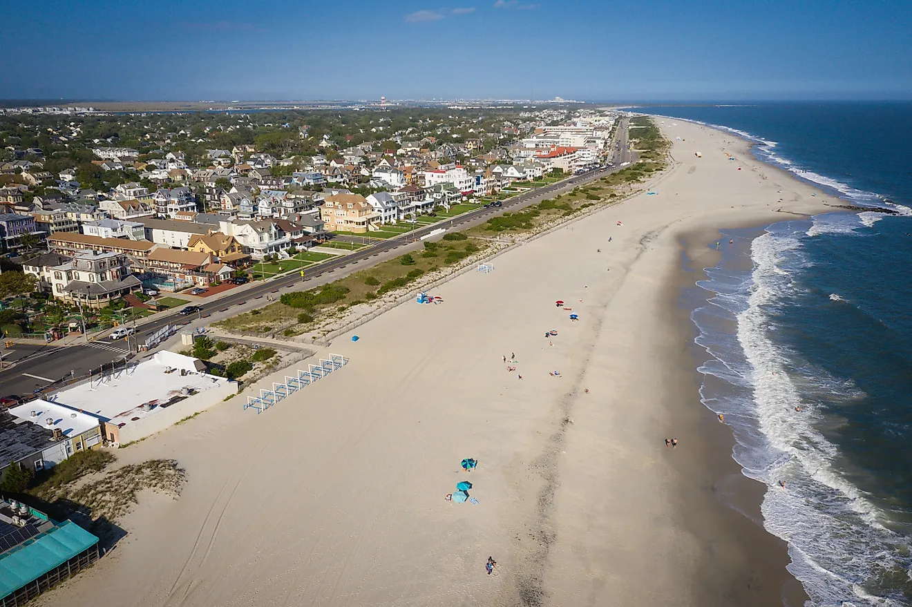
Esperance, Goldfields-Esperance Coast

Esperance serves as the regional centre for a vast slice of the southern coast. As a result, it supports hospital and specialist services well beyond what its size would suggest. Esperance Health Campus on Hicks Street provides 24/7 emergency, surgical, and renal dialysis services, and the Royal Flying Doctor Service operates from the airport. The town centre along Andrew Street and Dempster Street is laid out on a simple grid and remains easy to navigate on foot, with a recently upgraded foreshore that includes an accessible boardwalk and shaded seating. The Esperance Senior Citizens Centre runs daily activities, and local volunteer organisations coordinate over-55s social programs in town.

The 40 km Great Ocean Drive past Twilight Beach and Observatory Point is the standard half-day outing. Closer to the centre, the Esperance Museum sits near the corner of James and Dempster Streets, ferries run to Woody Island in the Recherche Archipelago for a day on the water, and the rebuilt Esperance Jetty remains a popular sunset walk.
Pinjarra, Peel Region

Pinjarra sits 82 km south of Perth on the Murray River inside the Shire of Murray. The shire records crime rates well below the Peel regional average and a fraction of those in neighbouring Mandurah. Murray District Hospital on McKay Street is a small public facility providing inpatient medical and palliative care, with a co-located health centre offering GP services. It does not operate an emergency department, so urgent care shifts to Peel Health Campus on Lakes Road in Mandurah (a 206-bed general hospital with a 24-hour ED, about 20 minutes north on the South Western Highway). Fiona Stanley Hospital in Murdoch sits about an hour away via the Kwinana Freeway for tertiary referrals.
The historic town centre along George Street is flat, with sealed footpaths linking the Edenvale Heritage Precinct, the Murray Districts Memorial Hall, and the IGA. The Murray Community Resource Centre coordinates Home and Community Care services and a regular over-55s morning tea program. The Hotham Valley Railway runs steam train trips from Pinjarra to Dwellingup, while the Pinjarra Heritage Trail loops past the Edenvale homestead and St John's Anglican Church. The town foreshore reserve is a quiet spot to kayak or fish the Murray, and the historic Blythewood pioneer farm sits a few kilometres south on the South Western Highway.
Donnybrook, South West

Donnybrook lies 36 km south of Bunbury, and the Shire of Donnybrook-Balingup ranks among the safer local government areas in the South West by independent crime measures. The town is best known as WA's apple-growing capital. Along South Western Highway, the compact main street places the IGA, post office, library, and Donnybrook Hospital within a five-minute walk of one another. Donnybrook Hospital on Bentley Street is a WA Country Health Service facility with a 24/7 emergency department, on-call doctor support, inpatient beds, and aged-care services. Bunbury Regional Hospital, about 30 minutes north, provides surgical referrals. The Donnybrook Community Resource Centre offers senior digital literacy classes and social programs.

In season, Newton Orchards and Tonon's both open for fruit picking. The Preston River trail through VC Mitchell Park is flat and easy to follow. The Old Goods Shed Markets run roughly monthly, and Balingup, 20 minutes south, draws crowds each spring for its Small Farm Field Day.
Bridgetown, South West

Bridgetown sits about 260 km south of Perth on the Blackwood River, and the Shire of Bridgetown-Greenbushes carries one of the lowest crime rates in the South West. Hampton Street, the main strip, retains much of its heritage character, and Bridgetown is classified by the National Trust as a Historic Town. Footpaths are sealed, traffic speeds stay low, and angle parking sits at every shopfront. Bridgetown Hospital on Peninsula Road provides 24/7 emergency and inpatient care for stabilisation and basic emergency needs. Manjimup District Hospital is about 38 km south for additional services, and Bunbury Regional Hospital, the tertiary referral, is roughly 90 minutes north.
The Bridgetown Senior Citizens Club on Steere Street runs cards, lawn bowls, and weekly bus outings. The Brierley Jigsaw Gallery is an unusual local draw, and the Blackwood River loop from Memorial Park offers a flat walk close to town. The Blues at Bridgetown festival is the calendar event most years (worth confirming current dates and status before booking), and the Heritage Trail north toward the Greenbushes lookout makes a pleasant drive.
Corrigin, Wheatbelt

Corrigin sits about 234 km south-east of Perth in the central Wheatbelt, and the Shire of Corrigin ranks among the lowest in WA on available crime indices. Walton Street forms the town centre and stays wide, flat, and almost traffic-free outside school pickup, with the IGA, post office, bank, and Corrigin District Hospital all within a single block. Corrigin Hospital is a WA Country Health Service facility offering emergency, inpatient, and residential aged care services on a single campus. Northam Regional Hospital is about 90 minutes north-west for higher-acuity referrals. The Corrigin Community Resource Centre runs the local Home and Community Care program.
The Corrigin Dog Cemetery, 2 km west of town, is a well-known local landmark dating from the 1970s and one of the more unusual roadside attractions in the Wheatbelt. The Corrigin Pioneer Museum grounds are an easy walk from town. During harvest, the Walton Street grain bins become a point of local activity, and Wave Rock at Hyden sits about 75 minutes east for a half-day outing.
Northampton, Mid West Coast

Northampton sits 50 km north of Geraldton, and the Shire of Northampton ranks favourably on crime measures for a coastal local government area. Hampton Road, the main street, is a designated heritage precinct lined with stone buildings from the 1860s, with low traffic and sealed footpaths along the commercial strip. Northampton Health Centre provides emergency and inpatient services as a WA Country Health Service facility (current service classifications are worth confirming with WACHS before relying on them). Geraldton Health Campus, the Mid West's regional health campus with full surgical, cardiac, and renal services, is about 35 minutes south on the North West Coastal Highway. The Northampton Old School Community Centre coordinates senior programs.
The convict-built Chiverton House Museum on Hampton Road is the town's main heritage stop, and Sacred Heart Catholic Church, designed by Monsignor John Hawes and completed in the 1930s, is a short walk away. Horrocks Beach, about 22 km west, has calm water for swimming, and the Hutt Lagoon pink lake at Port Gregory is roughly a 40-minute drive north.
What Sets These Towns Apart for Retirees
None of these towns will match metropolitan Perth for specialist medical care, but that is a different calculation from whether a place works for aging in place. Margaret River has an emergency department and a farmers' market within the same Saturday morning. Corrigin has a hospital on the same block as the post office. What these eight towns share is a scale where the essentials stay within reach and the community still notices when the regulars don't show up for Tuesday morning coffee.