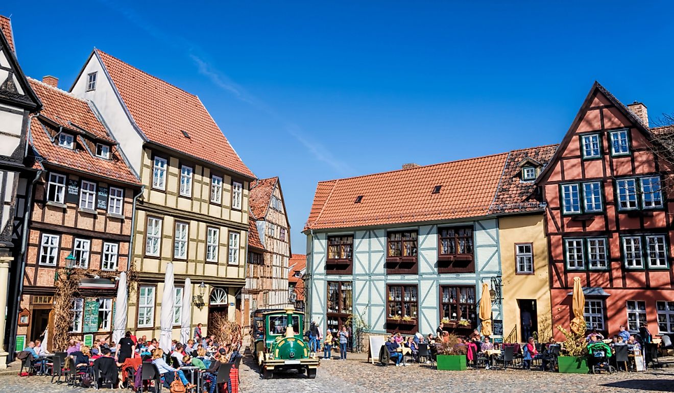
11 Picture-Perfect Main Streets In Hawaii
Many of Hawai‘i’s small towns developed along a single road during the 19th century, when ports expanded under the Hawaiian Kingdom and plantation economies shaped settlement patterns across the islands. Today, many of these streets remain compact and walkable, often stretching just a few blocks with preserved plantation-era storefronts and historic buildings that give them a picture-perfect look. In places like Hanalei, taro fields stretch right up to the roadside, while in Kōloa, the town grew around Hawai‘i’s first sugar plantation, established in 1835. These eleven main streets show that scenery and history can combine into one walkable space across Hawai‘i.
Makawao

Makawao is situated on the western slopes of Haleakalā in what is commonly called “Upcountry Maui,” approximately 1,500 feet above sea level. The town sits in a transition zone between the forested slopes of the volcano and the grassy pastures that once supported large-scale ranching.
Baldwin Avenue, Makawao’s primary street, blends historical architecture with cultural attractions. The Makawao History Museum documents the town’s paniolo (Hawaiian cowboy) past and plantation roots. Local art galleries such as Viewpoints Gallery and Hot Island Glass display and sell work by Upcountry artists, including live glass-blowing demonstrations. Shoppers and visitors often stop at T. Komoda Store & Bakery, a family-run shop that has been in operation since 1916 and is famous for its cream puffs and stick donuts.
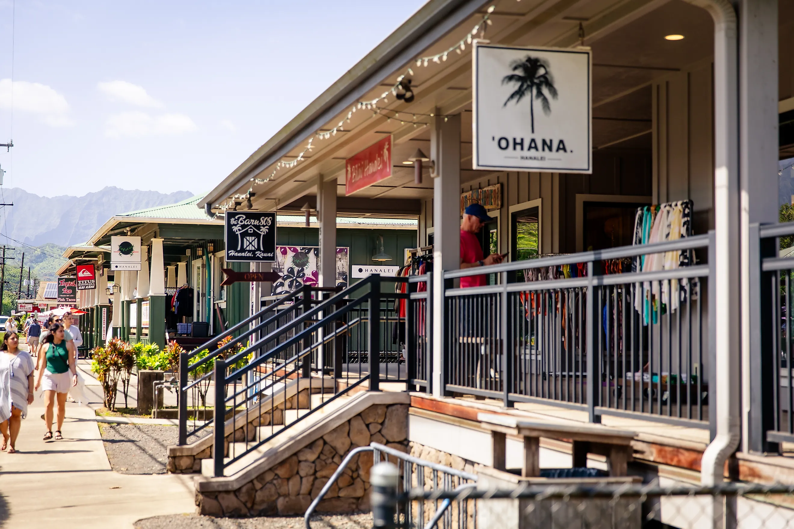
Hanalei

Hanalei lies on Kaua‘i’s north shore, bordered by the Hanalei River and the bay of the same name, with the backdrop of the steep Nā Pali cliffs. It sits on a low coastal plain shaped by centuries of sediment deposition, which created fertile lands still used for taro cultivation. Hanalei was historically an agricultural village centered on communal lo‘i systems and later influenced by missionary efforts.
The main route through Hanalei, a section of Kūhiō Highway, is dotted with significant landmarks and community spaces. The Wai‘oli Hui‘ia Church, with its green steeple and stained-glass windows, anchors the historic district, and the adjacent Wai‘oli Mission House showcases 19th-century missionary life. Visitors can browse local goods at the Hanalei Farmers Market (held weekly behind the community center), walk out to Hanalei Pier for views of the bay, or enjoy taro-based dishes at Hanalei Taro & Juice Co., reflecting the town’s agricultural heritage.
Haleiwa

Haleiwa is located on the North Shore of Oʻahu at the mouth of the Anahulu River, bordered by Waialua to the west and stretches of protected shoreline to the east. Established in the late 1800s as a sugar plantation town and later a gateway to coastal agriculture, Haleiwa’s wooden storefronts and preserved architecture reflect its early 20th-century layout.
Haleiwa’s main street, part of Kamehameha Highway, is lined with preserved storefronts and longstanding landmarks. Matsumoto’s Shave Ice has been a community staple since 1951 and draws long lines daily. Across the street, Haleiwa Art Gallery features rotating exhibits of local North Shore artists. At the southern end of town, visitors can explore the North Shore Marketplace, a cluster of shops and restaurants, before walking to the Haleiwa Beach Park or crossing the Anahulu “Rainbow” Bridge to watch sea turtles near the river mouth.
Pā‘ia

Pā‘ia sits along the north shore of Maui at the intersection of the Hana Highway and Baldwin Avenue, where it developed in the late 19th century as a plantation town supporting nearby sugar operations. Over time, it transitioned into a residential and arts-oriented community.
The compact stretch of Hana Highway that forms Pā‘ia’s main street is filled with eclectic and historic points of interest. Mana Foods, a natural grocery store dating back to the 1980s, anchors the commercial block with local produce and deli fare. The Pā‘ia Bay Coffee Bar offers open-air seating with views of public murals that document the town’s plantation history and surf culture. Nearby, Pā‘ia Fish Market serves seafood dishes to both locals and visitors, and the Pā‘ia Community Center hosts rotating cultural events and performances.
Kapa‘a

Kapa‘a is located on Kaua‘i’s eastern coast, bordered by the Wailua River to the south and the Anahola district to the north. It originated as a plantation-era community and expanded during the 20th century into a commercial and residential town.
Old Kapa‘a Town’s main stretch of Kūhiō Highway offers walkable access to several historic and community-centered attractions. The Kapa‘a First Hawaiian Church, founded in the 1880s, sits alongside preserved plantation-era storefronts. The Hee Fat General Store now operates as a modern shop selling shave ice and local goods. Nearby, the Art Café Hemingway doubles as a gallery and café, and visitors can also enter the Ke Ala Hele Makalae coastal path for bike rides or walks with scenic ocean views.
Koloa

Kōloa is set on the southern coast of Kaua‘i, just inland from Poʻipū, and was the site of Hawai‘i’s first commercial sugar plantation, established in 1835. The town developed around plantation activity and retains much of its early layout.
Kōloa Road, which runs through the town’s historic core, includes several preserved and active landmarks. The Kōloa History Center features photographs and artifacts from the plantation era. Across the street, the First Sugar Mill monument stands where Hawaiʻi’s sugar industry began in 1835. Just down the block, Sueoka Market, a local market in operation since the 1930s in its current location, continues to serve the community. Visitors can also find shaded seating and events at the Old Kōloa Town Courtyard, which is often used for music and heritage festivals.
Lanai City

Lānaʻi City is located in the central highlands of Lānaʻi Island. The Dole Company built it in the 1920s as a planned plantation town. It is arranged around a grassy square known as Dole Park, with Lānaʻi Avenue serving as the main street on its eastern edge. The town’s elevation gives it a cooler climate, and most original buildings remain in active use. On the park’s perimeter, visitors can explore the Lāna‘i Culture & Heritage Center, which preserves oral histories and archaeological findings from across the island. At the park’s western edge, the Mike Carroll Gallery showcases paintings and prints by local artists, and the preserved Lāna‘i jail building stands as a quiet historical site now open for public viewing.
Waimānalo

Waimānalo is located on the windward coast of Oʻahu, between the Koʻolau mountain range and the long, undeveloped shoreline of Waimānalo Bay. The town remains largely residential and agricultural, with no formal town center but a main strip along Kalaniana‘ole Highway where small community buildings cluster.
Waimānalo’s main strip is anchored by small but meaningful community landmarks. Waimānalo District Park offers playing fields and shaded walking paths for daily use. Across from the park, visitors find Waimānalo Beach Park, where more than three miles of open coastline are accessible for walking, fishing, and swimming. Just up the road, Shima’s Market serves as the town’s central grocery store and gathering place. The area also has a touch of scenery, thanks to a mural project maintained by local youth organizations that displays Waimānalo’s agricultural and cultural history along nearby walls.
Waimea

Waimea is situated on the southwestern coast of Kaua‘i at the mouth of the Waimea River, where the dry lowlands meet the base of inland ridges. The town is historically important as one of the first landing places of British explorer James Cook in 1778 and as a regional hub during the sugar plantation era.
Kaumuali‘i Highway forms Waimea’s main corridor and features several heritage points within walking distance. The statue of Captain Cook stands at the central intersection, near the old Waimea Theater. This venue, from 1938, is a town staple and was closed for a few years before reopening, showcasing Art Deco architecture, and now operates as a community cinema. Just off the highway, the West Kaua‘i Technology & Visitor Center provides interpretive exhibits and a timeline of the town’s sugar era. For outdoor exploration, visitors can head to Lucy Wright Beach Park or take a short drive to the Waimea Canyon entrance and its nearby hiking trails.
Wailuku

Wailuku is situated at the base of the West Maui Mountains, near the entrance to ʻĪao Valley, and serves as the county seat of Maui. The town was once a center of the sugar trade and continues to serve as a civic and legal hub, with several government buildings still located in and around its historic core. Wailuku’s Market Street retains its original early-20th-century structures and remains a focal point for the town’s civic and cultural life.
The ʻĪao Theater at the street’s southern end hosts live performances and local festivals, while nearby landmarks like the Kaʻahumanu Church, one of Maui’s oldest Christian churches dating back to 1876, add to the area’s historical depth. Across from the Wailuku Coffee Company, visitors can follow the sidewalk to the 1833 Bailey House Museum and be guided on a self-paced walking tour of Wailuku’s plantation-era and legal history.
Volcano Village

Volcano Village is located on the southeastern side of Hawaiʻi Island at an elevation of nearly 4,000 feet, adjacent to Hawaiʻi Volcanoes National Park. The town developed as a residential and visitor community supporting park activities and scientific research focused on volcanic landscapes.
The village’s main roads, including Old Volcano Road, connect a series of small commercial clusters rather than a single continuous strip. Volcano Garden Arts features locally made artwork set within a rainforest environment. Nearby, the Volcano Art Center (located within the national park) provides exhibitions tied to Hawaiian landscapes and culture. After exploring downtown and before heading out to the national park, spots like Thai Thai Bistro and Bar are ideal for recharging. This spot offers some of the best Thai dishes in the region, like spring rolls and papaya salad, in an ornate room perfect for a relaxing meal.
Main Streets That Shine Through The Islands
These eleven towns, spread across four Hawaiian islands, share a common thread: their main streets preserve a sense of place grounded in community use and historical continuity. They are not built around spectacle or commercial novelty but around walkable routes shaped by local geography and cultural needs. In Waimānalo, this takes the form of a beachside mural wall and community park. Meanwhile, in Lāna‘i City, it is reflected in the quiet geometry of Dole Park and its surrounding civic buildings. Across all these places, Hawai‘i’s main streets invite slow exploration.