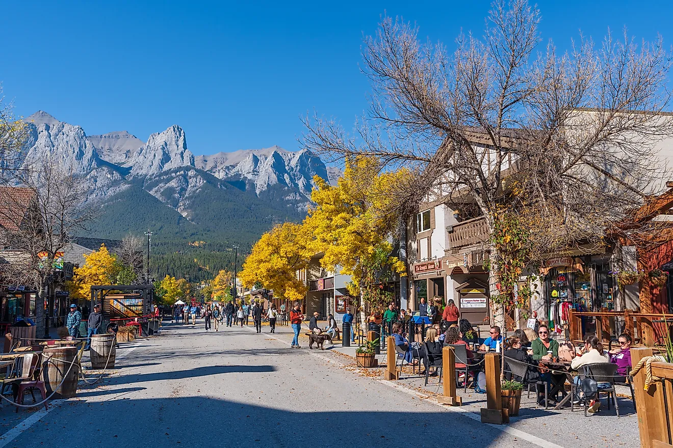
10 Most Relaxing Idaho Towns
Relaxation in Idaho tends to come from the same set of ingredients: a lake or river within walking distance, a mountain at the back of town, a downtown short enough to cross in fifteen minutes, and a population small enough that the trailhead and the grocery store share a parking lot. Stanley has 116 year-round residents and four hot springs along the Salmon River within ten miles of town. Sandpoint has Lake Pend Oreille, the deepest lake in Idaho, and Schweitzer Mountain Resort 11 miles up the road. Heyburn State Park, the oldest state park in the Pacific Northwest, runs along three lakes outside St. Maries with a 72-mile paved bike path passing through. The ten towns below all earn the label from a slightly different angle.
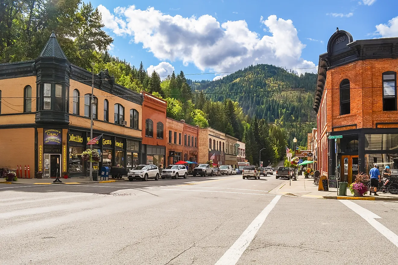
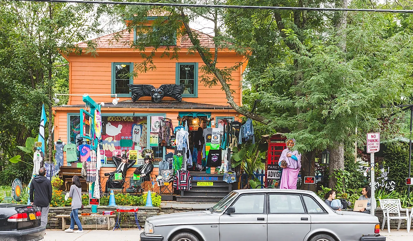
Sandpoint

Sandpoint sits on the north end of Lake Pend Oreille, the largest lake in Idaho and the fifth-deepest in the U.S., about 60 miles from the Canadian border. Sand Creek runs through the middle of town and is the easier paddle when the lake is choppy. Schweitzer Mountain Resort, 11 miles uphill, is Idaho's largest ski area at 2,900 skiable acres and 92 named runs. The lift-served hike to the summit, at 6,400 feet, is the easiest way up; the longer Scotchman Peak Trail east of town climbs to 6,872 feet, the highest point in Bonner County. Downtown wraps around First Avenue with a working bookstore (Vanderford's), a long-running pottery studio (Pend Oreille Arts Council), and the Panida Theater, a 1927 Spanish Mission-style movie house that still books films and live music.
McCall

McCall sits on the south shore of Payette Lake, a glacial lake roughly 5 miles long with public swimming, paddleboarding, and a marina at the foot of Lenora Street. Ponderosa State Park, on a peninsula that juts into the lake, has trails through old-growth pine and sightings of mallards, Canada geese, and bald eagles along the marsh. Brundage Mountain Resort, a 20-minute drive north, runs over 20 miles of mountain biking trails in summer and skiing on 1,920 acres in winter. The hot springs near town, including Gold Fork and Zims, are simple riverside soaks rather than developed resorts. Downtown is compact: Crusty's Pizza books occasional live music, the McCall Brewing Company anchors Lenora Street, and the McCall Winter Carnival in late January takes over the lakefront for two weeks of ice sculpture and fireworks.
Stanley

Stanley has 116 full-time residents and sits at 6,253 feet at the foot of the Sawtooth Range, the spine that runs north-south through central Idaho. The town is a starting point for hikes to Sawtooth Lake (a 10-mile round trip), Bench Lakes (4 miles), and the longer Alice-Toxaway Lake Loop (around 20 miles). Redfish Lake, 5 miles south, has a swimming beach, a lodge dating to 1929, and a shuttle boat that drops hikers at the head of the lake. Four hot springs sit along the Salmon River within ten miles of town: Sunbeam, Kirkham, Boat Box (a literal cast-iron tub on the riverbank), and Cove Creek. Three official scenic byways meet here, the Sawtooth, the Salmon River, and the Ponderosa Pine, and traffic stays light enough that the loudest sound in town most evenings is the river.
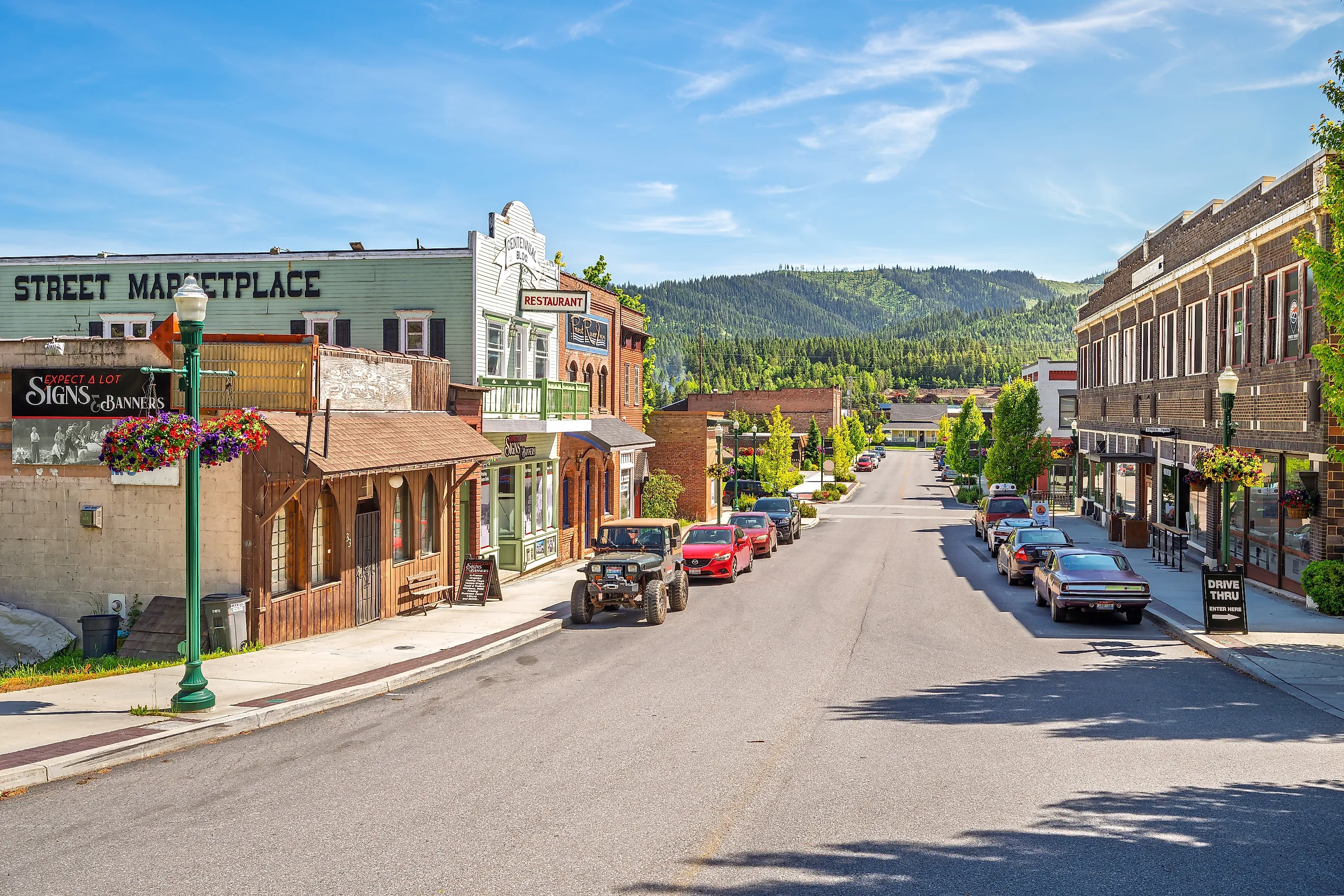
Priest River

Priest River sits at the meeting of the Priest and Pend Oreille Rivers in the Selkirk Mountains. The Mudhole, a swimming and picnic area run by Priest River Recreation Area, has the only public boat launch in town and a sandy beach that fills up on July weekends. The Priest River Experimental Forest, established in 1911 and one of the oldest in the U.S., sits north of town with hiking up to a 1929 fire lookout on Gisborne Mountain. Huckleberry and morel foraging is a serious local pastime in the surrounding national forest. Mi Pueblo Authentic Mexican Cuisine and The Settlement Kitchen + Craft Tavern handle the dinner side of town, and the Priest River Timber Days festival in August is built around log-rolling, axe-throwing, and a downtown parade.
Cambridge

Cambridge has fewer than 350 residents and serves as the eastern gateway to Hells Canyon, the deepest river gorge in North America at depths exceeding 7,900 feet. The Weiser River Trail, an 84-mile rail-trail running on the bed of the old Pacific & Idaho Northern Railway, has its northern terminus here and provides hours of flat walking, biking, and horseback riding through canyon and prairie. Pittsburg Landing is the closest road-accessible put-in for jet boats and rafts on the Snake River; the Snake River Trail runs along the canyon rim above. The Hells Canyon Scenic Byway loops back through Council and Council Mountain. The Washington County Fair in late August is the main social event of the year.
St. Maries

St. Maries sits at the confluence of the St. Joe and St. Maries Rivers as they flow toward Lake Coeur d'Alene. The St. Joe is one of the highest navigable rivers in the world and known for catch-and-release fly fishing for native westslope cutthroat trout. Heyburn State Park, the oldest state park in the Pacific Northwest (established 1908), spans 5,744 acres of land and 2,332 acres of water across three lakes (Chatcolet, Benewah, and Hidden) just north of town. The Trail of the Coeur d'Alenes, a 72-mile paved bike path, crosses the park on a 3,100-foot trestle over the St. Joe River. Within town, the Hughes House Museum (a restored 1902 log cabin) preserves photographs and artifacts from the timber and railroad era. Two Saints Brewing handles the local craft beer, and Country Fair stocks groceries plus secondhand goods.
Carey

Carey has roughly 800 residents and sits at the western edge of the Magic Valley, with Craters of the Moon National Monument and Preserve 20 minutes south. The 7-mile loop road inside Craters runs past lava flows, spatter cones, and three caves (Indian Tunnel, Boy Scout, and Beauty) that visitors can walk into with a free permit. In winter, the loop closes to cars and reopens for cross-country skiing and snowshoeing across the lava fields. Within town, the Dorcas Carey Public Library runs Storytime, Crazy Crafters, and Tech with Ted programs out of a building that doubles as the community gathering space. The 93 Bar and Grill is the only sit-down restaurant. The Blaine County Fair in early August is the year's main event.
Grangeville

Grangeville was founded in 1876 as a Grange (the rural farmer cooperative movement) settlement and sits at the southern edge of the Camas Prairie. The town's main institutions still run on volunteer time: the Grangeville Golf and Country Club is a 9-hole course with separate Men's and Women's Associations, and Pioneer Park's seasonal swimming pool runs lessons through the summer. Camas Lanes (a six-lane bowling alley) and Jungle Gym's Indoor Play Center & Café handle the rainy-day options. Snowhaven Tubing Hill, 7 miles south, is the local ski area, with skiing, snowboarding, and tubing on a single chairlift. The Visitor Center in Eimers Park displays a partial mammoth skeleton excavated from nearby Tolo Lake in 1994 and is staffed entirely by volunteers.
Bonners Ferry

Bonners Ferry sits in the Kootenai River Valley 30 miles south of the Canadian border. The Kootenai National Wildlife Refuge, just west of town, covers 2,774 acres of wetlands and meadows with a 4.5-mile auto tour route and walking trails that bring out moose, elk, and migratory waterfowl in season. The Brush Lake Trail (a 6-mile loop with about 200 feet of elevation gain) circles the lake and connects to a swimming area. The 3-mile climb to Myrtle Peak is the harder local hike, with views over the basin. The Boundary County Museum holds a reconstructed White Caribou Saloon and a Portrait Hall covering the valley's homestead history. Kootenai River Brewing Company has the local taps; Mirror Lake Municipal Golf Course is the 9-hole.
Rupert

Rupert was founded in 1905 as a planned town built around an oval town square, an unusual layout for Idaho. The Wilson Theatre, a 1920 vaudeville house anchoring the square, still books concerts, plays, and the occasional silent film with live organ accompaniment. The surrounding storefronts house The Gathering Place quilt shop and Book Central used bookstore. The Minidoka County Museum has a steam locomotive and caboose on display in their original Union Pacific colors and runs a self-guided walking tour of the railroad-era downtown. Lake Walcott State Park, 11 miles east, is built around a 1906 dam on the Snake River and has fishing, picnicking under mature trees, and a campground that rarely fills.
Pick by mood. The big mountain at the back of town: Sandpoint or McCall. The lake on the doorstep: McCall, St. Maries, Bonners Ferry. The hot springs and the trailhead: Stanley. The downtown to walk in fifteen minutes: Rupert, Cambridge, Carey, Grangeville. None of these are resort towns and that is the point.