Which Deserts Are In North America?
North America is the world’s third largest continent occupying an area of about 9,400,000 square miles. The continent has many deserts which receive less than 10 inches of rainfall annually. These deserts are largely situated between the Sierra Madre Oriental and the Rocky Mountain to the east and Peninsular, Transverse, and Sierra Nevada ranges to the west. The xeric area on the continent occupies an area of about 95,751 square miles, and it includes three major deserts, a huge non-desert arid area, and many smaller deserts in the northwest, central and northeast Mexico and in the western parts of the United States.
5. Great Basin Desert
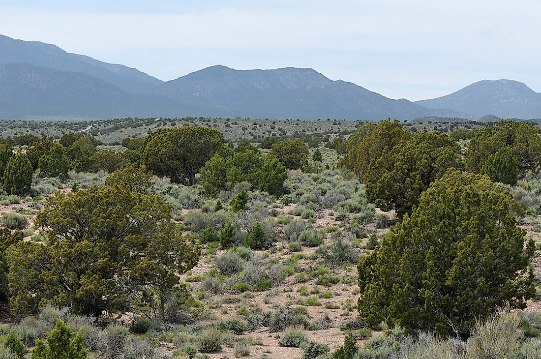
The Great Basin Desert is a temperate desert with snowy winters and dry, hot summers. It is situated in the Great Basin right between the Wasatch Range and the Sierra Nevada. It is one of the big biologically defined deserts in the continent that spans a considerable part of Nevada and then stretch into Idaho, eastern California, and western Utah. The desert has broad valleys which are surrounded by numerous parallel mountainous ranges. The desert has over 33 peaks whose summits are over 9,800 feet high, but its valleys have an elevation of over 3,900 feet. The biological community of the region varies with altitude from the Pinyon-juniper forests through the rolling sagebrush valleys to the lower salty dry lakes. The variation between the peaks and valleys established an array of habitat niches with numerous isolated unique animals and plant species populations. Over 600 vertebrate species are living in the Great Basin Desert. About 63 of these were identified as vertebrates of conservative concern because of their contracting territories. The desert’s climate starts with the 14,000 feet Sierra Nevada which casts a huge rain-shadow over the region. The humid weather from the Pacific Ocean loses its moisture as it blows over the steep mountain. The annual precipitation in the east averages at 12 inches while the west receives about 9 inches of rainfall. The terrain is extremely mountainous, and the temperature varies depending on the altitude. The temperature reduces by 3.6°F for every 1,000 feet gained, which translates to a difference of about 30°F between the valley floors and the summit of the mountains on any given day.
4. Colorado Plateau
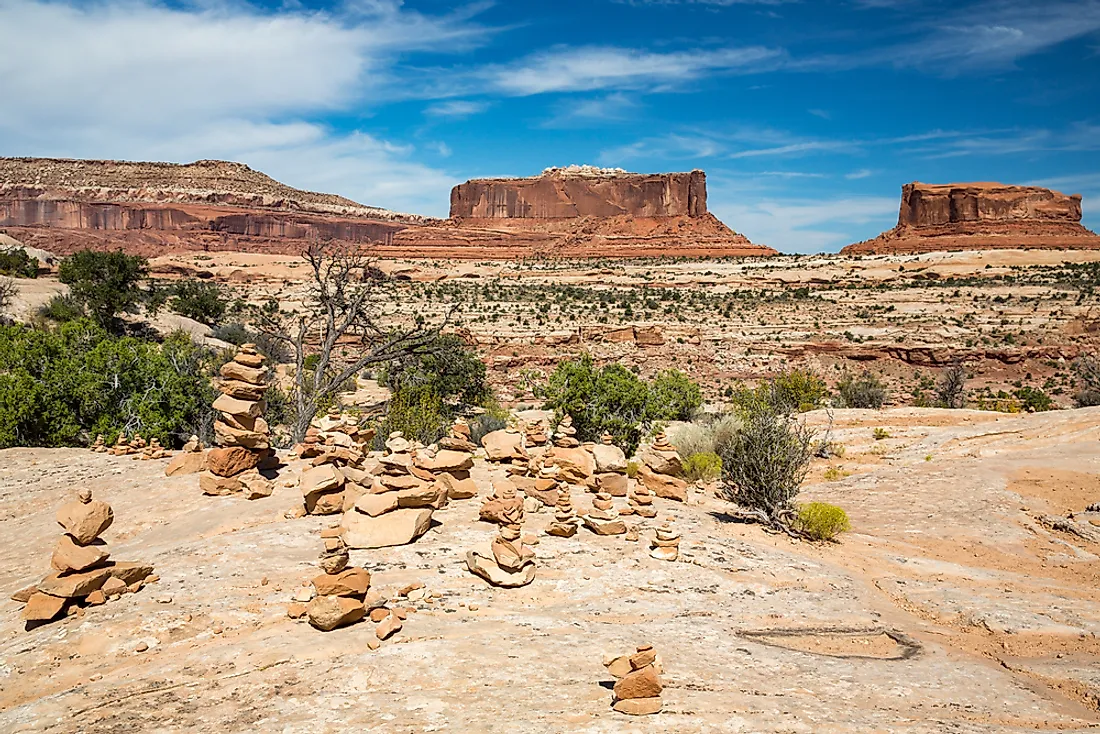
The Colorado Plateau is a desert and physiographic area of the Intermontane Plateaus that is on the Four Corners area of the southwestern parts of the country. The Colorado Plateau occupies an area of about 130,000 square miles within north Arizona, eastern and southern Utah, northwestern New Mexico, and western Colorado. Over 90% of the region is drained by River Colorado and its branches including Little Colorado, San Juan, and Green. The Rio Grande and its tributaries drain the remaining part of Colorado Plateau. Colorado Plateau is surrounded by the Wasatch Mountains, Uinta Mountains, and the Rocky Mountains. The region has a high desert with some scattered forested areas. The Grand Canyon is on the southwestern parts of the Colorado Plateau. Some of the other features in the region include slot canyons, natural bridges, fins, reefs, hoodoos, and domes among others. The desert has nine National Parks including Mesa Verde, Arches, Bryce Canyon, Canyonlands, and the Grand Canyon. Among the eighteen National Monuments in the region include Wupatki, Hovenweep, Bear Ears, Natural Bridges, and the Sunset Crater Volcano.
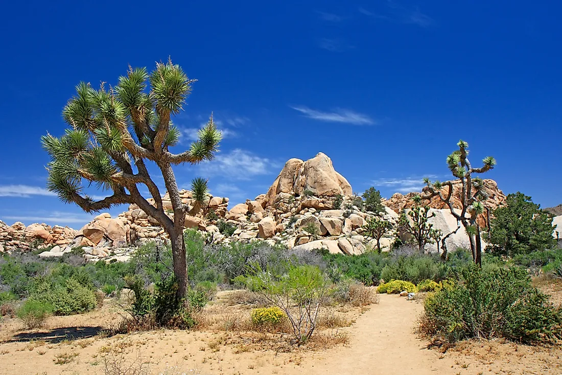
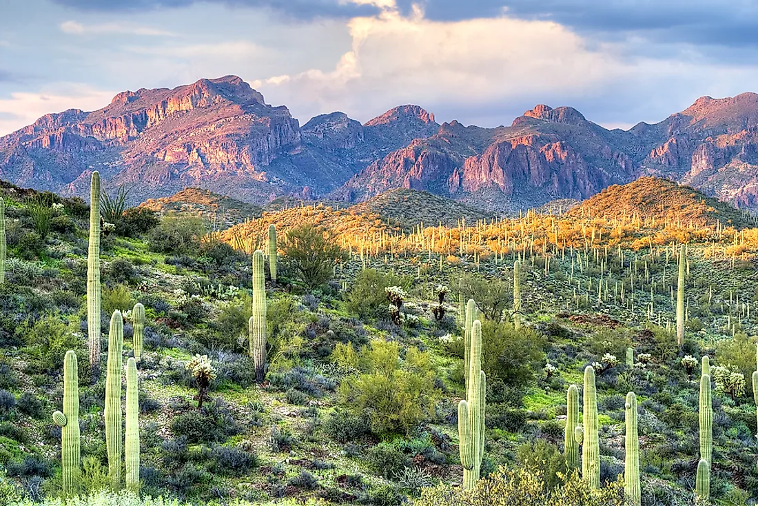
3. Mojave Desert
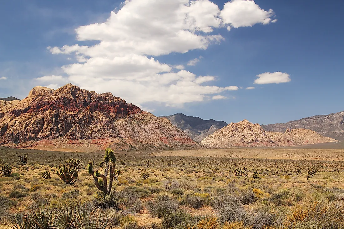
Mojave is the driest desert in the continent and it occupies an area of about 47,877 square miles. It is an arid-shadow desert that is primarily situated in southern Nevada and southeastern California. A smaller part of the desert extends into Arizona and Utah. The desert has about 2,000 plant species including the Joshua trees. The desert is bordered by the Sonoran Desert to the east and south and the Great Basin Desert to the northern side. Some of the topographical boundaries include the San Bernardino Mountains, San Gabriel Mountains, and the Tehachapi Mountains. The mountain borders are distinct since they are outlined by the Garlock and San Andrea faults (the largest faults in California). The high altitude regions in the Mojave Desert which are above 2,000 feet are known as the High Desert. Death Valley is the lowest desert in the continent at 280 feet below the sea level and the most notorious area in the desert.
2. Sonoran Desert
The Sonoran Desert occupies a large part of Baja California Sur, Baja California, and Sonora in Northwestern Mexico and California and Arizona in the southwestern parts of the US. The desert occupies an area of about 100,000 square miles. The western part of the Mexico-United States boundary passes through this desert. The sub-regions of the desert include the Yuma Desert in southwest Arizona, the Colorado Desert in southeast California, and the Gran Desierto de-Altar in Mexico which stretches over 770 square miles of the mountainous region and desert. Other sub-regions include Yuha Desert in Imperial Valley, California, Tonopah Desert situated west of Phoenix, and Lechuguilla Desert which lies near the Mexican-United States boundary in Arizona. The sonorant Desert has over 2,000 native-plant species, 1,000 bee species, 30 native fish species, 100 reptile species, 20 amphibian species, and 350 bird species. The only jaguar population in the United States lives in this desert right near the American- Mexican boundary. Some of the plants which are adapted to the harsh environmental conditions in this desert belong to the legume, cactus, palm, and agave families.
1. Chihuahuan Desert
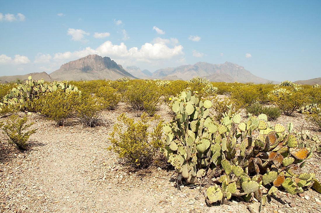
Chihuahuan Desert is an ecoregion and desert designation occupying parts of southwestern US and northern Mexico. It covers a considerable part of western Texas, lower Peco Valley, and the Rio Grande, and a small portion of Mexican Plateau and Arizona. It occupies a huge part of Chihuahua state and portions of Nuevo Leon, Zacatecas, Durango, and Coahuila in Mexico. It is the second biggest North American desert and third in the western hemisphere which occupies an area of about 139,769 square miles. The Chihuahuan Desert is a rain-shadow desert with two mountain ranges covering it, the Sierra Madre Oriental and the Sierra Madre, Occidental which block the moisture from the Mexican Gulf and the Pacific Ocean. The desert has only one rainy season during summer from June to October. The average temperature in the Chihuahuan Desert is about 75°F with the valley and lower elevation regions having extremely high temperatures.


