Which Countries Border Iran?
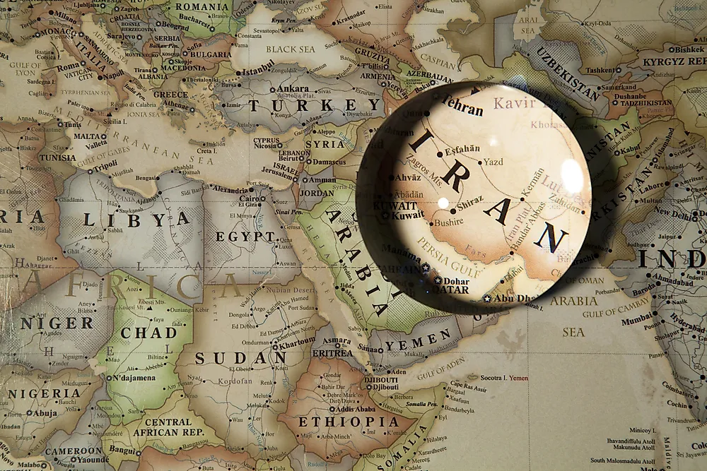
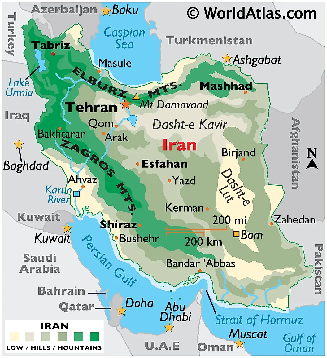
Iran shares land borders with seven countries: Iraq, Turkey, Azerbaijan, Armenia, Turkmenistan, Afghanistan, and Pakistan. The total land border runs approximately 5,440 kilometers (3,380 miles), one of the longest of any state in southwest Asia. The country also has maritime frontiers on three water bodies: the Caspian Sea to the north (shared with Russia, Kazakhstan, Turkmenistan, and Azerbaijan), the Persian Gulf to the south, and the Gulf of Oman to the southeast. Iran's longest land border is with Iraq at roughly 1,599 kilometers (994 miles), not with Turkmenistan as sometimes reported. The shortest is with Armenia at approximately 44 kilometers (27 miles). Each of the seven land borders has been substantially redefined by events between 2020 and 2026, including the August 2021 Taliban takeover of Afghanistan, the January 2024 Iran-Pakistan mutual airstrikes, the August 2025 US-brokered Armenia-Azerbaijan agreement creating the "Trump Route for International Peace and Prosperity" (TRIPP), the 2025 mass deportation of Afghans, and the 2026 war between Iran and the United States and Israel. The sections below cover each border in descending order of length.
Iraq - 1,599 km (994 mi)
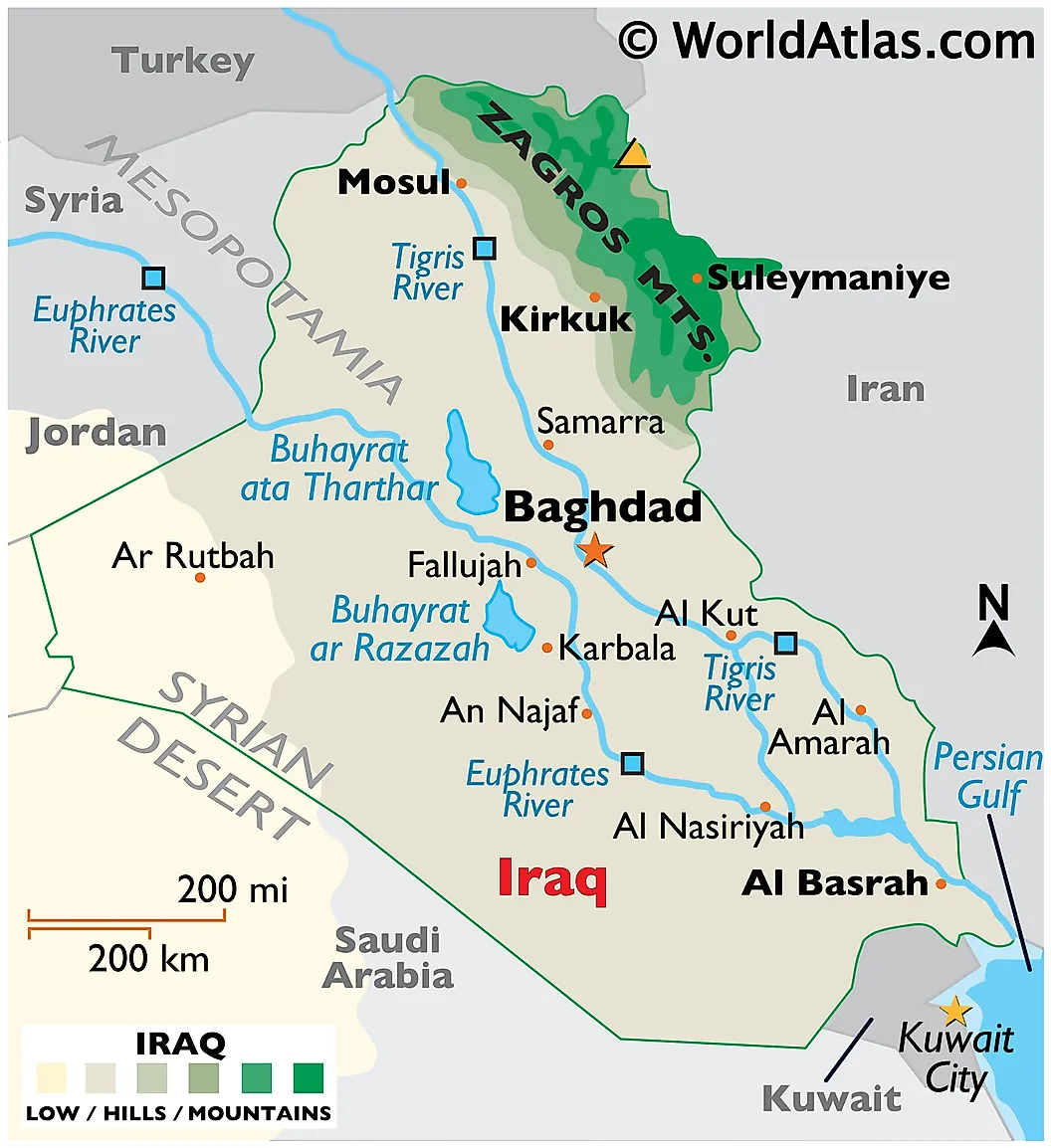
Iraq shares Iran's longest land border. The boundary runs from the tri-point with Turkey at Mount Dalanpar in the north to the Shatt al-Arab waterway at the Persian Gulf in the south. It is one of the oldest continuously recognized international borders in the world, established under the Treaty of Zuhab in 1639 between the Ottoman and Safavid empires, refined by the Treaty of Erzurum in 1847, and most recently updated by the 1975 Algiers Agreement (which was then violated by Iraq at the start of the 1980-1988 Iran-Iraq War, causing approximately one million deaths on both sides combined). The current border was reaffirmed under the 1991 ceasefire and ratified by both countries in the 1990s.
Iran's relationship with Iraq is the closest of any of its seven land neighbors. Since the 2003 US invasion and the collapse of Sunni Baathist rule, Iraq's Shia majority political establishment has maintained close ties with Tehran. Iranian-backed armed factions, organized formally under the Popular Mobilization Forces (al-Hashd al-Shaabi) since 2014, operate freely in much of southern and central Iraq. The pilgrimage trade to the Shia holy cities of Najaf and Karbala draws several million Iranian visitors to Iraq each year, with peak crossings of more than 100,000 per day during the Arbaeen pilgrimage. The principal border crossings include Khosravi-Munthiriya, Mehran-Zurbatiya, and Shalamcheh-Shalamja. Iraq remains a key route for Iran's exports of fuel, electricity, and natural gas, and is one of the few countries to which Iran still exports gas by pipeline. The border has also been used by the United States and Israel for intelligence operations against Iran throughout the 2020s.
Turkmenistan - 1,148 km (713 mi)
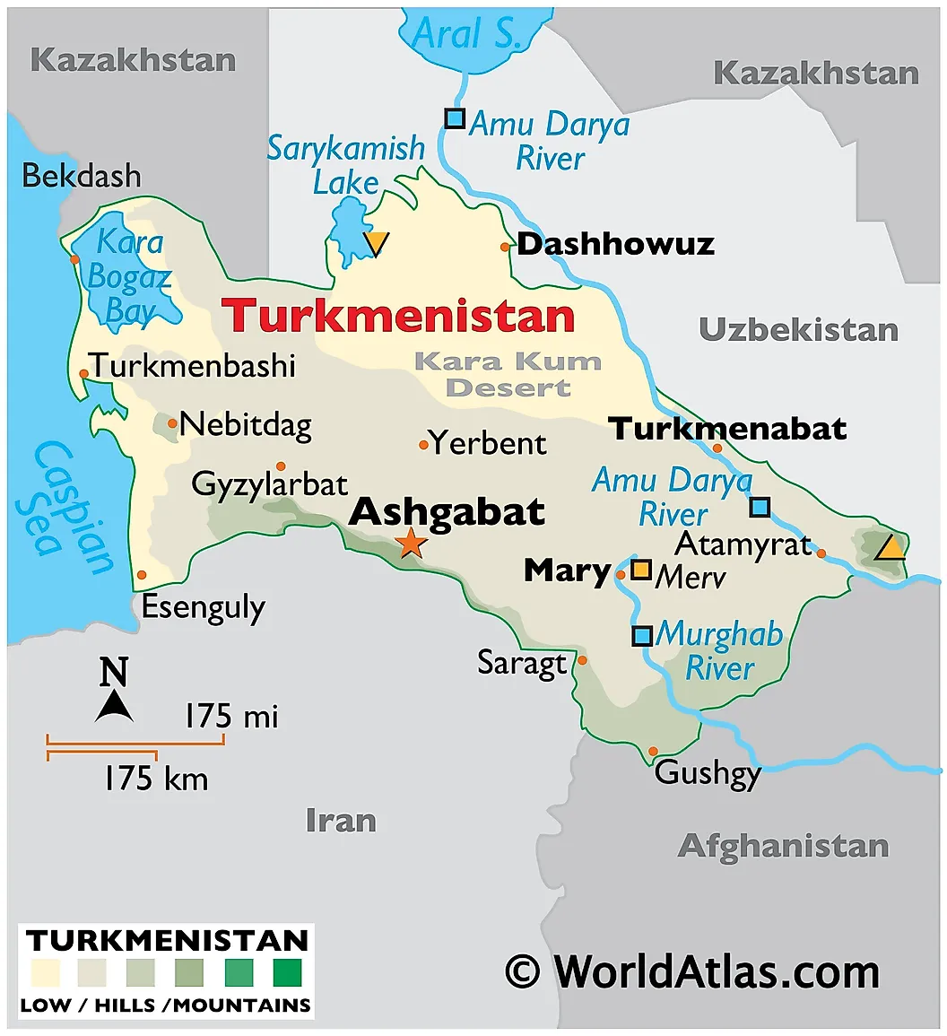
Turkmenistan shares Iran's second-longest border. The line runs along the foothills of the Kopet Dag mountains in northeastern Iran. Turkmenistan, ruled since 1991 by the closed authoritarian governments of Saparmurat Niyazov, Gurbanguly Berdimuhamedov, and now his son Serdar Berdimuhamedov, is in practical terms Iran's most stable land neighbor. The two countries cooperate on gas trade (with Turkmen gas flowing south into northern Iran, and Iran historically wheeling that gas onward to Azerbaijan and Turkey), on transport links (the Sarakhs-Sarakhs railway crossing and the Inche-Borun line), and on the management of the Doosti Dam on the Harirud River, which supplies water to the Iranian city of Mashhad. The Doosti Dam, however, has been one of the most visible casualties of the regional drought; by 2023 the reservoir had fallen to approximately zero usable storage and has not meaningfully recovered. Cross-border movement on the Turkmen side is heavily restricted by Ashgabat, which generally allows almost no foreign visitors and discourages its citizens from leaving.
Pakistan - 959 km (596 mi)
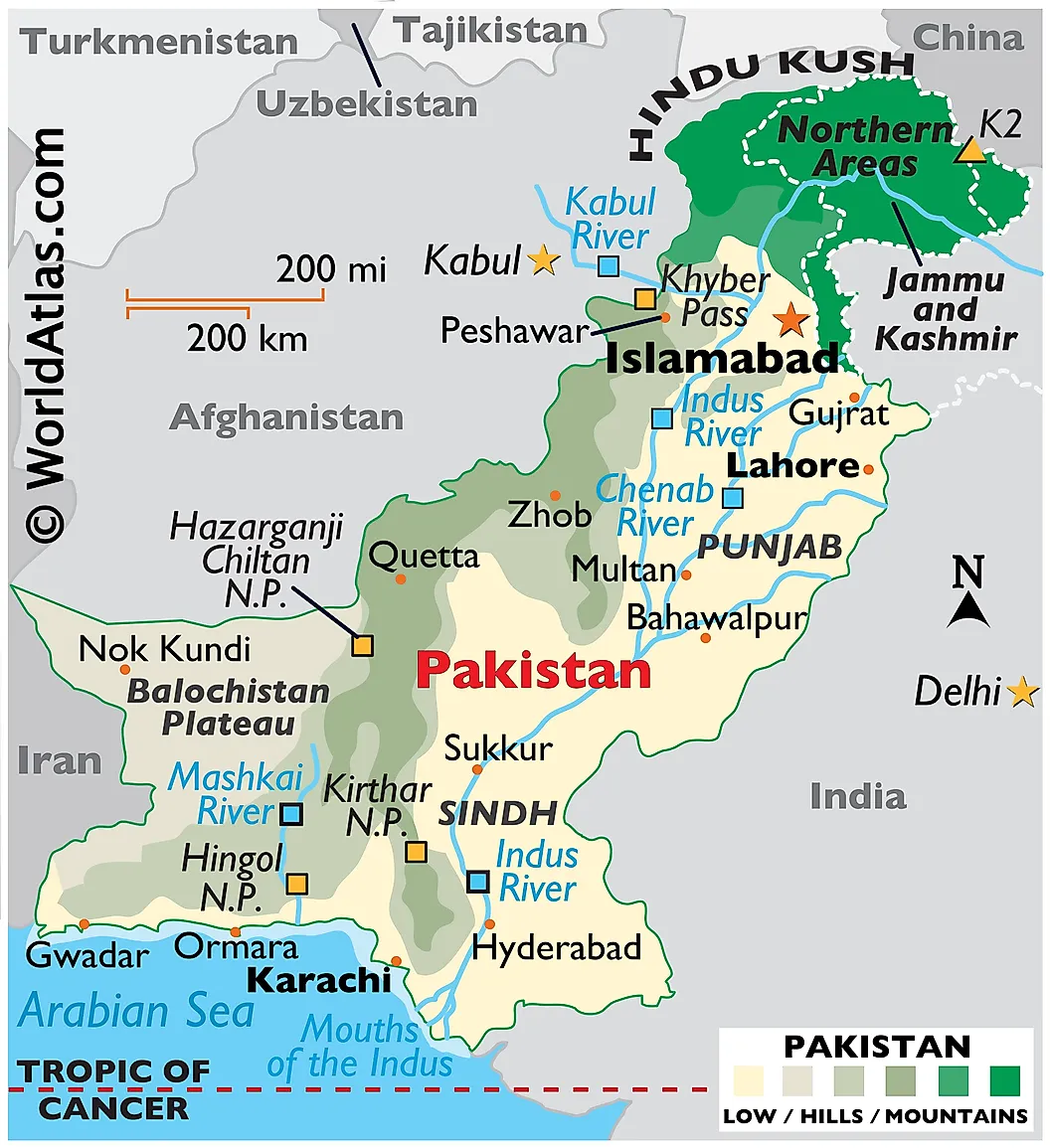
Pakistan shares Iran's third-longest border, running from the tri-point with Afghanistan in the north to the Gulf of Oman in the south, entirely within Pakistan's Balochistan province and Iran's Sistan and Baluchestan province. The Baloch people, who span both sides of the border, are an ethnic minority in both countries and have produced separate insurgent movements against both governments: Jaish al-Adl (Army of Justice), a Sunni Baloch group operating from Pakistani territory against Iranian targets, and the Balochistan Liberation Army and others operating against Pakistan from various bases.
The border experienced its most serious crisis in modern history in January 2024. On January 16, the Islamic Revolutionary Guard Corps fired drones and ballistic missiles at what Iran identified as two Jaish al-Adl bases in Pakistan's Panjgur district. Two Pakistani children were killed. On January 18, Pakistan retaliated with airstrikes inside Iran's Sistan and Baluchestan province against camps it identified as belonging to Baloch insurgent groups operating against Pakistan. At least nine people were killed on the Iranian side. Both governments stepped back from escalation within days, recalled and then restored ambassadors, and resumed diplomatic relations. The episode was significant because Iran had not conducted a missile strike inside another sovereign state's territory in modern history until that point. Iran has since accelerated construction of a concrete and barbed-wire wall along the border, intended to be approximately 700 kilometers in length and 3 meters high, designed primarily to stem drug smuggling and militant infiltration. The principal border crossing is Taftan-Mirjaveh.
Afghanistan - 921 km (572 mi)
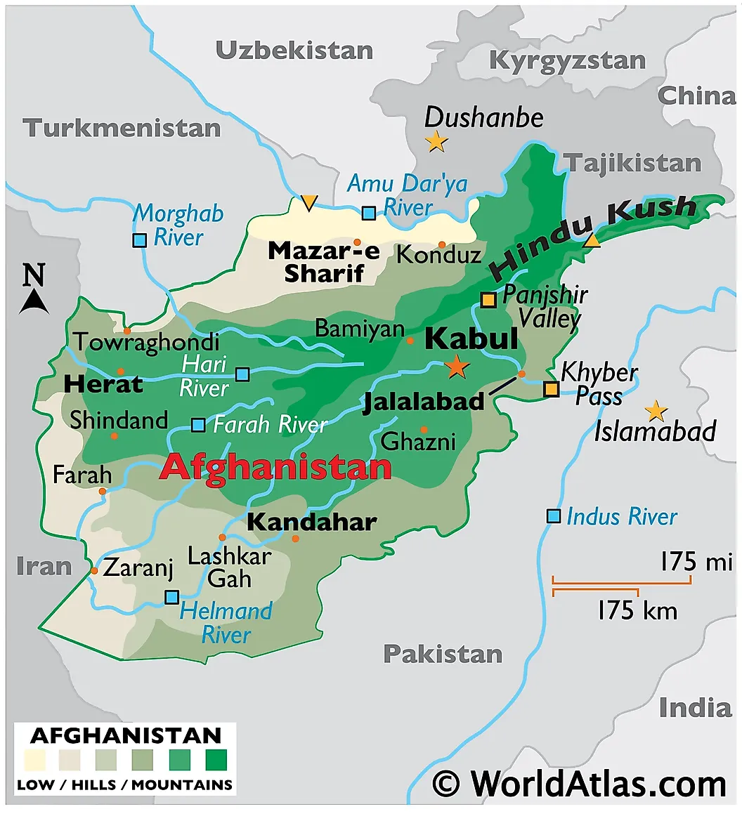
Afghanistan shares Iran's fourth-longest border, separating Iran's Khorasan and Sistan provinces from Afghanistan's Herat, Farah, and Nimroz provinces. The current border was established in 1872 by an arbitration commission headed by British officer Frederick Goldsmid. The relationship has been transformed by the August 15, 2021 Taliban takeover of Afghanistan and the events that have followed.
By 2026, Iran hosts between 4 and 6 million Afghan refugees and migrants, the largest Afghan population outside Afghanistan itself. The Iranian government has moved aggressively to reverse this. In March 2025, the Centre for Foreign Nationals and Immigration Affairs announced that the "headcount" documents that had provided temporary protected status to approximately 2 million Afghans would automatically expire, rendering most of that population legally undocumented overnight. Following the June 2025 Twelve-Day War between Iran and Israel, the Iranian government accused Afghan migrants of espionage for Israel and dramatically accelerated removals. The International Organization for Migration reported 508,426 Afghans were expelled from Iran in a 16-day window from June 24 to July 9, 2025, with peak daily crossings of 51,000 at the Islam Qala border crossing. By December 2025, the UNHCR had recorded approximately 1.8 million forced returns from Iran during the year. The Iranian government has stated an objective of removing up to 4 million Afghans in total. The border has also been the site of a low-intensity water dispute: the Helmand River and the Harirud River both originate in Afghanistan and flow into Iran, and the Taliban government's dam-building programme (including the Pashdan Dam, which became operational in August 2025) has further reduced cross-border flows during a period of severe drought on the Iranian side. Iranian and Taliban border forces have clashed several times since 2022, with sporadic exchanges of fire reported in Nimroz and Herat provinces.
Azerbaijan - 689 km (428 mi)
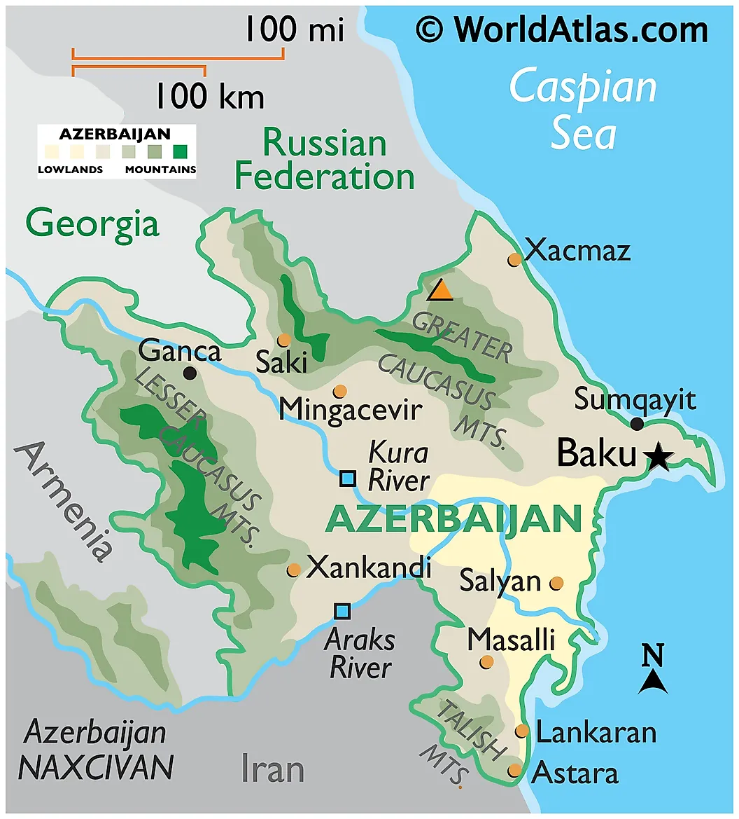
Iran's border with Azerbaijan runs in two separate sections: a longer eastern segment along the Aras River between Iran and the Azerbaijani mainland, and a shorter western segment with the Azerbaijani exclave of Nakhchivan, which is geographically separated from Azerbaijan proper by Armenia's Syunik province. The relationship is one of Iran's most strained. Iran has the largest ethnic Azerbaijani population in the world (estimated at 15 to 20 million, several times larger than Azerbaijan's own population of approximately 10 million), concentrated in the country's northwestern provinces of East Azerbaijan, West Azerbaijan, Ardabil, and Zanjan. Tehran has long worried about pan-Azerbaijani sentiment in those provinces.
The deeper source of tension is Azerbaijan's military and intelligence partnership with Israel, which has accelerated since the 2020 Nagorno-Karabakh war (where Israeli drones and missiles were decisive for Azerbaijan's victory) and intensified again during the 2025 Iran-Israel war. Iran views Baku as effectively an Israeli forward base on its northern border, and several alleged Israeli intelligence operations against Iranian nuclear scientists and military officials have been routed through Azerbaijani territory. The principal border crossings include Astara-Astara on the Caspian coast, Bilasuvar, and the Julfa-Jolfa crossing into Nakhchivan. In April 2025, Iran and Armenia conducted their first joint military exercises near the Nakhchivan tri-point, in a clear signal to Baku about Iran's commitment to Armenia's territorial integrity.
Turkey - 534 km (332 mi)
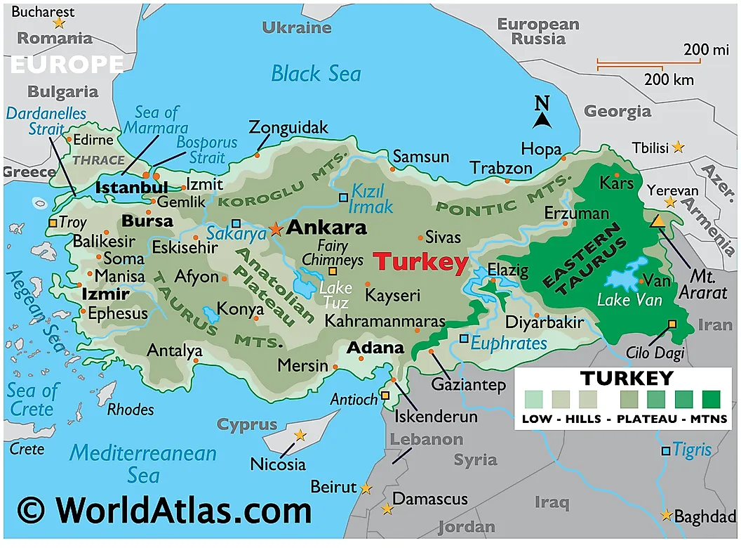
Turkey shares Iran's sixth-longest border, in the rugged eastern Anatolian highlands. This is among the oldest continuously recognized international borders in the world, first established by the Treaty of Zuhab in 1639 following the Battle of Chaldiran (1514) between the Safavid and Ottoman empires. The line has not changed in any significant way for nearly four centuries. Iran-Turkey relations under Recep Tayyip Erdoğan have been pragmatic rather than warm: the two countries cooperate on suppressing Kurdish armed groups (Iran targets PJAK, the Iranian wing of the Kurdistan Workers' Party; Turkey targets the parent PKK), maintain substantial trade including Iranian gas exports to Turkey via the Tabriz-Ankara pipeline, and have generally avoided direct confrontation despite supporting different sides in the Syrian civil war (Iran backing Assad, Turkey backing the opposition until 2024) and in the wider regional contest.
Turkey has constructed an approximately 173-kilometer security wall along the southern portion of the border (in Iğdır and Ağrı provinces), originally announced as 89 kilometers in 2017 and extended in 2021, primarily to stem irregular migration of Afghans, Iranians, and other migrants attempting to reach Turkey and onward to Europe. The principal border crossings are Bazargan-Gürbulak (the largest), Razi-Kapikoy, and Esendere-Sero. Trade through these crossings has increased substantially as Iran sought alternatives to sanctions-restricted maritime routes.
Armenia - 44 km (27 mi)
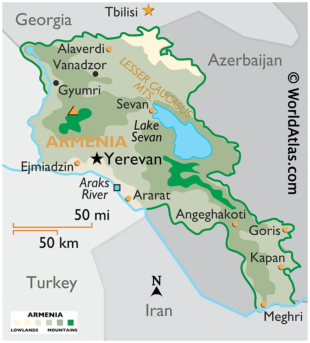
Armenia shares Iran's shortest border, along a single stretch of the Aras River in Armenia's Syunik province. Despite its short length, this is Iran's most strategically important boundary. Armenia is Iran's only Christian-majority neighbor and the only one with which Iran has consistently warm relations. The 44-kilometer border functions as Iran's only direct land access to the South Caucasus, the Black Sea region, and Russia, and is what Iranian officials and analysts routinely call the country's "northern lifeline." If this connection were lost, Iran would have no overland route to Europe that does not pass through Turkey or Azerbaijan.
The threat to that connection is the proposed corridor through Syunik that would link Azerbaijan's mainland to its Nakhchivan exclave. Azerbaijan and Turkey have promoted this as the "Zangezur Corridor" since the 2020 Nagorno-Karabakh war. The August 8, 2025 Washington agreement, brokered by US President Donald Trump and signed by Armenian Prime Minister Nikol Pashinyan and Azerbaijani President Ilham Aliyev, established a US-administered version of this route called the "Trump Route for International Peace and Prosperity" or TRIPP. Under the agreement, the United States holds development rights over the route for 99 years. Iran's response was sharp: Tehran has called the corridor an unacceptable foreign intrusion into the South Caucasus and a direct threat to its territorial connection with Armenia. In April 2025 (before the Washington agreement), Iran and Armenia conducted their first-ever joint military exercises near the trilateral border with Azerbaijan, and Iran has subsequently increased its diplomatic and economic engagement with Yerevan. The principal border crossing is the Agarak-Norduz bridge over the Aras River, which has been substantially upgraded in 2024-2025 as the volume of Iran-Armenia trade has increased.
What Iran's Borders Are Doing in 2026
The geography of Iran's borders has not changed substantially in a century. The politics of each border have changed completely in the past five years. By mid-2026, Iran is conducting a low-intensity border war with the Taliban government in Afghanistan, has built or is building security walls along significant portions of both the Pakistani and Afghan borders, has expelled approximately 1.8 million Afghans during 2025 alone, has lost (with the August 2025 TRIPP agreement) much of the leverage its land position in the South Caucasus once gave it, has exchanged direct military strikes with Pakistan within memory, hosts an active strategic relationship with Iraq through Shia political and militia networks, watches with concern as Azerbaijan deepens its partnership with Israel, and maintains its quiet but increasingly important link to Armenia as its single secure overland connection to the world outside the immediate region. The country's seven land borders, taken together, are simultaneously a strategic asset and a comprehensive vulnerability, and the war that began on February 28, 2026 has reshaped what each one means in ways that will continue to unfold through the decade.