Which Countries Border Switzerland?
Switzerland is located in the western region of Europe, where it covers a total area of 15,940 square miles. Of this area, approximately 4.2% is made up of various bodies of water. Some of the largest bodies of water in this country include Lake Geneva, Lake Constance, and the Rhine River. The entire country can be divided into 3 specific geographic regions: the Jura Mountains to the north, the Swiss Alps Mountains to the south, and the Central Plateau between the two. Switzerland has no direct access to the ocean or the sea, which means it is considered a landlocked country and must rely on friendly relations with neighboring countries that have access to sea ports. The territory of Switzerland is surrounded by nearly 1,180 miles of borders, which it shares with 5 other autonomous nations: Germany, Austria, Liechtenstein, Italy, and France. This article takes a closer look at each of these borders.
Countries Bordering Switzerland
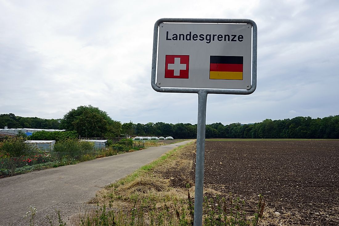
Germany
The border between Switzerland and Germany stretches for a total of 208 miles and is situated along the northern edge of Switzerland. The easternmost point of this border begins at the tripoint shared between Switzerland, Germany, and Austria at Lake Constance. From here, the boundary runs in an eastern direction until the town of Stein am Rhein, where it curves north and into German territory before turning south toward Switzerland once again. The majority of this border follows the course of the Rhine River, specifically the area known as the High Rhine. It ends at the tripoint location shared between Switzerland, Germany, and France. This particular location is distinguished by the Dreiländereck Monument, a tall pillar-like structure with one of the flags of each country located on one of its three sides.
Austria
The border between Switzerland and Austria runs for a total of 102 miles, along the eastern edge of Switzerland. The length of this border is separated into two sections due to the position of the country of Liechtenstein, which lies in the middle of the border with Austria to its east and Switzerland to its west. At its northernmost point, this boundary begins where Switzerland, Austria, and Italy meet. From here, it runs in a southern direction and moves through the Grison Alps mountain range. It is interrupted by Liechtenstein and begins again at the southern end of this country. From here, the border between Switzerland and Austria primarily follows the Alpine Rhine River Valley until it reaches Lake Constance in the south. On this border, the highest elevation is located at the Piz Fanga mountain peak, which stands at 11,148.29 feet above sea level. Its lowest point is at Lake Constance, which is 1,295.93 feet above sea level.
Liechtenstein
The border between Switzerland and Liechtenstein measures at only 25 miles in length, making it the shortest border in Switzerland. It runs along part of the eastern edge of Switzerland, effectively dividing the border between Switzerland and Austria into two section. Its position makes Liechtenstein a doubly landlocked country, which means it is surrounded by other landlocked countries. Switzerland and Liechtenstein share a long history of friendly border relations. In fact, these two countries enjoy control-free border crossings, meaning individuals can freely pass between these two autonomous nations. The collaboration between these two countries extends into their economies as well; Liechtenstein used the Swiss Franc for several years prior to the implementation of the Euro currency. As the larger country, the government of Switzerland has always acted in the best interest of both countries. It often represents Liechtenstein in negotiations and in international events, if representatives from Liechtenstein are not present.
Italy
The border between Switzerland and Italy stretches for a total of 460 miles, making it the longest international border in Switzerland. It is situated along the southern edge of this country and runs in an east to west direction. At its easternmost point, this border is located at the tripoint border between Switzerland, Italy, and France. This point is marked by Mont Dolent, a mountain peak in the Mont Blanc mountain range of the Alps Mountains. This boundary line then moves in an eastward direction through the High Alps region, which is known for its rugged terrain and extremely frigid climate. From this region, the border also runs through Lake Maggiore, which is the lowest elevation in Switzerland at 656 feet above sea level. This line continues until it reaches the tripoint boundary between Switzerland, Italy, and Austria in the east. As a result of the European refugee crisis, which began in 2015, the number of undocumented immigrants crossing the border from Italy into Switzerland has risen. In response the government of Switzerland has increased border patrol efforts, although it has turned down proposals to build a physical barrier between the two countries.
France
The border between Switzerland and France runs over a distance of 356 miles, making it the second longest border in Switzerland. It makes up the entire western edge of this country and passes through the Mont Blanc region of the Alps Mountain range. Its highest point in this mountain range is Aiguille d’Argentiere, which stands at 12,798.56 feet above sea level. Although the location of this border was agreed upon in 1815, it has experienced some changes over the years. One of the most recent changes occurred in 2002, when the territory of Switzerland gained a total area of 16,985.45 square feet. The border between these two countries begins at the tripoint shared between Switzerland, France, and Germany. From here, the border moves in a generally southwestern direction until it reaches the city of Ginebra in Switzerland. At this location, the border between these two countries takes a turn to the east, heads northeast, and passes through Lake Geneva (the largest lake in Switzerland by surface area). After passing through this lake, the border turns to the south until it reaches the tripoint shared between Switzerland, France, and Italy.


