The Territories Of The United States
The United States of America is officially made up of 50 separate states, with 48 of them being found in the middle of North America between Mexico and Canada. The two other states that are not connected to the rest of the USA by land are Alaska and Hawaii. However, the 50 states do not comprise all of the land that the United States controls.
While it might not be obvious when looking at a map, the United States is actually in possession of 14 separate overseas territories. Some of these lands are nothing more than a few isolated and remote atolls in the middle of the Pacific Ocean, while others serve the United States' military as crucial bases of operation and give them the ability to project their power and secure their interests across the globe. The majority of these territories fell under US control following World War II.
American Samoa

Found in the South Pacific, American Somoa is an unincorporated territory of the United States. Administered by the US Department of Interior, it consists of five volcanic islands and two coral atolls. The United States gained control of the islands in 1900 after the land was ceded to them by the Tutuila, a collection of Samoan chiefs and elders.
Fifty-five thousand people call these islands home, with the vast majority of them claiming direct Samoan ancestry. American Samoans are considered to be US nationals rather than US citizens. Being nationals grants them certain amounts rights that are protected by law, but they are also excluded from voting in US elections, running for political office, or serving on a jury.
Northern Mariana Islands
Sometimes referred to as the Commonwealth of the Northern Mariana Islands (CNMI), this US territory is again located in the South Pacific region. The territory is an archipelago of 14 islands sandwiched between Japan and the Philippines. The North Mariana Islands became a US commonwealth in 1975 after holding a referendum on the issue.
The culture on the islands is incredibly diverse. The indigenous Chamorro, Chinese, Korean, Japanese, Bangladeshi, and Filipino people practice a variety of cultural traditions that can all be seen in full force across the territory. Many of the islands are well-developed and have all the bells and whistles that one would expect from any other part of the United States.
Guam
Guam is an unincorporated US territory located in the western Pacific Ocean, acquired by the US in 1898 after its victory in the Spanish-American War. Since its acquisition, it has been used as a crucial military base for the United States military. Especially the navy. However, it experienced its most radical transformation during and in the immediate aftermath of the Second World War.
Similar to the inhabitants of the Northern Mariana Islands, the people of Guam voted in 1982 to pursue a commonwealth agreement with the United States. Guam and the United States have developed a mutually beneficial relationship over the decades. Guam provides the American military with a strategic outpost, and the American government continues to pour money into infrastructure projects on the island.
US Virgin Islands
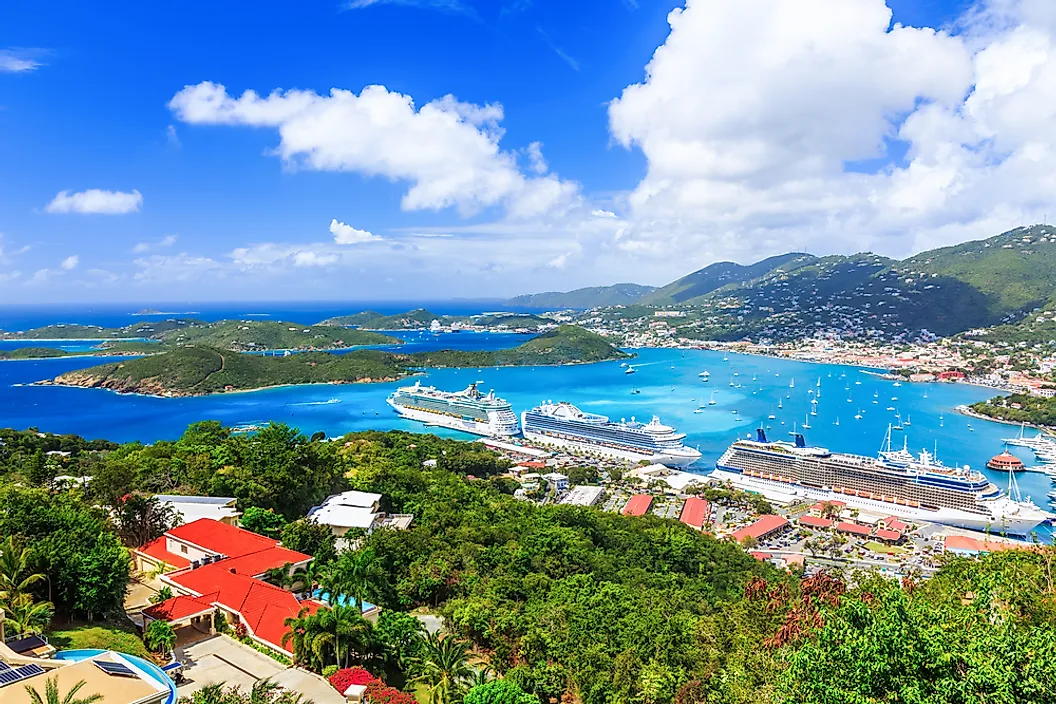
The US Virgin Islands is one of the few possessions that the United States has outside of the Pacific Ocean. This small island chain is positioned in the Caribbean Sea next to Puerto Rico and Saint Kits and Nevis. The US Virgin Islands are known for being some of the most beautiful places on Earth, with white sand beaches and crystal clear water.
The islands were once surprisingly owned by Denmark but were sold to the United States government in 1917 for $25 million. Adjusting for inflation, that would be roughly 600 million dollars in today's money. The islands were used during World War 2 as a naval base, but after the war, tourism and other industries really began to take off.
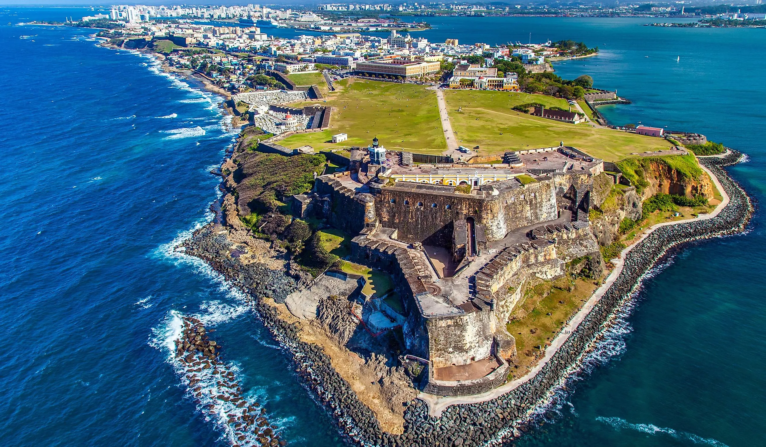
Puerto Rico

Perhaps one of the most well-known US territories, Puerto Rico fell into American possession after the land was ceded to them by the Spanish after the Spanish-American War in 1898. The island remained in political limbo for nearly 60 years before they were granted a constitution as a commonwealth in 1950 by Harry Truman.
More than 3 million people live in Puerto Rico in modern times, and there are still strong movements within the United States attempting to incorporate the territory as the 51st state. While it is unlikely that this will be realized anytime soon, support for this has only grown in the last few decades. Sooner or later, it looks as though a new star might be added to the American flag.
Baker Island

Baker Island is located in the central Pacific Ocean, administered by the US as part of its insular areas. The island is completely uninhabited and is used as a wildlife sanctuary for birds for the most part. Baker Island is recognized as an official US National Wildlife Refuge.
Baker Island gets its name from American sailor Capt. Michael Baker, who in 1838 first spotted the island when exploring the region. The island had little use from the United States until the outbreak of the Second World War. In 1942, an airbase was constructed, but it was abandoned in 1974. Since then, the island has seen little practical use by the American military.
Howland Island

A neighbor to Baker Island, Howland Island is another remote wildlife sanctuary in the middle of the Pacific Ocean. It has no permanent population and no official economic activity. Despite very few people even knowing about the island's existence, its biggest moment in the history books is its proximity to Amelia Earhart's 1937 ill-fated attempt to circumnavigate the globe by airplane.
The island was first spotted by an American whaling captain named George Worth from New England in 1822. Nothing came of this discovery until the island was officially claimed by the United States in 1857 and has remained under American control ever since.
Palmyra Atoll

Palmyra Atoll can be found near Hawaii in the middle of the Pacific Ocean. The atoll was first sighted in 1798 by an American ship under the command of Capt. Edmund Fanning. The ship never landed, but it was noted by mapmakers and geographers.
In 1898, the island was officially annexed by the United States but saw little use. This inactivity on the island would finally end at the outbreak of World War 2 when two airstrips were constructed along the atoll's central lagoon. When the conflict ended, the airbases were dismantled, and the island was never revisited in any meaningful way aside from a handful of scientists studying birds and marine life.
Jarvis Island

Jarvis Island is another uninhabited territory of the United States that can be found deep in the Pacific Ocean. It is one of the islands belonging to the United States Minor Outlying Islands and is administered by the US Fish and Wildlife Service as part of the National Wildlife Refuge System. The island was officially claimed by the British Empire in the middle of the 19th century, but nothing developed beyond that. In 1935, the United States took control of the island without the British hardly noticing.
There are no permanent inhabitants or visitors on Jarvis Island, but it does host visiting scientific research teams who use the island for studies on birds, crustaceans, turtles, sharks, and coral reef formation. As you can imagine, the island is incredibly remote and challenging to get to.
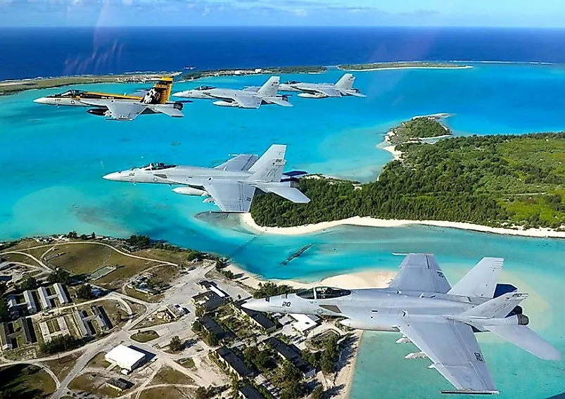
Johnston Atoll

Johnston Atoll is located 825 miles southwest of Honolulu. Despite being relatively close to a US state, this region is one of the most isolated places in the world and consists of four small islands: Johnston Island, Sand Island, Akau Island, and Hikina Island.
The atoll was once an important refueling station for flights from Hawaii to other parts of the Pacific Ocean and served as an important military base during and after World War II. Today, it is an unincorporated territory of the US administered by the US Fish and Wildlife Service as part of the Pacific Remote Islands Marine National Monument.
Kingman Reef

Kingman Reef is another barren atoll in the middle of the Pacific Ocean. The island was officially annexed in 1923 by the United States and was turned into a US naval reservation in 1934. The island came in handy during the Pacific Campaign against the Japanese Empire during World War 2. Runways and a primitive air base were also established here during the conflict.
The US Navy controlled the island directly until the administration was handed over to the US Fish and Wildlife Service in 2000. The island is incredibly small and sees little traffic aside from the odd group of scientists that come ashore each year. Kingman Reef is mostly composed of submerged reefs and sandbanks. It covers a total area of over seven acres.
Midway Atoll
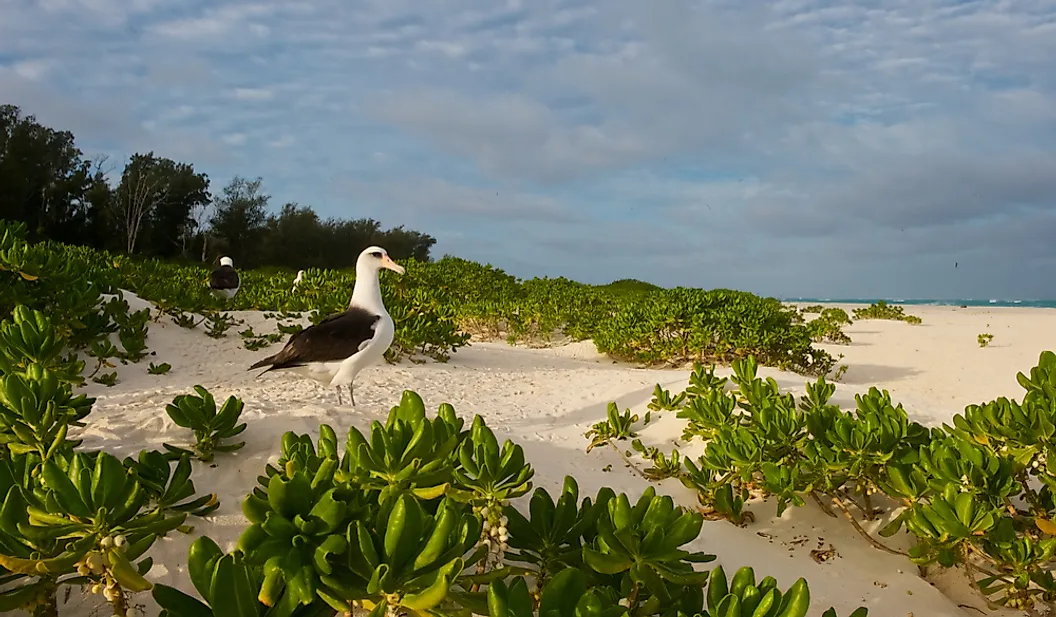
Midway Atoll, located in the Pacific Ocean at the northwestern end of the Hawaiian Archipelago, is an unorganized US territory consisting of only 40 inhabitants. Comprised of two coral islands, Sand and Eastern Island form part of the larger Midway Atoll National Wildlife Refuge. The refuge encompasses an area of over 590,990 acres, making it one of the largest natural wildlife refuges in the world, with millions of seabirds nesting on its shores and waters.
Midway Atoll was host to one of the pivotal battles between the United States and the Japanese Empire during the Second World War. One of the largest naval and air engagements in the entire conflict, it marked a massive turning point and the slow but gradual decline of Japanese power in the Pacific Ocean.
Navassa Island

Navassa Island is a small, uninhabited island located in the Caribbean Sea between Haiti and Jamaica. Originally controlled by Spain until 1801, Navassa was later claimed by the US in 1857. This move did little to upset the Spanish, who paid next to no attention to the island to begin with.
The island was settled for some time in the 19th century in order to collect guano phosphate. Guano is an incredibly potent fertilizer that can be used in agriculture to incredible effect. However, it has been more than 100 years since its guano serves dried up. Today, it is still legally owned by the US but managed as part of the Caribbean National Wildlife Refuge System and has no permanent human inhabitants.
Wake Island
Formally claimed by the United States in 1899, Wake Island originally served the United States as a place to stop in between trips from Guam and the Philippines. Military installations were ordered to begin construction on the island in 1939, but they were never finished. In 1941, the same day as the attack on Pearl Harbor, Wake Island was taken by Japanese forces.
The island was eventually retaken by the Americans in 1945, but not without heavy resistance from the Japanese forces who still occupied the area. After the war, the island slowly lost its military importance, and its presence was cut back.
Many of the territories of the United States have been under its influence for much longer than most people realize. Usually seized during or in the aftermath of wars with foreign powers, many of these territories have been vital in the American war effort during some of its darkest days. Plenty of these territories still serve the United States as key points of interest for military installations if need be. Similar to what happened during World War II, if a conflict ever broke out, there is a good chance that many of these islands and remote atolls would once again see use as airstrips and naval bases.


