Which US States Are Part Of The Pacific Ring Of Fire?
- The Pacific Ring of Fire encompasses 24,900 miles of the Pacific Ocean,
- The Ring of Fire is a semi-circle of volcanoes, oceanic trenches, and mountains that edges the Pacific basin
- In the United States, the Cascade Range is part of the Pacific Rim
- the rock begins to melt and turns into magma
Johnny Cash made "Ring of Fire" famous in 1963. A few movies borrowed the name later. None of them are about the real one. The actual Pacific Ring of Fire is a 24,900-mile loop of volcanoes, deep-sea trenches, and fault lines wrapped around the Pacific Ocean, and it is the most geologically restless place on Earth. Roughly 75% of the world's volcanoes sit on it. About 90% of the world's earthquakes strike there. Here is what it is, how it works, and which US states ride its edge.
A Horseshoe, Not A Ring
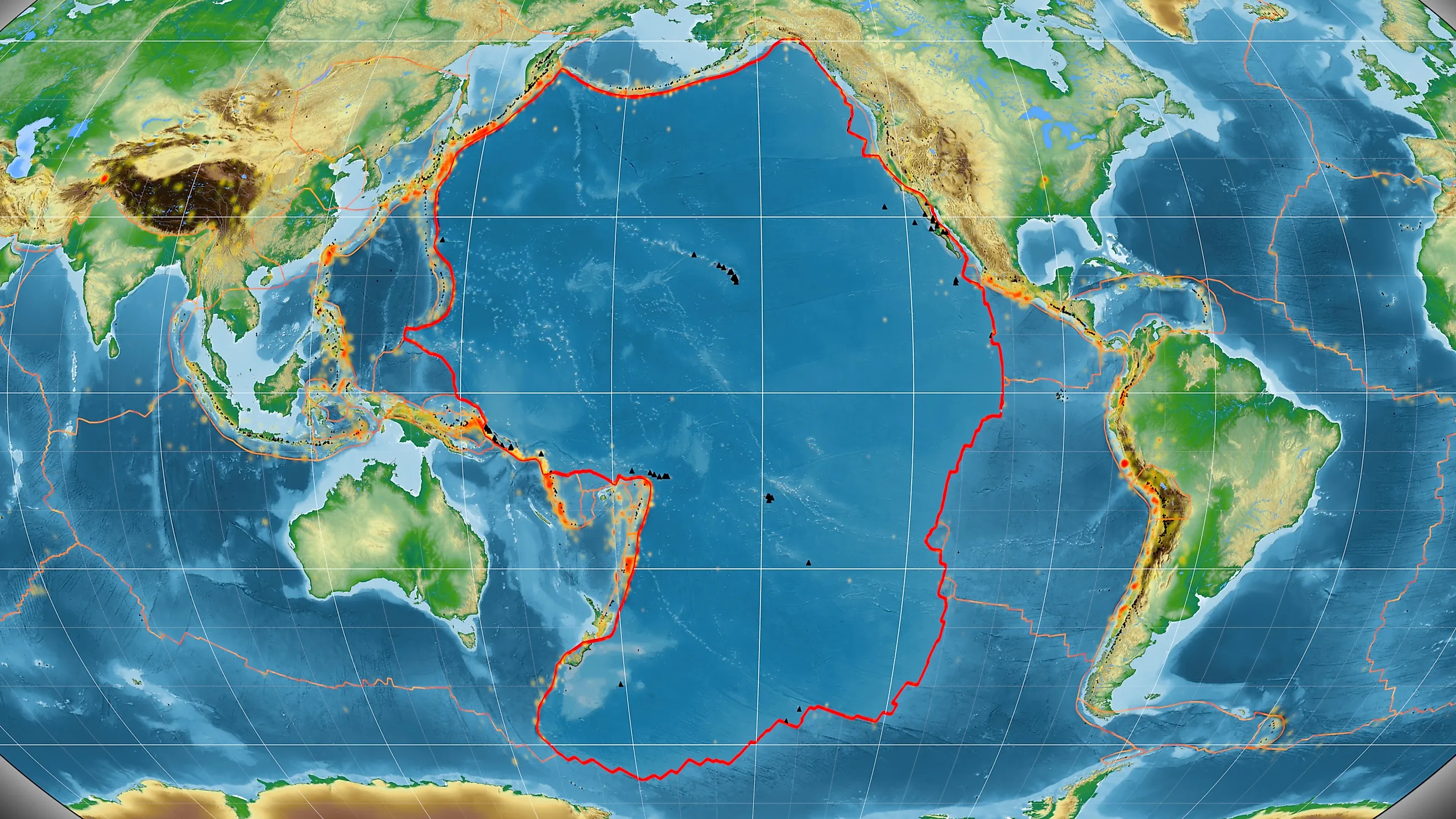
Despite the name, the Ring of Fire is not a ring. It is a broken horseshoe, open at the bottom, also known as the Circum-Pacific Belt. It is a band of volcanoes, ocean trenches, and mountains tracing the rim of the Pacific basin, and it runs on one thing: tectonics. This is where several of Earth's largest plates grind, dive, and slide past one another, and the friction has consequences. More than 450 volcanoes line it. About 81% of the planet's most powerful earthquakes begin here. When the ground moves in a big way, it usually moved on the Ring.
A Lasso Around The Pacific
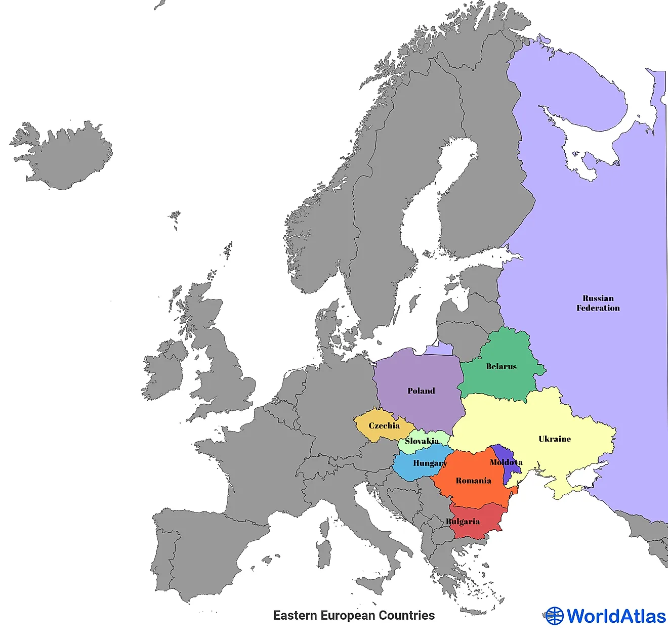
So where is it? Picture a lasso thrown around the Pacific. The belt starts in Chile and climbs north along the Pacific coast of South America, Central America, and North America to southern Alaska. There it swings west through the Aleutian Islands, then drops south past Russia's Kamchatka Peninsula, Japan, the Philippines, Indonesia, and the southwest Pacific before closing in New Zealand. Strung along that line: the Andes, Mount Fuji, the Cascades, and the deep trenches that fall away offshore. Four US states sit on the Ring, and the American stretch is where it gets close to home.
Where The Plates Collide

To see how it all works, start with the plates. Earth's rigid shell is cracked into tectonic plates that drift on the hotter, softer rock below, and the Pacific is ringed by some of the biggest. Where two collide, the denser one usually dives beneath the other. That is subduction, and as the sinking slab melts into magma, the magma forces its way up and builds volcanoes. Most of the Ring works this way, the Aleutians and the Cascades included. California is the exception. There, the Pacific and North American plates do not crash head-on; they grind past each other sideways along the San Andreas Fault. That transform boundary stores up strain and lets it go as earthquakes, not eruptions, which is why California shakes but rarely erupts.
The Cascades: America's Volcano Row

In the Lower 48, the Ring surfaces as the Cascade Range, an 800-mile volcanic chain running from southern British Columbia through Washington and Oregon into Northern California. The lineup makes geologists nervous: Mount Rainier, Mount St. Helens, Mount Hood, Glacier Peak, Mount Jefferson, and the drowned caldera that became Crater Lake. Underneath them, the small Juan de Fuca Plate is sliding beneath the continent and feeding the whole row. The star is Mount St. Helens. On May 18, 1980, it blew its top, killed 57 people, and lost more than 1,300 feet of summit in a single morning. It stayed restless through 1986, then erupted again from 2004 to 2008. All told, the Cascades pack close to 3,000 volcanic features.
Alaska, The Volcano Capital

North of the Cascades, Alaska takes the crown. No state has more volcanoes, over 40 of them active, most strung along the Alaska Peninsula and the Aleutian Islands. The Aleutians mark the Ring's northernmost bend, an arc of some 57 volcanoes thrown up where the Pacific Plate dives under North America. Mount Shishaldin, on Unimak Island, tops them at 9,373 feet and erupts often. Novarupta earns its own line: its 1912 blast was the largest eruption anywhere on Earth in the entire 20th century. Alaska also owns one of the Ring's worst quakes, the magnitude 9.2 giant of 1964, still the strongest ever recorded in North America.
Hawaii: Famous Volcanoes, Wrong Ring

Now the twist. Hawaii's volcanoes are not on the Ring of Fire at all. They sit dead center on the Pacific Plate, nowhere near a boundary, fed by a stationary hotspot of magma that the plate slowly slides over, which is exactly why the islands form a chain. The fire is still real. Kilauea ranks among the most active volcanoes on Earth and has erupted again and again in recent years, while Mauna Loa, the largest volcano on the planet by volume, woke up in 2022 after nearly four decades of quiet. Haleakala on Maui makes three. Different engine, same fire.
Earthquakes Off The Charts

The Ring does not just build volcanoes. It produces the biggest earthquakes humans have ever measured. The all-time record belongs to Valdivia, Chile, a magnitude 9.5 in 1960 that has never been topped. Four years later came Alaska's 9.2. In 2004, a magnitude 9.1 off Sumatra spawned a tsunami that killed more than 200,000 people. In 2011, a magnitude 9.0 off Japan drove the wave that wrecked the Fukushima nuclear plant. Chile took another 8.8 in 2010. Same belt, every time, which is why no stretch of ground on Earth is watched more closely.
A Restless Rim
The Pacific Ring of Fire is less a place than a process: the visible seam where Earth's plates collide, dive, and slip in slow motion. It is why the Pacific Northwest keeps one eye on Mount St. Helens, why Alaska braces for the next big one, and why Chile and Japan have written so much of the modern science of earthquakes. None of it is slowing down. The plates keep moving, the magma keeps rising, and the Ring will go on doing what it has done for millions of years: reminding everyone along its edge exactly whose planet this is.