- Coastline:
3,148 miles (5,067 km)
- Land Area:
(land) 379,725 sq miles (983,482 sq km)
(water) 23,178 sq miles (60,032 sq km)
(TOTAL) 402,903 sq miles (1,043,514 sq km)
- To convert sq km (kilometers) to sq mi (miles)
- use our converter
- Land Area: (all countries)
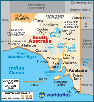
- Land Divisions: There are 49 counties in South Australia
- Horizontal Width: 722.64 miles (1162.97 km) from Marla east to Clifton Hills
- Vertical Length: 1,184 miles (1,905 km) from Clifton Hills south to Mount Gambier
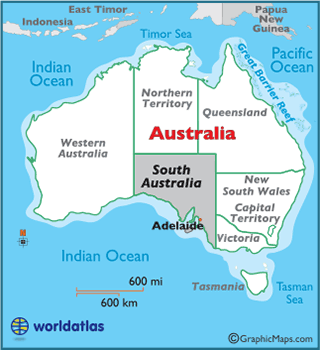
Note: Lengths and widths are point-to-point, straight-line measurements from a Mercator map projection, and will vary some using other map projections - Bordering States/Territories: (5) New South Wales, Queensland, Victoria, Northern Territory, and Western Australia
- Geographic Center: About 78.43 miles (126.22 km) southeast of Coober Pedy
- Highest Point: Mt. Woodroffe 4,708 ft (1,435 m)
- Lowest Point: Lake Eyre −16 m (−52.5 ft)
- Latitude and Longitude
- Relative Location