Maps of South Australia
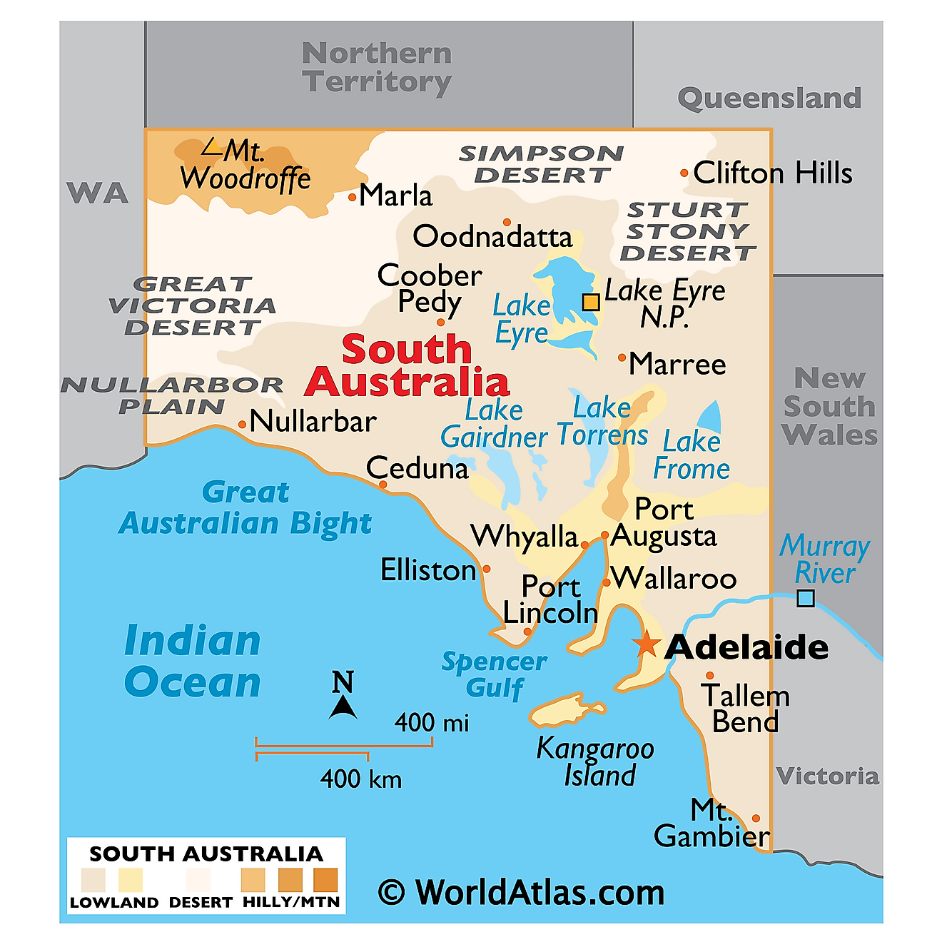
South Australia, a state in the southern central part of Australia, shares its borders with four other states and the Indian Ocean. To the west lies Western Australia, to the north the Northern Territory, to the east Queensland and New South Wales, and to the southeast Victoria. Covering an area of approximately 380,048 square miles, South Australia constitutes approximately 13% of the Australian continent. The state's extensive coastline stretches over 3,143 miles, with the Indian Ocean defining its southern border.
South Australia's geography consists of four primary regions: the Flinders Ranges, the Eyre Peninsula, the Murray-Darling Basin, and the Nullarbor Plain.
The Flinders Ranges, located in the northeastern part of South Australia, form the largest mountain range in the state. It extends over 265 miles from Port Pirie to Lake Callabonna. These ranges feature diverse landscapes, from rugged mountains and deep gorges to vast plains and sandy deserts. The highest peak in the Flinders Ranges, St. Mary Peak, rises to 3,832 feet above sea level.
The Eyre Peninsula, situated in the western part of South Australia, is bordered by the Great Australian Bight and Spencer Gulf. The peninsula is renowned for its rugged coastline, pristine beaches, and diverse marine life. Key features of the region include the Head of Bight, known for its Southern Right Whale watching opportunities, and the Coffin Bay National Park, popular for its breathtaking beaches and rugged cliffs.
The Murray-Darling Basin, located in the southeastern part of South Australia, is the state's most fertile agricultural region. It comprises the catchment areas of the Murray River and its tributaries, such as the Darling River. The Murray River, Australia's longest river, stretches over 1,558 miles, and flows through New South Wales, Victoria, and South Australia before reaching the Indian Ocean at Lake Alexandrina. The region supports a wide range of agricultural activities, including viticulture, dairy farming, and sheep and cattle grazing.
The Nullarbor Plain, a vast, arid region, covers a significant portion of South Australia and Western Australia. Spanning around 100,000 square miles, the Nullarbor Plain is the world's largest single expanse of limestone bedrock. The region's name, derived from the Latin words "nullus" and "arbor," means "no trees," which accurately describes its treeless landscape. The Nullarbor Plain is home to the Nullarbor National Park, which features unique cave systems and the famous Bunda Cliffs that stretch over 60 miles along the Great Australian Bight.
Major bodies of water in South Australia include the Spencer Gulf, Gulf St Vincent, and the Great Australian Bight. The Spencer Gulf, a large inlet on the state's central coast, separates the Eyre Peninsula from the Yorke Peninsula. Gulf St Vincent lies to the east of the Yorke Peninsula and is known for its pristine beaches and coastal ecosystems. The Great Australian Bight, along the state's southern coast, features rugged cliffs and supports a rich marine ecosystem, including the endangered Southern Right Whale.
Counties Map
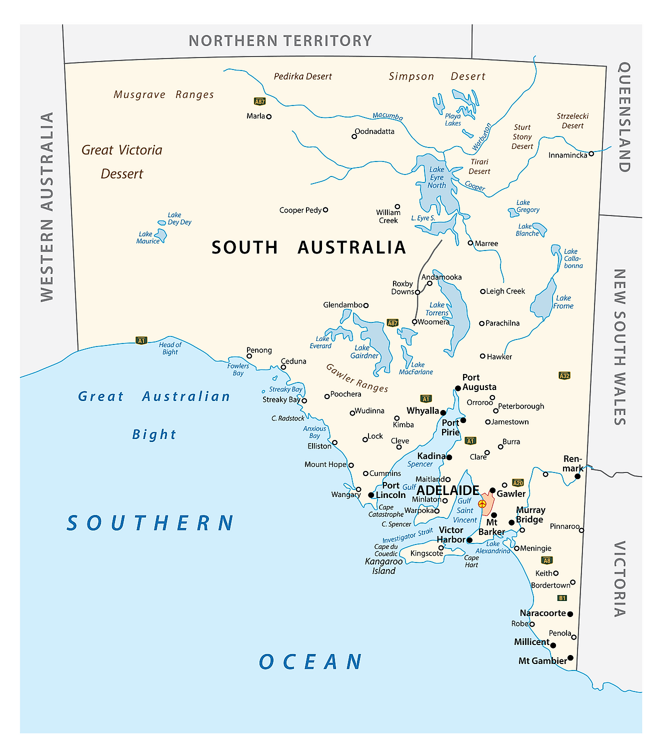
The State of South Australia is administratively divided into a total of 49 counties and 535 hundreds, that are located in the southern and southeastern parts of the state. Covering a total land area of 983,482sq.km, The State of South Australia is Australia’s 4th largest state. Located to the north of the Fleurieu Peninsula on the Adelaide Plains is Adelaide – the capital and the largest city of South Australia. It is also the 5th most populous city in Australia. Adelaide serves as the administrative and commercial center of South Australia.
Where is South Australia?
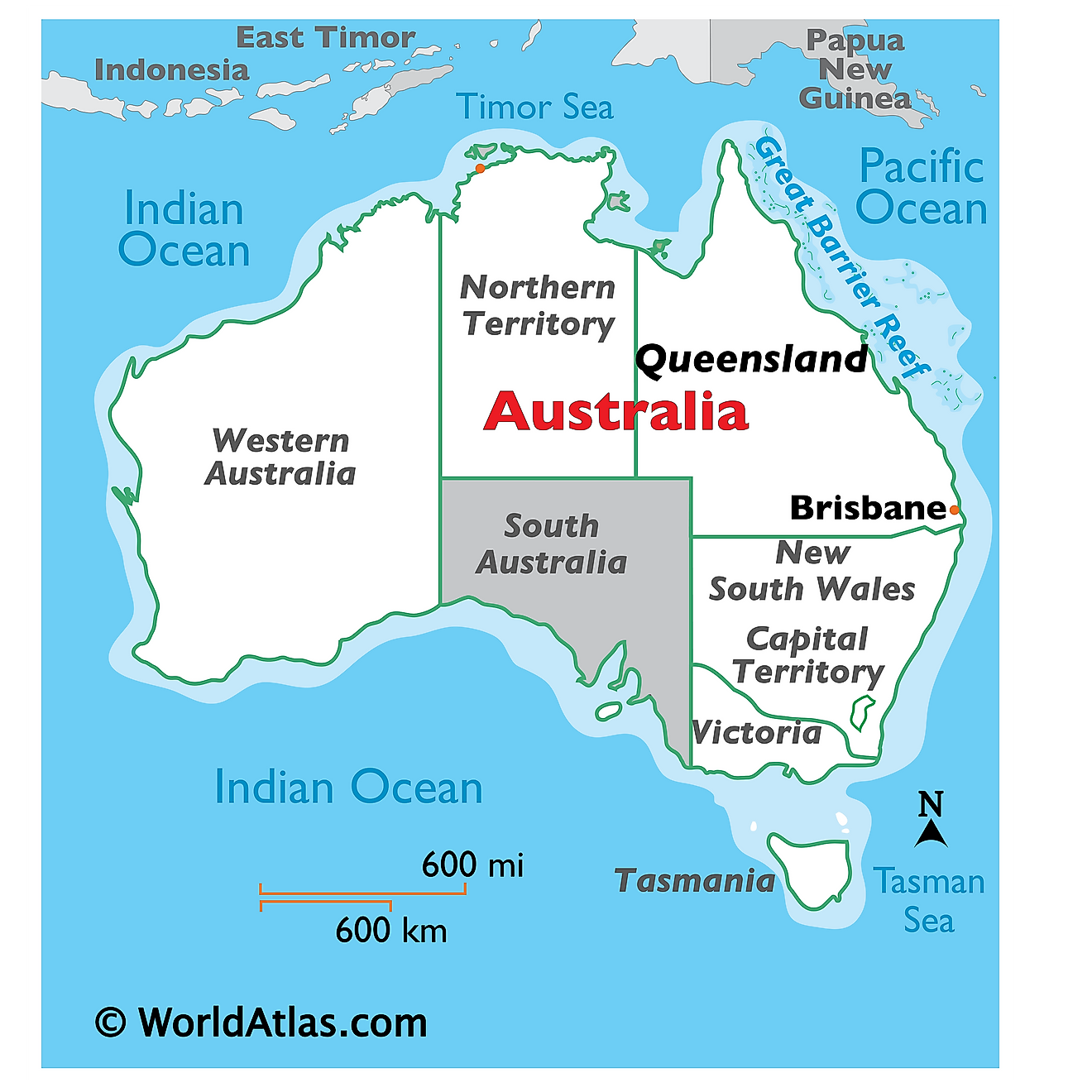
South Australia is a large state that is located in the southern-central part of Australia. It is geographically positioned in the Southern and Eastern hemispheres of the Earth. South Australia is bordered by the states of New South Wales in the east; Victoria in the southeast; Queensland in the northeast; Northern Territory in the north and Western Australia in the west. It is bounded by the Great Australian Bight in the south.
Regional Maps: Map of Oceania
Outline Map of South Australia
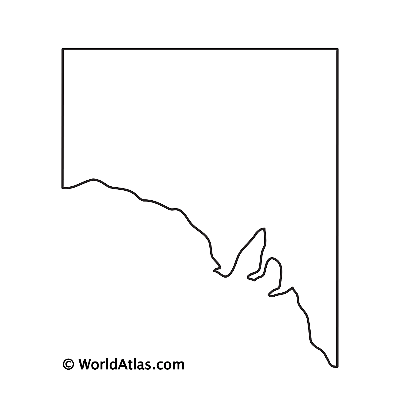
The above blank map represents the State of South Australia, located in the southern-central part of Australia. The above map can be downloaded, printed, and used for geography education purposes like map-pointing and coloring activities.
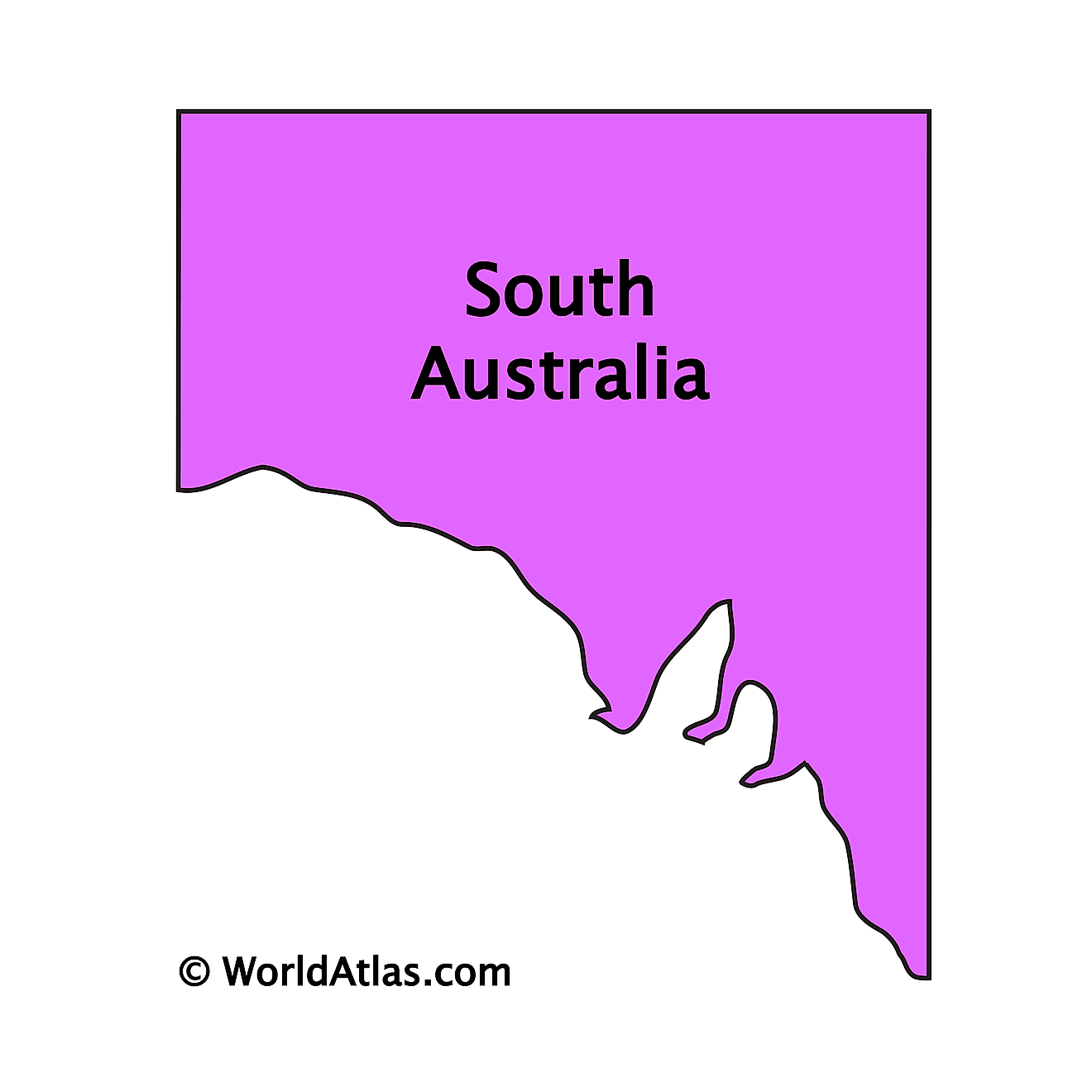
The above outline map represents the State of South Australia, located in the southern-central part of Australia. South Australia has been nicknamed “The Festival State” and “The Wine State”.
Key Facts
| Legal Name | State of South Australia |
|---|---|
| ISO 3166 Code | AU-AU_SA |
| Capital City | Adelaide |
This page was last updated on April 7, 2023
