Maps of Illinois
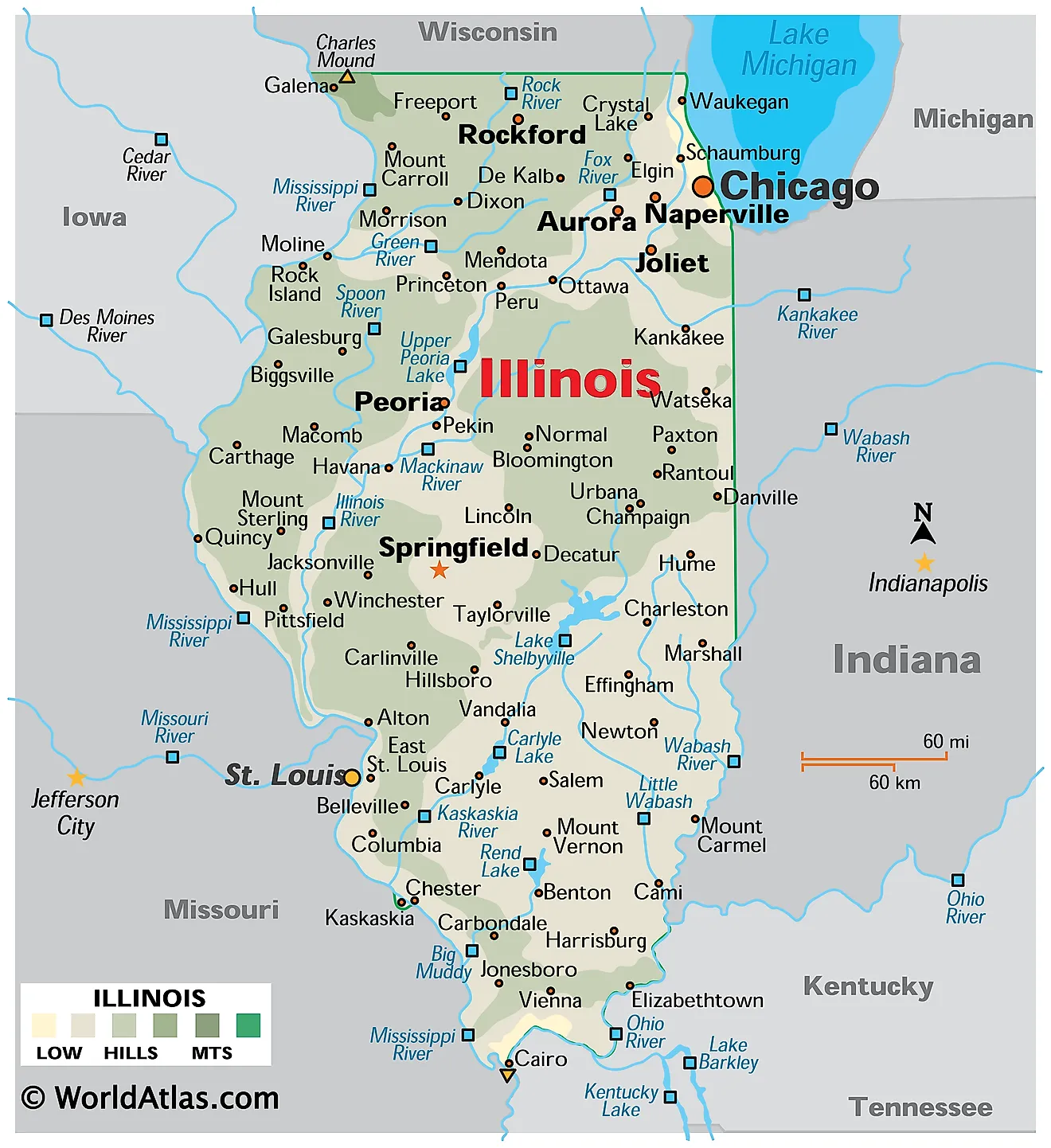
Illinois is a state in the Midwestern United States. It shares its borders with Wisconsin to the north and Indiana to the east, while the Mississippi River forms its western border with Iowa and Missouri. To the south it meets Kentucky across the Ohio and Mississippi rivers, and in the northeast it fronts Lake Michigan. The state encompasses a total area of 57,915 square miles (149,997 square kilometers), making it the 25th largest state.

Illinois is defined more by what water has done to it than by any mountain range. Glaciers covered roughly 85% of the state during the Ice Ages, planing down the hills and leaving behind deep, rock-flour-rich soils that became some of the most productive farmland on earth. The two corners the ice never reached — the far northwest and the far south — kept their hills, and those are the only genuinely rugged parts of the state. From the Wisconsin line to the southern tip, Illinois stretches almost 390 miles, far enough that Cairo sits at the latitude of Richmond, Virginia.
Where Is Illinois?

Illinois measures about 390 miles north to south and 210 miles east to west, giving it a long, tapering shape. Rivers define almost all of its boundary: the Mississippi on the west, the Ohio and Mississippi on the south, and the Wabash along much of the eastern border with Indiana. Only the northern boundary with Wisconsin is a surveyed line.
Relief across the whole state spans under 1,000 feet. Elevations run from 1,235 feet at Charles Mound in the northwest corner down to 279 feet where the Ohio meets the Mississippi at Cairo, with a statewide average near 600 feet. With roughly 12.7 million residents, Illinois is the sixth most populous state, and it is divided into 102 counties.
Northern Illinois and the Driftless Area

The northern third of the state is mostly rolling glacial terrain, marked by moraines — ridges of debris left where ice sheets paused during their retreat. Around the Lake Michigan shore these moraines form a low arc of hills, and the flat lake plain behind them was once the bed of a much larger glacial lake.
The exception is the state's extreme northwestern corner, in Jo Daviess County, which forms a small part of the Driftless Area shared with Wisconsin, Iowa, and Minnesota. This pocket escaped the ice entirely, so streams have been cutting into it uninterrupted for far longer than anywhere else in Illinois. The result is steep hills, rock outcrops, and deep valleys.

Charles Mound, at 1,235 feet (376 meters), is the highest point in Illinois. It lies in Scales Mound Township, about 2 miles northeast of the village of Scales Mound and 11 miles northeast of Galena, right against the Wisconsin line. It is a gentle erosional hill with a prominence of only 95 feet, and it ranks 45th among the 50 state high points — the lowest of any Midwestern state. The summit sits on private land and is open to visitors only a handful of days each year.
Central Illinois and the Grand Prairie

The broad middle of Illinois is the Till Plains, part of the Central Lowland province that extends across the Midwest. This is the flattest and most agriculturally productive ground in the state — a gently undulating surface of glacial till, blanketed with wind-blown loess and organic prairie soils built up over thousands of years.
Before settlement this was the Grand Prairie, a nearly treeless expanse of tallgrass that gave Illinois its nickname, the Prairie State. Tallgrass prairie once covered around 60% of the state; well under one percent of the original remains, almost all of it converted to corn and soybeans.
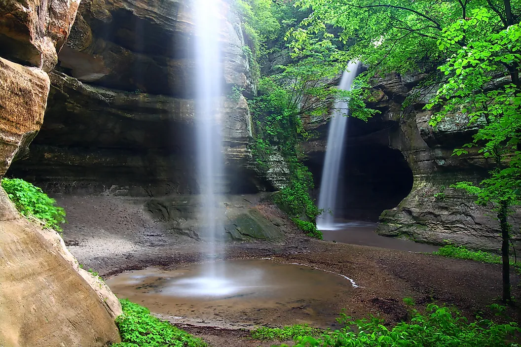
The flatness is broken along the rivers. Where the Illinois and Mississippi have cut into the plain, bluffs rise several hundred feet above the water. At Starved Rock, meltwater from a catastrophic glacial-lake outburst carved a series of narrow sandstone canyons — the most dramatic small-scale topography in central Illinois.
Southern Illinois and the Shawnee Hills

South of the glacial limit, Illinois changes character entirely. The Shawnee Hills run in an east-west arc across the southern part of the state, a forested upland where Mississippian and Pennsylvanian sandstone and limestone reach the surface instead of lying buried beneath drift.
A point of clarification is needed here, because it is widely muddled. The Shawnee Hills belong to the Interior Low Plateaus province — the same region that continues east into southern Indiana and Kentucky and includes the Highland Rim and Mammoth Cave country. They are sometimes nicknamed the "Illinois Ozarks," but they are not part of the Ozarks proper, and they have no connection at all to the Ouachita Mountains, which lie in Arkansas and Oklahoma several hundred miles southwest.

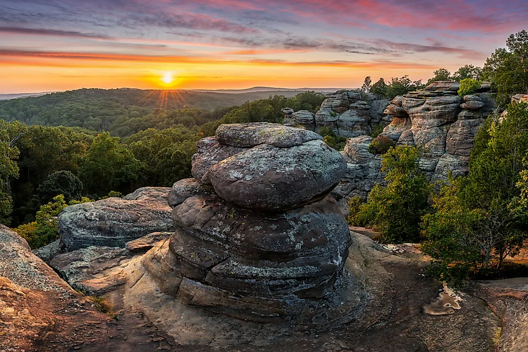
Illinois does contain a true fragment of the Ozark Plateaus, but it is elsewhere — the Salem Plateau section in the far southwest, in Monroe, Randolph, and Jackson counties, along with the Lincoln Hills further north. The Shawnee National Forest protects roughly 280,000 acres of the southern hill country, including the sandstone hoodoos and weathered blocks of Garden of the Gods.
The Southern Tip and Coastal Plain

Below the Shawnee Hills, the land drops into a small wedge of Gulf Coastal Plain — the northernmost tip of the Mississippi Embayment, a structural trough that reaches up from the Gulf of Mexico. Geologically and biologically this corner has more in common with Mississippi or Louisiana than with the rest of Illinois.

The Cache River wetlands here hold bald cypress and tupelo swamp, with some trees over 1,000 years old, and the area is recognised as a Wetland of International Importance. At the very tip, where the Ohio joins the Mississippi at Cairo, lies the state's lowest point at 279 feet (85 meters) — a figure sometimes misreported. The town sits below river level and survives behind a ring of levees.
Rivers and Lake Michigan

Illinois is bounded by water on three sides and threaded by rivers throughout. The Mississippi runs about 580 miles along the western edge; the Ohio forms roughly 130 miles of the southern boundary; and the Wabash defines much of the border with Indiana.
The Illinois River is the principal interior waterway, running 273 miles from the junction of the Kankakee and Des Plaines rivers southwest to the Mississippi near Grafton. Its valley is unusually broad for the size of the modern river — it was cut by enormous volumes of glacial meltwater, and the present stream occupies only a fraction of the channel.

Other significant rivers include the Rock, Kaskaskia, Sangamon, Big Muddy, Embarras, and Little Wabash. Because the Chicago Sanitary and Ship Canal reversed the flow of the Chicago River in 1900, water from the Great Lakes basin now drains through Illinois into the Mississippi system — the only such connection between the two watersheds.

Illinois has about 63 miles of frontage on Lake Michigan, the shortest of the four states bordering it, but that short stretch gave rise to Chicago and remains the state's most valuable natural asset. Natural inland lakes are scarce and confined to the glaciated northeast; Carlyle Lake, the largest body of water wholly within Illinois at about 26,000 acres, is a reservoir on the Kaskaskia.
Climate
Illinois has a humid continental climate over most of its area, shading into humid subtropical in the far south. The state's great north-south extent produces a real gradient: the Chicago area averages about 49 °F annually while Cairo averages closer to 59 °F, and the growing season is roughly seven weeks longer at the southern tip.
Precipitation increases southward, from about 35 inches a year in the north to over 48 inches in the far south. Snowfall runs the other way, from more than 38 inches in the northwest to under 14 inches at the southern tip, with lake-effect snow adding to totals near Lake Michigan.
With no mountains in any direction, cold Canadian air and warm Gulf moisture meet here freely. Illinois averages around 50 tornadoes a year and sits at the eastern edge of the corridor where they are most frequent; river flooding is the other recurring hazard, most severely during the Great Flood of 1993.
Illinois Geography at a Glance
| Feature | Detail |
|---|---|
| Total area | 57,915 sq mi (149,997 sq km) — 25th largest state |
| Dimensions | Approx. 390 mi north-south; 210 mi east-west |
| Highest point | Charles Mound, 1,235 ft (376 m) — Jo Daviess County |
| Lowest point | Confluence of Ohio and Mississippi at Cairo, 279 ft (85 m) |
| Mean elevation | Approx. 600 ft |
| Bordering states | Wisconsin, Indiana, Kentucky, Missouri, Iowa |
| Great Lakes frontage | Approx. 63 mi on Lake Michigan |
| Physiographic provinces | Four: Central Lowland, Interior Low Plateaus, Ozark Plateaus, Coastal Plain |
| Glaciated share | About 85% of the state |
| Principal interior river | Illinois River, 273 mi |
| Counties | 102 |
Counties Map
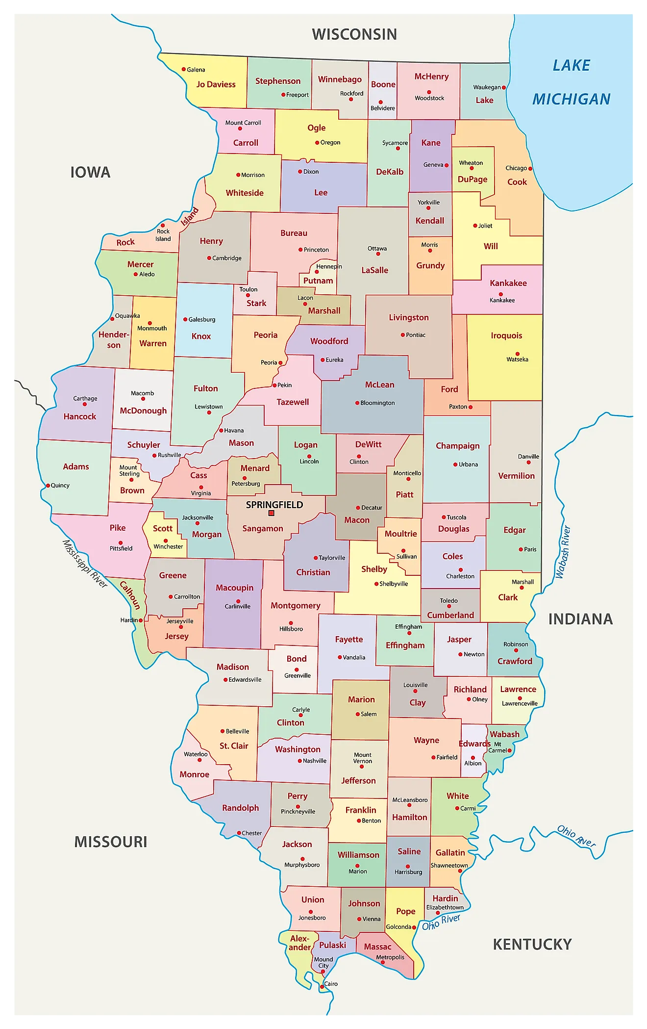
The State of Illinois is divided into 102 counties. In alphabetical order, these counties are: Adams, Alexander, Bond, Boone, Brown, Bureau, Calhoun, Carroll, Cass, Champaign, Christian, Clark, Clay, Clinton, Coles, Cook, Crawford, Cumberland, DeKalb, Dewitt, Douglas, DuPage, Edgar, Edwards, Effingham, Fayette, Ford, Franklin, Fulton, Gallatin, Greene, Grundy, Hamilton, Hancock, Hardin, Henderson, Henry, Iroquois, Jackson, Jasper, Jefferson, Jersey, Jo Daviess, Johnson, Kane, Kankakee, Kendall, Knox, La Salle, Lake, Lawrence, Lee, Livingston, Logan, Macon, Macoupin, Madison, Marion, Marshall, Mason, Massac, McDonough, McHenry, McLean, Menard, Mercer, Monroe, Montgomery, Morgan, Moultrie, Ogle, Peoria, Perry, Piatt, Pike, Pope, Pulaski, Putnam, Randolph, Richland, Rock Island, Saint Clair, Saline, Sangamon, Schuyler, Scott, Shelby, Stark, Stephenson, Tazewell, Union, Vermilion, Wabash, Warren, Washington, Wayne, White, Whiteside, Will, Williamson, Winnebago, and Woodford.
With an area of 149,997 sq. km, Illinois is the 25th largest and the 6th most populous state in the USA. Located in the central part of the state along the shores of the Sangamon River is Springfield – the capital city of Illinois. As the seat of state government, its economy is dominated by public-sector employment, with healthcare as the other main contributor. Situated in the northeastern part of the state along the shores of Lake Michigan is Chicago – the most populous city in Illinois and the 3rd most populous city in the United States. It serves as a major international hub for culture, education, finance, commerce, international trade, industry, telecommunications, and transport. The Chicago Metropolitan Area is the 3rd largest metropolitan area in the United States and the 4th largest in North America.
Where is Illinois?

The State of Illinois is located in the East-North-Central (Midwest and Great Lakes) region of the United States. Illinois is bordered by the state of Indiana in the east; by Kentucky in the southeast; by Missouri in the west; by Iowa in the northwest and by Wisconsin in the north. It is also bounded by Lake Michigan in the northeast.
Regional Maps: Map of North America
Outline Map of Illinois
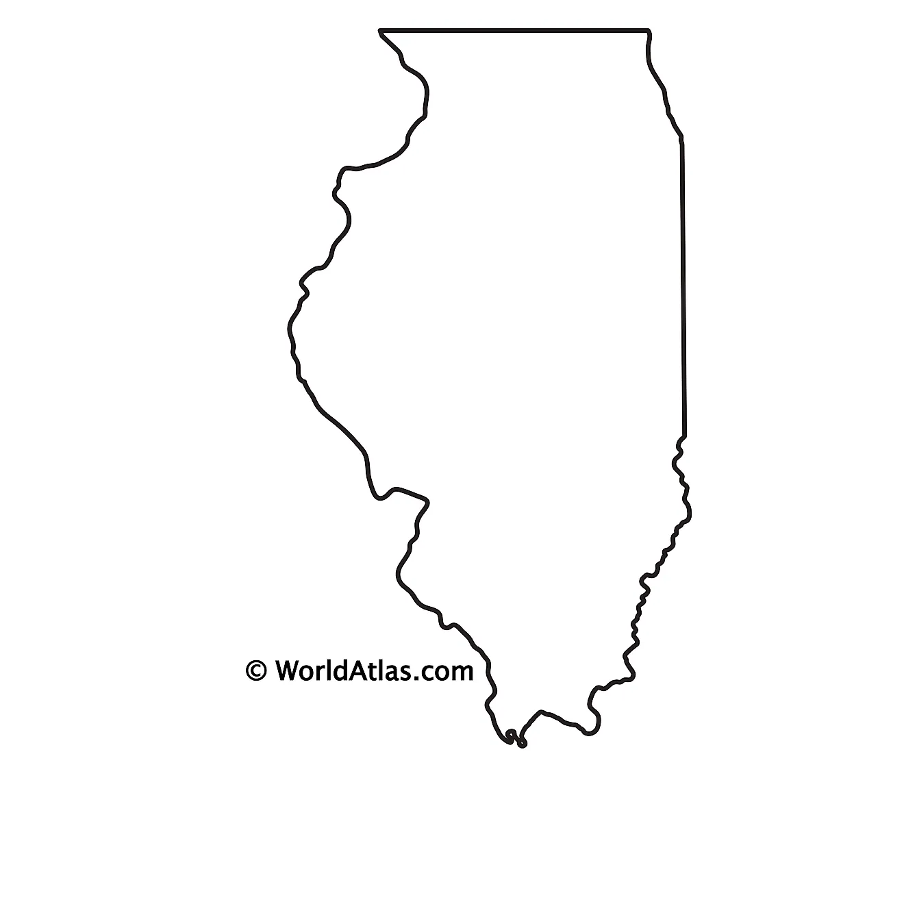
The above blank map represents the State of Illinois, located in the East-North-Central (Midwest and Great Lakes) region of the United States. The above map can be downloaded, printed and used for geography education purposes like map-pointing and coloring activities.
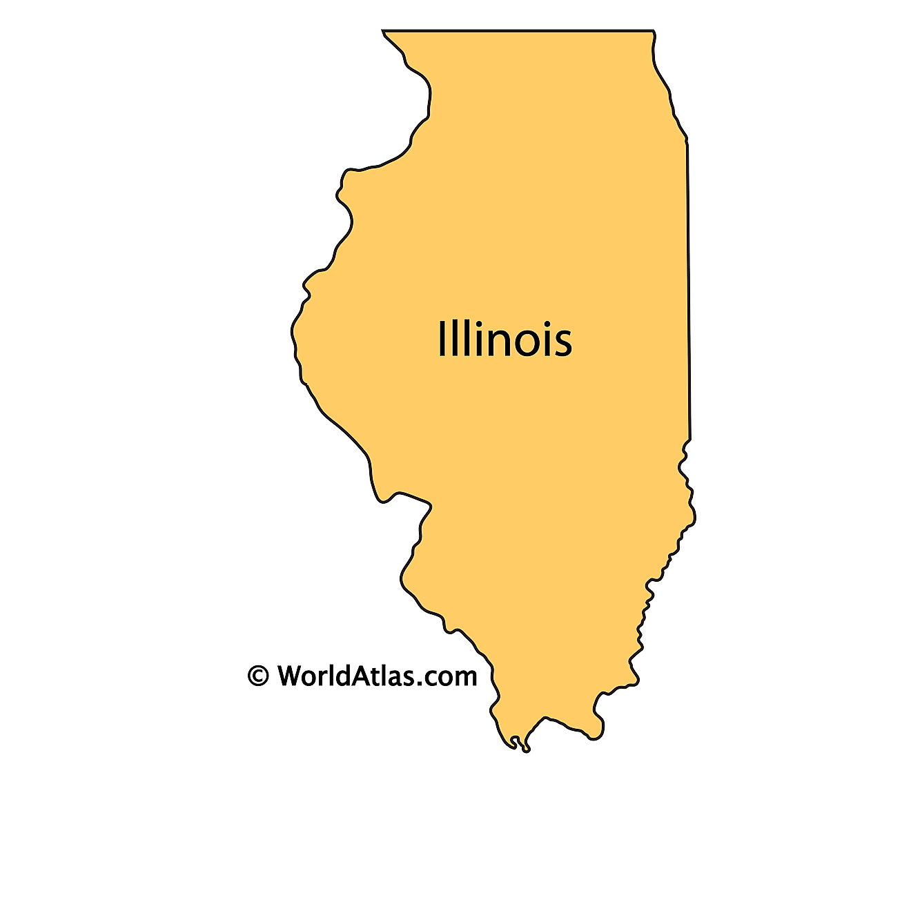
The above outline map represents the State of Illinois, located in the East-North-Central (Midwest and Great Lakes) region of the United States. Illinois has been nicknamed as “The Prairie State” in reference to the landscape of rolling hills and prairies that occupy large areas of the state.
Key Facts
| Legal Name | State of Illinois |
|---|---|
| ISO 3166 Code | US-IL |
| Capital City | Springfield |
| Major Cities |
|
This page was last updated on September 19, 2026