Maps of Connecticut
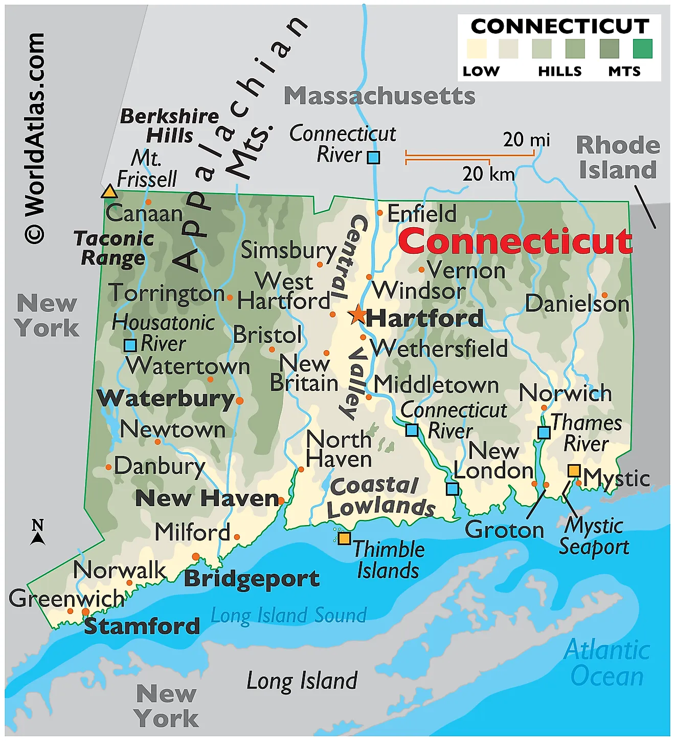
Connecticut is a state in the northeastern United States, covering a total area of approximately 5,543 square miles (14,356 square kilometers). That makes it the 48th largest state and the third smallest, after Rhode Island and Delaware. It shares its borders with New York to the west, Massachusetts to the north, and Rhode Island to the east. Its southern boundary is formed by Long Island Sound, a tidal estuary of the Atlantic Ocean.

Connecticut's landscape is arranged in north-south bands, and the pattern is easier to read than in almost any other state. Uplands rise on the west, a broad lowland runs down the middle, more uplands occupy the east, and a narrow coastal strip cuts across the bottom. That structure comes from two separate events: an ancient continental collision that welded together the rocks now forming the uplands, and a much later rifting that tore open the central valley when Pangaea began to break apart. Glaciers then smoothed the whole thing over.
Where Is Connecticut?

The state measures only about 110 miles east to west and 70 miles north to south. Its northern border with Massachusetts is a surveyed line, but the southwestern boundary with New York has a distinctive notch — the Panhandle around Greenwich and Stamford — the result of a 1683 colonial settlement that traded land near the Sound for territory further north.
Connecticut has no true oceanfront. Its entire 96 miles of general coastline face Long Island Sound, a tidal estuary roughly 110 miles long that is sheltered from the open Atlantic by Long Island. Counting every cove, river mouth, and island, the tidal shoreline runs to about 618 miles. With roughly 3.6 million residents in so small an area, Connecticut is the fourth most densely populated state.
The Western Uplands

The Western Uplands, locally called the Litchfield Hills, occupy the northwestern quarter of the state and hold its highest and most rugged ground. They are the southern continuation of the Berkshires, built from hard metamorphic rock — schist, gneiss, and marble — deformed during the Taconic and Acadian mountain-building events hundreds of millions of years ago.
A note on naming: this region is sometimes mislabelled the Hudson Highlands. Those are a separate range along the Hudson River in New York, and while the Hudson Highlands do clip Connecticut's extreme southwest near Danbury, they have nothing to do with the northwest corner or the Taconics.

The far northwest corner rises into the southern Taconic Mountains, and this is where Connecticut's high point sits — though not in the way most people expect. The highest elevation in Connecticut is 2,380 feet (725 meters), on the south slope of Mount Frissell. The summit of Frissell itself, at 2,454 feet, lies across the line in Massachusetts. Connecticut is one of only three states whose high point is not a mountaintop, marked instead by a green survey stake in a patch of scrub oak.
The highest actual summit wholly within the state is Bear Mountain in Salisbury, at 2,316 feet. An 1885 stone cairn there still declares it the "highest ground in Connecticut," a claim a later survey disproved by about 60 feet.
The Central Valley

Down the middle of the state runs the Central Valley, a lowland 15 to 20 miles wide stretching from the Massachusetts line south toward New Haven. It is a rift basin: about 200 million years ago, as the supercontinent Pangaea began to pull apart, the crust here dropped along a series of faults. The resulting trough filled with red sandstone and shale, and lava repeatedly welled up between the sediment layers.
Those lava flows are why the valley is not simply flat. Tilted and eroded, the hardened basalt now stands as the trap rock ridges that rise abruptly from the valley floor — the Hanging Hills of Meriden, Sleeping Giant, East Rock and West Rock at New Haven, and Talcott Mountain. Their west faces are gentle slopes and their east faces sheer cliffs, a tell-tale sign of tilted blocks. Dinosaur tracks preserved in the valley's sandstone at Rocky Hill are among the largest such sites in North America.
One quirk is worth noting: the Connecticut River does not follow this valley all the way to the sea. At Middletown it turns sharply southeast, abandons the lowland, and cuts a narrow gorge through the hard rock of the Eastern Uplands before reaching the Sound at Old Saybrook. Because it carries no major port at its mouth, the river's estuary escaped industrial development and is recognised as a wetland of international importance.
The Eastern Uplands

East of the Central Valley the land rises again into the Eastern Uplands, sometimes called the Worcester Plateau where it continues into Massachusetts. The rock is broadly similar to the Western Uplands — ancient metamorphic material — but the terrain is gentler and the elevations lower.
Ground near the Massachusetts border generally stands between 500 and 1,100 feet, falling to 200 to 500 feet toward the southeast. This is Connecticut's least developed quarter; the northeastern corner is known as the Quiet Corner, and a 1,100-square-mile area spanning the Connecticut and Massachusetts border has been designated the Last Green Valley for being the darkest, least light-polluted stretch along the entire Boston-to-Washington corridor.
The Coastal Lowland

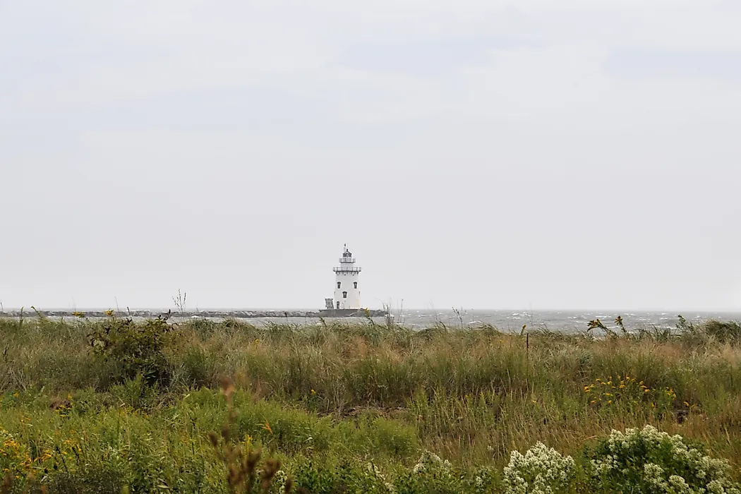
Lighthouse Point Park in the afternoon in New Haven, Connecticut.
A narrow strip six to sixteen miles wide runs the length of the shoreline, cutting across the southern ends of all three upland and valley regions. Elevations here rarely exceed 100 feet, and many coastal towns sit below 20 feet.
The shore alternates between sandy beaches, rocky headlands, tidal marsh, and small coves — a mixed coast rather than a barrier-island one, because Long Island absorbs the Atlantic's wave energy before it arrives. Long Island itself is a terminal moraine, the pile of debris left at the furthest reach of the last ice sheet, and the Sound is the drowned lowland behind it. Because this strip is flat and well connected, it carries most of the state's population.
Islands of Long Island Sound

Connecticut's islands are small, rocky, and glacial in origin — outcrops of hard pink granite scoured bare by ice and then partly drowned as sea level rose. The Thimble Islands off Branford are the best known, an archipelago variously counted at 25 named islands or more than 100 rocks and islets depending on the tide.

The Stewart B. McKinney National Wildlife Refuge is not a single island but a scattered refuge of ten units spread along more than 70 miles of coast, protecting islands, salt marsh, and barrier beach. Its holdings include Outer Island in the Thimbles, Sheffield Island off Norwalk, Chimon Island, Great Meadows Marsh, and Falkner Island off Guilford — note the spelling, which is commonly rendered incorrectly as "Faulkner's." Falkner Island's 1802 lighthouse is the second oldest in the state, and the island supports Connecticut's only nesting colony of roseate terns, a federally endangered species.
Rivers

Every major Connecticut river flows south into Long Island Sound. The Connecticut River is by far the largest — at 410 miles the longest river in New England, draining four states and supplying most of the fresh water that reaches the Sound. Only its lower 68 miles lie within Connecticut, but the state takes its name from it.

The Housatonic drains the western third, rising in the Massachusetts Berkshires and running about 149 miles through the Litchfield Hills to the Sound at Stratford; the Naugatuck is its principal tributary. In the east, the Thames is unusual in being almost entirely tidal — it is formed at Norwich by the Shetucket and Yantic and runs only about 15 miles to New London, functioning more as an estuary than a river. The Quinnipiac, Farmington, and Quinebaug complete the network.
Lakes and Reservoirs

Connecticut has roughly 6,000 lakes and ponds, nearly all of them glacial kettle holes left where blocks of buried ice melted out. Most are small. The state's two largest bodies of water, by contrast, are entirely artificial.
Candlewood Lake, at about 5,420 acres, is the largest lake in Connecticut. It was created in 1928 by Connecticut Light and Power as part of one of the first large pumped-storage hydroelectric schemes in the United States — water is pumped uphill from the Housatonic at night and released to generate power at peak demand. Several farms and a village were flooded to make it.

Lake Lillinonah, also on the Housatonic behind Shepaug Dam, is the second largest at about 1,900 acres. The largest natural lake is Bantam Lake in Litchfield, covering roughly 947 acres — small enough that Connecticut's biggest genuinely natural water body would be unremarkable in most states.
Climate

Connecticut sits on a climate boundary. The coast and the Central Valley have a humid subtropical climate with hot summers and relatively mild winters, while the northwestern hills are humid continental, cold enough to support ski areas. The difference across 60 miles is substantial: the Litchfield Hills average about 10 °F colder in January than Bridgeport, and receive roughly three times the snowfall.
Precipitation is generous and evenly spread, around 44 to 50 inches a year with no dry season. Long Island Sound moderates the shoreline, delaying autumn frost by several weeks.
Nor'easters are the principal hazard, bringing the heaviest snow and the worst coastal flooding. Hurricanes reach the state less often but have caused severe damage when they do — the 1938 New England Hurricane and Hurricane Sandy in 2012 both drove destructive surges into the Sound, which funnels water westward toward the state's most densely settled shoreline.
Connecticut Geography at a Glance
| Feature | Detail |
|---|---|
| Total area | Approx. 5,543 sq mi (14,356 sq km) — 48th largest state, 3rd smallest |
| Dimensions | Approx. 110 mi east-west; 70 mi north-south |
| Highest point | South slope of Mount Frissell, 2,380 ft (725 m) — not a summit |
| Highest summit | Bear Mountain, 2,316 ft, Salisbury |
| Lowest point | Long Island Sound, sea level |
| Bordering states | New York, Massachusetts, Rhode Island |
| Coastline | Approx. 96 mi general; approx. 618 mi tidal shoreline |
| Major regions | Four: Western Uplands, Central Valley, Eastern Uplands, Coastal Lowland |
| Longest river | Connecticut River, 410 mi total (68 mi in state) |
| Largest lake | Candlewood Lake, approx. 5,420 acres (reservoir) |
| Largest natural lake | Bantam Lake, approx. 947 acres |
Counties Map
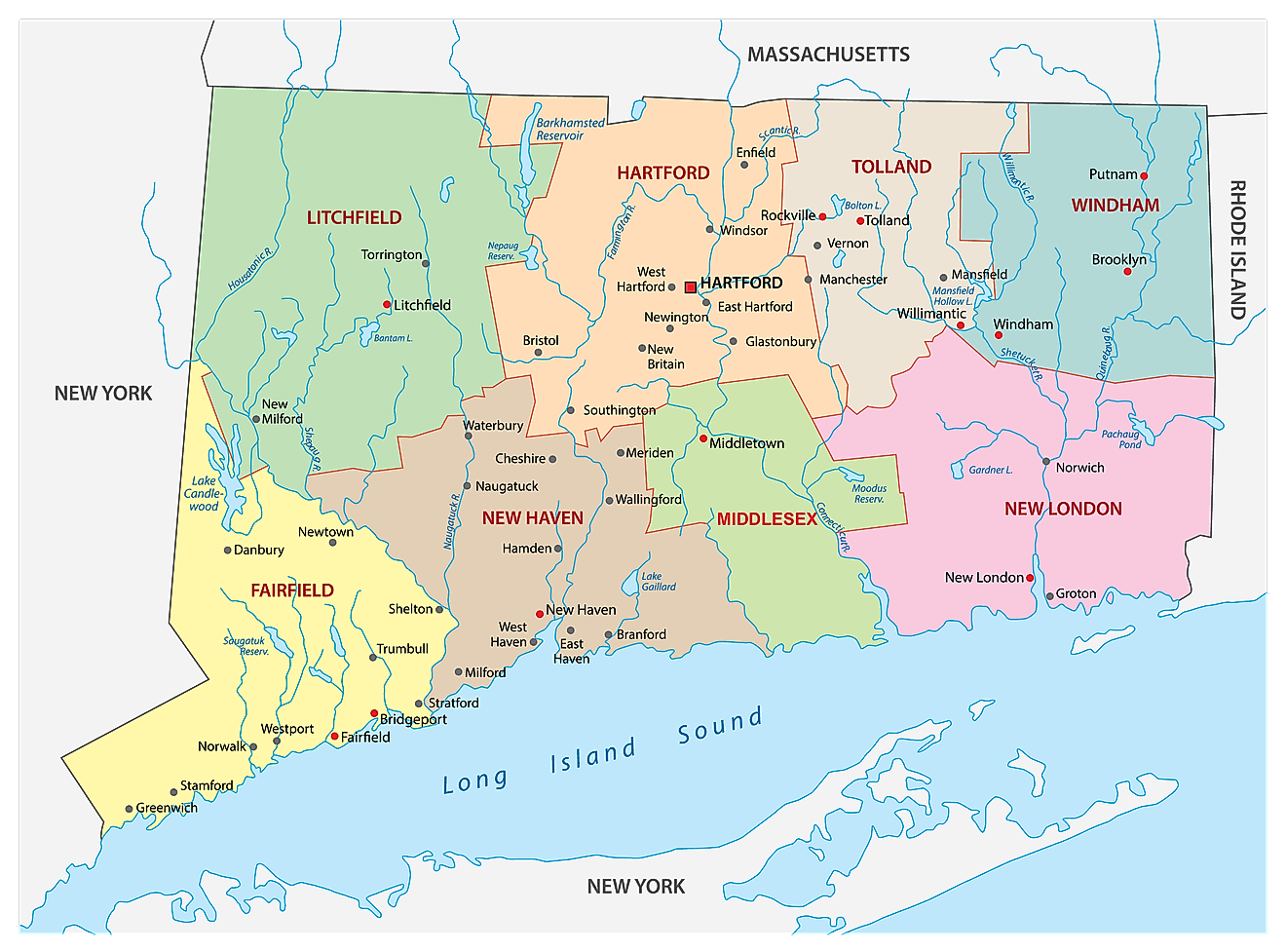
The State of Connecticut is divided into 8 counties. In alphabetical order, these counties are: Fairfield, Hartford, Litchfield, Middlesex, New Haven, New London, Tolland, and Windham. Connecticut is unusual in that its county governments were abolished in 1960, and in 2022 the US Census Bureau replaced the eight counties with the state's nine planning regions as county equivalents for statistical purposes, a change fully implemented by 2024. The counties remain in use as place names and as judicial districts.
With an area of 14,356 sq. km, Connecticut is the 3rd smallest, 29th most populous, and the 4th most densely populated state in the USA. Located in the north-central part of the state, on the banks of the Connecticut River is Hartford – the capital and the 4th largest city of Connecticut. It serves as a major financial, insurance, and commercial center of the state. Due to the presence of numerous insurance company headquarters in Hartford, it is often referred to as the "Insurance Capital of the World". Situated in the southwestern part of the state, in Fairfield County, is Bridgeport – the most populous city of Connecticut, anchoring a metropolitan area that forms part of the wider New York City region.
Where is Connecticut?
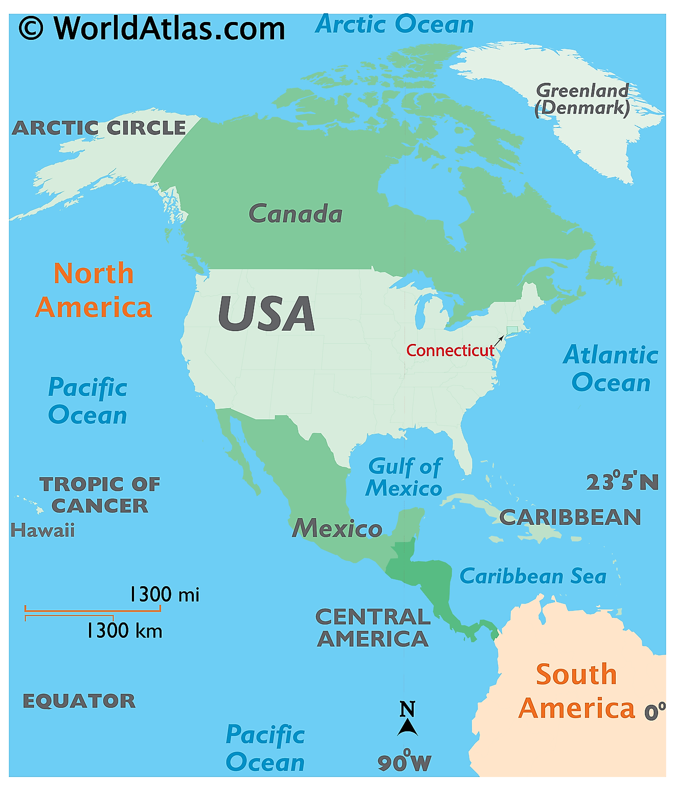
The State of Connecticut is located in the north-eastern (New England) region of the United States. Connecticut is bordered by the state of Massachusetts in the north; by Rhode Island in the east; by New York in the west and by Long Island Sound and the Atlantic Ocean in the south.
Regional Maps: Map of North America
Outline Map of Connecticut
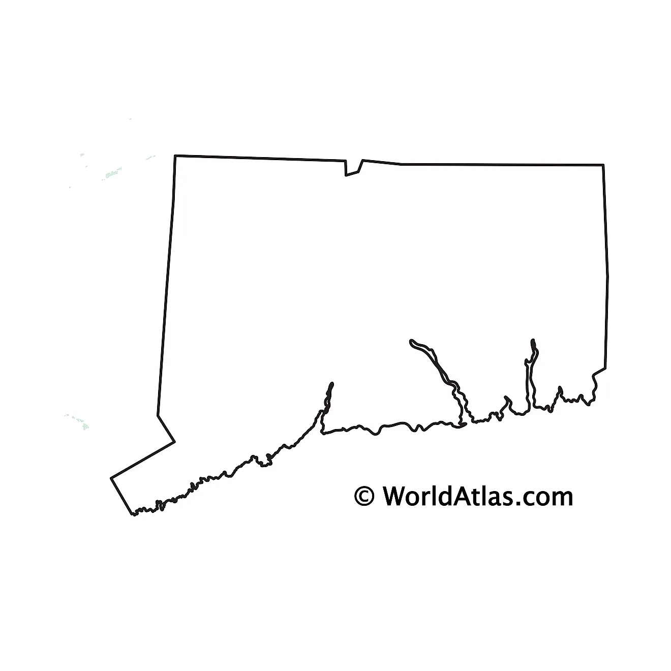
The above blank map represents the State of Connecticut, located in the north-eastern (New England) region of the United States. The above map can be downloaded, printed and used for geography education purposes like map-pointing and coloring activities.
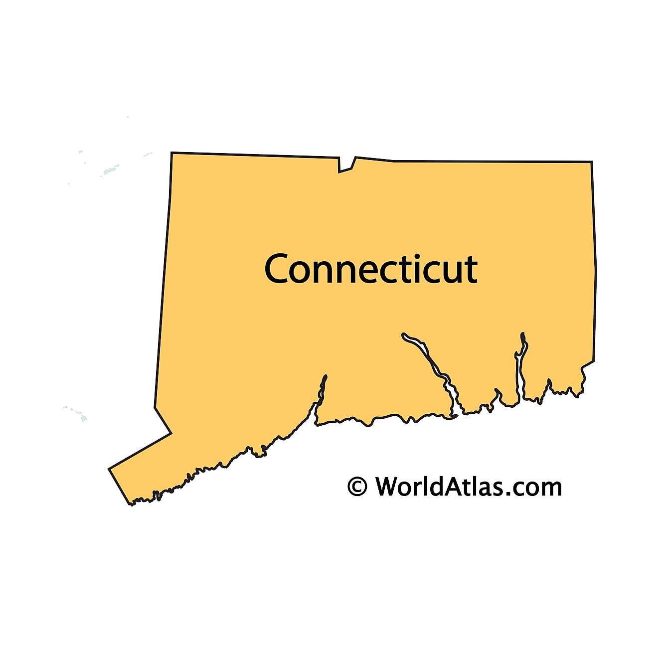
The above outline map represents the State of Connecticut, located in the north-eastern (New England) region of the United States. Connecticut is roughly rectangular in shape and is colloquially known as the Constitution State, Nutmeg State, the Provisions State and the Land of Steady Habits.
Key Facts
| Legal Name | State of Connecticut |
|---|---|
| ISO 3166 Code | US-CT |
| Capital City | Hartford |
| Major Cities |
|
This page was last updated on September 17, 2026