Maps of Jordan

Jordan occupies an area of around 91,880 sq. km in Southwest Asia.
As observed on the physical map above, the country can be divided into three main physiographic regions.
The desert region includes the eastward extensions of the Syrian and the Ard As Sawwan Deserts and covers over four-fifths of the country.
To the west of the desert is the upland region that features an escarpment overlooking the rift valley to the west. Here the average elevation of land is 600 to 900 m. Jordan's highest point marked on the map by a yellow upright triangle is located at the southern edge of this upland region. It is the 5,755 feet (1,754 m) tall Mount Ramm.
Further west is the Great Rift Valley's mountains and hills that cut through the Jordan River's East and West Banks.
Significant bordering bodies of water include the Dead Sea, the Gulf of Aqaba and the Sea of Galilee.
The Jordan River runs for about 5,755 feet (1,754 m) and drains into the Dead Sea.
Governorates of Jordan Map

Jordan (officially, the Hashemite Kingdom of Jordan) is divided into three administrative regions. These regions are divided into 12 governorates (muhafazat, sing. muhafazah). In alphabetical order, these governorates are: Al ‘Asimah (Amman), 'Ajlun, Al 'Aqabah, Al Balqa', Irbid, Jarash, Al Karak, Madaba, Al Mafraq, Ma'an, At Tafilah, and Az Zarqa'. These governorates are divided into districts (liwa), which are further subdivided into smaller subdivisions (qda).
With an area of 89, 342sq. km, and a population of over 10 million people, Jordan is the 11th most populous Arab country. Amman - the capital and largest city of Jordan is located on the east Bank Plateau and serves as the country’s economic, political and commercial centers, as well as one of the Arab world’s major cultural capitals.
Where is Jordan?

Jordan is a small, semi-arid Arab country in Southwest Asia. It is located in the rocky desert of the northern Arabian Peninsula, in the Northern and Eastern hemispheres of the Earth. It is a landlocked country, bordered by 5 Nations: Syria in the north, Iraq in the east, Saudi Arabia in the south and southeast and Israel and Palestine in the west. The Dead Sea is located along the western borders of the country. Al-Aqabah, the only port of Jordan is located in the south-western part of the country along the coasts of the Gulf of Aqaba (Red Sea).
Jordan Bordering Countries: Saudi Arabia, Palestine, Iraq, Israel, Syria.
Regional Maps: Map of Asia
Outline Map of Jordan


Key Facts
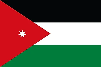
| Legal Name | Hashemite Kingdom of Jordan |
|---|---|
| Flag |
|
| Capital City | Amman |
| 31 57 N, 35 56 E | |
| Total Area | 89,342.00 km2 |
| Land Area | 88,802.00 km2 |
| Water Area | 540.00 km2 |
| Population | 10,101,694 |
| Major Cities |
|
| Currency | Jordanian dinars (JOD) |
| GDP | $43.74 Billion |
| GDP Per Capita | $4,330.33 |
This page was last updated on February 24, 2021