Maps of Burkina Faso

Burkina Faso, with its total area of 105,900 square miles (274,200 square kilometers), sits landlocked in the heart of West Africa. It shares its borders with six other nations: Mali to the north and west, Niger to the east, and Benin to the southeast, while to the south it touches Togo, Ghana, and Ivory Coast.
The country's geography unfolds over several distinct regions, each with its unique characteristics. The northern region, closest to the Sahara Desert, exhibits semi-arid conditions, forming part of the Sahel belt that stretches across Africa. This Sahelian zone morphs into a Savannah as it moves south, offering a transitional ecosystem that gives way to a more fertile Sudano-Guinean zone in the southernmost region of the country.
The Sudanian Savannah region in the south and southwest of Burkina Faso marks the lushest part of the country. Here, the landscape is interspersed with scattered woodland and denser gallery forests. Rainfall, significantly higher than the rest of the country, enriches this region's soil, enabling more diverse plant growth and agriculture.
Burkina Faso's topography generally slopes from the north and west towards the south and east, creating a vast peneplain, a landscape that's been eroded nearly flat and punctuated by isolated hills, the highest of which is Tena Kourou at 2,451 feet (747 meters). The western and southwestern regions feature the most elevation, which is shown in the Banfora Escarpment's remarkable sandstone cliffs and scenic waterfalls.
Water resources in Burkina Faso are not abundant, but they play a crucial role in the nation's geography and the livelihood of its people. The country's major river, the Mouhoun (Black Volta), flows from the north to the south, marking a natural border with neighboring Ghana. This river, along with the Nakambé (White Volta) and Nazinon (Red Volta), forms the Volta River system, which feeds into the Volta Lake in Ghana, one of the largest man-made lakes in the world. These rivers, especially the Mouhoun, form fertile valleys and are indispensable for agriculture and fishing.
Burkina Faso also hosts several smaller rivers and streams that are seasonal, filling during the rainy season and often drying out in the dry season. The country's largest lake, Lake Bam, lies near the center of the country. It serves as a vital reservoir, especially during the dry season.
Regions of Burkina Faso Map

Burkina Faso is divided into 13 regions which are then divided into 45 provinces and subdivided into 351 communes.
The 13 regions are; Boucle du Mouhoun, Cascades, Centre, Centre-Est, Centre-Nord, Centre-Ouest, Centre-Sud, Est, Hauts-Bassins, Nord, Plateau-Central, Sahel, Sud-Ouest. With an area of 46,694 sq. km, Est is the largest region while Centre is the most populous one. Ouagadougou, the national capital city, is also located in the Centre Region.
Where is Burkina Faso?

Burkina Faso is a West African country located in the Northern Hemisphere region of the Earth. As it straddles the Prime Meridian, it has territories on both the Eastern and Western Hemispheres. It borders six countries. These are Benin and Togo to the southeast, Niger to the east, Mali to the north and west, Ivory Coast to the southwest, and Ghana to the south. Being a landlocked country, Burkina Faso does not have a coastline.
Burkina Faso Bordering Countries: Mali, The Niger, Ghana, Benin, Togo, Cote D'Ivoire.
Regional Maps: Map of Africa
Outline Map of Burkina Faso


Key Facts
| Legal Name | Burkina Faso |
|---|---|
| Flag |
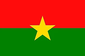
|
| Capital City | Ouagadougou |
| 12 22 N, 1 31 W | |
| Total Area | 274,200.00 km2 |
| Land Area | 273,800.00 km2 |
| Water Area | 400.00 km2 |
| Population | 20,321,378 |
| Major Cities |
|
| Currency | Communaute Financiere Africaine francs (XOF) |
| GDP | $15.75 Billion |
| GDP Per Capita | $774.84 |
This page was last updated on June 14, 2023