The Longest Highway Without A Gas Station In America
Drive north out of Coldfoot, Alaska, with less than a full tank and the mistake becomes obvious quickly. The next public fuel stop is at Deadhorse, 239 miles away. That stretch of the Dalton Highway is the longest widely documented gap between gas stations on a public highway in the United States. The road itself runs 414 miles from Livengood to Deadhorse, cutting through interior Alaska and reaching the edge of the North Slope. Its route crosses the Yukon River, the Arctic Circle, and the Brooks Range before ending near Prudhoe Bay. Most traffic still has a practical purpose, hauling supplies to northern oil operations. For everyone else, the Dalton is a rare road trip where fuel range, tires, weather, and road conditions can decide how far the day goes.
The Longest Fuel Gap Is 239 Miles

Coldfoot sits at Mile 175. Deadhorse is at Mile 414. Subtract the two and the problem facing northbound drivers is clear, since that leaves 239 miles without a public gas station. Bureau of Land Management maps show fuel at Yukon Crossing, Coldfoot, and Deadhorse, with nothing comparable between Coldfoot and the highway's northern end. A roadside sign near Coldfoot rounds the warning to 240 miles until the next services.
A vehicle getting 25 miles per gallon would need almost 10 gallons for the drive under ideal conditions. The Dalton rarely provides ideal conditions for long. Gravel increases rolling resistance, strong winds sweep across open sections, and roadwork can leave vehicles idling. Steep grades around the Brooks Range add another variable. Alaska transportation officials advise carrying extra fuel, especially on the northern half of the route. A fuel gauge that looks comfortable in Coldfoot can look very different after hours on rough road.
Oil Built The Dalton Highway

The road began as infrastructure for Alaska's oil industry. Oil discoveries around Prudhoe Bay created demand for a land route linking the North Slope with the state's existing road network. Alyeska Pipeline Service Company started road construction north of Livengood in 1969. Work accelerated once the Trans-Alaska Pipeline project received federal approval.
Construction crews pushed roughly 390 miles of the Haul Road north in 1974, completing the route in about five months. Trucks soon carried pipe, machinery, fuel, and building materials into territory that previously had no continuous highway connection. Alaska assumed control of the road in 1979. Public access expanded in stages, and ordinary motorists were finally allowed to drive the entire route in 1994. The highway carries the name of James W. Dalton, an engineer involved in early North Slope development.
The Arctic Circle Appears At Mile 115

About 115 miles north of Livengood, a turnout and sign mark the Arctic Circle at roughly 66.5 degrees north latitude. It is one of the most photographed stops on the Dalton and a useful geographic marker for how far north the road has already traveled. Beyond this latitude, at least one day each year passes without sunset and another passes without sunrise.
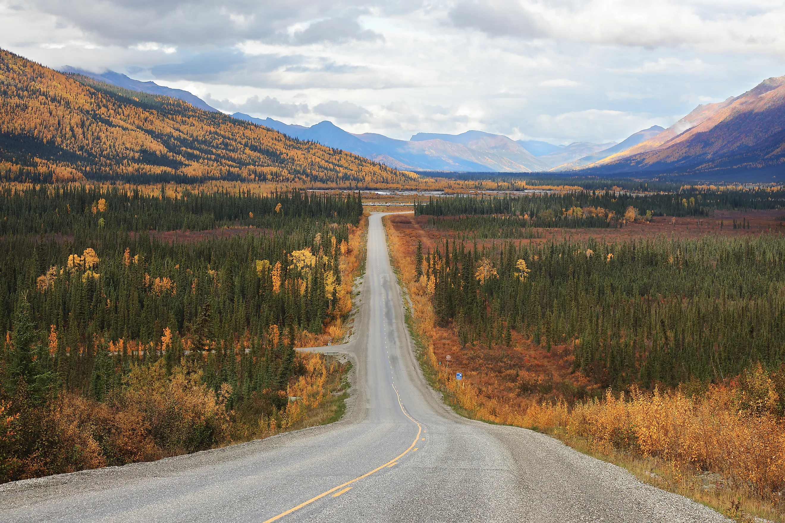
The landscape around the crossing still contains boreal forest. Continue north and the trees gradually thin. Mountains take over around the Brooks Range, followed by open tundra on the North Slope. The change is visible through the windshield over the course of a single drive. By the final approach to Deadhorse, trees have disappeared and the horizon opens across the Arctic coastal plain.
The Yukon River Crossing Comes First

Before reaching the Arctic Circle, drivers meet one of the largest rivers on the continent. The Dalton crosses the Yukon River at Mile 56 on a bridge built as part of the pipeline corridor. The river runs for nearly 2,000 miles through Canada and Alaska before emptying into the Bering Sea. At the highway crossing, its broad channel cuts through a region with almost no conventional roadside development.
Yukon Crossing is also one of the few places on the southern Dalton where motorists can buy fuel. Its importance becomes obvious on a road where towns do not appear every 20 or 30 miles. The next major service point is Coldfoot, more than 100 miles farther north. Past Coldfoot, even that sparse pattern disappears.
Atigun Pass Climbs To 4,739 Feet

Atigun Pass rises at Mile 244, roughly 69 miles north of Coldfoot. At 4,739 feet, it is the highest point on the Dalton Highway and the road's crossing of the Continental Divide. Streams on opposite sides of the pass ultimately drain toward different oceans. Water south of the divide moves toward the Bering Sea or Pacific drainage system, while water north of it heads toward the Arctic Ocean.
The climb also delivers some of the Dalton's hardest driving. Snow can fall at the pass during June or July, and winter storms can pile deep drifts across the road. Avalanche danger is another concern in the surrounding Brooks Range. The highway squeezes through steep mountain terrain here before dropping toward the broad North Slope. Dall sheep inhabit the rocky slopes, and motorists sometimes spot them above the road.
Large Sections Still Have Gravel Under The Tires

A route number does not guarantee Interstate-style pavement on the Dalton. Long sections remain gravel, and even paved stretches can deteriorate under heavy trucks and severe weather. Dry days bring dust and loose stone. Rain can turn unpaved portions slick. Potholes and road construction appear regularly, and sharp rocks pose a particular risk to tires.
Flat tires are serious this far from a repair shop. Alaska officials recommend a full-size spare and equipment capable of changing a tire without roadside assistance. Extra fuel and emergency supplies are standard preparation for the route. Rental cars require extra attention because some rental agreements ban Dalton Highway travel or exclude damage caused by gravel roads. A driver can reach the highway legally and still discover that the rental contract does not allow the trip.
Heavy Trucks Still Rule The Road

The Dalton never stopped being a working haul road. Tankers and tractor-trailers continue to supply Prudhoe Bay and other North Slope operations. Passenger vehicles are the visitors here. Truck drivers may travel much faster than tourists on sections they know well, and gravel thrown by large tires can crack windshields.
Alaska transportation guidance tells motorists to give trucks plenty of room and to keep headlights on. Passing can require patience because dust clouds sometimes reduce visibility on dry gravel. The combination of commercial traffic and long empty distances gives the Dalton a different rhythm from scenic highways built primarily around tourism. A roadside viewpoint may sit only a few miles from a convoy carrying equipment toward the oil fields.
There Are Almost No Towns North Of Coldfoot

The 239-mile fuel gap exists in a place with very few permanent settlements. Coldfoot itself is tiny. Nearby Wiseman has a small year-round population and traces its history to early twentieth-century gold mining. Once the highway climbs through the Brooks Range, there is no conventional chain of towns waiting on the other side.
Galbraith Lake provides a campground and access to the surrounding tundra, but it is not a roadside service town. The miles beyond cross broad stretches of public land and North Slope terrain before reaching Deadhorse. There are no suburban fringes slowly announcing the next community, no strip malls appearing ahead, and no sequence of convenience stores spaced along the route. Mile markers become more useful than town names.
The Road Ends Before The Arctic Ocean

Deadhorse arrives at Mile 414, surrounded by the industrial infrastructure of the Prudhoe Bay oil fields. The Arctic Ocean lies only a few miles beyond town, yet the Dalton does not continue as a public road to the shore. Access through the oil fields is controlled, and independent vehicles cannot drive directly to the coast.
Visitors who want to reach the ocean have to arrange an authorized tour through the restricted area. After nearly 500 road miles from Fairbanks, the final stretch is therefore completed in someone else's vehicle. The highway has already crossed the Yukon River, passed north of the Arctic Circle, climbed over the Brooks Range, and covered 239 miles beyond its last intermediate gas station. The public road ends at Deadhorse, with the Beaufort Sea still several miles ahead.
A Dalton Trip Starts With Preparation
Fairbanks to Deadhorse is roughly 500 miles by road, and the Bureau of Land Management estimates at least 13 hours of driving in good conditions. Few travelers should treat that figure as a target. Construction delays, weather, wildlife, tire trouble, and stops along the route can add hours. BLM recommends several days for a round trip to the northern end.
Cell service is unreliable across much of the highway, and emergency medical help may be far away. The practical decisions happen before leaving Fairbanks and again at Coldfoot, where a driver checks the vehicle, fills the tank, inspects the tires, and accounts for the distance ahead. North of Coldfoot, the odometer has to cover 239 miles before another public fuel pump appears in Deadhorse.