The Busiest Bridges In The United States
More than 100 million vehicles can cross a single US bridge in a year, but bridge traffic data needs careful reading. Toll agencies often count only the tolled direction, while highway departments may publish two-way average daily traffic. For that reason, each entry below identifies what the operating agency actually measured. The selection also focuses on major named crossings rather than short freeway structures that the Federal Highway Administration technically classifies as bridges. That keeps the comparison centered on recognizable crossings over the Hudson, Potomac, Delaware, San Francisco Bay, and New York Harbor, where heavy traffic and memorable views often occupy the same few miles of road.
George Washington Bridge, New York-New Jersey

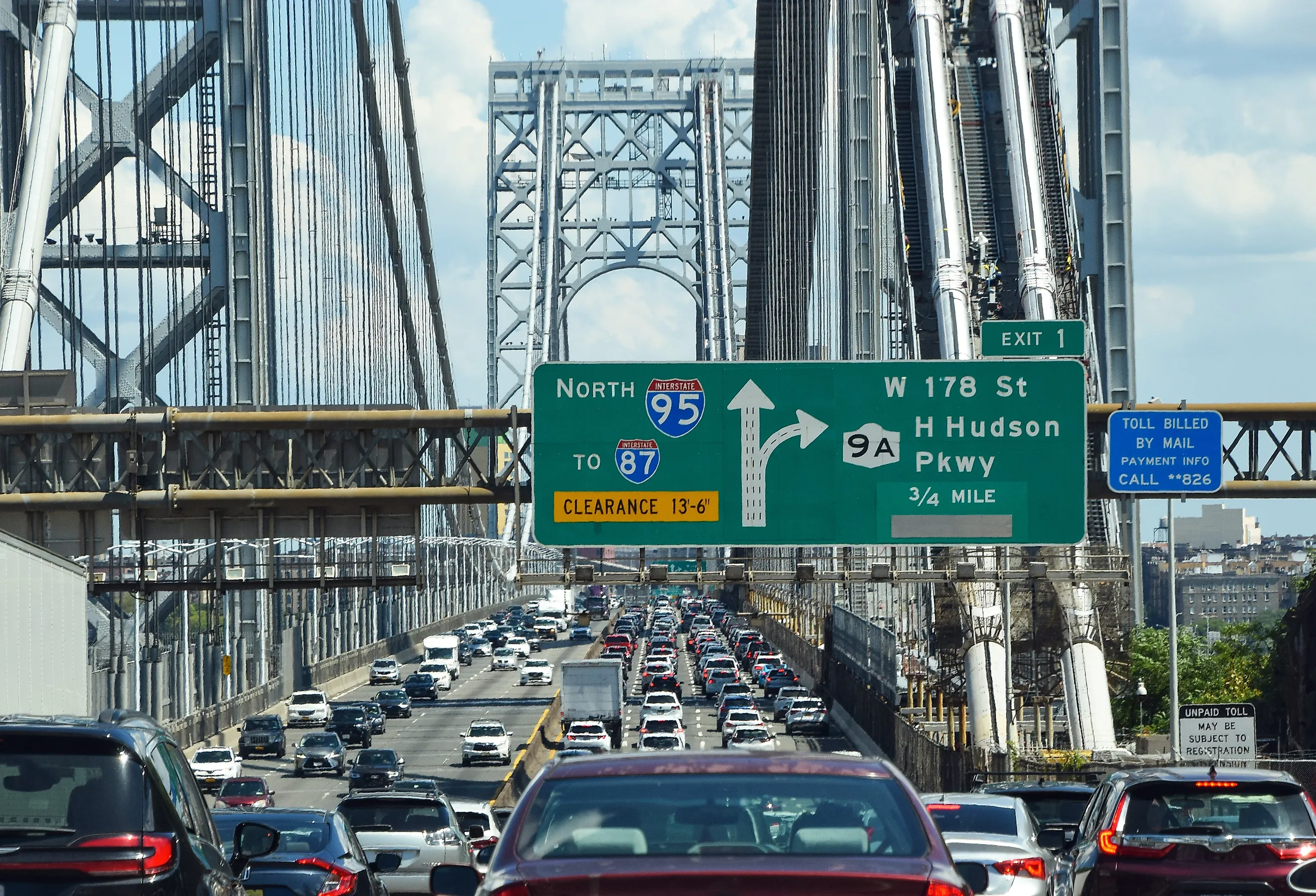
The George Washington Bridge occupies the most heavily used highway crossing of the Hudson River. The Port Authority of New York and New Jersey recorded 50,241,454 eastbound toll transactions in 2024, averaging more than 137,000 vehicles a day in the tolled direction. Federal Highway Administration studies using two-way counts have placed total daily traffic at roughly 275,000 to 300,000 vehicles. Interstate 95 reaches the bridge through Fort Lee, crosses into Upper Manhattan, and continues onto the Cross Bronx Expressway, bringing together commuter traffic, regional deliveries, and long-distance freight.
Two roadway levels stack those vehicles across the same span. The exposed steel towers rise more than 600 feet above the Hudson, and the New Jersey approach runs beside the Palisades. South-facing passengers can catch a short view downriver before the highway enters Manhattan and the bridge traffic spreads into the city street and expressway network.
Woodrow Wilson Memorial Bridge, Maryland-Virginia

Interstate 95 and the Capital Beltway share the Woodrow Wilson Memorial Bridge between Alexandria, Virginia, and Prince George's County, Maryland. Virginia Department of Transportation material has cited about 200,000 vehicles per day on the surrounding I-495 Southside corridor, with earlier bridge-specific counts reaching roughly 257,000. The flow combines Washington-area commuting with long-distance I-95 travel through the Mid-Atlantic. The current crossing consists of two parallel bridges carrying a total of 12 highway lanes. A bascule section can open for vessels that cannot clear the fixed span, an uncommon feature on a bridge carrying a major interstate. Westbound traffic reaches Alexandria immediately after the Potomac, and the Maryland approach passes National Harbor. For drivers who have spent miles inside the Capital Beltway, the river itself is unusually open, with long views across the water before the next interchange.
San Francisco-Oakland Bay Bridge, California

Metropolitan Transportation Commission data recorded 43,007,927 westbound toll crossings on the San Francisco-Oakland Bay Bridge in 2024, about 118,000 vehicles per day in the tolled direction. That was the highest total among California's seven state-owned Bay Area toll bridges. Eastbound vehicles are not included in that toll count, so the full two-way volume is considerably larger. The bridge carries Interstate 80 between Oakland and San Francisco, linking two of the region's largest employment centers.
Westbound drivers first cross the newer self-anchored suspension span to Yerba Buena Island. Interstate 80 then passes through the Yerba Buena Tunnel and continues over the older western suspension spans toward downtown San Francisco. MTC counted more than 47 million westbound crossings in 2019, meaning 2024 traffic had recovered substantially without reaching its pre-pandemic peak. The tunnel exit places the downtown waterfront directly ahead, a view that arrives only after several miles of open bay and bridge structure.
Verrazzano-Narrows Bridge, New York

At the entrance to New York Harbor, the Verrazzano-Narrows Bridge carries traffic between Staten Island and Brooklyn. The Metropolitan Transportation Authority recorded 80.3 million toll-paying vehicle crossings in 2023, about 220,000 per day on average and the highest total among MTA bridge and tunnel facilities.
Its 4,260-foot main span carries traffic on two roadway levels. The Staten Island Expressway feeds the western approach, and the Brooklyn side connects with the Gowanus Expressway and Belt Parkway. Those routes make the crossing important for trips between New Jersey, Brooklyn, and Long Island as well as local travel.
Passengers on the upper level can see across Lower New York Bay, including ships moving through the Narrows below. Each November, the New York City Marathon starts on the bridge, sending thousands of runners toward Brooklyn before the roadway returns to normal traffic.
Governor Mario M. Cuomo Bridge, New York

Nearly 60 million vehicles cross the Governor Mario M. Cuomo Bridge each year, according to the New York State Thruway Authority, which works out to roughly 164,000 trips per day. The twin cable-stayed spans cross the Hudson between Tarrytown and South Nyack and fully opened in 2018, replacing the Tappan Zee Bridge. Eight tapered towers support the roadway with 192 stay cables across a crossing about three miles long. The northern span also carries a 3.6-mile bicycle and pedestrian path. Thruway Authority figures show about 120,000 people used it in 2024. Six overlooks project toward the Hudson at intervals, giving walkers and cyclists places to stop above the river. Interstate 287 uses the bridge as part of an east-west route around the northern side of the New York metropolitan area, which accounts for much of its heavy daily traffic.
Ed Koch Queensboro Bridge, New York

NYC DOT reports an average of 129,874 motor vehicles per day on the Ed Koch Queensboro Bridge, along with 7,568 cyclists and 2,785 pedestrians. The bridge links East 59th Street in Manhattan with Long Island City in Queens. Opened in 1909, it uses a cantilever-truss design rather than the suspension system found on several other major New York crossings. Roosevelt Island lies directly beneath the central section and supports intermediate piers.
The two roadway levels are wrapped in a dense framework of steel that is easier to see from shore than from a moving car. Gantry Plaza State Park in Queens provides a broad side view, and Roosevelt Island brings visitors close to the piers from below. On the Manhattan end, traffic drops into Midtown East. In Queens, the approach reaches Long Island City, where newer residential towers stand beside older industrial buildings along the East River.
Golden Gate Bridge, California

The Golden Gate Bridge carries U.S. 101 between San Francisco and Marin County across the narrow entrance to San Francisco Bay. A 2024 U.S. Department of Transportation report cited about 114,400 vehicles per day and as many as 40 million crossings annually, including roughly 550,000 freight trucks.
Six traffic lanes handle that demand. The Golden Gate Bridge, Highway and Transportation District changes the lane configuration during the day with a movable median barrier. Four southbound lanes are normally provided for the weekday morning commute, then the balance shifts northbound later in the day. A specialized barrier-transfer vehicle moves the concrete-and-steel divider across the roadway.
Southbound drivers see San Francisco beyond the towers when visibility is good. The northern approach climbs toward the Marin Headlands, where Battery Spencer and nearby overlooks look back across the full span. Summer fog can cover the roadway or leave only the upper sections of the towers visible, so conditions at the same viewpoint can change substantially over the course of a day.
Walt Whitman Bridge, Pennsylvania-New Jersey

Delaware River Port Authority figures recorded 19.631 million westbound toll crossings on the Walt Whitman Bridge in 2024, the highest total among the authority's four bridges. DRPA collects tolls only from New Jersey into Pennsylvania, so that number does not include eastbound traffic. Interstate 76 follows the seven-lane suspension bridge between Gloucester City and South Philadelphia, serving commuters as well as drivers connecting Philadelphia with the New Jersey Turnpike and routes toward the Jersey Shore. The main span extends 2,000 feet across the Delaware River and clears the shipping channel used by commercial vessels. On the Pennsylvania side, I-76 reaches South Philadelphia near the city's stadium complex, where events can add substantial traffic to an already busy corridor. Passengers heading west can also see the Center City skyline before the roadway descends toward the city.
Brooklyn Bridge, New York

More than 140 years after opening, the Brooklyn Bridge still carries 103,051 motor vehicles on an average day, according to NYC DOT's 2024 count. The same count recorded 28,845 pedestrians and 5,504 cyclists. Trucks are prohibited, and a traffic lane was converted into a protected two-way bicycle path in 2021, leaving five lanes for cars.
People crossing on foot travel above the roadway on the elevated promenade, with moving traffic visible below and the East River beyond the cables. The granite towers frame Lower Manhattan in one direction and Brooklyn in the other. When the bridge opened in 1883, its 1,595.5-foot main span was the longest suspension span in the world. Current traffic numbers show that the bridge remains an everyday transportation route between two densely populated parts of New York, even as its pedestrian deck draws large numbers of visitors.
Delaware Memorial Bridge, Delaware-New Jersey

The Delaware River and Bay Authority reported 36.1 million two-way vehicle crossings on the Delaware Memorial Bridge in 2024, averaging just under 99,000 per day. Commercial traffic accounted for about 2.88 million toll transactions. Two suspension spans carry Interstate 295 and U.S. 40 between New Castle, Delaware, and Deepwater, New Jersey, placing the crossing on a major freight and passenger route through the Northeast.
Northbound traffic reaches the southern end of the New Jersey Turnpike soon after leaving the bridge. On the Delaware side, roads continue toward Wilmington, Baltimore, and the Delmarva Peninsula. The surrounding terrain is flat enough that the green towers appear well before drivers reach the river. From the span, the view includes tankers, port facilities, and the broad Delaware shipping channel. The original bridge opened in 1951, and a parallel span followed in 1968, allowing opposing directions of traffic to use separate structures.
What the Traffic Counts Mean
The busiest bridges in the United States show how much pressure a single river or bay crossing can absorb. New York dominates the group, but major links around San Francisco, Washington, Philadelphia, and the Delaware River carry similarly important regional and interstate traffic. Some handle well over 100,000 vehicles a day, while others move tens of millions in a single toll direction each year. Their traffic counts also explain why lane management, rehabilitation, and replacement projects matter so much. Closing even part of one of these crossings can affect commuters, freight routes, and surrounding highways for miles. For travelers, that infrastructure has a more visible side, since Hudson River panoramas, San Francisco Bay, the Golden Gate Strait, and New York Harbor all sit directly beneath roads used by enormous numbers of people every day.