8 Great Road Trips to Take in Upstate New York
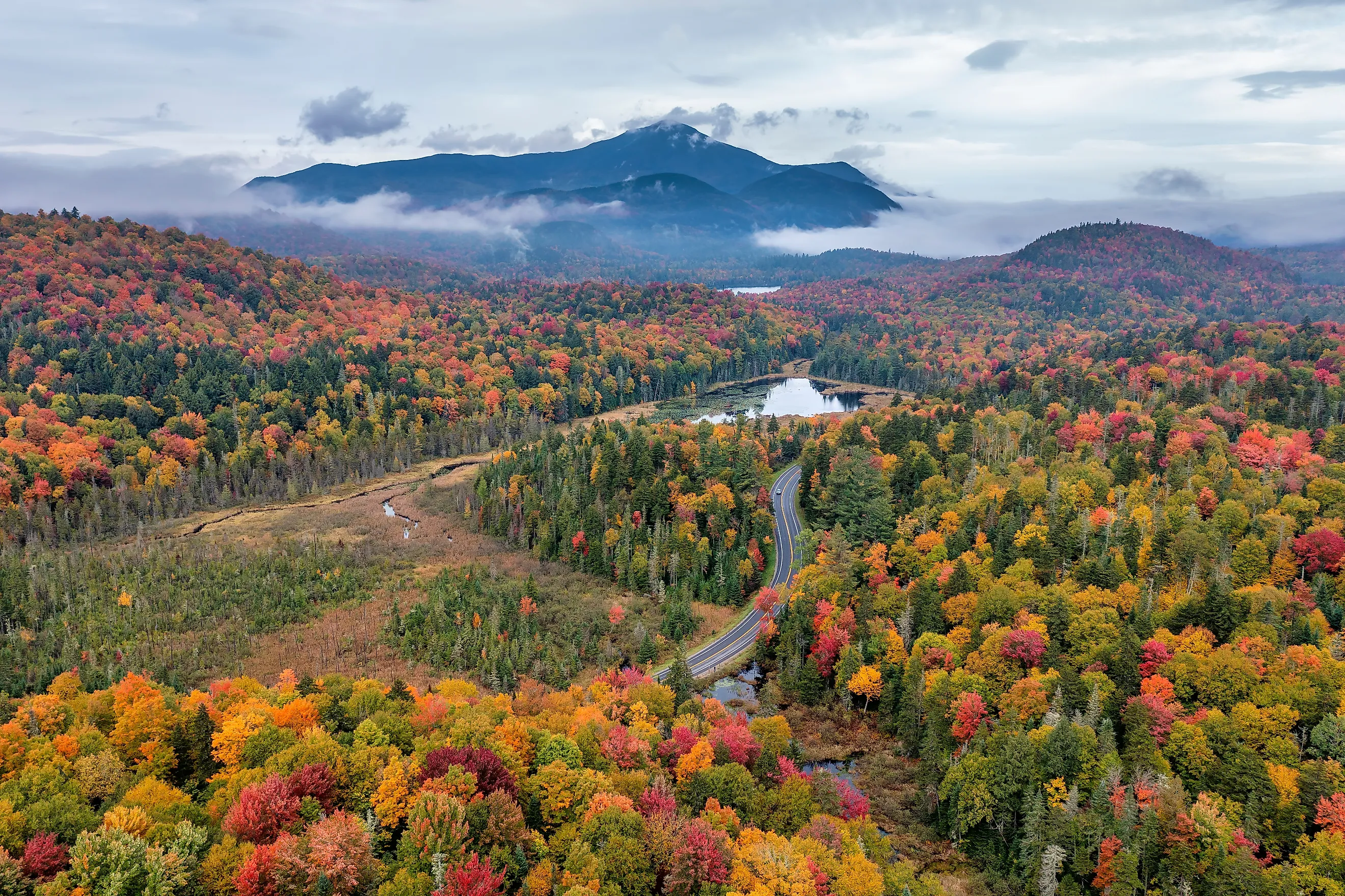
This time of year, a road trip through Upstate New York is practically mandatory for lucky locals and visitors in the know. Scenic byways showcase fall colors across the Adirondacks and Catskills, along the Delaware and St. Lawrence rivers, and on the shores of the Finger Lakes, Lake Champlain, and the Great Lakes. The 30-mile High Peaks Scenic Byway climbs Route 73 past Chapel Pond and Cascade Lakes on its way to Lake Placid. On the Upper Delaware Scenic Byway, NY Route 97 curves along the hillside above the Delaware River at Hawks Nest. The 87-mile Cayuga Lake Scenic Byway circles the lake past Taughannock Falls and the vineyards of the eastern shore. The Great Lakes Seaway Trail traces about 454 miles of shoreline, passing Niagara Falls and the Thousand Islands. Pick any of these eight road trips this season, and you'll see Upstate New York in all its glory.
High Peaks Scenic Byway: North Hudson to Lake Placid

The 30-mile High Peaks Scenic Byway follows NY Route 73 from the Adirondack Northway near North Hudson toward Lake Placid. The road climbs through the High Peaks region, passing Chapel Pond, Roaring Brook Falls, Johns Brook, and Cascade Lakes before reaching the Olympic Village. The terrain changes noticeably along the route, moving from lower forest and valley landscapes into tighter mountain corridors.
The short distance makes this an easy route to stretch into a full day without spending most of it behind the wheel. Stop at roadside pull-offs around Cascade Lakes and Chapel Pond, then continue toward Lake Placid for the Olympic sites and village center. This is a good choice when the idea is to experience a concentrated place of Adirondack mountain driving rather than cover hundreds of miles. Keep in mind that winter weather can make mountain roads slower and more difficult than the mileage suggests.
Olympic Byway: Sackets Harbor to Keeseville

For a much longer Adirondack drive, follow the Olympic Byway from Sackets Harbor on Lake Ontario to Keeseville near Lake Champlain. The roughly 170-mile route uses NY Routes 3, 86, and 9N, passing through Watertown, Cranberry Lake, Tupper Lake, Saranac Lake, Lake Placid, and Wilmington before reaching the Champlain Valley. The landscape changes considerably along the way, which is half the fun. The western section has broad forest and lake country, the middle reaches the Saranac Chain and central Adirondacks, and the eastern section becomes more mountainous around Lake Placid and Wilmington.
This is better treated as a two-day road trip than a quick scenic drive, especially if you want time outside the car. Tupper Lake makes a useful early stop, followed by Saranac Lake and Lake Placid, before the road continues through Wilmington and toward Keeseville. The route also passes through areas where services become less frequent, so filling up before longer stretches is practical. In warmer months, the combination of lakes, forest roads, and mountain communities makes the drive easy to divide into several stops, while fall brings heavier traffic around the Adirondacks' busiest leaf-peeping areas.
Adirondack Trail: Fonda to Malone

NY Route 30 provides one of the longer north-south drives through the Adirondacks, running roughly 188 miles from the Mohawk Valley near Fonda to Malone. The Adirondack Trail passes through Northville, Speculator, Indian Lake, Blue Mountain Lake, Long Lake, Tupper Lake, and Paul Smiths before leaving the Adirondack Park and continuing to Malone. Rather than concentrating on a single mountain pass, the route gradually winds through lakes, forests, small communities, and open stretches of Adirondack terrain.
The route works well for travelers who want a longer drive without repeatedly retracing the same roads. Northbound drivers can stop around Great Sacandaga Lake before reaching Northville and then continue into the more heavily forested central Adirondacks. Indian Lake and Blue Mountain Lake provide natural stops along the drive, while Long Lake and Tupper Lake offer additional services before the road continues north. Allow most of a day for the driving alone, or make it a weekend route if you want to hike, paddle, or spend time in the communities along the way.
Catskill Mountains Scenic Byway: Olive to Andes

The Catskill Mountains Scenic Byway follows NY Route 28 through the central Catskills, with extensions along Routes 42 and 214. The main corridor runs from the towns of Olive and Shandaken, through Phoenicia, Pine Hill, Margaretville, and toward Andes, covering roughly 65 miles, depending on which route section is counted. The road follows the Esopus Creek through the eastern Catskills before reaching the East Branch of the Delaware River farther west, with forested mountains and open farmland replacing one another along the drive.
This route is short enough for a day trip but has enough side roads and stops to keep it from feeling like a simple point-to-point drive. Phoenicia is a practical first break, followed by the Belleayre Mountain area and Margaretville, before the road reaches the higher viewpoints around Andes. A detour onto NY Route 214 leads toward Stoney Clove and connects with the Mountain Cloves Scenic Byway, while Route 42 provides another option through the western Catskills. The mountain roads can be slower than expected, particularly in winter, so the 65-mile distance should not be treated like a highway mileage estimate.
Upper Delaware Scenic Byway: Hancock to Port Jervis

NY Route 97 follows the Delaware River for one of the more characteristic drives in southeastern Upstate New York. The Upper Delaware Scenic Byway runs for roughly 70 miles between the Hancock area and Port Jervis, with the road staying close to the river through places such as Callicoon, Narrowsburg, and Barryville. Large rock formations, wooded hillsides, river bends, and open views replace the mountain scenery found farther north. The route is particularly recognizable around Hawks Nest, where Route 97 curves along the hillside above the Delaware.
The drive works best when treated as a river route rather than a race between the two endpoints. Narrowsburg is a useful stopping point, while the smaller communities farther north provide access to river activities and local roads. There are also several places where travelers can pull off for views or access the Delaware, although some recreation areas are seasonal. Because Route 97 remains a two-lane road for much of the trip, expect slower traffic around curves and in certain areas, especially on summer weekends.
Cayuga Lake Scenic Byway: Ithaca Loop

The Cayuga Lake Scenic Byway is an 87-mile loop around Cayuga Lake, starting in Ithaca and continuing through the Finger Lakes countryside to the lake's northern end. The route uses several state highways, including NY Routes 89, 34, 34B, 90, and portions of Routes 5 and 20. The southern end around Ithaca has steeper hills and more concentrated development, while the northern end opens into flatter farmland and wetlands around Seneca Falls, Union Springs, and the Montezuma National Wildlife Refuge.
The loop format helps on a road trip because travelers can choose how much time to spend outside the car without backtracking. Start in Ithaca, follow Route 89 along the western shore toward Taughannock Falls, then continue north toward Seneca Falls before crossing to the eastern side through the lake communities and vineyards. The entire loop can technically be driven in one day, but the byway organization recommends more time for stops. Fall weekends can bring heavier traffic on the lake roads, while summer offers easier access to parks, boat launches, and lakeside stops.
Lakes to Locks Passage: Waterford to Rouses Point

This route connects the Hudson River and the Champlain Valley, offering a long north-south drive through eastern New York. The designated corridor extends from Waterford through the Saratoga and Lake George region, past Fort Edward, Whitehall, Ticonderoga, Crown Point, Port Henry, Essex, Plattsburgh, and eventually Rouses Point. The route follows portions of US 4, NY 22, NY 9N, NY 9, and other connecting roads, linking the Upper Hudson, Champlain Canal, Lake George, and Lake Champlain.
Rather than driving the entire corridor in one push, divide it into sections based on the waterways and towns along the route. Waterford and the Champlain Canal provide the southern starting point, while Fort Ticonderoga and Crown Point mark the transition into the Lake Champlain corridor. Farther north, the road passes through lakeside communities such as Essex and continues toward Plattsburgh and Rouses Point. The route also involves ferry options around Lake Champlain, so travelers should check seasonal schedules before planning a crossing. With its mix of water views, rural roads, historic sites, and longer stretches between towns, this is one of the better choices for a multi-day drive in eastern New York.
Great Lakes Seaway Trail: Buffalo to the Thousand Islands

For a road trip centered on New York's northern shoreline, follow the Great Lakes Seaway Trail along Lake Erie, Lake Ontario, and the St. Lawrence River. The full New York portion exceeds about 454 miles from Ripley near the Pennsylvania border to Massena, passing through Buffalo, Niagara Falls, Rochester, Oswego, Sackets Harbor, Cape Vincent, Alexandria Bay, Ogdensburg, and other waterfront communities. The route shifts repeatedly between lakefront roads, agricultural country, larger cities, and river communities, making it extremely different from the mountain-focused drives farther inland.
Because of its length, the entire route is best handled as a multi-day trip rather than a single day's drive. A western section can combine Lake Erie communities with Buffalo and Niagara Falls, while an eastern section can concentrate on the Lake Ontario shoreline before reaching the Thousand Islands and St. Lawrence River. Cape Vincent and Alexandria Bay make natural breaks in the drive toward Ogdensburg and Massena. Travelers should also check current road conditions before leaving, since construction can affect sections of this long shoreline route.
Choosing Your Route Through Upstate New York
The strongest Upstate New York road trips are not necessarily the longest ones. A 30-mile mountain route such as the High Peaks Scenic Byway can provide a full day of driving and stops, while routes such as the Olympic Byway, Lakes to Locks Passage, and Great Lakes Seaway Trail work better when divided into multiple days. The common thread is that the roads connect distinct landscapes rather than simply linking a collection of attractions.
For a short mountain drive, the High Peaks or Catskill Mountains Scenic Byway are practical choices. The Cayuga Lake loop works well for a Finger Lakes weekend, while the Upper Delaware route keeps the focus on a river corridor. For a much longer trip, the Olympic Byway, Lakes to Locks Passage, Adirondack Trail, and Seaway Trail provide enough changes in terrain and communities to justify spending several days on the road rather than simply driving from one place to another.