7 Great Road Trips to Take in Michigan
Shaped by four Great Lakes and divided into two peninsulas, Michigan has one of the most extensive scenic driving networks in the Midwest. The state maintains 22 designated state and national scenic byways, many of which follow lake shorelines, such as Lake Michigan along the West Michigan Pike and Lake Huron along the Sunrise Coast Heritage Route. Along the ride, expect to pass dune fields at places like Warren Dunes and Sleeping Bear Dunes and major landmarks including Pictured Rocks and the Mackinac Bridge. The following seven routes highlight some of Michigan’s most rewarding road trips, each presented as a clear point-to-point drive with optional extensions and connecting segments.
West Michigan Pike Historic Byway (US-31): Warren Dunes State Park to Grand Haven

The western edge of Michigan's Lower Peninsula contains one of the largest freshwater dune systems in the world, along with a string of established beach towns along Lake Michigan. One of the most direct ways to experience this shoreline is by driving the West Michigan Pike Historic Byway, a section of US-31 that follows the lake north from the Indiana state line.
For this route, begin at Warren Dunes State Park, where dunes rising up to 260 feet overlook three miles of Lake Michigan shoreline. The park’s trail network winds through forests and boardwalk wetlands before reaching open sand ridges that offer wide views of the lake. Leaving the park, US-31 runs north along the shoreline, with frequent state park entrances, beach access points, and lake overlooks appearing along the route.

The highway first reaches St. Joseph, where the St. Joseph River enters Lake Michigan beside a lighthouse-lined pier and harbor. Continuing north, the drive passes orchards and marinas before arriving in South Haven, another lakefront community with public beaches and a historic harbor district. Farther along, the road approaches Saugatuck, where dune ridges and the Kalamazoo River shape the surrounding landscape.
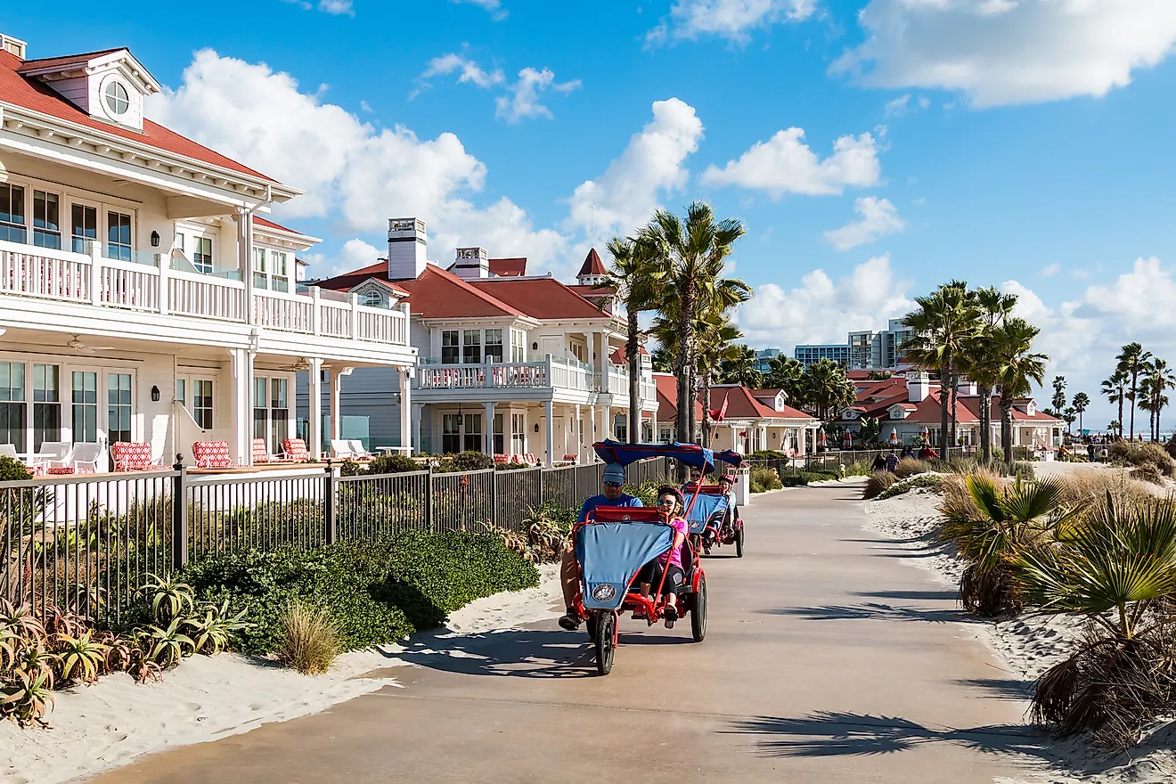
The final stretch moves through Holland, known for its Dutch heritage and large spring tulip plantings, before ending at Grand Haven, where the Grand River meets Lake Michigan beside a long pier and lighthouse. The towns along this section of US-31 are typically 10 to 30 miles apart, making the byway easy to explore with short stops at beaches, parks, and roadside overlooks along the lake.
Leelanau Scenic Byway (M-22): Empire to Traverse City via Sleeping Bear Dunes

This Lake Michigan road trip follows M-22 along the Leelanau Scenic Byway, combining the region’s largest dune landscapes with working harbors and vineyard country. The drive begins at the Philip A. Hart Visitor Center in the village of Empire, the main gateway to Sleeping Bear Dunes National Lakeshore, a 35-mile stretch of protected shoreline.
From Empire, M-22 passes several of the national lakeshore’s most accessible roadside stops. Just north of town, the Pierce Stocking Scenic Drive branches off for a 7.4-mile loop through forest and dune overlooks above Lake Michigan. A few miles farther along, the Dune Climb provides access to the park’s interior dune plateau, while nearby Glen Haven preserves the restored buildings of a former 19th-century shipping village.

Beyond the lakeshore, M-22 continues 21 miles along the Leelanau Peninsula, where the landscape shifts from open dunes to fishing harbors and farmland shaped by Lake Michigan’s lake-effect climate. One of the most notable stops is Leland, where the Historic Fishtown preserves the weathered docks, shanties, and smokehouses of the region’s commercial fishing industry.
The route eventually reaches Traverse City, where the Leelanau Peninsula meets the two arms of Grand Traverse Bay. Drivers with extra time can continue along the Old Mission Peninsula Byway (M-37), a 17-mile drive extending north between the bays to Old Mission State Park and the Mission Point Lighthouse, built in the 1870s.
Sunrise Coast Heritage Route (US-23): Standish to Mackinaw City

The Sunrise Coast Heritage Route (US-23) follows Lake Huron’s east-facing shoreline from the top of Saginaw Bay to the Straits of Mackinac. Known as Michigan’s “Sunrise Coast,” this stretch of shoreline is quieter than the state’s Lake Michigan coast and passes through forests, wetlands, and small harbor communities over the course of roughly 200 miles across six counties.
The drive begins in Standish, where US-23 meets the shoreline of Saginaw Bay before turning north toward open Lake Huron. From there, the highway runs close to the water for long stretches, with public forests and protected wetlands often appearing on the inland side of the road while wide views of the lake open to the east.

One of the most concentrated sections of the route lies between Tawas City and Alpena, a 65-mile stretch that includes several coastal towns and state parks. In Tawas City, the road passes near Tawas Point State Park, sometimes called the “Cape Cod of the Midwest” for its sandy point and historic lighthouse. Continuing north, US-23 reaches Oscoda before following the shoreline past Harrisville State Park, one of the few state parks directly on Lake Huron with beach access from the highway.
Farther along the route, Sturgeon Point State Park preserves a historic lighthouse complex that includes the keeper’s house and a restored one-room schoolhouse. The drive eventually arrives in Alpena, where the Great Lakes Maritime Heritage Center interprets the shipwreck history of Lake Huron. From Alpena, US-23 continues north along the shoreline to Mackinaw City, where the route meets the Straits of Mackinac and connects with the next section of the journey.
Mackinac Island Loop via Mackinac Bridge and Lake Shore Drive

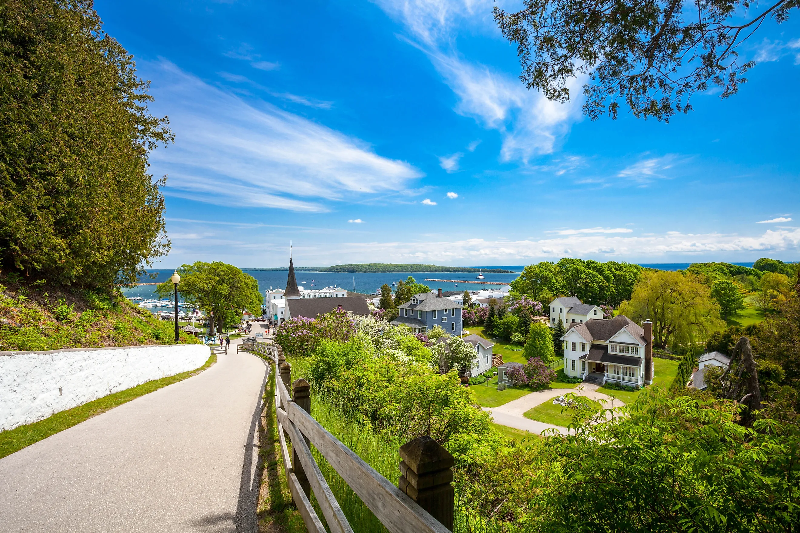
This route combines a short ferry crossing with a non-motorized circuit of Mackinac Island, followed by a drive across the Mackinac Bridge into Michigan’s Upper Peninsula. After parking in Mackinaw City, a 20-minute ferry crosses the Straits of Mackinac to the island, located between Lake Huron and Lake Michigan.
Ferry docks arrive in the village of Mackinac Island, where motor vehicles are prohibited. The island’s main travel corridor is Lake Shore Drive, an 8.2-mile paved perimeter road that circles the shoreline and provides access to Mackinac Island State Park, which covers most of the island’s interior. The route passes Victorian-era hotels, the harborfront business district, and Fort Mackinac, positioned on a bluff above town.

Travel around the island typically takes place by bicycle or horse-drawn carriage, both of which follow the perimeter road. The route passes several well-known natural landmarks including the Devil’s Kitchen sea caves, the limestone arch known as Arch Rock, forested sections of shoreline, and interpretive stops explaining the island’s geology and history.
Returning to the mainland by ferry, the route continues across the Mackinac Bridge, commonly called “Mighty Mac.” Spanning roughly five miles across the Straits of Mackinac, the suspension bridge connects Mackinaw City in the Lower Peninsula with St. Ignace in the Upper Peninsula. Crossing the bridge provides wide views of the straits and marks the transition into Michigan’s Upper Peninsula for the next section of the journey.
Lake Superior Shoreline Drive (H-58 / M-28 / US-41): Grand Marais to Marquette via Pictured Rocks

After crossing the eastern portion of Michigan’s Upper Peninsula, this route follows the Lake Superior shoreline west from Grand Marais to Marquette. Lake Superior is the largest and northernmost of the Great Lakes, and this stretch of coastline has a noticeably quieter and more remote character. The drive covers roughly 90 miles, linking forested shoreline, national lakeshore landmarks, and working harbor infrastructure.
The first segment runs through the drivable portion of Pictured Rocks National Lakeshore, a 42-mile protected shoreline known for its colorfully striated sandstone cliffs. Leaving Grand Marais, drivers follow H-58 west toward Munising, passing the Grand Sable Visitor Center and the Grand Sable Lake Scenic Overlook, where dune ridges rise above inland lakes. A short trail from the nearby parking area leads to the Au Sable Light Station, built in 1874, which overlooks the open waters of Lake Superior. Continuing toward Munising, the route passes trailheads connected to the North Country Trail, which runs through large sections of the lakeshore. Just outside town, a short walk from the parking area leads to Munising Falls, a 50-foot waterfall located within the national lakeshore boundary.

From Munising, the drive transitions onto M-28, which follows Lake Superior’s southern shoreline west. Roadside turnouts appear frequently along this section, providing access to narrow beaches backed by conifer forest and dune grass. The route eventually intersects US-41, where drivers turn north toward Marquette.
Before entering the downtown area, Lakeshore Boulevard branches off toward the waterfront and Presque Isle Park, a peninsula park with shoreline views and a scenic loop drive. Nearby stand Marquette’s large ore docks, historic loading structures that once transferred iron ore from rail lines to Great Lakes freighters and remain one of the city’s most recognizable waterfront landmarks.
Copper Country Trail National Byway (US-41): Houghton to Copper Harbor

Portage Canal Lift Bridge. Photo: Andrew Douglas
The Keweenaw Peninsula can be explored through two distinct drives: one focused on the region’s mining history and another highlighting its shoreline scenery. First up, let's take a straight-shot tour of the 47-mile section of US 41 known as the Copper Country Trail National Byway.
The route begins in Houghton, crossing the Portage Canal Lift Bridge into Hancock. The double-decked lift bridge, often described as the world’s widest and heaviest double-decked lift bridge, spans the Portage Canal between two cities that were major centers of the 19th-century copper mining boom. Just north of the bridge, the first major historic stop appears at Quincy Mine, where preserved surface structures overlook the canal. Visitors can explore the above-ground facilities or join a guided underground tour that explains how copper was extracted during the region’s mining era.

About 10 miles farther north, US-41 reaches Calumet, a community once at the center of the Keweenaw’s copper industry. The town is home to the Keweenaw National Historical Park Visitor Center, which interprets the area’s industrial past. Many of Calumet’s large brick and stone buildings remain intact, reflecting the scale of the region’s mining economy during the late 1800s.
Continuing north on US-41, the Delaware Mine offers another preserved mining site before the highway enters an 18-mile stretch of forest canopy, designated a Scenic Heritage Route, leading toward Copper Harbor. This final section winds through dense forest before reaching the peninsula’s northern tip. At the end of the route, Fort Wilkins Historic State Park preserves a reconstructed 1840s military outpost built to maintain order during the early copper rush. Just beyond the fort stands the northern terminus marker for US-41, marking the end of a highway that begins more than 1,900 miles to the south in Miami, Florida.
Keweenaw Scenic Route (Brockway Mountain Drive & M-26 Lakeshore Drive): Copper Harbor to Houghton

The Keweenaw Peninsula is more than a collection of historic mining sites. It is also a quiet landscape of forests, coves, and small shoreline villages. This return drive from Copper Harbor follows several scenic spurs before reconnecting with the peninsula’s main highway. From the east end of Copper Harbor, take Manganese Road south for about 2.5 miles to reach Estivant Pines Nature Sanctuary, where loop trails pass through some of Michigan’s last remaining old-growth white pine stands.
After returning to town, the route continues to the west side of Copper Harbor and climbs Brockway Mountain Drive, a ridge-top road that winds toward the summit of Brockway Mountain. From the overlook, wide views extend across Lake Superior and the surrounding second-growth forests that now dominate this former logging region.

Descending the mountain, the route joins the Lakeshore Drive Spur (M-26), which follows the shoreline as an alternative to US-41. The road passes small harbor communities and several historic maritime sites, including the lighthouse facilities at Eagle Harbor. A few miles farther south, Eagle River marks another stop along the route, where the town’s namesake waterfall and small museum sit near the shoreline.
Continuing south on M-26, the drive eventually reconnects with US-41 near Calumet. From there, drivers can return to Houghton along the Copper Country Trail National Byway, or follow M-203 to McLain State Park, where the road runs along the Portage Canal before rejoining the main highway near Houghton.
From the wild forests of the Upper Peninsula to the sandy shores of the Lower Peninsula, Michigan offers some of the Midwest’s most rewarding road trips. These seven routes highlight both the state’s famous destinations and its quieter corners, places where lighthouses, dunes, vineyards, and historic towns unfold mile by mile. As warmer weather returns and seasonal roads reopen, the only thing left to do is pick a direction and start driving.