6 Best Natural Wonders To Visit In Tennessee This Year
Tennessee runs more than fifty state parks. A handful of them protect natural features that hold up against anything else in the eastern United States. Deep gorges cut into the Cumberland Plateau. Underground lakes sit at the bottom of cave systems like the Lost Sea. Cypress trees rise out of shallow water at Reelfoot Lake. Timing matters since water levels and foliage change what you can see from one season to the next.
Great Smoky Mountains National Park

Straddling the Tennessee-North Carolina border, Great Smoky Mountains National Park was established on June 15, 1934 and dedicated by President Roosevelt in 1940. The park was built from land bought up by state lawmakers, local families, and conservation groups working to keep the southern Appalachians out of the hands of timber companies. Much of that Appalachian heritage is still visible today. Worn churches sit beside gravel roads in Cades Cove, and historic cabins are set deep in the hills around Cataloochee on the North Carolina side.
The Roaring Fork Motor Nature Trail keeps a quieter feel than other parts of the park. Higher up, Kuwohi (the 6,643-foot peak formerly named Clingmans Dome, restored to its Cherokee name in September 2024) is the highest point in Tennessee and the third-highest east of the Mississippi. Its observation tower runs a half-mile walk from the parking area to a 360-degree view of the surrounding mountains. October draws the heaviest leaf-peeping crowds, but late April and early May bring wildflowers, with the park's Spring Wildflower Pilgrimage in late April running guided walks through some of the most diverse temperate plant communities in the country.
Fall Creek Falls

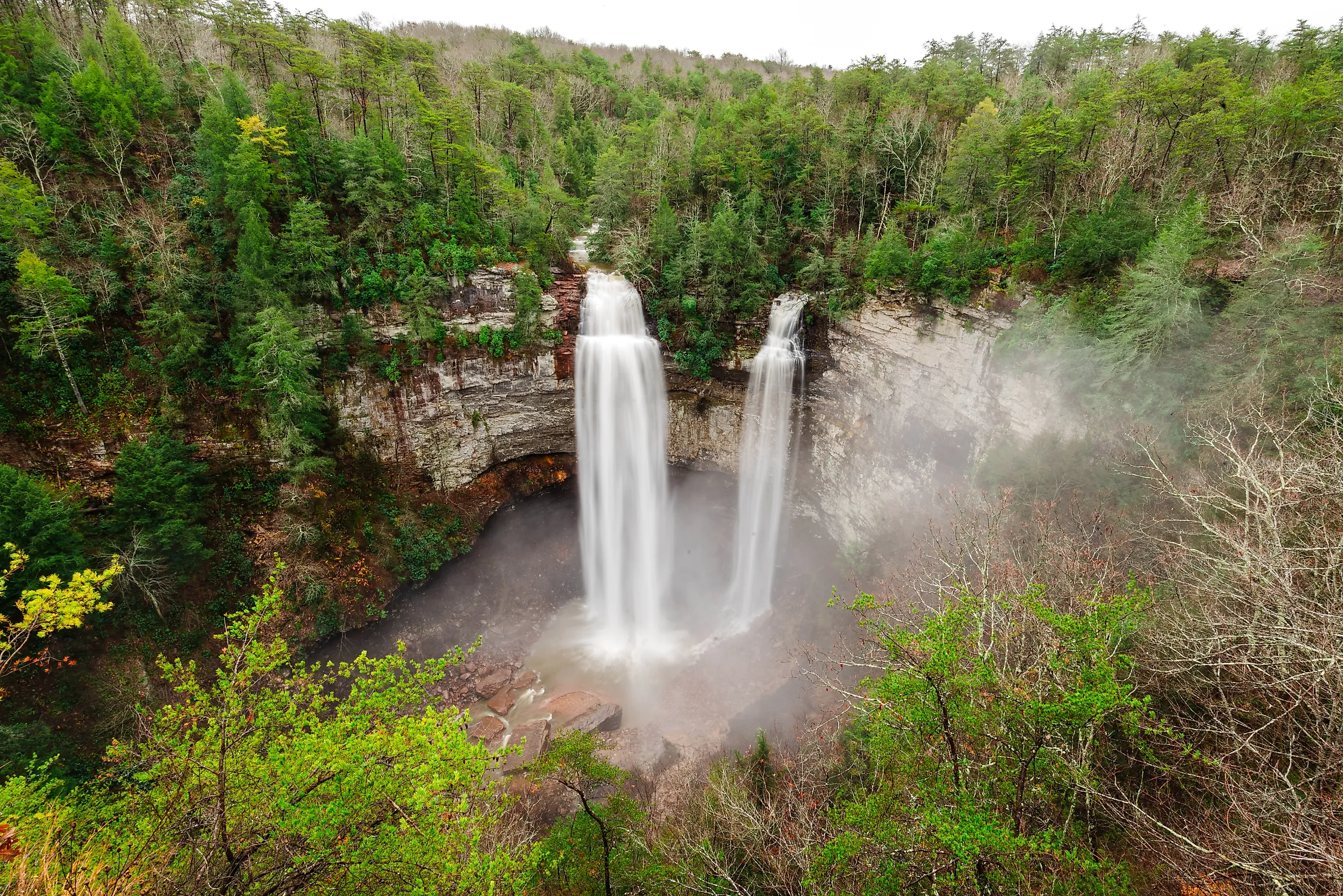
Fall Creek Falls drops 256 feet in a single sheer plunge, making it the highest free-fall waterfall east of the Mississippi River. The scale of the drop only registers when you stand at the rim and look straight down into the gorge. Fall Creek Falls State Park covers about 30,000 acres on the western edge of the Cumberland Plateau and got its start in 1935 when the federal government began buying up the badly eroded land. The Civilian Conservation Corps and Works Progress Administration built the original park facilities through the New Deal during the Great Depression, and the state took over management in 1944.
The main overlook sits a short walk from the parking area, but the steeper trail down to the base gives the unobstructed view of the full drop into the plunge pool. Cane Creek Falls (85 feet), Rockhouse Falls (125 feet), and Piney Creek Falls (95 feet) round out the park's signature seven cascades. The suspension bridge over Cane Creek and the paddle access to the 345-acre Fall Creek Falls Lake give visitors something to do when the falls themselves are running low. October through early November lights the surrounding hardwood forest in full fall color.
The Lost Sea

The Lost Sea sits at the bottom of Craighead Caverns near Sweetwater, about 50 miles south of Knoxville. The lake measures 4.5 acres at its visible surface (800 by 220 feet), but divers have mapped passages well beyond that. It is the largest underground lake in America and the second-largest non-subglacial underground lake in the world. The cave system has been used in turn by the Cherokee (whose council room sits about a mile from the entrance), 19th-century settlers who stored vegetables in the 58-degree chambers, and Confederate soldiers who mined saltpeter for gunpowder during the Civil War. Carbon-dated 1863 graffiti from those miners is still visible on the cave walls.
The standard guided tour runs about an hour and fifteen minutes, covering three-quarters of a mile round-trip and ending with a glass-bottom boat ride across the lake itself. The lake was discovered in 1905 by a 13-year-old local named Ben Sands, who crawled through a small opening into a chamber his lantern could not light up. Rainbow trout glide under the boat (introduced by tour operators, not native to the cave). Weekday spring visits avoid the summer school-group crowds.
Big South Fork National River and Recreation Area

Congress established Big South Fork on March 7, 1974 to protect a free-flowing stretch of the Big South Fork of the Cumberland River from upstream dam projects. The area covers 125,310 acres across northeastern Tennessee and southeastern Kentucky, taking in Scott, Fentress, Pickett, and Morgan counties on the Tennessee side and McCreary County to the north. Old coal-mining towns and abandoned logging camps sit just off the trails, where the sandstone gorges drop as much as 600 feet to the river below.
The Twin Arches Loop reaches two of the largest natural sandstone arches in the eastern United States: the South Arch spans 135 feet with a 70-foot clearance, and the North Arch spans 93 feet with a 51-foot clearance. The Angel Falls Overlook Trail looks down on a bend in the river from the rim. On the Kentucky side, the Yahoo Falls Trail drops via steel staircase to the base of a 113-foot drop. Mid-October weather and the start of the hardwood color change make the rim trails especially worthwhile.
Reelfoot Lake

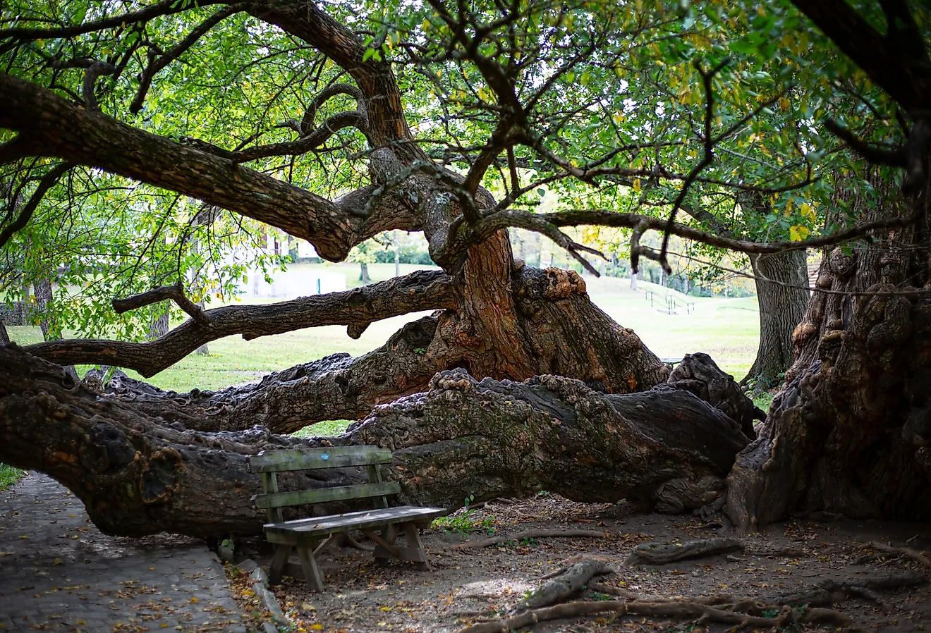
Reelfoot Lake is Tennessee's only natural lake, created when the New Madrid earthquakes of December 1811 through February 1812 reshaped this corner of the state. The February 7, 1812 quake temporarily reversed the Mississippi River and dammed the Reelfoot River, flooding a cypress forest in northwest Tennessee. The drowned trees still rise from the water today, with their roots winding through channels passable only by small boat or kayak. Rentals leave from Blue Bank Resort, and crappie fishermen drop lines next to the submerged stumps. The Reelfoot Lake Boardwalk runs low platforms among the cypress on the south shore.
The lake covers about 15,000 acres and supports one of the largest wintering populations of bald eagles in the country, with more than 200 birds on the lake from December through February. The state park runs guided eagle bus tours in January and February. The annual Eagle Festival in early February draws birders nationwide. Late-afternoon light around Samburg, on the lake's northeast shore, makes for the best photography conditions when the sun drops behind the cypress.
Savage Gulf State Park

Savage Gulf became Tennessee's 57th state park in September 2022, after it split off from South Cumberland State Park (which had grown unmanageably large). The 19,000-acre park protects some of the deepest gorges on the Cumberland Plateau, plus an old-growth forest that escaped the logging era because the slopes were too steep for crews to work. Two hours southeast of Nashville, the park has main access points at the Stone Door Ranger Station near Beersheba Springs and at Greeter Falls near Altamont.
The Great Stone Door is the headline destination, a 10-foot-wide crack splitting 100 feet from the top of the escarpment to the gorge below, which Native travelers once used as a passageway through the cliff line. The Greeter Falls Loop drops down a spiral staircase to the lower falls. The Savage Day Loop crosses a suspension bridge over Boyd Branch on a longer route. September through November runs cooler trail temperatures and full fall color across the gorges.
Six Wonders, Six Reasons To Get Outside
Tennessee has many natural features, but these six stand out. Great Smoky Mountains National Park anchors the east on its border with North Carolina. Fall Creek Falls and Savage Gulf run the Cumberland Plateau's two deepest gorge systems. The Lost Sea takes the underground angle. Big South Fork combines river running, sandstone arches, and the Kentucky border country. Reelfoot Lake in the far northwest holds the cypress and the wintering eagles. Each works best in a different season, so the calendar matters as much as the map.