The National Parks That Are Bigger Than Some States
Some US national parks occupy enough territory to rival entire states. The comparison is especially striking in Alaska, where vast protected landscapes encompass whole mountain systems and river basins and glaciers and forests and tundra.
Wrangell-St. Elias alone covers more ground than Maryland, Hawaii, Massachusetts and six others! Yet enormous parks are not limited to Alaska. Death Valley and Yellowstone also exceed at least one state in total area, as do Everglades and Grand Canyon and Glacier. Using total area for both parks and states produces a consistent comparison. That standard identifies 12 of the 63 US national parks as larger than at least one state. Glacier National Park barely clears the threshold, while Olympic National Park falls just short.
Wrangell-St. Elias National Park & Preserve, Alaska

At roughly 20,587 mi2, Wrangell-St. Elias is so large that comparing it with individual states gives a better sense of its scale than comparing it with most other parks. The protected area is larger than nine states, including Maryland, Hawaii, Massachusetts, and Vermont. Only when the comparison reaches West Virginia, with more than 24,000 mi2 of total area, does the state become larger. The park spans an immense section of southeastern Alaska where the Wrangell, St. Elias, Chugach, and Alaska mountain systems converge. Its boundaries contain glaciers, ice fields, volcanic peaks, river valleys, coastal environments, and some of North America's highest mountains. Wrangell-St. Elias demonstrates how differently federal conservation developed in Alaska, where protected areas were drawn across ecological systems measured in millions of acres rather than around individual scenic landmarks.
Gates of the Arctic National Park & Preserve, Alaska

There are no roads leading into Gates of the Arctic, despite the park covering approximately 13,238 mi2. That area exceeds the total size of Maryland and eight other states. Located almost entirely north of the Arctic Circle, the park stretches across the central Brooks Range, where mountain ridges divide waters flowing toward the Arctic Ocean from those draining south and west. Its geography includes broad tundra valleys, boreal forest, alpine terrain, rivers, lakes, and glaciated mountains. The absence of major developed infrastructure makes its enormous size particularly consequential: most travel requires aircraft, hiking, or river transport. Rather than preserving a heavily managed recreational landscape, Gates of the Arctic protects a largely intact Arctic ecosystem in which natural processes operate across an area larger than several densely populated states in the eastern United States.
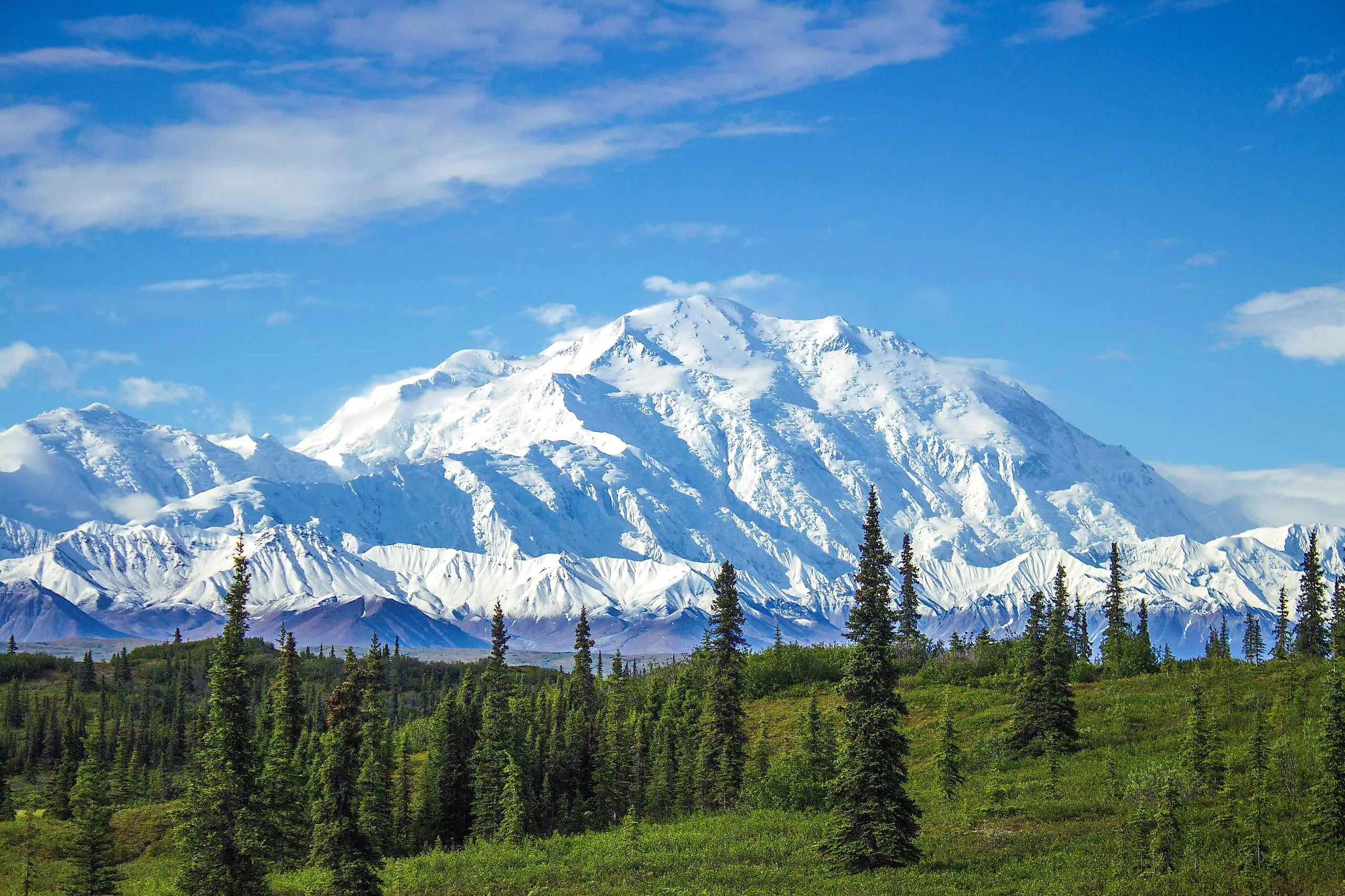
Denali National Park & Preserve, Alaska

Denali sits near an unusual statistical boundary. Its approximately 9,492 mi2 make it larger than New Hampshire, whose total area is about 9,349 mi2, but smaller than Vermont at roughly 9,616 mi2. The result places five states below Denali in size: Rhode Island, Delaware, Connecticut, New Jersey, and New Hampshire. The park's territory extends far beyond the mountain that gives it its name. Elevation changes from low forested valleys to alpine tundra and the permanently snow-covered Alaska Range, culminating at 20,310-foot Denali, the highest summit in North America. Such extreme changes in elevation compress multiple climate and ecological zones into one protected area. Large mammals including caribou, moose, Dall sheep, wolves, and grizzly bears occupy portions of a landscape whose dimensions are comparable to an entire small state.
Katmai National Park & Preserve, Alaska

Katmai's approximately 6,395 mi2 are larger than Connecticut, Delaware, and Rhode Island, but its scientific significance comes from an event far more concentrated in space. In June 1912, Novarupta produced the largest volcanic eruption of the 20th century, covering the surrounding landscape with ash and creating what became known as the Valley of Ten Thousand Smokes. Katmai National Monument was established partly to protect this extraordinary volcanic terrain before later expansion and redesignation produced today's national park and preserve. The resulting protected area now encompasses volcanoes, lakes, rivers, tundra, coastline, and major brown bear habitat. Brooks River became internationally known for bears catching migrating salmon, but the park's origins remain rooted in geology. Its state-sized dimensions preserve both an active volcanic landscape and the watersheds supporting one of Alaska's most famous concentrations of wildlife.
Lake Clark National Park & Preserve, Alaska

Lake Clark covers approximately 6,297 mi2 at a geographical transition zone between Southcentral and Southwest Alaska. That places it above Connecticut in total area, as well as Delaware and Rhode Island. Its boundaries encompass an unusually varied combination of volcanic mountains, glaciers, tundra, boreal forest, coastal environments, rivers, and large lakes. Two active volcanoes, Redoubt and Iliamna, rise within the region, while water from the park feeds systems connected to Bristol Bay. That hydrological connection gives Lake Clark significance well beyond its administrative boundaries because Bristol Bay supports some of the world's most important wild sockeye salmon runs. The park therefore illustrates a major advantage of conservation at very large scales: upland watersheds, spawning habitat, lakes, rivers, and coastal ecosystems can remain connected rather than being managed as isolated natural features.
Death Valley National Park, California and Nevada

Death Valley is the largest U.S. national park outside Alaska, covering approximately 5,270 mi2 across California and a small portion of Nevada. It is larger than Delaware and more than three times the total area of Rhode Island. Unlike the huge northern parks dominated by glaciers and tundra, Death Valley protects one of the driest and hottest landscapes in North America. Its terrain ranges from Badwater Basin, 282 feet below sea level, to high mountain summits separated by enormous desert valleys. That vertical range creates major differences in temperature, precipitation, vegetation, and habitat within the same park. The region also records an unusually detailed geological history through exposed sedimentary rocks, faulting, volcanic deposits, salt flats, alluvial fans, and eroded mountain ranges. Its immense footprint makes desert processes visible on a scale rarely protected elsewhere in the contiguous United States.
Glacier Bay National Park & Preserve, Alaska

Much of Glacier Bay's approximately 5,126 mi2 is defined by the interaction between land, ice, and ocean. The park exceeds both Rhode Island and Delaware in total area and includes fjords, coastlines, mountains, temperate rainforest, glaciers, and marine waters. Its modern landscape is geologically young. During the Little Ice Age, ice filled much of Glacier Bay, but extensive retreat over the last several centuries exposed new land that plants and animals progressively recolonized. Scientists have therefore used the region to study ecological succession following glacial retreat. The park also protects tidewater glaciers that terminate directly in marine environments, where freshwater, sediment, nutrients, and ice influence coastal ecosystems. Its great size matters because the ecological story does not stop at the shoreline: terrestrial and marine systems operate together across a protected landscape larger than two U.S. states.
Yellowstone National Park, Wyoming, Montana, and Idaho

Yellowstone's approximately 3,472 mi2 make it larger than Rhode Island and Delaware individually, although not larger than their combined total area. Its physical dimensions are closely tied to the enormous volcanic system beneath the park. Yellowstone occupies much of a volcanic plateau shaped by immense eruptions, lava flows, earthquakes, uplift, erosion, and hydrothermal activity. The park contains more than 10,000 hydrothermal features, including geysers, hot springs, mudpots, and fumaroles, supported by heat remaining beneath the Yellowstone Caldera. Its size also provides habitat for wide-ranging animals such as bison, elk, grizzly bears, wolves, and pronghorn. Established in 1872, Yellowstone became the first U.S. national park, but the scale of the protected area was unusual from the beginning. Its boundaries encompass not simply individual attractions but watersheds, wildlife ranges, forests, plateaus, lakes, and geothermal systems.
Kobuk Valley National Park, Alaska

Kobuk Valley crosses a striking threshold at approximately 2,735 mi2: it is larger than Delaware, but only by about 246 mi2. The park lies in northwestern Alaska above the Arctic Circle and protects a broad section of the Kobuk River valley. One of its most distinctive features is the Great Kobuk Sand Dunes, where large deposits of glacially derived sand accumulated and were reshaped by wind. These dunes appear almost anomalous within an Arctic landscape, yet they are the product of processes operating since the end of the last ice age. The region is also part of a major migration corridor used by the Western Arctic Caribou Herd. Hundreds of thousands of caribou may move across the broader ecosystem during seasonal migrations. Kobuk Valley's scale therefore protects both unusual geomorphology and the open landscape required by one of North America's great terrestrial migrations.
Everglades National Park, Florida

Everglades National Park reaches roughly 2,410 mi2, putting it well above Rhode Island but just below Delaware. Unlike most parks on this list, its defining characteristic is not mountainous relief but extremely shallow gradients. Water historically moved slowly southward across the South Florida landscape in a broad sheet, creating interconnected sawgrass marshes, sloughs, mangrove forests, freshwater wetlands, and estuarine environments. Small changes in elevation can determine how long an area remains flooded and which plant communities develop there. The park represents the southern portion of the greater Everglades ecosystem, and its condition depends heavily on water entering from areas beyond park boundaries. Consequently, acreage alone cannot guarantee ecological protection. Everglades demonstrates that even a national park larger than a state can remain vulnerable when its hydrology is connected to agriculture, cities, canals, levees, and water-management systems across a much wider region.
Grand Canyon National Park, Arizona

The Grand Canyon may appear as a narrow feature on a continental map, but the national park surrounding it covers approximately 1,904 mi2, making it larger than Rhode Island. The park protects 277 river miles of the Colorado River along with plateaus, tributary canyons, cliffs, forests, desert environments, and an extraordinary vertical sequence of exposed rock. Elevation differs by thousands of feet between the river and the rims, producing substantial changes in temperature and vegetation over comparatively short horizontal distances. The canyon's rock layers also preserve an exceptionally long geological record, with some exposed rocks approaching two billion years in age. Erosion by the Colorado River and its tributaries has progressively cut through this sequence as the Colorado Plateau was uplifted. Grand Canyon's state-scale area is therefore not simply empty space surrounding a famous gorge; it protects an enormous three-dimensional geological system.
Glacier National Park, Montana

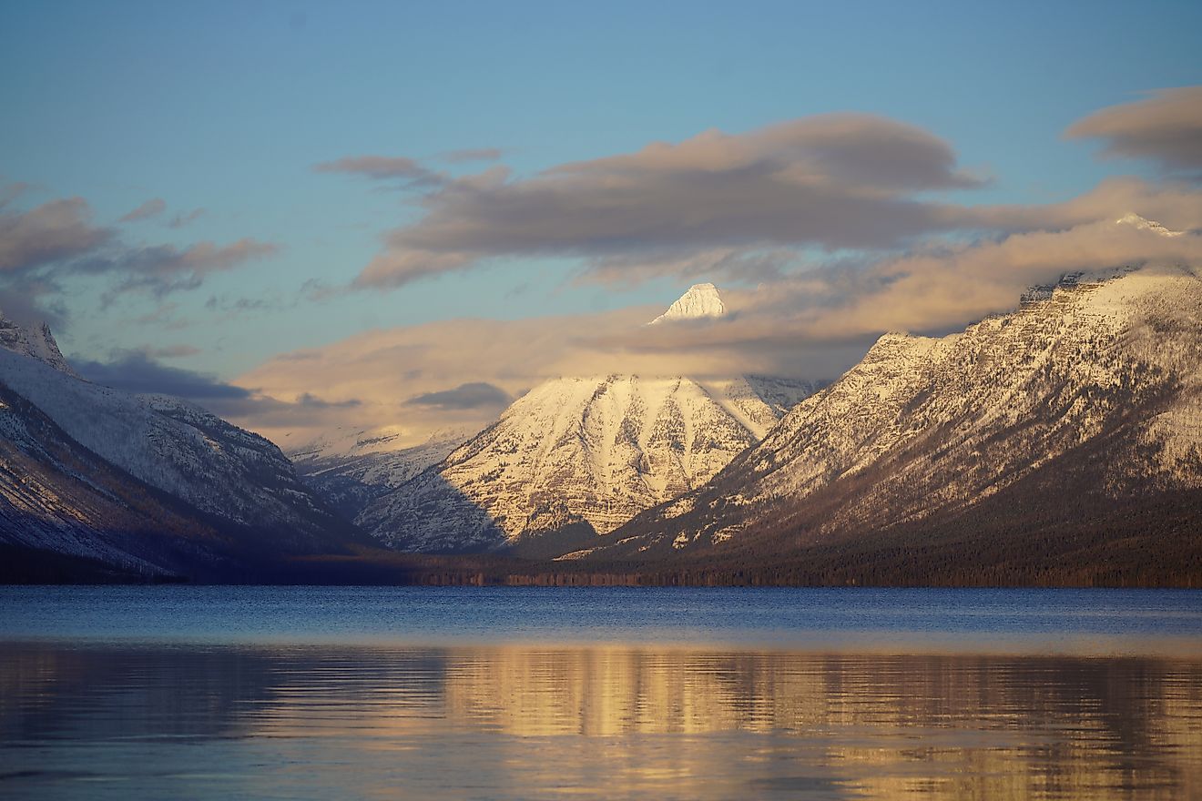
Glacier National Park is the narrowest qualifier on the list. Its approximately 1,583 mi2 exceed Rhode Island's roughly 1,545 mi2 by only about 38 mi2. That small difference establishes the lower boundary for a consistent total-area comparison. The Montana park sits along the Continental Divide and contains rugged mountains shaped heavily by past glaciation, along with hundreds of lakes, alpine meadows, forests, and active glaciers. Water originating in the region ultimately enters river systems flowing toward the Pacific Ocean, Hudson Bay, and the Gulf of Mexico, giving the landscape unusual continental hydrological significance. Glacier also forms part of the larger Crown of the Continent ecosystem extending across the U.S.-Canada border. Its inclusion shows that a park does not need Alaska-style dimensions to surpass a state, but the margin can be remarkably small.
Why The List Stops At Glacier National Park
The comparison ends after Glacier because the next major candidate, Olympic National Park in Washington, covers approximately 922,651 acres, or about 1,442 mi2. Rhode Island has a total area of approximately 1,545 mi2, leaving Olympic about 103 mi2 short. The distinction depends on using total area consistently. Rhode Island contains only about 1,034 mi2 of land because a substantial portion of its Census-defined area is water. If state land area were compared with park total area instead, Olympic, Big Bend, Joshua Tree, Yosemite, and Kenai Fjords would also appear to be larger than Rhode Island. That approach mixes two different measurements. For a scientific comparison, using total park area against total state area provides the clearest and most reproducible standard.
The Takeaway
The 12 national parks larger than at least one U.S. state reveal how dramatically protected-area scale varies across the National Park System. Seven are in Alaska, where federal conservation boundaries frequently encompass entire watersheds, mountain ranges, migration corridors, and largely undeveloped ecosystems. Wrangell-St. Elias is the extreme example at more than 20,000 mi2, while Glacier National Park qualifies by only about 38 mi2. The parks between those extremes represent very different environments, including Arctic tundra, volcanic landscapes, deserts, wetlands, glacial fjords, geothermal terrain, and deep river canyons. Their size is scientifically important because ecological and geological processes often operate across large areas. Comparing them with states offers an intuitive measure of scale, but it also shows why consistent definitions of land area, water area, and total area are essential when making geographical comparisons.
The National Parks That Are Bigger Than Some States
| Rank | National Park | Approximate Total Area | States Smaller Than the Park |
|---|---|---|---|
| 1 | Wrangell-St. Elias National Park & Preserve | 20,587 mi2 | Rhode Island, Delaware, Connecticut, New Jersey, New Hampshire, Vermont, Massachusetts, Hawaii, Maryland |
| 2 | Gates of the Arctic National Park & Preserve | 13,238 mi2 | Rhode Island, Delaware, Connecticut, New Jersey, New Hampshire, Vermont, Massachusetts, Hawaii, Maryland |
| 3 | Denali National Park & Preserve | 9,492 mi2 | Rhode Island, Delaware, Connecticut, New Jersey, New Hampshire |
| 4 | Katmai National Park & Preserve | 6,395 mi2 | Rhode Island, Delaware, Connecticut |
| 5 | Lake Clark National Park & Preserve | 6,297 mi2 | Rhode Island, Delaware, Connecticut |
| 6 | Death Valley National Park | 5,270 mi2 | Rhode Island, Delaware |
| 7 | Glacier Bay National Park & Preserve | 5,126 mi2 | Rhode Island, Delaware |
| 8 | Yellowstone National Park | 3,472 mi2 | Rhode Island, Delaware |
| 9 | Kobuk Valley National Park | 2,735 mi2 | Rhode Island, Delaware |
| 10 | Everglades National Park | 2,410 mi2 | Rhode Island |
| 11 | Grand Canyon National Park | 1,904 mi2 | Rhode Island |
| 12 | Glacier National Park | 1,583 mi2 | Rhode Island |