Where is Portage County, Ohio?
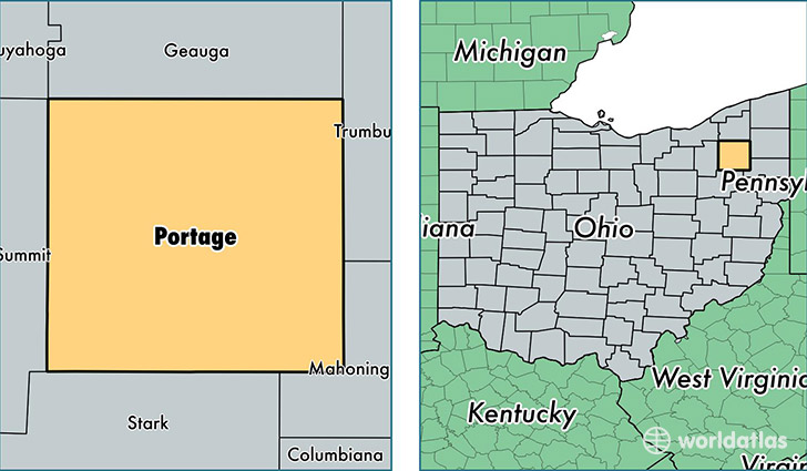
Portage County is a county equivalent area found in Ohio, USA. The county government of Portage is found in the county seat of Ravenna.
With a total 1,305.5 sq. km of land and water area, Portage County, Ohio is the 2164th largest county equivalent area in the United States. Home to 161,882 people, Portage County has a total 67717 households earning 52697 on average per year.
Portage County, Ohio - Quick Facts
| FIPS Code | 39133 |
| Area Codes | 330 |
| Time Zone | EST |
| Major Cities | Kent (population: 43,593), Ravenna (population: 33,587), Aurora (population: 19,559), Streetsboro (population: 16,431), Mogadore (population: 13,444), Garrettsville (population: 8,312), Mantua (population: 7,988), Atwater (population: 6,918), Rootstown (population: 5,209), Hiram (population: 4,196) |
| Land Area | 62,503 sq miles |
| Water Area | 487 sq miles |
| Household Income | $52,697 |
| Housing Units | 67,717 |
| Median Home Value | $150,300 |
| High School Grads | 91% of population |
| Holders of Bachelors Degrees | 25% of population |
| Retail Spending | $10,630 per capita |
| Food & Accomodation Sales | $187,682 per capita |
| Universities and Colleges | Hiram College, Kent State University Kent Campus |
This page was last updated on June 30, 2016.