Where is Trumbull County, Ohio?
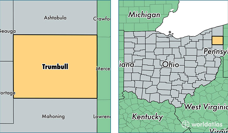
Trumbull County is a county equivalent area found in Ohio, USA. The county government of Trumbull is found in the county seat of Warren.
With a total 1,648.7 sq. km of land and water area, Trumbull County, Ohio is the 1623rd largest county equivalent area in the United States. Home to 205,175 people, Trumbull County has a total 95323 households earning 42880 on average per year.
Trumbull County, Ohio - Quick Facts
| FIPS Code | 39155 |
| Area Codes | 330,440 |
| Time Zone | EST |
| Major Cities | Warren (population: 74,852), Niles (population: 20,665), Cortland (population: 17,168), Girard (population: 15,215), Hubbard (population: 14,691), Newton Falls (population: 10,322), Leavittsburg (population: 5,197), Mineral Ridge (population: 4,896), Masury (population: 4,685), McDonald (population: 4,193) |
| Land Area | 79,218 sq miles |
| Water Area | 618 sq miles |
| Household Income | $42,880 |
| Housing Units | 95,323 |
| Median Home Value | $97,400 |
| High School Grads | 88% of population |
| Holders of Bachelors Degrees | 17% of population |
| Retail Spending | $10,872 per capita |
| Food & Accomodation Sales | $245,161 per capita |
| Universities and Colleges | Raphaels School of Beauty Culture, Trumbull Business College |
This page was last updated on June 30, 2016.