Where is Mahoning County, Ohio?
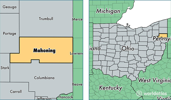
Mahoning County is a county equivalent area found in Ohio, USA. The county government of Mahoning is found in the county seat of Youngstown.
With a total 1,101.23 sq. km of land and water area, Mahoning County, Ohio is the 2466th largest county equivalent area in the United States. Home to 233,204 people, Mahoning County has a total 111150 households earning 41058 on average per year.
Mahoning County, Ohio offers the following attraction to visitors: Butler Institute of American Art
Mahoning County, Ohio - Quick Facts
| FIPS Code | 39099 |
| Area Codes | 330 |
| Time Zone | EST |
| Major Cities | Youngstown (population: 160,714), Canfield (population: 21,714), Struthers (population: 10,926), Campbell (population: 8,102), Sebring (population: 4,798), New Middletown (population: 3,944), Beloit (population: 3,930), Lowellville (population: 3,776), North Lima (population: 3,118), North Jackson (population: 2,985) |
| Land Area | 90,041 sq miles |
| Water Area | 412 sq miles |
| Household Income | $41,058 |
| Housing Units | 111,150 |
| Median Home Value | $95,800 |
| High School Grads | 89% of population |
| Holders of Bachelors Degrees | 21% of population |
| Retail Spending | $12,567 per capita |
| Food & Accomodation Sales | $340,679 per capita |
This page was last updated on June 30, 2016.