Where is Washington County, New York?
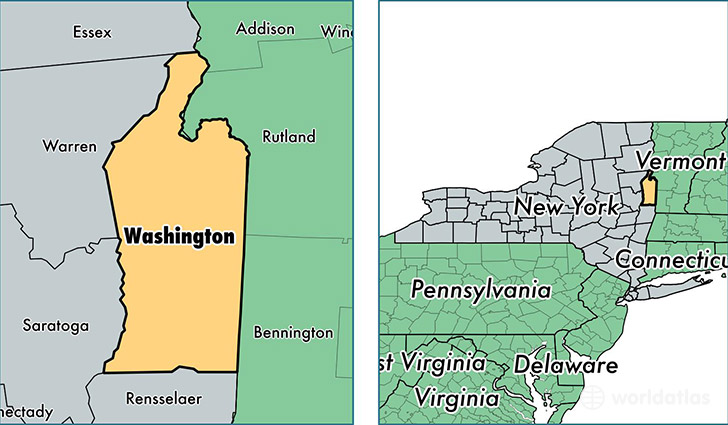
Washington County is a county equivalent area found in New York, USA. The county government of Washington is found in the county seat of Hudson Falls.
With a total 2,190.84 sq. km of land and water area, Washington County, New York is the 1091st largest county equivalent area in the United States. Home to 62,372 people, Washington County has a total 28904 households earning 52361 on average per year.
Washington County, New York - Quick Facts
| FIPS Code | 36115 |
| Area Codes | 518 |
| Time Zone | EST |
| Major Cities | Hudson Falls (population: 13,527), Fort Edward (population: 9,464), Granville (population: 7,074), Greenwich (population: 6,564), Whitehall (population: 4,949), Cambridge (population: 4,589), Fort Ann (population: 3,859), Salem (population: 3,646), Argyle (population: 3,512), Comstock (population: 2,737) |
| Land Area | 24,082 sq miles |
| Water Area | 831 sq miles |
| Household Income | $52,361 |
| Housing Units | 28,904 |
| Median Home Value | $148,300 |
| High School Grads | 88% of population |
| Holders of Bachelors Degrees | 18% of population |
| Retail Spending | $7,759 per capita |
| Food & Accomodation Sales | $25,041 per capita |
This page was last updated on June 30, 2016.