Where is Rutland County, Vermont?
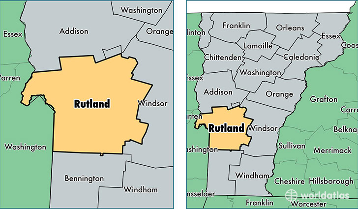
Rutland County is a county equivalent area found in Vermont, USA. The county government of Rutland is found in the county seat of Rutland.
With a total 2,446.97 sq. km of land and water area, Rutland County, Vermont is the 847th largest county equivalent area in the United States. Home to 60,086 people, Rutland County has a total 33649 households earning 49271 on average per year.
Rutland County, Vermont offers the following attraction to visitors: Calvin Coolidge Tomb
Rutland County, Vermont - Quick Facts
| FIPS Code | 50021 |
| Area Codes | 802 |
| Time Zone | EST |
| Major Cities | Rutland (population: 20,541), Brandon (population: 5,833), Castleton (population: 4,346), Fair Haven (population: 4,275), Poultney (population: 3,408), West Rutland (population: 3,377), Pittsford (population: 2,712), Wallingford (population: 2,109), North Clarendon (population: 1,804), Proctor (population: 1,780) |
| Land Area | 23,199 sq miles |
| Water Area | 930 sq miles |
| Household Income | $49,271 |
| Housing Units | 33,649 |
| Median Home Value | $176,800 |
| High School Grads | 89% of population |
| Holders of Bachelors Degrees | 28% of population |
| Retail Spending | $17,136 per capita |
| Food & Accomodation Sales | $124,431 per capita |
| Universities and Colleges | Green Mountain College |
This page was last updated on June 30, 2016.