Where is Warren County, New York?
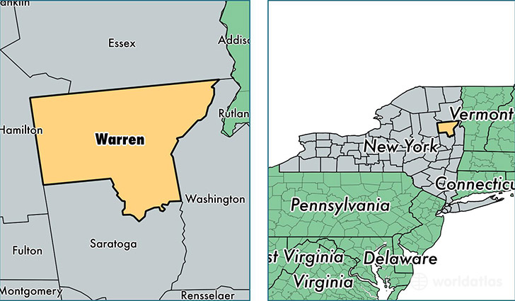
Warren County is a county equivalent area found in New York, USA. The county government of Warren is found in the county seat of Queensbury.
With a total 2,412.84 sq. km of land and water area, Warren County, New York is the 871st largest county equivalent area in the United States. Home to 64,973 people, Warren County has a total 38795 households earning 55904 on average per year.
Warren County, New York offers the following attractions to visitors: Magic Forest, The Great Escape & Splashwater Kingdom
Warren County, New York - Quick Facts
| FIPS Code | 36113 |
| Area Codes | 518 |
| Time Zone | EST |
| Major Cities | Queensbury (population: 26,471), Glens Falls (population: 14,669), Lake George (population: 4,829), Warrensburg (population: 4,590), Lake Luzerne (population: 3,289), Chestertown (population: 2,268), North Creek (population: 1,764), Bolton Landing (population: 1,569), Diamond Point (population: 891), Brant Lake (population: 868) |
| Land Area | 25,086 sq miles |
| Water Area | 867 sq miles |
| Household Income | $55,904 |
| Housing Units | 38,795 |
| Median Home Value | $189,400 |
| High School Grads | 91% of population |
| Holders of Bachelors Degrees | 28% of population |
| Retail Spending | $21,005 per capita |
| Food & Accomodation Sales | $299,993 per capita |
This page was last updated on June 30, 2016.