Where is Stokes County, North Carolina?
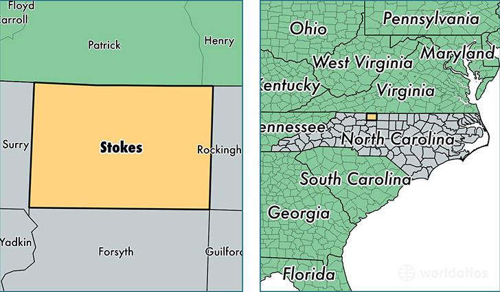
Stokes County is a county equivalent area found in North Carolina, USA. The county government of Stokes is found in the county seat of Danbury.
With a total 1,180.07 sq. km of land and water area, Stokes County, North Carolina is the 2323rd largest county equivalent area in the United States. Home to 46,419 people, Stokes County has a total 21674 households earning 42703 on average per year.
Stokes County, North Carolina - Quick Facts
| FIPS Code | 37169 |
| Area Codes | 336 |
| Time Zone | EST |
| Major Cities | King (population: 17,874), Walnut Cove (population: 10,530), Pinnacle (population: 6,561), Germanton (population: 4,030), Sandy Ridge (population: 1,997), Danbury (population: 1,910), Lawsonville (population: 1,539), Pine Hall (population: 823) |
| Land Area | 17,922 sq miles |
| Water Area | 449 sq miles |
| Household Income | $42,703 |
| Housing Units | 21,674 |
| Median Home Value | $118,100 |
| High School Grads | 81% of population |
| Holders of Bachelors Degrees | 13% of population |
| Retail Spending | $4,921 per capita |
| Food & Accomodation Sales | $28,721 per capita |
This page was last updated on June 30, 2016.