Where is Rockingham County, North Carolina?
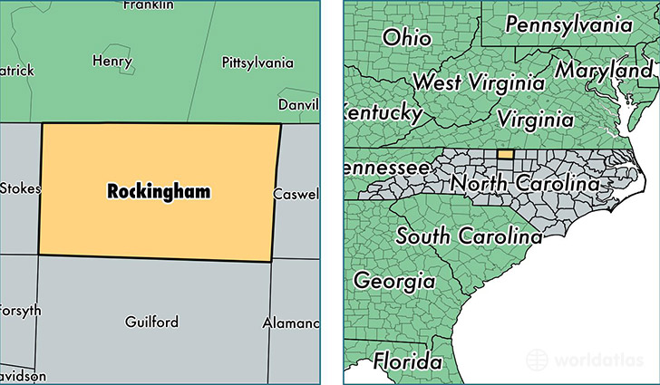
Rockingham County is a county equivalent area found in North Carolina, USA. The county government of Rockingham is found in the county seat of Wentworth.
With a total 1,483.3 sq. km of land and water area, Rockingham County, North Carolina is the 1904th largest county equivalent area in the United States. Home to 91,696 people, Rockingham County has a total 43386 households earning 38567 on average per year.
Rockingham County, North Carolina - Quick Facts
| FIPS Code | 37157 |
| Area Codes | 336 |
| Time Zone | EST |
| Major Cities | Reidsville (population: 38,947), Eden (population: 23,833), Madison (population: 11,020), Stoneville (population: 8,524), Stokesdale (population: 7,939), Mayodan (population: 4,341), Ruffin (population: 3,953) |
| Land Area | 35,404 sq miles |
| Water Area | 566 sq miles |
| Household Income | $38,567 |
| Housing Units | 43,386 |
| Median Home Value | $102,900 |
| High School Grads | 79% of population |
| Holders of Bachelors Degrees | 13% of population |
| Retail Spending | $9,121 per capita |
| Food & Accomodation Sales | $84,590 per capita |
| Universities and Colleges | Rockingham Community College |
This page was last updated on June 30, 2016.