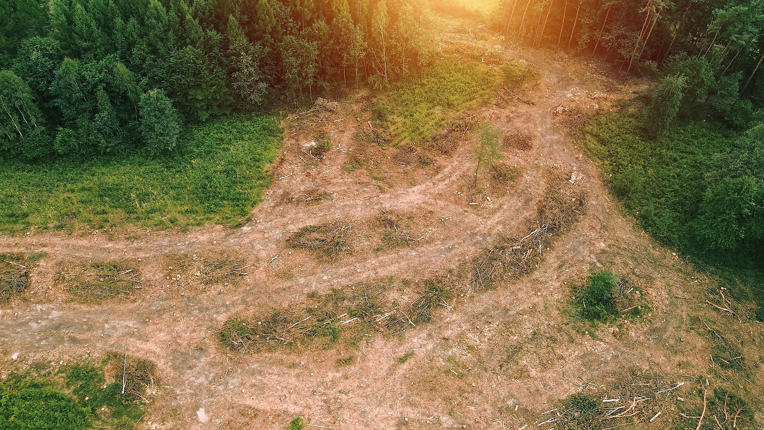
The National Forests That Used To Be Logged Bare
The law that helped build many eastern national forests was blunt about what the government was buying. The Weeks Act of 1911 authorized the purchase of "forested, cutover, or denuded lands" in the watersheds of navigable streams. Denuded was not an exaggeration. Federal buyers took in ground that had been heavily logged, burned over, and in some places abandoned outright. A century of regrowth has covered much of that damage, but not erased it. The clues are still there in ruined mill sites, altered tree cover, and wildlife populations that nearly disappeared.
White Mountain National Forest, New Hampshire and Maine

The White Mountains were largely a denuded cutover landscape of eroding hillsides in 1918, according to the USDA Forest Service's account of the range. Historical data indicates that by the early 20th century, roughly 80% to 90% of the region's primeval forest had been heavily impacted by commercial logging. Streams ran black with silt and ash from fires that moved through the slash the logging crews left.
The 1911 purchase law also funded cooperative fire protection between federal and state agencies. Congress aimed the program at protecting headwater streams. Woodrow Wilson signed Executive Order 1449 on May 16, 1918, creating a national forest across the New Hampshire and Maine line. The tracts inside it had been bought parcel by parcel from private owners who had already taken what they wanted.
Nothing about the range looks damaged now. The forest covers close to 800,000 acres in two states, and several million visitors a year come to hike, camp, climb, and ski.
Green Mountain National Forest, Vermont

Vermont entered the same program 14 years later, and the damage there had a different cause. Crews cleared the Green Mountains for furnaces and pasture as well as for lumber. Demand for charcoal rose with Vermont's iron industry in 1820, and state forestry records note that Glastenbury alone burned 10,000 bushels for smelting ore that year. The 1840 census counted 1,081 sawmills across the state.
Burlington had become a major lumber processing center by 1870, taking in more than 150 million board feet annually. A flood in November 1927 caused severe damage across Vermont, and federal purchase followed within five years.
A proclamation of April 25, 1932 set apart lands the government had acquired through the Weeks Act. Regrowth went far enough that the state now tracks the opposite trend. Vermont foresters recorded forest cover falling from 79% to 75% in 2007, the first such decline since clearing peaked in the mid-1800s.
Allegheny National Forest, Pennsylvania

In Pennsylvania's only national forest, the industrial past lies underground. Forest Service heritage staff describe a present-day canopy grown over the archaeological remains of logging railroads, chemical wood factories, band sawmills, and whole town sites. None of it is visible from a road or a trailhead.
The surrounding plateau was mostly clear-cut during the 1800s. Hearts Content became the exception. One lumber company owned its original 20 acres from 1897 and never cut them, then deeded the tract to the government as the national forest took shape. Those white pines run 300 to 400 years old, and the National Park Service registered the 122-acre area as a National Natural Landmark in 1977.
What replaced the rest is not what came down. Agency heritage work suggests that where the chemical-wood railroads reached deepest, sun-loving black cherry now dominates. The old growth that survived is white pine, hemlock, and beech. A Forest Service employee arrived in September 1921 to secure land-purchase proposals from the lumber companies still holding the country, the largest being the Central Pennsylvania Lumber Company.
Monongahela National Forest, West Virginia

West Virginia's national forest shares a range name with its northern neighbor. Over 95% of the red spruce that once dominated its high elevations was destroyed by the time Monongahela was established in 1920. Nearly 90% of the region's old-growth forests were clear-cut. Catastrophic wildfire followed, then erosion and severe flooding.
Among the casualties was the West Virginia northern flying squirrel, whose numbers fell as the spruce canopy disappeared. The forest today extends past 920,000 acres across 10 counties and takes in the headwaters of six river systems, along with Spruce Knob at 4,863 feet.
Roughly 300,000 acres are identified as capable of carrying red spruce again. The Mower Tract, a 40,000-acre block on Cheat Mountain purchased in the late 1980s, is where much of that work concentrates. Crews put seedlings back into ground the spruce left generations ago. The flying squirrel, once an endangered species, is doing well there again.
Pisgah National Forest, North Carolina

Forestry education in America traces to a valley inside this forest. The Cradle of Forestry is the preserved grounds of the Biltmore Forest School, which opened in 1898 as the first forestry school in the country. Congress set the 6,500-acre heritage site aside in 1968, in the Pink Beds.
The instruction was not theoretical. Students worked southern Appalachian slopes during the years those slopes were being cut hard. Forest historians record that several of the estate tracts around the school were among the first parcels the government bought under the 1911 law.
What those students were walking through is the reason the forest exists at all. Beyond the estate line, the ridges were being stripped by logging railroads and the crews working ahead of them, and the country the government bought here came out of that condition rather than out of anything anyone had preserved. The school was an island in it. The forest around the school is second growth like the rest.
More than three miles of paved trail now connect the school buildings, and an old logging locomotive stands along that route. The Pisgah Ranger District covers approximately 163,168 acres across four counties and contains two of the East's earliest designated wilderness areas. That locomotive is the plainest object on the site, and it is the kind of machine that emptied the ridges around it.
Chattahoochee-Oconee National Forest, Georgia

Georgia's mountain counties supplied one of the first tracts the federal government acquired anywhere. The Gennett Land and Lumber Company sold 31,000 acres of north Georgia mountain land to the United States in 1911, at $7 an acre. Purchasing agents were working through seriously overcut and overfarmed land, and 51% of the first 1.3 million acres approved for eastern purchase had already been stripped of much of their valuable timber.
The mountain economy contracted alongside the timber. Average homestead size in those counties had dropped below 80 acres by 1930. The 34,000-acre Cohutta Wilderness occupies part of the recovery.
The sharper evidence of the farmed kind of damage lies in the Piedmont half of the forest. Scull Shoals was a mill village on the banks of the Oconee River and the site of Georgia's first paper mill. The village is gone. Tumbling walls and other ruins still stand in the forest that grew up around them, near the reservoir that now bears the river's name.
Mark Twain National Forest, Missouri

Shortleaf pine once ran across almost 6.6 million acres of the Missouri Ozark Highlands. Modern surveys by the USDA note that a mere 552,000 acres of shortleaf pine-oak forests survive in Missouri. This means roughly 91.6% of the original ecosystem has been lost over the last century. Uncontrolled logging depleted Missouri's forests by the early 20th century, and the mills that had grown up on that supply ran out of it.
A 1939 consolidation brought Missouri's scattered federal tracts into a single national forest. That forest today reaches about 1.5 million federal acres across southern Missouri, most of it inside the Ozark Highlands.
Replanting alone does not rebuild the woodland that was there. Shortleaf pine grew in open stands maintained by frequent low fire, and without burning it loses ground to shade-tolerant species crowding in behind it. Restoration therefore pairs planting with periodic prescribed burning. Crews also reduce overstory canopy cover, reopening an open pine woodland that federal planners trace to the earliest accounts of the region.
Huron-Manistee National Forests, Michigan

Northern Michigan was heavily logged in the late 19th and early 20th centuries, with roughly 90% of the region's original timber cut by the early 1900s. After the valuable trees were removed, fires swept through the cutover land, poor soils defeated many attempts at farming, and large areas were abandoned.
Fire kills mature jack pine and opens many of its cones at the same time, releasing seeds onto bare ground. Burned country can therefore produce dense young pine within a few years. Kirtland's warbler nested in that cycle for thousands of years and in almost nothing else.
Modern fire control interrupted the sequence. Stands that would once have burned grew tall instead. By 1970, the loss of young jack pine habitat, together with nest parasitism by brown-headed cowbirds, had driven the warbler's numbers down. Forest managers responded by cutting mature jack pine and planting seedlings behind the harvest to recreate the dense young stands the bird requires. The warbler recovered enough to leave the endangered species list in 2019, but its survival still depends on active management of a landscape that was once heavily logged, burned, and abandoned.
Ottawa National Forest, Michigan

Sylvania is the yardstick for the western Upper Peninsula. Its 18,327 acres of wilderness contain old-growth timber and 34 named lakes, several of them ringed by record-size red and white pines. Rare orchids grow there, and bald eagles, loons, and osprey use the water.
According to the USDA, by the 1920s the lands that now make up the Ottawa National Forest had been almost entirely cut over and stripped of their original white pine and northern hardwoods. Federal ownership arrived in 1931. The Ottawa now covers nearly a million acres, rolling wooded hills reaching from the south shore of Lake Superior to the Wisconsin border.
Sylvania therefore stands for what no photograph of the cutover era can quite capture: the standard rather than the wreckage. About 26 miles of unmarked trail wind through that old growth and along the lake shores, left unmarked on purpose.
Chequamegon-Nicolet National Forest, Wisconsin

Wisconsin's northern forest grew from seedlings set out by hand. Two national forests were proclaimed there in 1933, assembled largely out of abandoned and tax-delinquent land that owners walked away from after the cut. Civilian Conservation Corps crews planted thousands of acres of red pine and jack pine across the damaged landscape during the Depression. Statewide, the CCC planted an estimated 265 million trees in Wisconsin between 1933 and 1942, with a significant share going into the newly established and heavily cutover lands of the Chequamegon National Forest. They also cut firebreaks and built recreation facilities.
That work is still legible. Forest Service planning documents note that evidence of this history can be seen across both units.
Fire towers went up during those years, because the conditions that made the land burn had not changed. The Mountain Fire Lookout Tower, built in 1935 by Forest Service and Corps labor, became the first tower in Wisconsin on the National Historic Lookout Register. It also joined the National Register of Historic Places. The tower was once part of an extensive lookout network across what was then a separate national forest.
Reading The Second Growth
None of these forests is a preserved landscape. Each was acquired in poor condition and grew back into what now looks like ordinary woodland. The details still give the history away. Black cherry crowds ground that once grew hemlock, a mill village lies in ruins beneath second growth, and a warbler depends on saws where fire once did the work. The evidence is not gone, only overgrown.