The Highest-Elevation National Forest In America
The highest-elevation national forest in the United States, Inyo National Forest, spans nearly two million acres along the eastern edge of the Sierra Nevada. Within the forest, elevation climbs dramatically from about 3,900 feet near Owens Lake to 14,505 feet at the peak of Mount Whitney, the tallest point in the contiguous United States.
Above 10,000 feet, Inyo's air is significantly thinner, holding about 30 percent less oxygen than at sea level. In that thin air, fewer plants and animals can survive, and the plants that do grow more slowly. Human travelers must also acclimate slowly on the high-elevation trails to avoid altitude sickness or serious respiratory complications.
Once acclimated to the high elevations, visitors can experience a vast and highly varied landscape of ancient alpine trees, volcanic craters, and turquoise glacial lakes.
The Diverse Landscape of the Highest-Elevation National Forest

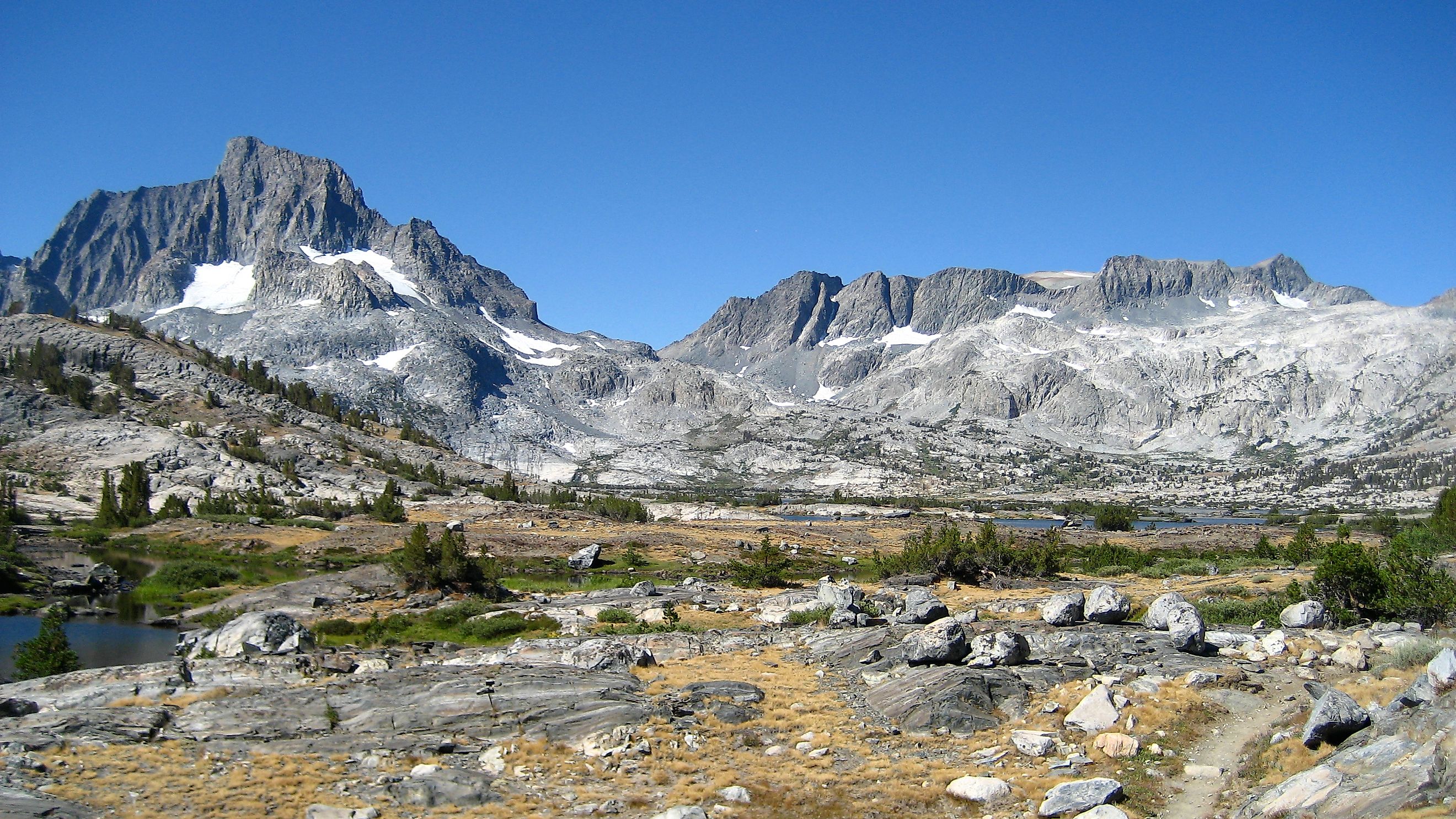
The landscape of Inyo National Forest changes abruptly across the dramatic elevation gradient. Within about a 15-mile drive on SR 168 starting in Owens Valley, the terrain shifts from dry sagebrush and pinyon-juniper woodlands on the valley floor to alpine zones. Beginning around 11,000 feet, the tree cover thins into open expanses of exposed granite, scree slopes, and alpine tundra. Without a canopy to buffer the elements, these high-altitude crests bake under intense solar radiation during the day and freeze at night, battered by unrelenting winds.
The climate is heavily shaped by the rain shadow of the Sierra Nevada. Pacific storm systems drop most of their rain and snow on the western side of the mountains, leaving the eastern slopes much drier. Lower elevations are covered in pinyon pine and juniper trees, which have small needles built to conserve water. Higher up, the soil consists mostly of porous granite sand that drains water quickly.
Mount Whitney is not alone. The Sierra Crest along Inyo's western boundary carries several other summits above 14,000 feet, part of a lineup that includes most of California's fourteeners. Life at these extreme heights has adapted to a compressed growing season that often lasts only a few short weeks between the summer snowmelt and autumn blizzards.
High in the White Mountains on the eastern side of the forest lies the Ancient Bristlecone Pine Forest. Growing at elevations between 9,800 and 11,000 feet, these ancient trees take root in harsh, nutrient-poor dolomite soil that blocks most other plant life. Adapted to extreme wind, drought, and freezing temperatures, bristlecone pines grow extraordinarily slowly. Their dense wood is rich with resin that resists rot, fungi, and insect infestations. Many trees here are several thousand years old, including "Methuselah," a Great Basin bristlecone pine estimated to be over 4,800 years old.
Volcanic and Thermal Features of Inyo National Forest

Inyo also holds active volcanic areas. The forest sits along the eastern boundary of the Long Valley Caldera, a massive volcanic depression measuring about 20 miles long and 10 miles wide. An enormous eruption formed it roughly 760,000 years ago.
Magma remains active beneath the surface, feeding several thermal sites. The most famous is the Hot Creek Geological Site, about eight miles east of Mammoth Lakes. Hot Creek is a gorge in Inyo National Forest where groundwater comes into direct contact with shallow magma chambers. The superheated water surges up through fractures in the streambed, reaching temperatures well above boiling. Because the springs are rich in dissolved minerals, sulfur fumes drift through the canyon and bright blue thermal pools bubble up alongside cold mountain runoff. Swimming in Hot Creek is strictly prohibited because of frequent, sudden eruptions of scalding water.
Near the northern edge of the forest lies the Mono Basin, where Mono Lake sits at 6,382 feet with no natural outlet, which makes its water highly salty and alkaline. Just south of the lake is Panum Crater, a volcanic dome of pumice and obsidian that formed roughly 650 years ago. Visitors can hike the steep, 1.7-mile Panum Crater Trail loop around the crater rim. The path is loose gravel, which makes the climb slow. From the summit, Mono Lake and its limestone tufa towers spread out below.
Inyo's Wildlife

The sharp changes in elevation create distinct habitats for a range of wildlife throughout the forest. Lower sagebrush flats and pinyon-juniper woodlands host desert species like black-tailed jackrabbits, coyotes, and kangaroo rats. Mule deer migrate up and down the mountain slopes seasonally. They winter on the valley floor and move up into the high meadows for the summer.
Black bears are common in mid-elevation forests and near lakes. Hikers must store food in bear-resistant canisters when visiting backcountry areas. Higher up near the timberline, high-altitude specialists like yellow-bellied marmots and American pikas live among the rock talus slopes.
Inyo also shelters rare and protected species, including Sierra Nevada bighorn sheep that inhabit the high granite crags. Down along the riparian streams and Mono Basin wetlands, birdwatchers can spot migratory species such as Wilson's phalaropes and eared grebes that rely on the area as a rest stop.
Hiking Across Inyo National Forest

Inyo National Forest contains nearly 2,200 miles of trails and roads. Proper acclimatization to the thin alpine air is essential on the many routes that surpass 9,000 feet. Preparing for these high-elevation hikes means spending one to three days hiking at intermediate elevations between 6,000 and 9,000 feet before attempting anything higher. Staying hydrated, sleeping at lower altitudes, and taking it slowly all help the body adjust.
Easy options include the Discovery Trail at Schulman Grove, a one-mile loop through the Ancient Bristlecone Pine Forest with minimal elevation gain and interpretive signs. For dramatic alpine scenery, the 14.9-mile round-trip Big Pine Lakes Trail is a popular choice that climbs over 3,000 feet to a chain of turquoise glacial lakes below the Palisade Glacier.
The most challenging route in the forest is the Mount Whitney Trail, a grueling 22-mile round-trip hike that climbs over 6,600 feet to the 14,505-foot summit. The Forest Service caps traffic here through a competitive lottery permit for both day use and overnight stays. Another high-country option is the Kearsarge Pass Trail, which begins out of Onion Valley at 9,200 feet and ascends to an 11,700-foot pass with views into Kings Canyon National Park.
Wilderness permits are mandatory for all overnight stays in the backcountry. Summer quotas fill up months in advance for major trailheads. A percentage of permits open online shortly before trip dates. High-elevation trails are usually free of heavy snow from July through September, though early autumn blizzards can close high mountain passes without much warning.
Experiencing the Highest-Elevation National Forest in the US

Inyo National Forest stands out as a high-elevation ecosystem where ancient bristlecone pines survive in harsh dolomite soils and boiling water surges through Hot Creek. Ice, volcanic heat, and extreme elevation have shaped this wilderness into a dynamic and varied place. A visit means almost two million acres of alpine granite crests meeting thermal desert basins and glacial lakes, all carved by the relentless interplay of wind, ice, and volcanic upheaval.