The Landlocked County With A Seaport
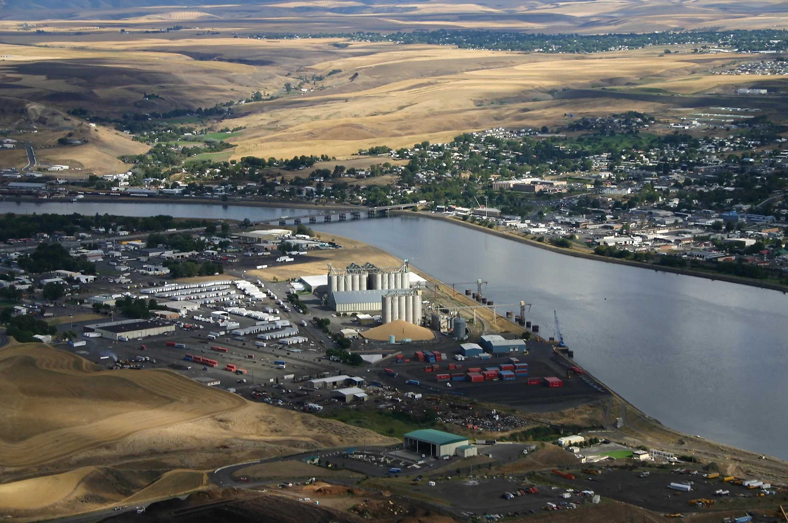
Idaho touches six other states and one Canadian province. It touches zero oceans. It has a seaport anyway. The Port of Lewiston sits in Nez Perce County, roughly 465 river miles from the Pacific, and it is the farthest inland port on the West Coast. Ocean freight goes out of a county whose nearest saltwater is in another time zone. This is not a technicality anybody stretched. It is a working port with cranes, a warehouse, and barges that leave on a schedule.
Idaho's Only Seaport Is Also Its Lowest Point

Lewiston sits where the Clearwater River meets the Snake, at an elevation of 738 feet. That is the lowest ground in Idaho. A state famous for mountains keeps its basement in the northwest corner, and somebody put a shipping terminal in it.

The geography does the rest of the work. The Snake feeds the Columbia, the Columbia reaches the Pacific, and the whole corridor is the second-largest water transportation system in the country behind the Mississippi and its tributaries. A barge leaving Lewiston reaches ocean ports in about three days.
The town itself has around 34,000 people and was briefly the capital of Idaho Territory, from 1863 until Boise took it in 1864. Losing the capital and gaining a seaport is a reasonable trade, though it took another 111 years to collect.
How A Barge Climbs Seven Hundred Feet

Here is the part that sounds impossible. Lewiston is 738 feet above sea level. Ships arrive there from an ocean at zero feet. Water does not flow uphill and neither do barges.
The answer is eight locks and dams, four on the lower Snake and four on the Columbia. On the Snake: Ice Harbor, Lower Monumental, Little Goose, and Lower Granite. On the Columbia: Bonneville, The Dalles, John Day, and McNary. Each lock is a concrete box that a vessel enters at one water level and exits at another, so the trip upriver is less a voyage than a staircase.
Total lift is more than 700 feet. A tug pushing wheat toward Portland spends three days going down a set of stairs the size of a mountain, and the whole system runs year round because the dams keep the river tame enough to work.
That last point is not a neutral fact in the Pacific Northwest. The four lower Snake River dams are the subject of a long argument over salmon recovery, and the port is openly on one side of it. Remove the dams and the reservoir drops, and Idaho's seaport becomes a river bank with a very good crane.
The County Voted For A Port It Could Not Use For Seventeen Years

The legal groundwork came first. Idaho Senate Bill 116 authorized ports in the state on March 16, 1931, and then nothing happened for twenty-seven years.
In November 1958, about 80 percent of Nez Perce County voters approved creating the Port of Lewiston. This was a county with no navigable connection to the sea voting to establish a seaport, which is either remarkable foresight or the most optimistic ballot measure in Idaho history.
They were right, eventually. Lower Granite Dam was completed in 1975, the last piece of slackwater fell into place, and the port became a functioning facility seventeen years after the vote that created it.
What Actually Leaves Idaho By Boat

Wheat, mostly, and a lot of it. The port moves somewhere around 24 million bushels a year, alongside barley, garbanzos, lentils, cedar logs, and wood fiber. It operates the largest crane and warehouse facility on the inland river system, and it works next door to the privately owned Lewis-Clark Terminal, which holds the region's biggest grain storage.
None of that is glamorous, which is rather the point. The most surprising port in America is mostly moving legumes.
The setting deserves a mention too. Lewiston sits at the mouth of Hells Canyon, the deepest river gorge in North America, and the old highway out of town climbs 2,000 feet up Lewiston Hill on 64 curves. Freight leaves by water because leaving by road was, for most of the town's history, genuinely difficult.
Oklahoma Would Like A Word

Rogers County, Oklahoma, is also landlocked, also has a major port, and also gets water to the sea by an absurd route. The Tulsa Port of Catoosa is the head of navigation for the McClellan-Kerr Arkansas River Navigation System, which runs 445 miles down the Verdigris and Arkansas rivers to the Mississippi, which carries on toward the Gulf.
The engineering is even more aggressive than Idaho's. Eighteen locks and dams, five in Oklahoma and thirteen in Arkansas, deliver a total lift of 420 feet through a nine-foot channel, with each lock chamber 110 feet wide and 600 feet long.
The first commercial barge arrived in January 1971 carrying newsprint from Tennessee. Richard Nixon dedicated the system that June. Since then the port has handled more than 80 million tons of freight, ships upward of 30 million bushels of wheat toward the Gulf annually, and anchors a 2,000-acre industrial park with roughly 70 companies and 3,000 workers.
By volume it beats Lewiston comfortably. What it does not do is call itself a seaport. Catoosa is classified as an inland river port, which is the accurate term and a much worse bumper sticker.
And Then There Is Duluth, Ruining Everything

If the contest is simply distance from the ocean, neither Idaho nor Oklahoma is close.
The Port of Duluth-Superior in Minnesota sits 2,342 miles from the Atlantic, which its port authority bills as the farthest-inland freshwater seaport in North America. Oceangoing ships reach it through the St. Lawrence Seaway and four Great Lakes, a trip of about a week. Locals call the ocean vessels salties and the freshwater freighters lakers, which is the best vocabulary in American shipping.
The numbers are not small either. Around 900 vessels a year, roughly 35 million tons of cargo, the top tonnage port on the Great Lakes and among the top twenty in the country. Iron ore and coal make up close to 80 percent of it.
Duluth has one disqualifying feature for our purposes. It is on Lake Superior, and a city with 49 miles of harbor frontage does not really get to claim it is landlocked. St. Louis County has a shoreline. It is just a freshwater one.
What Makes A Seaport A Seaport
Nobody licenses the word. There is no federal agency that inspects a dock and issues a certificate reading SEAPORT, which is precisely why this argument exists at all.
In practice the distinction people use comes down to one question: can an oceangoing vessel physically get there? A river port handles barges, which are unpowered boxes shoved around by towboats and transferred to real ships somewhere downstream. A seaport receives hulls that have crossed open water under their own power.
By that test Duluth is unambiguous. Salties from Europe tie up at its docks. Catoosa is unambiguous the other way, since a nine-foot channel and 600-foot lock chambers rule out anything oceangoing, and the port says so itself by calling what it does inland river navigation.
Lewiston sits in the interesting middle. The Columbia-Snake locks are big enough that vessels of shallow enough draft have made the run all the way up, and the port handles breakbulk and project cargo rather than only bulk grain. Most days it is barge traffic. But the door is open, which is more than most inland facilities can say, and it is why the seaport label has stuck for fifty years without anybody successfully objecting.
Oklahoma runs two more on the same system, the Port of Muskogee and Oakley's Port 33, and neither reaches for the word either.
So Who Actually Wins

Depends entirely on how you phrase it, which is how these things always go.
Farthest from the ocean: Duluth-Superior, by a mile and then 1,876 more of them. Biggest inland river operation among the landlocked contenders: the Tulsa Port of Catoosa, which moves far more tonnage than Lewiston and does not pretend to be a seaport. Most tonnage of any inland port in the country: that fight is between Cincinnati-Northern Kentucky and Huntington Tri-State on the Ohio River, and neither markets itself as coastal.
The title in the headline belongs to Nez Perce County. It is a county with no coast, in a state with no coast, containing a facility that calls itself a seaport and can back it up, because eight federal dams turned 465 miles of whitewater into a staircase and somebody in 1958 voted yes on a hunch.
Idaho got a seaport out of it. Washington and Oregon got the dams. The salmon are still filing objections.