Where People Are Moving To In The Rockies In 2026
A cheaper house on the far side of a mountain pass, a hospital job in a rural hub, or a lake at the end of the street can be enough to turn a Rockies vacation town into a permanent address. The region’s newest residents are not all chasing the same life. Some are commuting into expensive job markets such as Jackson, Park City, and Helena. Others are settling near universities, laboratories, hospitals, and outdoor industries that provide work without leaving the mountains. This list uses the U.S. Census Bureau’s July 1, 2025 population estimates, released in May 2026, and measures growth since July 2024. County-level domestic migration is included only as regional context because the Census Bureau does not publish equivalent migration totals for individual towns and cities.
Saratoga Springs, Utah

No town on this list grew faster: Saratoga Springs added 4,242 residents in a single year, climbing from 57,155 to 61,397, a rate of 7.4 percent, while Utah County drew about 3,162 people through domestic migration over the same stretch. The arithmetic behind that surge is a commute. Pioneer Crossing runs from the city's new western subdivisions to Interstate 15 and the technology and manufacturing employers strung along the Silicon Slopes corridor through Lehi, close enough that a household can hold a Salt Lake-area salary against a mortgage those closer cities no longer allow. The lakefront is what persuades people to stay rather than treat the place as a bedroom. North Marina Park opens onto Utah Lake through a boat ramp and beach beneath Mount Timpanogos, the Utah Lake Shoreline Trail connects several waterfront recreation areas, and Lake Mountain rises behind the city with hiking and off-road routes a short drive from the newest cul-de-sacs.
Rathdrum, Idaho

The flat, open ground of the Rathdrum Prairie holds new homes at prices that Coeur d'Alene and Spokane gave up years ago. Idaho State Highway 53 ties the town to U.S. Route 95, with Interstate 90 near enough to make the daily drive into either city practical, which lifted the population from 12,614 to 13,227, a gain of 4.9 percent, as Kootenai County took in roughly 3,161 more domestic arrivals than departures. For a commuter town, a surprising amount of the recreation stays within walking distance of the new subdivisions. Rathdrum Mountain rises immediately west, its lower slopes crossed by the city-owned StormKing trail system for hikers and mountain bikers, with a disc golf course folded into the same ground, and Twin Lakes opens to public boating and fishing a few miles north. The recreation is municipal rather than distant, which for a bedroom community is the harder thing to build.
Victor, Idaho

Victor exists, in its present form, on the cheap side of a mountain pass. Idaho State Highway 33 crosses Teton Pass into Wyoming and the Jackson job market beyond, where tourism, construction, and health care pay wages that Victor housing can still absorb, and the same road runs north through Driggs toward Grand Targhee Resort. That commute pushed the town from 2,474 residents to 2,589, a 4.6 percent gain, with Teton County adding about 49 through domestic migration. Most people cross the pass for work and come home to the mountains they wanted in the first place. Trails near the top carry hikers in summer and backcountry skiers in winter, the paved pathway to Driggs crosses open farmland under the Teton Range, and the Victor Emporium has poured huckleberry milkshakes on the main street since the 1950s, through several booms and at least one bust.
Granby, Colorado

A hospital is what keeps Granby steady. At Middle Park Health, the surrounding county gets emergency care and specialist clinics without a mountain drive, and the payroll does not empty out when the ski season ends. Granby is also where the smaller communities scattered across Middle Park come for shopping and services. That working core added about 100 residents over the year, lifting the town from 2,292 to 2,392 as Grand County recorded roughly 106 net domestic arrivals. The recreation packed around it is much of the draw. U.S. Routes 40 and 34 meet in town and reach Winter Park, Lake Granby, and the western gate of Rocky Mountain National Park, the lifts at Granby Ranch turn for skiers in winter and downhill bikers in summer, and Lake Granby sits less than 10 miles north with marinas, boat launches, and shoreline campgrounds.
Buena Vista, Colorado

The Arkansas River along the eastern edge of Buena Vista is a working economy as much as a view: rafting companies, outfitters, and the guiding trade run trips into Browns Canyon National Monument and put people on a payroll and not just a riverbank, which helped raise the town from 3,130 residents to 3,248, a 3.8 percent gain, as Chaffee County took in roughly 55 through domestic migration. Two narrow-gauge railroads reached this valley within months of one another in 1880, and the standard-gauge Colorado Midland, incorporated in 1883, followed in 1887 as the first standard-gauge line in Colorado to cross the Continental Divide, hauling ore and lumber past the town until it quit in 1918. The present recreation grew out of what that history left behind. The Midland Trail, laid out in 1991 along the abandoned grade, now carries hikers and cyclists past crumbling tunnels toward the Collegiate Peaks, the Buena Vista Whitewater Park sets engineered features into the river for kayakers and surfers, and East Main Street ends at the water near Deerhammer Distillery, the Buena Vista Heritage Museum in the former courthouse, and the outfitters that supply the high peaks.
Ridgway, Colorado

Position is what sells Ridgway. U.S. Route 550 connects the town with jobs in Montrose and Ouray while State Highway 62 runs west toward Telluride, which makes it a practical and far cheaper base for anyone working across the northern San Juan Mountains, particularly for people priced out of Telluride itself. That access carried the population from about 1,276 to 1,324, a 3.8 percent gain, with Ouray County recording roughly 93 net domestic arrivals. The reasons to settle rather than merely sleep here sit right at the edge of the streets. Ridgway State Park wraps a five-mile reservoir north of town for boating, paddleboarding, and shoreline fishing, the Uncompahgre RiverWay Trail passes through on its way toward the park, and Orvis Hot Springs has natural soaking pools to the south.
Ennis, Montana

The Madison River is both the reason most people arrive in Ennis and the reason many find work: a substantial fly-fishing trade supports the guide services and tackle shops along Main Street, and the fishing lodges bring seasonal business and seasonal jobs into the valley. That trade nudged the town from 1,088 residents to 1,126, a 3.5 percent gain, while Madison County took in about 283 through domestic migration, a large number for a place this size. Enough of daily life is covered to make it more than a summer address. Madison Valley Medical Center handles emergency care and family medicine in town, U.S. Route 287 connects Ennis with Bozeman and West Yellowstone, and Ennis Lake to the south is where warm-weather boating and, on its steadier winds, windsurfing happen. Virginia City sits about 11 miles west, its gold-rush buildings and boardwalks surviving from the strike of 1863, preserved less by anyone's design than by the long stretch of hard times that left no money to tear them down.
Townsend, Montana

Thirty-five miles is the number that matters in Townsend. U.S. Route 287 leaves the town that far from Helena, close enough for state-government jobs and the capital's larger medical facilities while keeping both the drive and the mortgage smaller than living in Helena would, which raised the population from 2,201 to 2,272, a 3.2 percent gain, as Broadwater County added around 214 through domestic migration. There is more to the town than the commute. Broadwater Health Center runs a hospital with emergency care and rehabilitation services, and Canyon Ferry Lake begins to the north and stretches along the Missouri River for roughly 25 miles, its public recreation areas holding boat ramps and campgrounds, its wetlands drawing American white pelicans and migrating waterfowl through much of the year.
Heber City, Utah

Two highways out of one valley open two separate job markets, and that is Heber City's pull. U.S. Route 40 runs to Park City and Interstate 80, while U.S. Route 189 threads Provo Canyon toward Provo and Orem, so resort work, technology jobs, and university employment all sit within reach of a place that still reads as small-town. The population rose from 19,039 to 19,651, a 3.2 percent gain, with Wasatch County recording roughly 382 net domestic arrivals. The valley fills in fast around the newcomers. Jordanelle State Park has marinas along the reservoir to the north, Soldier Hollow, built for the 2002 Winter Olympics, still opens its cross-country trails and a tubing hill that families crowd in winter, the Heber Valley Railroad pulls excursion trains through farmland near the Provo River, and Wasatch Mountain State Park adds hiking and campgrounds near Midway.
Idaho Falls, Idaho

The economy of Idaho Falls still turns on a decision announced on May 18, 1949, when the Atomic Energy Commission named the city as headquarters for its National Reactor Testing Station on the desert flats to the west, a headline the local paper set in the type it saved for Pearl Harbor. That station, now Idaho National Laboratory, employs more than 6,000 people in nuclear research, national security, and engineering, and the Department of Energy describes it as the largest concentration of technical professionals in the Rocky Mountain region. Its payroll helped lift the city from 69,568 residents to 71,785, a 3.2 percent gain, with Bonneville County adding about 1,207 through domestic migration. The rest of the city grew up around that laboratory and now stands as the commercial center of eastern Idaho on its own. Eastern Idaho Regional Medical Center carries more than 300 beds for patients across the region, Idaho Falls Regional Airport runs commercial flights to western hubs, and the Snake River Greenbelt follows the water through downtown past the namesake falls, linking waterfront parks to the Museum of Idaho and to Tautphaus Park with its zoo and ballfields.
Sandpoint, Idaho

People move to Sandpoint for the setting and sort out the work afterward, though Bonner General Health near the waterfront and a tourism economy built on the lake and the ski hill account for a good share of the local payroll. That draw brought the town from about 10,373 residents to 10,645, a 2.6 percent gain, with Bonner County recording around 814 more domestic arrivals than departures. The Northern Pacific first reached the town in 1882 and opened a route for North Idaho timber to the coasts, and Sandpoint has kept the passenger rail that most of the region lost: its 1916 depot has been the only Amtrak stop in all of Idaho since 1997, where the Empire Builder pauses each night on the Chicago-to-Pacific run. What people stay for, though, is the water at the end of the streets. Lake Pend Oreille reaches the edge of downtown, where City Beach Park fills a peninsula with a public swimming area, boat access, and picnic grounds, and Schweitzer rises northwest across 2,900 acres of ski terrain that turns to hiking and biking trails in summer.
Kalispell, Montana

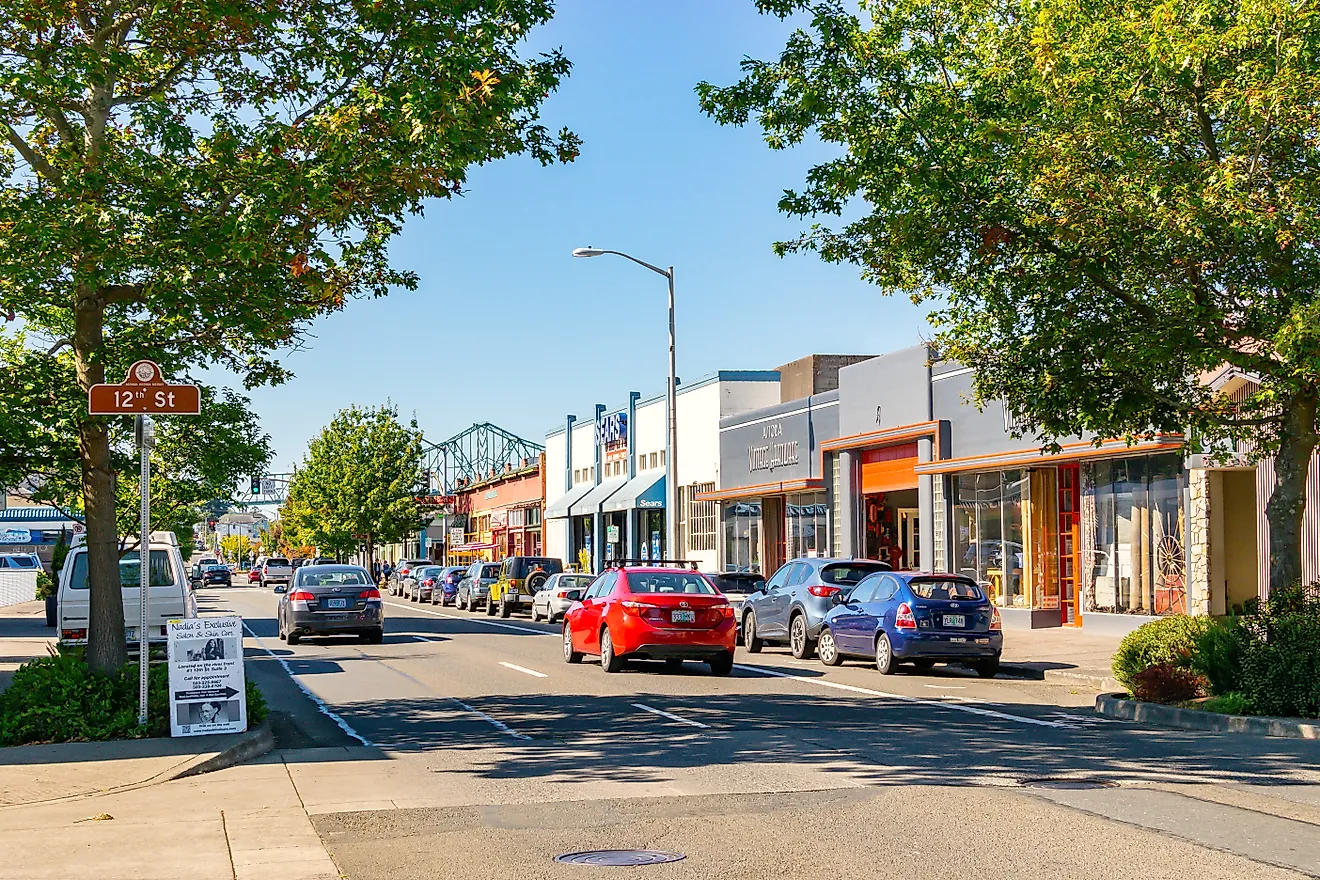
Kalispell is the Flathead Valley's commercial and medical center, and that role is its pull: Logan Health runs a large hospital campus with cancer care and pediatric services, and Glacier Park International Airport sits about eight miles northeast with nonstop flights to several major U.S. cities, the two making the city a hub for work and travel alike. The population grew from 31,225 to 31,851, a 2 percent gain, with Flathead County adding about 914 through domestic migration. Charles Conrad platted the town in 1891 to catch the Great Northern Railway's new division point, and when James J. Hill moved the main line to Whitefish only thirteen years later, in 1904, Kalispell held on as the county's trade center rather than fading the way nearby Demersville did. That survival explains the present-day core. The Parkline Trail now runs along the old railroad corridor through downtown, Conrad's 1895 home stands open as the Conrad Mansion, and the Hockaday Museum of Art holds a collection tied to Montana and Glacier National Park, whose west entrance lies about 32 miles off, with Flathead Lake beginning roughly 10 miles south.
Alpine, Wyoming

Like Victor across the state line, Alpine is Jackson's overflow on the cheaper side of a canyon. U.S. Routes 26 and 89 follow the Snake River Canyon to Jackson, fewer than 40 miles northeast, putting Jackson Hole jobs in hospitality, construction, health care, and recreation within reach of housing that Jackson itself priced out long ago, which moved the town from about 1,359 residents to 1,382, a 1.7 percent gain, as Lincoln County recorded roughly 147 net domestic arrivals. The compensation for the commute waits at the confluence. Alpine sits where the Snake, Salt, and Greys rivers meet at Palisades Reservoir, its boat ramps making fishing and water skiing easy to reach, and the Greys River Road runs from near town into the Bridger-Teton National Forest past trailheads and campgrounds before it heads deep into the mountains.
Bozeman, Montana

Under the resort-town surface, two institutions hold Bozeman's economy steady. Montana State University ranks among the city's largest employers, its research programs feeding jobs in engineering and agriculture, and Bozeman Health Deaconess Regional Medical Center is where the region turns for emergency and specialty care. Between them, the university and the hospital give the city a professional base that ski traffic alone would not. That base grew the population from 58,125 to 58,814, a 1.2 percent gain, with Gallatin County recording about 545 net domestic arrivals, and it explains why so few of the people who arrive for the mountains leave again. Bozeman Yellowstone International Airport runs the busiest passenger terminal in Montana, Bridger Bowl lies about 16 miles from downtown across more than 2,000 acres of ski terrain, and the Main Street to the Mountains trail system ties neighborhoods to Peets Hill and the foothills. The university also runs the Museum of the Rockies, whose Tyrannosaurus growth series, assembled from Hell Creek and Two Medicine specimens dug across eastern Montana, made the museum a center of dinosaur research after paleontologist Jack Horner's teams brought in the first of those skeletons.
Sheridan, Wyoming

The largest year-round employer in Sheridan exists because of a fort. The Army set aside Fort Mackenzie here in 1898, and after President Taft blocked its demolition, the post reopened in 1922 as a veterans' hospital for World War I soldiers carrying what would now be called PTSD, growing into one of the country's largest neuropsychiatric hospitals, some 900 patients after World War II, then roughly 8 percent of the town. That campus still operates as the Sheridan VA Medical Center, alongside Sheridan Memorial Hospital and Sheridan College, which together give the local economy an institutional footing no single season could. Behind those anchors, the town climbed past 20,000 residents, up from 19,794 to 20,015, a 1.1 percent gain, with Sheridan County adding about 320 through domestic migration. People stay for the downtown and the range behind it. Main Street still lines up its early twentieth-century commercial buildings, the Brinton Museum holds Western and Indigenous art on a former ranch to the south, and U.S. Highway 14 climbs west into Bighorn National Forest, where alpine lakes and hiking trails open directly off the edge of town.
What the Numbers Add Up To
Across these fifteen towns, the same three engines keep turning up in different combinations. Some grow on a commute, trading a canyon or a pass for a mortgage that a job market next door no longer supports, which is the Saratoga Springs, Victor, Alpine, and Townsend story. Some grow on an institution that pays year-round regardless of the ski season, a laboratory in Idaho Falls, a university in Bozeman, a VA hospital in Sheridan, a rural hospital in Granby. And some grow on the setting itself, a river in Ennis or a lake in Sandpoint that people choose first and then build a living around. The fastest growth clusters where a commute meets cheap ground, but the steadiest belongs to the towns with an institution behind them, because a payroll that does not depend on the weather is what turns a seasonal address into a permanent one.