8 of the Most Walkable Towns in Texas
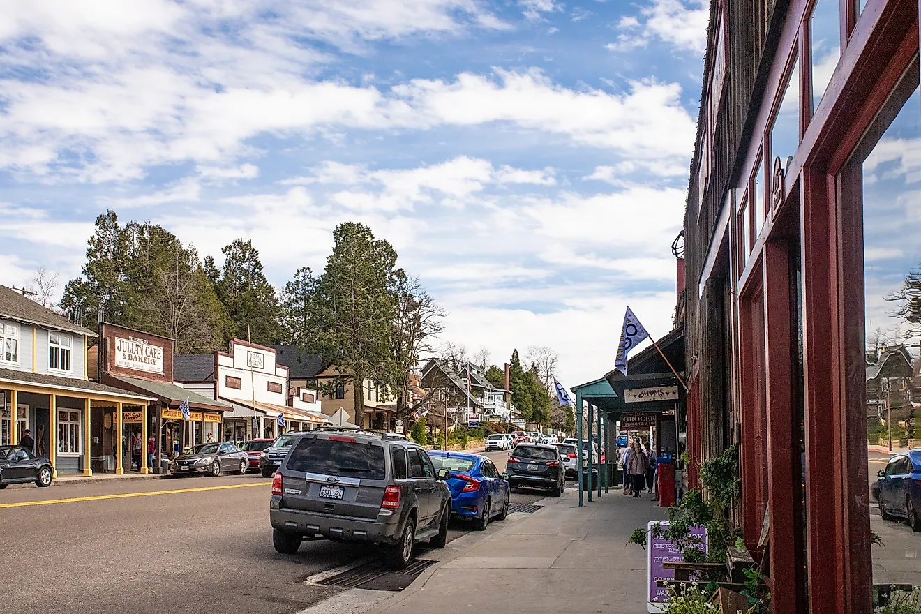
Texas runs bigger on driving than walking, but eight small towns hold downtowns or beachfronts tight enough to cover on foot. University Park near Dallas wraps around the campus of Southern Methodist University. Port Aransas and Port Isabel run barrier-island grids with the Gulf at the end of every street. Boerne, Dripping Springs, Bandera, and Fredericksburg run Hill Country Main Streets with German and Western heritage in the building stock. Each town rewards a pair of comfortable shoes and an afternoon without a car.
University Park

University Park is the Dallas suburb that wraps around Southern Methodist University on the north side of the city. Redfin scores the city's walkability at 61 out of 100, the highest among incorporated Texas municipalities. The neighborhood grid around Snider Plaza and Caruth Park is the walking heart of the city, with about twenty restaurants and shops accessible without a car. Hillcrest High School and the SMU campus anchor a tree-lined street pattern that has held its shape since the 1920s.
Goar Park covers three acres at the center of the city with shaded walking paths and picnic spots. The Inwood Theatre on the south edge of University Park, built in 1947, is one of the oldest single-screen movie houses still operating in Dallas County, with sofa-and-armchair seating in two of its three auditoriums. SMU's Meadows Museum on Bishop Boulevard holds one of the largest Spanish art collections outside Spain.
Port Aransas

Port Aransas sits at the north end of Mustang Island on the Gulf Coast just east of Corpus Christi. The town's beach-and-harbor footprint is easy to walk in either direction. North Beach and South Jetty stretch along about 18 miles of Mustang Island sand, all open to the public and most of which can be driven on or walked along during low tide.
The Port Aransas Museum on West Avenue covers the town's boat-building heritage and runs guided tours of the Chapel on the Dunes, an early 20th-century stone chapel painted inside with original frescoes. Mustang Island State Park five miles south covers about 4,000 acres of dunes, marsh, and Gulf-front beach with five miles of paddling trail through the back-bay system. Birding is the off-season anchor; Port Aransas sits on a major spring migration corridor along the Central Flyway.
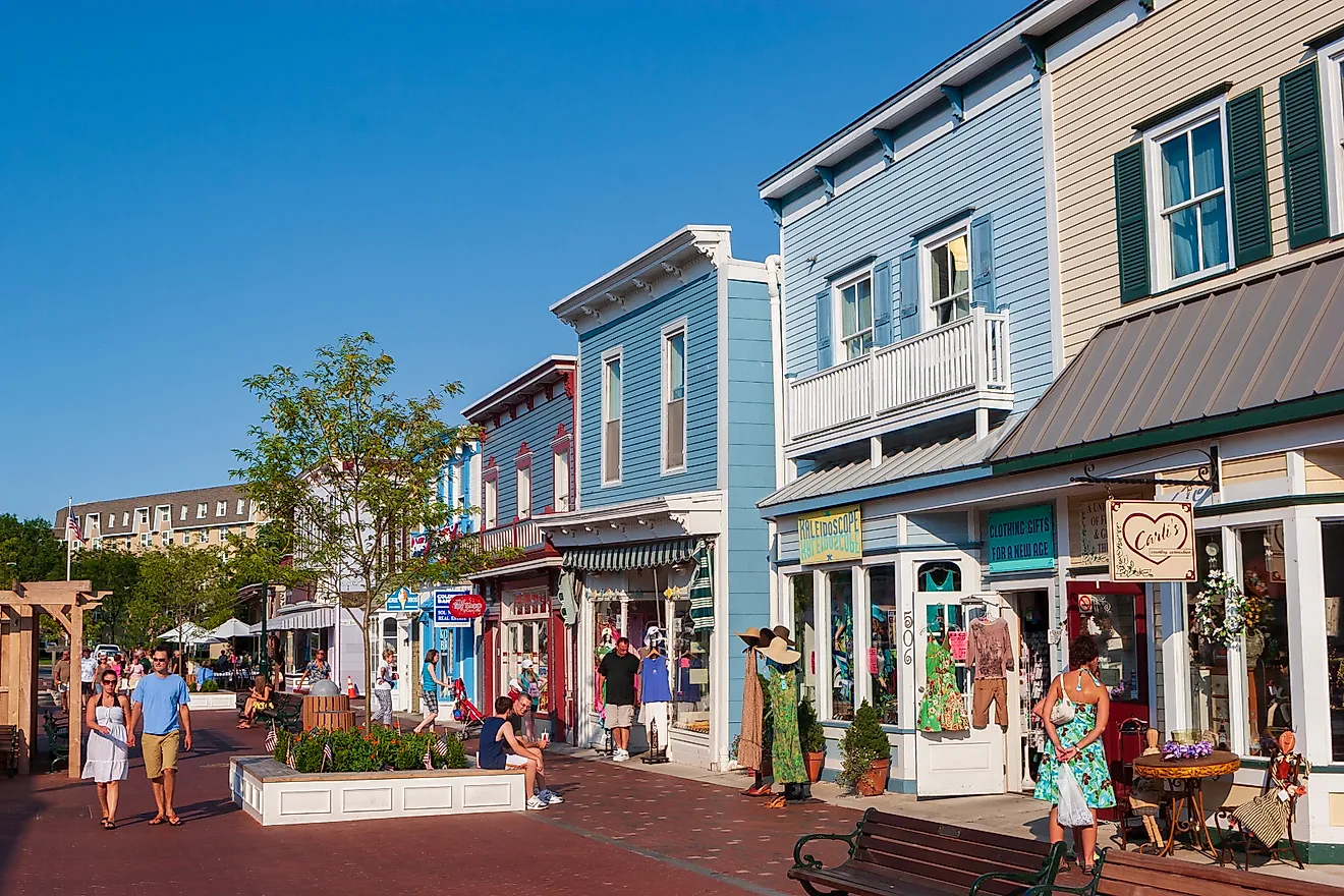
South Padre Island

South Padre Island sits on a barrier island off the deep south Texas coast facing the Gulf of Mexico. The municipality stretches about five miles along the southern end of Padre Island, bookended on the north by Padre Island National Seashore and on the south by the Laguna Madre. The walkable section runs about a mile and a half from the Convention Centre area south through the resort district.
The Sea Turtle Inc. rescue center on Padre Boulevard runs a year-round rehabilitation operation focused on the Kemp's ridley sea turtle, the smallest and most endangered sea turtle species in the world. The center is open to public visits with a small admission fee. The South Padre Island Birding and Nature Center on the north edge of town runs five acres of boardwalk through wetlands that attract roughly 350 bird species across the migration cycles.
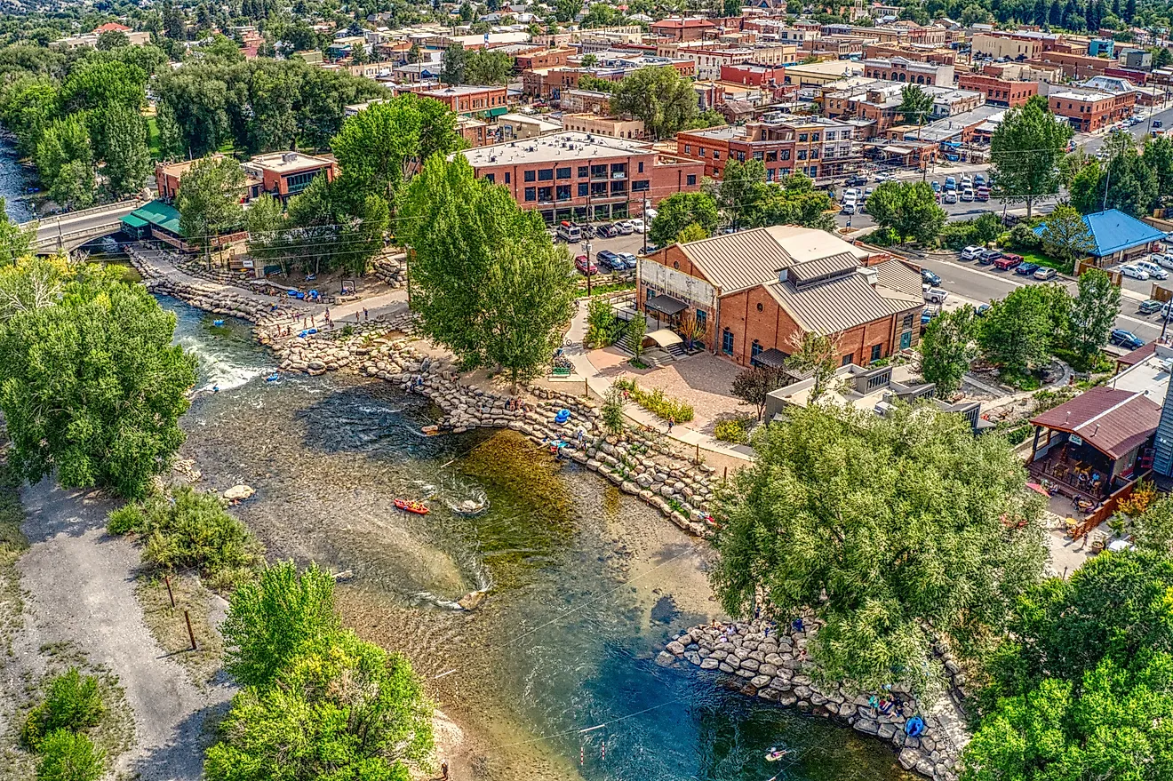
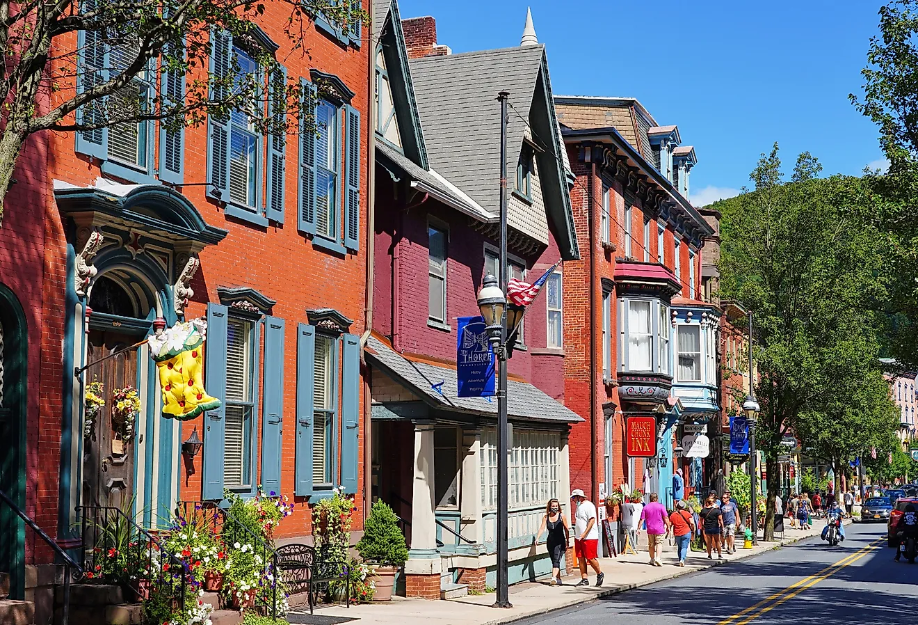
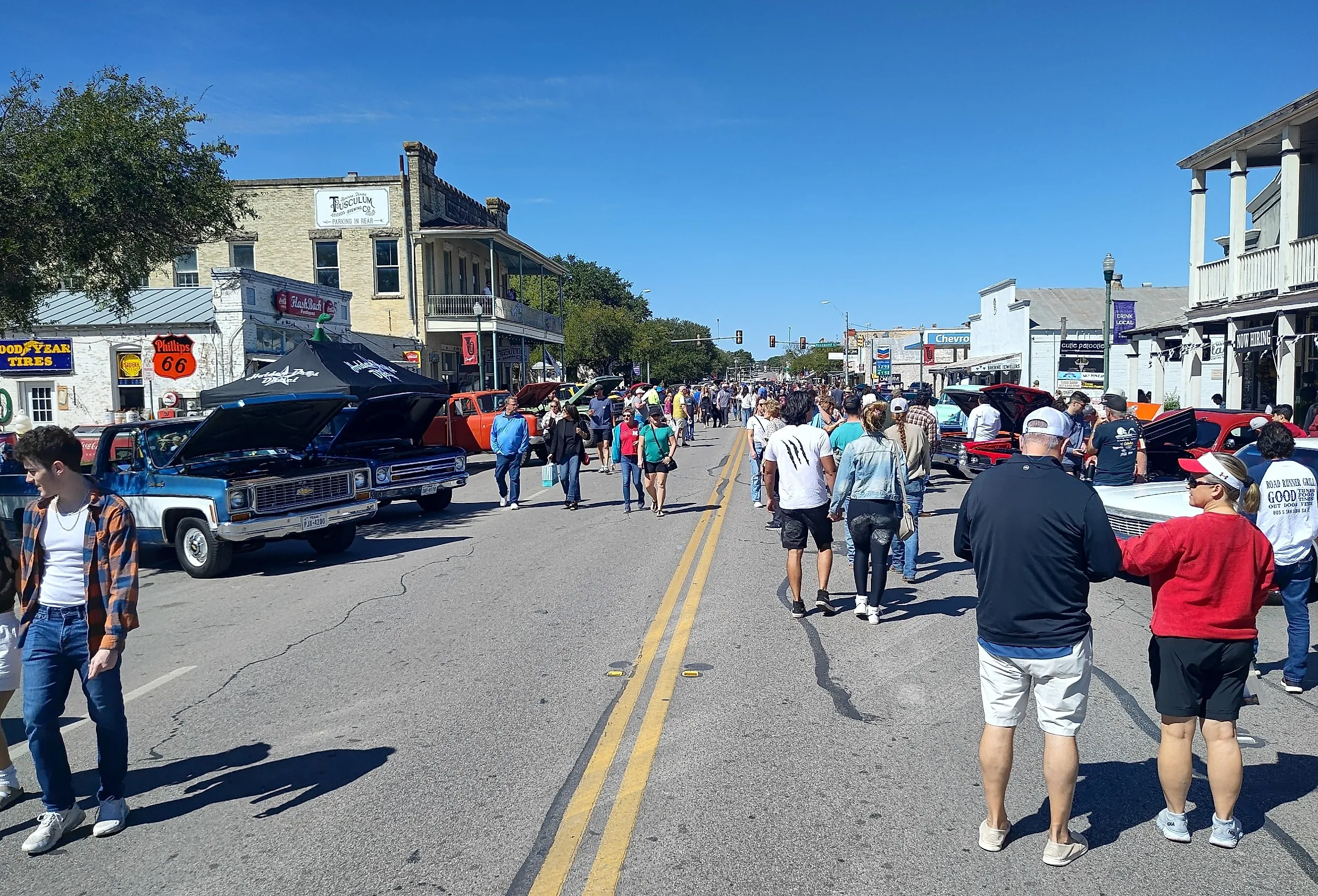
Boerne

Boerne sits about 30 miles northwest of San Antonio in the Texas Hill Country with a German-immigrant founding that dates to 1849. The town was named for Ludwig Börne, a German political writer admired by the founding settlers. The Hauptstrasse historic district covers the original Main Street with about 70 designated historic structures and a tight grid of independent shops, restaurants, and antique stores that can be covered on foot in an afternoon. Main Plaza at the south end runs the weekly farmers market on Saturday mornings.
The Old Jail Museum on the Hauptstrasse holds the 1884 limestone jail building with original iron cells still in place. The Herff Farm just outside town covers 62 acres of historically restored farmland and runs a second farmers market on the weekends. Cibolo Center for Conservation on the east edge of Boerne maintains 100 acres of preserved Hill Country habitat with five miles of trail through cypress-shaded creek corridors.
Dripping Springs

Dripping Springs calls itself the Gateway to the Texas Hill Country and sits about 25 miles west of Austin. Mercer Street, the historic Main Street, runs five blocks of 1870s commercial buildings with independent shops, restaurants, and tasting rooms for the surrounding wineries and distilleries. Founders Memorial Park anchors the south end of the corridor with a band shell, walking paths, and a calendar of summer concert events.
Pedernales Falls State Park covers 5,200 acres about 14 miles west of town with the limestone river-shelf cascades that give the park its name. Charro Ranch Park inside the town limits covers 64 acres of native Hill Country grassland and a one-mile walking loop. The Dripping Springs Distilling Wine and Spirits Trail covers roughly thirty wineries, breweries, and distilleries within a 15-mile radius, with Treaty Oak Distilling and Deep Eddy Vodka among the better-known operations.
Bandera

Bandera sits in the Hill Country on the Medina River about 50 miles northwest of San Antonio. The town has earned the "Cowboy Capital of the World" designation by virtue of producing more national rodeo champions per capita than any other municipality in the country, with seven Bandera-bred competitors inducted into the National Cowboy Hall of Fame. Main Street runs three blocks of original Western storefronts that can be covered on foot, with the Bandera Cattle Company running scheduled gunfight reenactments on Saturday afternoons.
The Frontier Times Museum on Thirteenth Street holds about 50,000 artifacts of Hill Country settlement, ranching, and rodeo history in a 1933 stone building. Lost Maples State Natural Area covers 2,174 acres about 50 miles northwest of town and holds the bigtooth maples that produce the most reliable fall color in Texas during late October and early November. Hill Country State Natural Area west of town runs 5,400 acres of undeveloped Hill Country with about 40 miles of equestrian, hiking, and mountain biking trail.
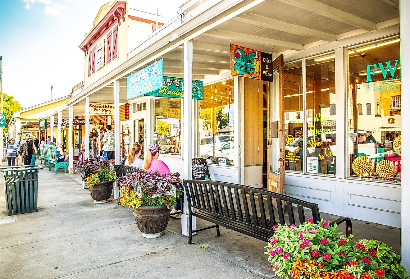
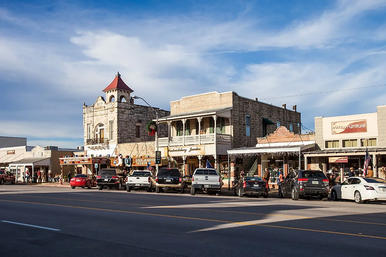
Fredericksburg

Fredericksburg was founded by German immigrants in 1846 and still runs its Main Street as one of the most walkable downtown corridors in the state. Main Street stretches more than a mile and holds roughly 150 independent shops, restaurants, wineries, and tasting rooms in restored limestone storefronts. The Marktplatz at the center of downtown holds the Vereins Kirche, an octagonal replica of the original 1847 church that the founding German settlers built as combination church, school, and town hall.
The National Museum of the Pacific War on East Main Street is the only U.S. museum dedicated solely to the Pacific Theater of World War II. The museum covers six acres on the site of Admiral Chester Nimitz's family hotel (Nimitz, the fleet admiral who led Pacific naval operations, was a Fredericksburg native) and holds the largest collection of Pacific War artifacts in the country. Enchanted Rock State Natural Area covers about 1,640 acres of pink granite batholith 18 miles north of town, and the summit hike runs about a mile each way for broad Hill Country views.
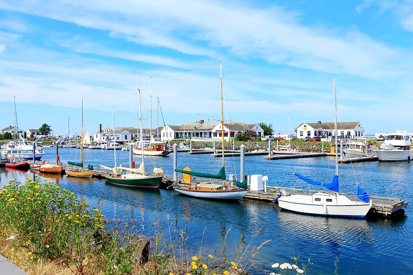
Port Isabel

Port Isabel sits across the Laguna Madre Bay from South Padre Island, connected by the 2.37-mile Queen Isabella Causeway, the longest bridge in Texas. The walkable downtown grid runs along Maxan and Tarnava Streets with independent shops, seafood restaurants, and art galleries built around the central plaza. The town runs a working shrimp fleet out of the harbor and the Long Island Village marina, and the Pirate's Landing Restaurant on the water serves the catch directly off the boats.
The Port Isabel Lighthouse State Historic Site anchors the central plaza. The 1852 brick tower stands 57 feet tall and is one of only two lighthouses on the Texas coast open to the public for the climb to the lantern room. The lighthouse keeper's cottage next door operates as the town's visitor center. The Port Isabel Historic Museum on East Queen Isabella Boulevard covers the Mexican-American War history of the area, including the May 8, 1846 Battle of Palo Alto fought just inland, the first major engagement of the war.
What These Eight Have In Common
Each of the eight runs a walkable core that the rest of the state's car-first geography rarely allows. University Park has its tight Snider Plaza grid. Port Aransas and Port Isabel work the waterfront. South Padre Island runs the resort strip. Boerne, Dripping Springs, Bandera, and Fredericksburg run the Hill Country German and Western storefronts. Each is small enough to leave the car behind for a day. Each gives the visitor something to do once the car is parked.