7 Coolest Small Towns in Arizona For A Summer Vacation
Sedona's Slide Rock State Park lets you slide down 80 feet of natural slick-rock on Oak Creek with the cottonwoods overhead. Show Low runs two stocked lakes for walleye and rainbow trout 6,400 feet up in the White Mountains. Bisbee hosts an annual stair climb every October through a hilltop downtown of mining-baron Victorians. Tombstone reenacts the OK Corral gunfight three times daily on the original Allen Street. Tubac's 80-plus art galleries stay open through the desert summer. Seven Arizona towns, seven specific reasons to make the drive.
Bisbee

Bisbee (population about 4,800) sits at 5,500 feet in the Mule Mountains of southeastern Arizona, about 90 miles from Tucson. The high elevation keeps summer highs typically around 90 degrees (20 degrees cooler than Tucson on average), and the old mining-town downtown is steep enough that the annual Bisbee 1000 Stair Climb each October takes runners up more than 1,000 steps across nine staircases through the historic district.
The Queen Mine Tour takes visitors 1,500 feet into the abandoned Copper Queen Mine (in operation 1877-1975, the foundational mine for the Phelps Dodge Corporation). The Bisbee Mining and Historical Museum on Howell Avenue is a Smithsonian Affiliate and runs detailed copper-mining and frontier-Arizona exhibits. The town's main drag through Brewery Gulch holds independent restaurants, the Copper Queen Hotel (opened 1902, the oldest continuously operating hotel in Arizona), and live music venues that punch above the town's size.
Tombstone

Tombstone (population about 1,300) sits at 4,540 feet on the high desert plains 23 miles north of the Mexican border, the elevation keeps summer highs in the mid-90s. The OK Corral Gunfight Site preserves the location of the October 26, 1881 shootout between the Earp brothers and Doc Holliday against the Clanton-McLaury cowboy faction, the most famous gunfight in American Wild West history. Live reenactments run multiple times daily.
Boothill Graveyard on the north edge of town holds the original 1879 cemetery with about 300 marked graves (most famously Billy Clanton, Frank McLaury, and Tom McLaury, killed at the OK Corral). The Bird Cage Theatre on Allen Street, opened in 1881 as a combination theater, saloon, gambling hall, and brothel, is now a museum with the original 1880s decor mostly intact. Allen Street itself remains closed to motor vehicles, with horse-drawn stagecoaches running tours through the original 1880s buildings.
Globe

Globe (population about 7,500) sits at 3,500 feet in the central Arizona highlands and runs summer highs in the upper 90s. The town's headline summer stop is Besh-Ba-Gowah Archaeological Park, the partially restored Salado culture pueblo on the south edge of town. The Salado occupied the 200-room masonry pueblo from approximately 1225 to 1400 AD, leaving behind one of the most extensively excavated and accessible pre-Columbian sites in the Southwest. Visitors can climb wooden ladders into the ground-level reconstructed rooms.
The Bullion Plaza Cultural Center and Museum, in the 1916 Bullion Plaza School building, runs rotating exhibits on Globe-Miami mining history (Globe was a major copper-mining center from the 1870s through the 20th century). The historic downtown along Broad Street holds dozens of antique stores in the original brick storefronts. Pinal Mountain Recreation Area south of town climbs to 7,800 feet and provides the high-elevation summer escape from Globe's heat.
Show Low

Show Low (population about 11,800) sits at 6,400 feet in the White Mountains of eastern Arizona, the highest town on this list. Summer highs typically run in the mid-80s with cool 50-degree nights, making the town the standard summer escape for Phoenix and Tucson residents fleeing 110-degree heat. The town's name comes from an 1870 card game between Corydon Cooley and Marion Clark, where Cooley won the entire ranch (and the right to name the place) on a "show low" cut of the deck.
Show Low Lake (a 100-acre reservoir on the south side of town) and Fool Hollow Lake Recreation Area (150 acres on the west side) both run fishing for stocked walleye, rainbow trout, and largemouth bass. The Show Low Bluff City Park covers a 4-mile mountain-biking trail system with views east toward Mount Baldy (11,420 feet, the second-highest peak in Arizona). The Sunrise Park Resort 45 minutes east operates as a working ski area in winter and a summer destination for the White Mountain Apache Tribe-owned scenic chairlift.
Tubac

Tubac (population about 1,300) sits at 3,300 feet about 45 miles south of Tucson, on the historic Camino Real (Royal Road) that connected colonial Mexico City to Santa Fe. The town was founded in 1752 as Presidio San Ignacio de Tubac, the first European settlement in what is now Arizona (24 years before the US Declaration of Independence). Tubac Presidio State Historic Park preserves the partially excavated presidio walls, an 1885 schoolhouse, and the 1898 St. Ann's Church.
The town's identity now centers on the 80-plus art galleries and Spanish Colonial-style craft shops along the central plaza. Many of the galleries run year-round, and the annual Tubac Festival of the Arts each February (one of the longest-running art festivals in Arizona, since 1959) draws 100,000-plus visitors over five days. Summer heat (typical July highs in the upper 90s) keeps the warmer months quieter, but the cooler galleries and shaded plaza make summer mornings workable.
Sedona

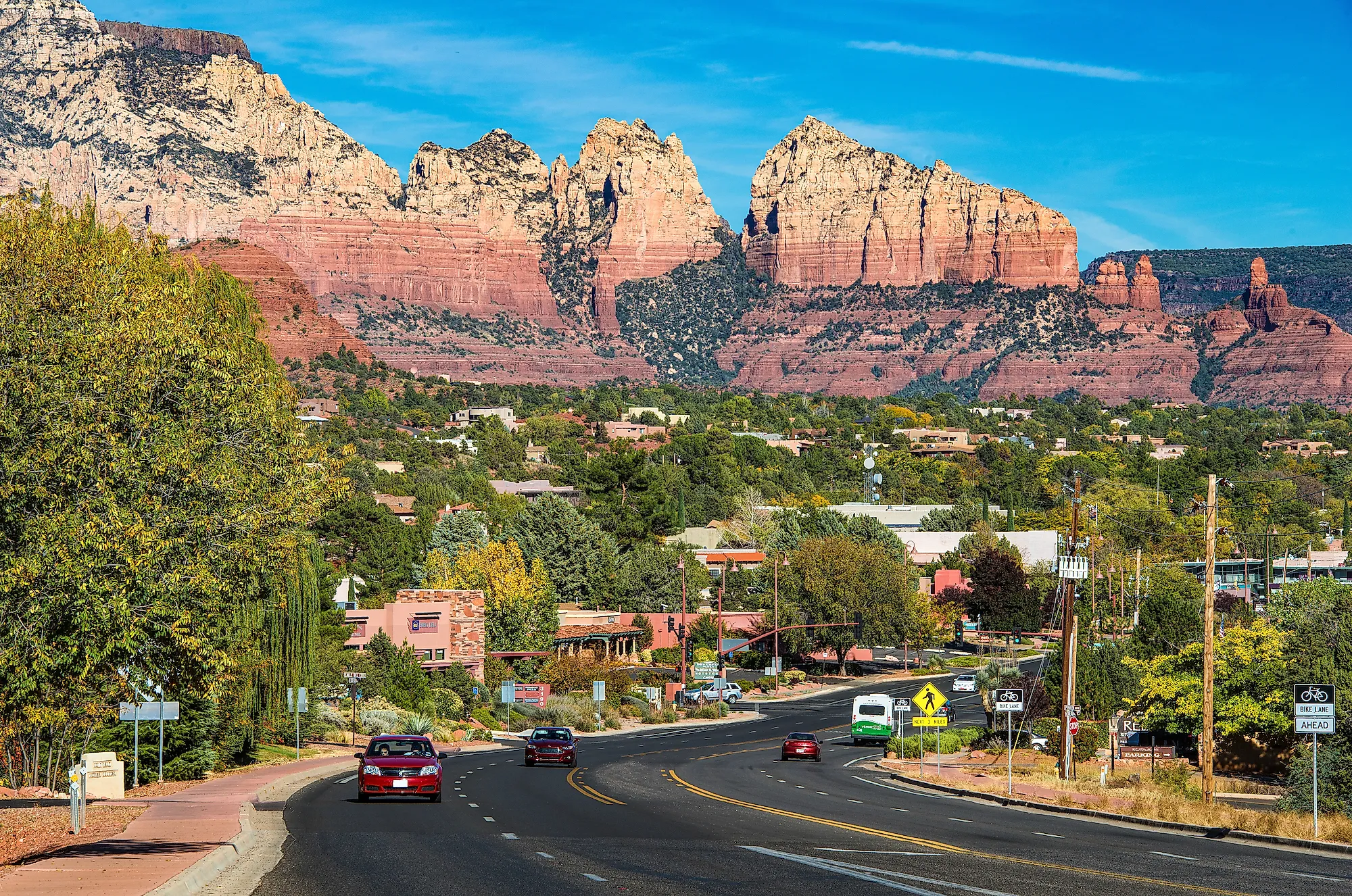
Sedona (population about 9,700) sits at 4,300 feet in the Verde Valley of north-central Arizona, surrounded by the iron-oxide-rich red-rock formations of the Coconino National Forest. Summer highs typically run in the mid-90s, but the canyon shadows and high-elevation evenings cool dramatically. Cathedral Rock, Bell Rock, Coffeepot Rock, and Devil's Bridge are the headline formations, with established trail networks running through the Red Rock State Park, Slide Rock State Park (a natural water slide on Oak Creek), and the dozens of trailheads in the surrounding national forest.
The town runs on tourism (about 3 million annual visitors), but the local economy also supports a working artist community (the Tlaquepaque Arts & Crafts Village is the central anchor) and the Sedona International Film Festival each February. The Chapel of the Holy Cross, built in 1956 by Marguerite Brunswig Staude on a recommendation of Frank Lloyd Wright, sits embedded in a red-rock cliff and remains the town's most photographed building. Oak Creek Canyon north of town runs Highway 89A through one of the most scenic drives in Arizona.
Wickenburg

Wickenburg (population about 7,400) sits at 2,100 feet about 60 miles northwest of Phoenix, the lowest town on this list and the hottest in summer (typical July highs in the upper 100s). The town was founded in 1863 by Henry Wickenburg after he discovered the Vulture Mine, which became one of the most productive gold mines in Arizona history (producing about 340,000 ounces of gold between 1863 and 1942). The Vulture Mine ghost town 12 miles southwest of Wickenburg now operates as a self-guided tour through the original assay office, miners' quarters, and gallows.
The Desert Caballeros Western Museum on Frontier Street runs one of the largest Western and Native American art collections in the Southwest, with major holdings from Frederic Remington, Charles Russell, and contemporary Cowboy Artists of America members. Wickenburg's identity as the "Dude Ranch Capital of the World" dates to the 1920s, with several working dude ranches (Kay El Bar Guest Ranch, Rancho de los Caballeros, Flying E Ranch) still running summer and winter horseback programs. The Hassayampa River runs (intermittently) through town as one of the few perennial water features in the Sonoran Desert.
Seven Towns On Seven Different Thermometers
Each Arizona summer town earns its place by what its elevation lets it do. Show Low at 6,400 feet runs the proper mountain-cool summer with two stocked lakes and trout fishing. Bisbee at 5,500 feet keeps the old mining-town downtown 20 degrees below Tucson. Tombstone at 4,540 feet runs the 1881 OK Corral reenactments under bearable midday sun. Sedona at 4,300 feet uses canyon shadows to soften the red-rock heat. Globe at 3,500 feet and Tubac at 3,300 feet run lower and hotter, but Salado-culture archaeology and 80-plus art galleries reward early-morning visits. Wickenburg at 2,100 feet runs hot enough that the dude ranches mostly close summer programs, but the Desert Caballeros Museum has air conditioning. Pick the elevation that fits the trip.